- Nissequogue, New York
-
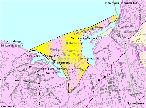
Nissequogue, New York — Village — U.S. Census Map Location within the state of New York

Coordinates: 40°53′55″N 73°11′41″W / 40.89861°N 73.19472°WCoordinates: 40°53′55″N 73°11′41″W / 40.89861°N 73.19472°W Country United States State New York County Suffolk Incorporated 1926 Area – Total 4.0 sq mi (10.3 km2) – Land 3.8 sq mi (9.8 km2) – Water 0.2 sq mi (0.5 km2) Elevation 85 ft (26 m) Population (2000)[1] – Total 1,543 – Density 408.9/sq mi (157.9/km2) Time zone Eastern (EST) (UTC-5) – Summer (DST) EDT (UTC-4) ZIP code 11780 Area code(s) 631 FIPS code 36-51286 GNIS feature ID 0958622 Nissequogue (pronounced /ˈnɪsəkwɒɡ/ niss-ə-kwog[2]) is a village in Suffolk County, New York on the North Shore of Long Island. As of the United States 2000 Census, the village population was 1,543.[1]
The Village of Nissequogue is in the Town of Smithtown. It incorporated in 1926.[3]
Geography
According to the United States Census Bureau, the village has a total area of 4.0 square miles (10 km2), of which, 3.8 square miles (9.8 km2) of it is land and 0.2 square miles (0.52 km2) of it (5.04%) is water.
To the west of the village is its namesake, the Nissequogue River. To the north is the Long Island Sound; while to the east is the St. James Harbor (formerly known as Stony Brook Harbor).
Demographics
As of the census of 2000, there were 1,543 people, 533 households, and 455 families residing in the village. The population density was 408.9 people per square mile (158.0/km²). There were 570 housing units at an average density of 151.1 per square mile (58.4/km²). The racial makeup of the village was 97.34% White, 0.13% African American, 0.97% Asian, and 1.56% from two or more races. Hispanic or Latino of any race were 2.92% of the population.[1]
There were 533 households out of which 36.0% had children under the age of 18 living with them, 79.2% were married couples living together, 4.5% had a female householder with no husband present, and 14.6% were non-families. 12.2% of all households were made up of individuals and 4.3% had someone living alone who was 65 years of age or older. The average household size was 2.89 and the average family size was 3.15.[1]
In the village the population was spread out with 25.6% under the age of 18, 4.4% from 18 to 24, 25.3% from 25 to 44, 32.9% from 45 to 64, and 11.9% who were 65 years of age or older. The median age was 42 years. For every 100 females there were 106.0 males. For every 100 females age 18 and over, there were 100.7 males.[1]
The median income for a household in the village was $140,786, and the median income for a family was $157,973. Males had a median income of $100,000 versus $69,167 for females. The per capita income for the village was $63,148. About 1.1% of families and 2.4% of the population were below the poverty line, including none of those under age 18 and 2.7% of those age 65 or over.[1]
References
- ^ a b c d e f "American FactFinder". United States Census Bureau. http://factfinder.census.gov. Retrieved 2008-01-31.
- ^ http://www.forvo.com/search/Nissequogue/
- ^ "Village of Nissequogue". Suffolk County Village Officials Association. http://www.scvoa.com/pages/directory/nssqg.html. Retrieved August 23, 2010.
Town of Smithtown, New York County Villages Hamlets Commack · Fort Salonga · Hauppauge · Kings Park · Lake Ronkonkoma · Nesconset · Smithtown · St. JamesWebsite Categories:- Smithtown, New York
- Villages in New York
- Long Island Sound
- Populated places in Suffolk County, New York

Wikimedia Foundation. 2010.