Nissequogue River

Nissequogue River
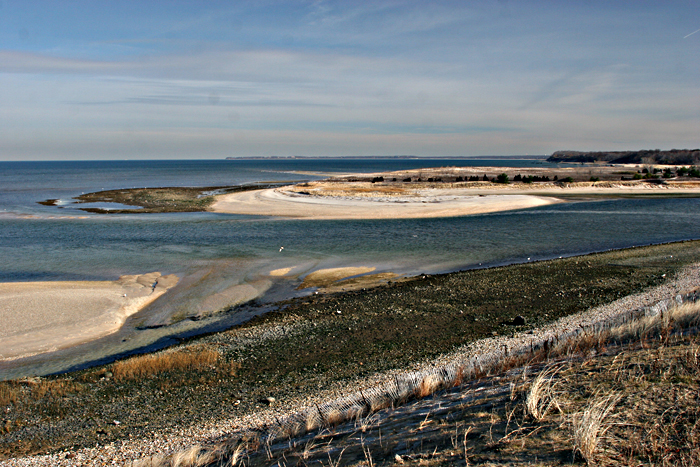
Nissequogue River
River
Mouth on the Long Island Sound
Country United States
State New York
Region Suffolk
District Smithtown
Source Caleb Smith Park (at northern end of New Mill Pond)
 - elevation 29 ft (9 m)
 - coordinates 40°50′34″N 73°13′40″W / 40.8428°N 73.2279°W / 40.8428; -73.2279
Mouth Nissequogue River State Park at Long Island Sound
 - elevation 0 ft (0 m)
 - coordinates 40°54′15″N 73°13′48″W / 40.90426°N 73.23011°W / 40.90426; -73.23011
Length 8.3 mi (13 km), SN
Volume 42.2 cu ft (1 m3)
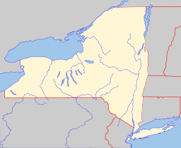
Website: tr

The Nissequogue River is an 8.3-mile (13.4 km) long river flowing from Smithtown, New York into the Long Island Sound.

Its discharge of 42.2 cubic feet (1.19 m3) a second[1] is the most of any of the freshwater rivers on Long Island.

The river, like all other freshwater rivers on the island, is totally derived from groundwater (not from lakes).

Its name is derived from one of the Algonquian-speaking Nissequaq tribe in the area.[2]

The river begins at Caleb Smith Park in Smithtown (where special regulation trout fishing is available) and flows to Kings Park, New York. Since much of the river is an estuary canoeists travel in both directions based on the tides.

Fish found in the river include Striped Bass, Bluefish, Summer Flounder, Winter Flounder, Porgies, Eels, Brown, Rainbow and Brook Trout, Yellow Perch, Largemouth Bass, Alweives, Herring, Shad, etc.

References

External links


Wikimedia Foundation. 2010.

Игры ⚽ Нужна курсовая?

Look at other dictionaries:

  • Nissequogue River State Park — The Nissequogue River State Park is located on the banks and bluffs of the Nissequogue River in Kings Park, New York. The park was conceived in 1999, and established on the waterfront portion of the former Kings Park Psychiatric Center. The name… …   Wikipedia

  • Nissequogue — Mündung des Nissequogue River Lage in New York …   Deutsch Wikipedia

  • Nissequogue, New York —   Village   U.S. Census Map …   Wikipedia

  • Connetquot River State Park Preserve — Southside Sportsmens Club District U.S. National Register of Historic Places U.S. Historic district …   Wikipedia

  • Moose River Plains Wild Forest — The Moose River Plains Wild Forest is a 50,000 acre (200 km2) tract in the Adirondack Park in Hamilton and Herkimer counties in New York State; it is designated as Wild Forest by the New York State Department of Environmental Conservation.… …   Wikipedia

  • List of New York state parks — This is a list of state parks and state historic sites in the U.S. state of New York. Contents 1 Forest Preserve 2 State Parks 3 State Historic Sites 4 …   Wikipedia

  • List of rivers of New York — The Raquette River, in Colton, New York. This is a list of rivers in the U.S. state of New York. Contents 1 By drainage basi …   Wikipedia

  • Kings Park, New York — Infobox Settlement official name = Kings Park, New York settlement type = CDP nickname = motto = imagesize = 250px image caption = Kings Park Psychiatric Center image pushpin pushpin label position = pushpin map caption =Location within the state …   Wikipedia

  • Kings Park Psychiatric Center — The Kings Park Psychiatric Center is a former state run psychiatric hospital located in Kings Park, New York. It operated from 1885 until 1994, when the State of New York closed the facility down, either releasing its few remaining patients or… …   Wikipedia

  • List of county routes in Suffolk County, New York (76–100) — The following is a list of county routes in Suffolk County, New York from Routes 76 to 100. Contents 1 County Route 76 1.1 Major intersections 2 County Route 77 2.1 Route description …   Wikipedia

Share the article and excerpts

Direct link
Do a right-click on the link above
and select “Copy Link”