- National Register of Historic Places listings in Riverhead (town), New York
-
This list is intended to provide a comprehensive listing of entries in the National Register of Historic Places in the Town of Riverhead, New York. The locations of National Register properties for which the latitude and longitude coordinates are included below, may be seen in a Google map.[1]
Contents
Listings
[2] Landmark name Image Date listed Location City or Town Summary 1 Hallock-Bilunas Farmstead 
April 18, 2003 733 Herricks Lane
40°58′42″N 72°35′30″W / 40.97833°N 72.59167°WJamesport 2 Jedediah Hawkins House 
June 13, 2008 400 South Jamesport Avenue40°56′50″N 72°34′46″W / 40.94722°N 72.57944°W Jamesport (new listing; refnum 08000514) 3 Hallock Homestead 
June 7, 1984 163 Sound Avenue
40°59′2″N 72°35′12″W / 40.98389°N 72.58667°WNorthville 4 Jamesport Meeting House February 20, 2009 1590 Main Road
40°56′59.62″N 72°34′51.78″W / 40.9498944°N 72.58105°WJamesport New listing; refnum# 09000039 5 Suffolk County Historical Society Building 
July 29, 1994 300 West Main Street
40°55′22″N 72°40′6″W / 40.92278°N 72.66833°WRiverhead 6 Tuthill-Lapham House March 13, 2009 324 Sound Road, at the corner of Sunset Boulevard
40°57′52.6″N 72°51′7.53″W / 40.964611°N 72.8520917°WWading River 7 US Post Office-Riverhead 
May 11, 1989 23 West Second Street
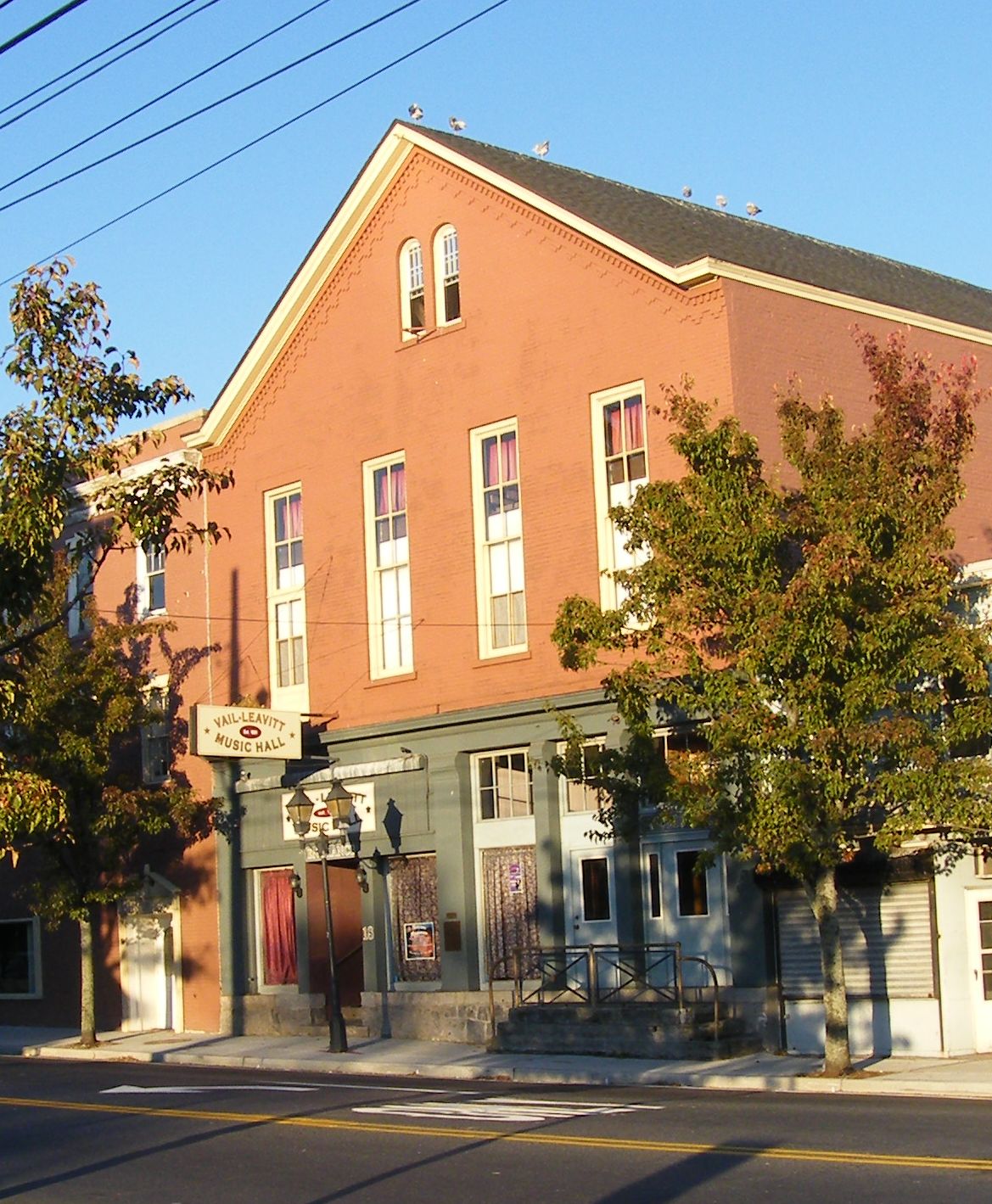
40°55′6″N 72°39′50″W / 40.91833°N 72.66389°WRiverhead 8 Vail-Leavitt Music Hall 
August 25, 1983 Peconic Avenue
40°54′59″N 72°39′45″W / 40.91639°N 72.6625°WRiverhead 9 Benjamin King Woodhull House June 13, 2008 126 Sound Road40°57′30.52″N 72°51′1.5762″W / 40.9584778°N 72.850437833°W Wading River (new listing; refnum 08000515) See also
- National Register of Historic Places listings in New York
- National Register of Historic Places listings in Suffolk County, New York
References
- ^ The latitude and longitude information provided is primarily from the National Register Information System, and has been found to be fairly accurate for about 99% of listings. For 1%, the location info may be way off. We seek to correct the coordinate information wherever it is found to be erroneous. Please leave a note in the Discussion page for this article if you believe any specific location is incorrect.
- ^ Numbers represent an ordering by significant words. Various colorings, defined here, differentiate the Historic districts, National Historic Landmarks, and other designations from other NRHP buildings, structures, sites or objects.
External links
- NRHP applications for New York State sites (Note, interface works best with Microsoft Internet Explorer browser; hit "Results" after searching, to actually see the results).
Town of Riverhead, New York County Hamlets Website Categories:- Riverhead (town), New York
- National Register of Historic Places in Riverhead (town), New York
- Buildings and structures in Suffolk County, New York


Wikimedia Foundation. 2010.