- Baxter Estates, New York
Infobox Settlement
official_name = Baxter Estates, New York
settlement_type = Village
nickname =
motto =
imagesize =
image_caption =
image_pushpin_
pushpin_label_position = none
pushpin_map_caption =Location within the state of New York
pushpin_mapsize =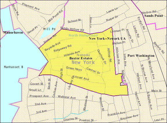
mapsize = 250px
map_caption = U.S. Census Map
mapsize1 =
map_caption1 =subdivision_type = Country
subdivision_name =United States
subdivision_type1 = State
subdivision_name1 =New York
subdivision_type2 = County
subdivision_name2 = Nassau
government_footnotes =
government_type =
leader_title =
leader_name =
leader_title1 =
leader_name1 =
established_title =
established_date =unit_pref = Imperial
area_footnotes =area_magnitude =
area_total_km2 = 0.5
area_land_km2 = 0.5
area_water_km2 = 0.0
area_total_sq_mi = 0.2
area_land_sq_mi = 0.2
area_water_sq_mi = 0.0population_as_of = 2000
population_footnotes =
population_total = 1006
population_density_km2 = 2152.3
population_density_sq_mi = 5574.5timezone = Eastern (EST)
utc_offset = -5
timezone_DST = EDT
utc_offset_DST = -4
elevation_footnotes =
elevation_m = 12
elevation_ft = 39
latd = 40 |latm = 50 |lats = 2 |latNS = N
longd = 73 |longm = 41 |longs = 43 |longEW = Wpostal_code_type =
ZIP code
postal_code = 11050
area_code = 516
blank_name = FIPS code
blank_info = 36-04803
blank1_name = GNIS feature ID
blank1_info = 0943176
website =
footnotes =The Village of Baxter Estates (also known as VBE) is a
village in Nassau County,New York ,United States (in the Town of North Hempstead). The population was 1,006 at the 2000 census.Geography
Baxter Estates is located at coor dms|40|50|2|N|73|41|43|W|city (40.833975, -73.695246)GR|1.
According to the
United States Census Bureau , the village has a total area of 0.2square mile s (0.5km² ), all of it land.History
Baxter Estates owes much of its history to the homestead settlement of "Cow Neck" built in 1673 by John Betts and Robert Hutchings, this still stands on its original site at the corner of Central Drive and Shore Road, overlooking
Manhasset Bay . In c. 1741 this property was purchased by Oliver Baxter, maps of the time show that, perhaps, an entirewigwam village may have been located on Baxter's land, this belonged to theMatinecock Indians.The Baxters, who were shipbuilders, whalers and sea captains retained the property until the 19th Century; Hessian troops were quartered in the house during the Revolutionary War and, in 1895, the first library of
Port Washington met in the parlor of the Baxter house on Shore Road. The residence is now a designated historic building.The Village of Baxter Estates was incorporated in 1931.
Demographics
As of the
census GR|2 of 2000, there were 1,006 people, 376 households, and 262 families residing in the village. Thepopulation density was 5,574.4 people per square mile (2,157.9/km²). There were 386 housing units at an average density of 2,138.9/sq mi (828.0/km²). The racial makeup of the village was 84.00% White, 2.68% African American, 0.10% Native American, 7.16% Asian, 3.98% from other races, and 2.09% from two or more races. Hispanic or Latino of any race were 14.61% of the population.There were 376 households out of which 36.4% had children under the age of 18 living with them, 57.2% were married couples living together, 8.5% had a female householder with no husband present, and 30.1% were non-families. 25.3% of all households were made up of individuals and 10.9% had someone living alone who was 65 years of age or older. The average household size was 2.68 and the average family size was 3.21.
In the village the population was spread out with 24.8% under the age of 18, 6.2% from 18 to 24, 29.0% from 25 to 44, 27.1% from 45 to 64, and 12.9% who were 65 years of age or older. The median age was 39 years. For every 100 females there were 99.2 males. For every 100 females age 18 and over, there were 95.6 males.
The median income for a household in the village was $84,592, and the median income for a family was $111,074. Males had a median income of $56,250 versus $51,250 for females. The
per capita income for the village was $44,718. About 3.0% of families and 4.7% of the population were below thepoverty line , including 5.0% of those under age 18 and 6.3% of those age 65 or over.References
External links
* [http://www.BaxterEstates.org Village of Baxter Estates website]

Wikimedia Foundation. 2010.