- Plandome Heights, New York
Infobox Settlement
official_name = Plandome Heights, New York
settlement_type = Village
nickname =
motto =
imagesize =
image_caption =
image_pushpin_
pushpin_label_position = none
pushpin_map_caption =Location within the state of New York
pushpin_mapsize =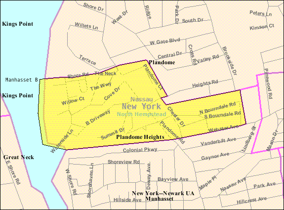
mapsize = 250px
map_caption = U.S. Census Map
mapsize1 =
map_caption1 =subdivision_type = Country
subdivision_name =United States
subdivision_type1 = State
subdivision_name1 =New York
subdivision_type2 = County
subdivision_name2 = Nassau
government_footnotes =
government_type =
leader_title = Mayor
leader_name = Diana Merenda
leader_title1 =
leader_name1 =
established_title =
established_date =unit_pref = Imperial
area_footnotes =area_magnitude =
area_total_km2 = 0.5
area_land_km2 = 0.5
area_water_km2 = 0.0
area_total_sq_mi = 0.2
area_land_sq_mi = 0.2
area_water_sq_mi = 0.0population_as_of = 2000
population_footnotes =
population_total = 971
population_density_km2 = 2065.9
population_density_sq_mi = 5350.6timezone = Eastern (EST)
utc_offset = -5
timezone_DST = EDT
utc_offset_DST = -4
elevation_footnotes =
elevation_m = 27
elevation_ft = 89
latd = 40 |latm = 48 |lats = 5 |latNS = N
longd = 73 |longm = 42 |longs = 17 |longEW = Wpostal_code_type =
postal_code =
area_code =
blank_name = FIPS code
blank_info = 36-58486
blank1_name = GNIS feature ID
blank1_info = 0960669
website =
footnotes =Plandome Heights is a
village in Nassau County,New York in theUnited States . The population was 971 at the 2000 census.The Village of Plandome Heights is in the Town of North Hempstead. It is served by the
Manhasset, New York school district.Geography
Plandome Heights is located at coor dms|40|48|5|N|73|42|17|W|city (40.801395, -73.704828)GR|1.
According to the
United States Census Bureau , the village has a total area of 0.2square mile s (0.5km² ), of which, 0.2 square miles (0.5 km²) of it is land and 5.26% is water.Demographics
As of the
census GR|2 of 2000, there were 971 people, 324 households, and 268 families residing in the village. Thepopulation density was 5,350.6 people per square mile (2,082.8/km²). There were 328 housing units at an average density of 1,807.4/sq mi (703.6/km²). The racial makeup of the village was 92.28% White, 0.31% African American, 0.10% Native American, 6.80% Asian, 0.10% Pacific Islander, 0.10% from other races, and 0.31% from two or more races. Hispanic or Latino of any race were 3.09% of the population.There were 324 households out of which 42.0% had children under the age of 18 living with them, 72.8% were married couples living together, 7.1% had a female householder with no husband present, and 17.0% were non-families. 15.1% of all households were made up of individuals and 11.4% had someone living alone who was 65 years of age or older. The average household size was 3.00 and the average family size was 3.33.
In the village the population was spread out with 28.6% under the age of 18, 5.0% from 18 to 24, 24.6% from 25 to 44, 27.8% from 45 to 64, and 13.9% who were 65 years of age or older. The median age was 40 years. For every 100 females there were 91.9 males. For every 100 females age 18 and over, there were 86.8 males.
The median income for a household in the village was $123,199, and the median income for a family was $142,088. Males had a median income of $100,000 versus $46,000 for females. The
per capita income for the village was $57,050. About 0.7% of families and 1.5% of the population were below thepoverty line , including none of those under age 18 and 5.0% of those age 65 or over.References
External links

Wikimedia Foundation. 2010.