- Cross Island Parkway
-
This article is about the parkway in New York. For the parkway in South Carolina, see U.S. Route 278.
Cross Island Parkway
Route information Length: 10.57 mi[1] (17.01 km) Existed: 1940 – present Major junctions South end: 
 Belt Parkway / Southern State Parkway in Cambria Heights
 Grand Central Parkway on Bellerose/Douglaston/Glen Oaks/Oakland Gardens border
 I-495 on Douglaston/Oakland Gardens border
 I-295 in Bayside
North end:  I-678 in Whitestone
Location Counties: Nassau, Queens Highway system Numbered highways in New York
Interstate • U.S. • N.Y. (former) • Reference • County Driving southbound on Interstate 295 (New York) South on the Throgs Neck Bridge merging onto the Cross Island Parkway
 Approaching Route 25A on Cross Island Parkway South
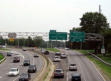 Exit to Southern State Parkway
Cross Island Parkway, also known as the 100th Infantry Division Parkway, is a parkway within New York State. The parkway is a part of the Belt Parkway system that runs along the perimeter of the borough of Queens in New York City. The Cross Island Parkway runs 10.6 miles (17.1 km) from the Whitestone Expressway (Interstate 678) in Whitestone past the Throgs Neck Bridge, along and across the border of Queens and Nassau County to meet up with the Southern State Parkway. The road is designated as New York State Route 907A, an unsigned reference route.
The Cross Island Parkway is the main route to Belmont Park in Elmont.
Being a part of the "Belt System", its exit numbering is a continuation of the Belt Parkway, with exit numbers increasing north. At exit 25A (Southern State Parkway), the Cross Island Parkway becomes the Belt Parkway (more specifically, the section once known as the Laurelton Parkway). Before its exits were renumbered to align with the Belt Parkway, they were numbered to co-align with the Southern State Parkway, which is why that parkway begins with exit 13 (the Cross Island Parkway was once exits 1 to 12).
Contents
Route description
The Cross Island Parkway begins at an interchange with the Southern State Parkway and the Laurelton Parkway.[2] Exit 26A is for Belmont Park in Elmont, NY, however, the exit is only northbound.[3] Exits 26B and 26C are for the Hempstead Turnpike, also known as State Route 24. Exit 26D is for the northern end of Belmont Park. Exit 27 is split into E and W southbound and is for State Route 25 and Jamaica Avenue.[4] In Bellerose, the Cross Island leaves Nassau County for Queens again and interchanges with Route 25B and Union Turnpike at exits 28A and B.
The speed limit throughout the entire parkway is 50 miles per hour (80 km/h). Police services are primarily provided by the New York City Police Department Highway Patrol District 3, and, when the Highway Patrol is unavailable, the 105, 109 and 111 Precincts.
Exit list
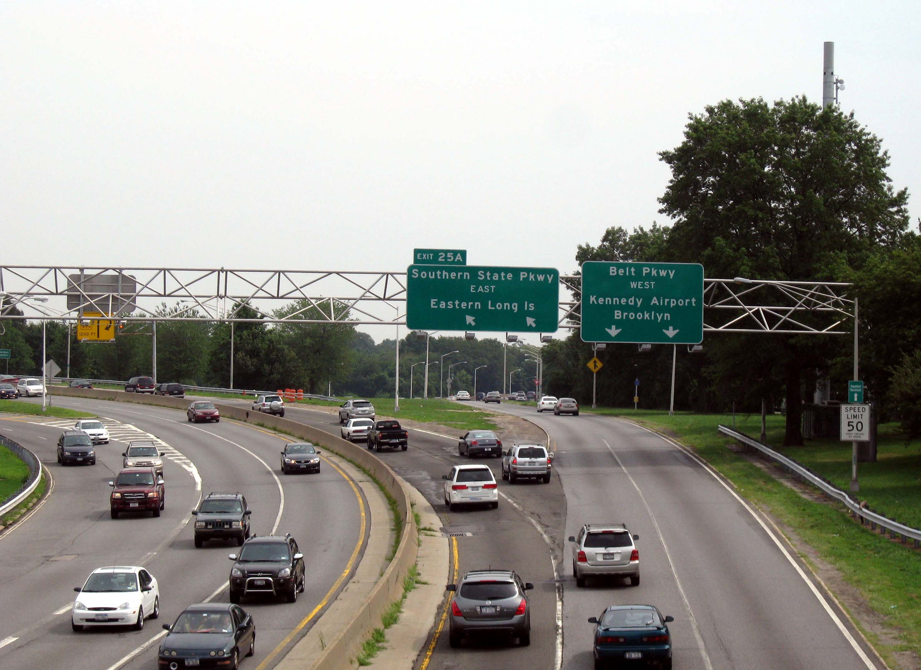
County Location Mile[1] Exit Destinations Notes Queens Cambria Heights 0.00 Belt Parkway west – Kennedy Airport, BrooklynSouthbound exit and northbound entrance 0.00 25A Southern State Parkway east – Eastern Long IslandSouthbound exit and northbound entrance 25B Elmont Road, Linden Boulevard Queens Village 26A Belmont Racetrack No southbound exit 1.56 26B  NY 24 (Hempstead Avenue) – Belmont Racetrack
Signed as exits 26B (east) and 26C (west) southbound Nassau Floral Park 1.93 26D Belmont Racetrack 2.52 27  NY 25 (Braddock Avenue, Jamaica Avenue, Jericho Turnpike)
Signed as exits 27E (east) and 27W (west) southbound Queens Bellerose 3.23 28A  NY 25B (Hillside Avenue)
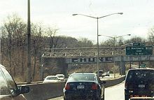
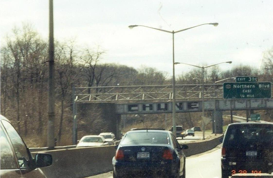
Bellerose, Glen Oaks 3.76 28B Union Turnpike Bellerose, Glen Oaks, Oakland Gardens, Douglaston 4.13 29 Grand Central Parkway – Robert F. Kennedy Bridge, Eastern Long Island, HauppaugeSigned as exits 29E (east) and 29W (west) Oakland Gardens, Douglaston 5.05 30E I-495 east (Long Island Expressway) – Eastern Long Island30W I-495 west (Long Island Expressway) – ManhattanNorthbound exit and southbound entrance Bayside, Douglaston 5.95 31  NY 25A (Northern Boulevard)
Signed as exits 31E (east) and 31W (west) Bayside 8.33 32 To I-295 south (Clearview Expressway) / Bell BoulevardSigned as exit 33 southbound 8.83 33 I-295 north (Throgs Neck Bridge) – Bronx, New EnglandNorthbound exit and southbound entrance Whitestone 9.06 34 160th Street, Utopia Parkway 35 14th Avenue, Francis Lewis Boulevard No northbound exit 10.57 36 I-678 (Whitestone Bridge, Whitestone Expressway) – Bronx, La Guardia Airport, Kennedy AirportNorthbound exit and southbound entrance; signed as exits 36N (north) and 36S (south) 1.000 mi = 1.609 km; 1.000 km = 0.621 mi References
- ^ a b "2007 Traffic Data Report for New York State" (PDF). New York State Department of Transportation. July 25, 2008. https://www.nysdot.gov/divisions/engineering/technical-services/hds-respository/NYSDOT_Traffic_Data_Report_2007.pdf. Retrieved July 17, 2009.
- ^ Google, Inc. Google Maps – Cross Island Parkway in Cambria Heights (Map). Cartography by Google, Inc. http://maps.google.com/maps?hl=en&q=Cross+Island+Pkwy,+Cambria+Heights,+New+York,+United+States&um=1&ie=UTF-8&sa=N&tab=wl. Retrieved April 1, 2010.
- ^ Google, Inc. Google Maps – Cross Island Parkway in Queens Village (Map). Cartography by Google, Inc. http://maps.google.com/maps?hl=en&q=Cross+Island+Pkwy,+Queens+Village,+New+York,+United+States&um=1&ie=UTF-8&sa=N&tab=wl. Retrieved April 1, 2010.
- ^ Google, Inc. Google Maps – Cross Island Parkway in Floral Park (Map). Cartography by Google, Inc. http://maps.google.com/maps?hl=en&q=Cross+Island+Pkwy,+Floral+Park,+New+York,+United+States&um=1&ie=UTF-8&sa=N&tab=wl. Retrieved April 1, 2010.
External links
Parkways in New York City Manhattan The Bronx Brooklyn-Queens Belt Parkway system: Cross Island - Laurelton - Shore - Southern
Others: Grand Central - Jackie Robinson (Interborough)
Former: Gowanus - Whitestone - Long Island Motor ParkwayStaten Island Korean War Veterans (Richmond)
Former: Willowbrook - Proposed: Wolfe's PondCategories:- Parkways in New York City
- Parkways in New York
- Transportation in Queens
- Robert Moses projects


Wikimedia Foundation. 2010.