- Jackie Robinson Parkway
-
Jackie Robinson Parkway

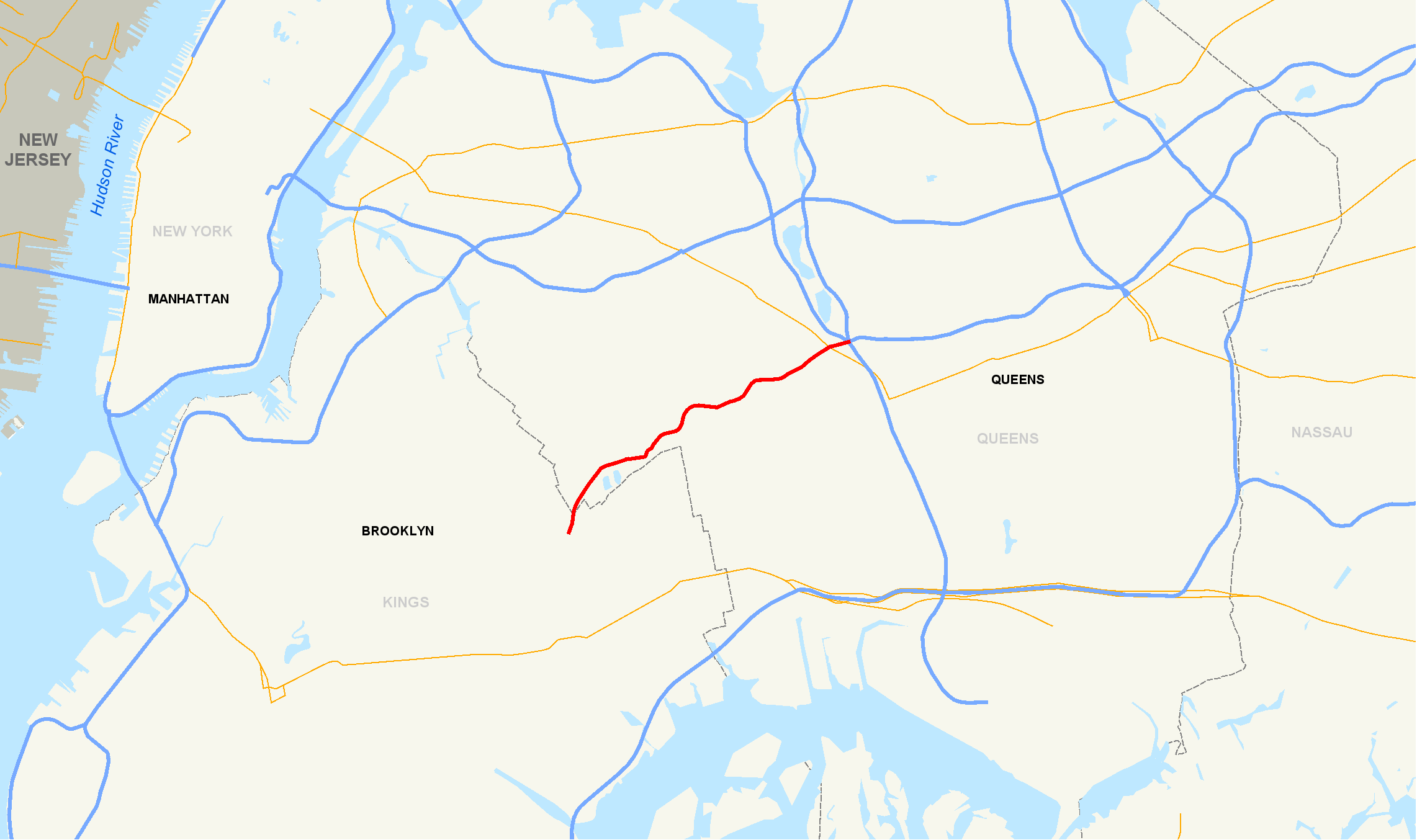
Map of New York City with the Jackie Robinson Parkway highlighted in redRoute information Length: 4.95 mi[2] (7.97 km) Existed: 1935[1] – present Major junctions West end: Jamaica Avenue in East New York  I-678 in Kew Gardens
East end:  Grand Central Parkway in Kew Gardens
Location Counties: Kings, Queens Highway system Numbered highways in New York
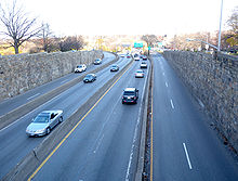
Interstate • U.S. • N.Y. (former) • Reference • CountyThe Jackie Robinson Parkway is a 4.95-mile (7.97 km) parkway in the New York City boroughs of Brooklyn and Queens. The western terminus of the parkway is at Jamaica Avenue in the Brooklyn neighborhood of East New York. It runs through Highland Park, along the north side of Ridgewood Reservoir, and through Forest Park. The eastern terminus is at the Kew Gardens Interchange in Kew Gardens, Queens, where the Jackie Robinson Parkway meets the Grand Central Parkway and Interstate 678 (the Van Wyck Expressway). It is designated New York State Route 908B, an unsigned reference route. The parkway was known as the Interboro Parkway until 1997, when it was renamed for former Major League Baseball player Jackie Robinson.
Contents
Route description
The Jackie Robinson Parkway starts in East New York in Brooklyn at a big junction with Jamaica and Pennsylvania Avenues. Exit 1, Bushwick Avenue via Highland Boulevard, is a westbound-only exit. The highway enters Queens and passes Mt. Judah Cemetery before Exit 2, Vermont Place and Cypress Avenue, which lead to Highland Park and Hungarian Cemetery. Exit 3, Cypress Hills Street, leads to Cypress Cemetery, where Jackie Robinson was buried. Here the parkway narrows and makes sharp turns. At Exit 4, Forest Park Drive, the parkway enters Forest Park. Exit 5 is Myrtle Avenue and Woodhaven Boulevard. At Exit 6, Metropolitan Avenue, Union Turnpike becomes a service road to the parkway, but there is no access to/from Union Turnpike. The parkway and Union Turnpike then exit Forest Park, and go under Queens Boulevard (NY 25). Union Turnpike shares a diamond interchange with Queens Boulevard, but there is no access from the parkway. Exit 7, an eastbound-only exit, goes to the Van Wyck Expressway (I-678) northbound (no access southbound). Exit 8 (eastbound only) is the Grand Central Parkway, where the Jackie Robinson ends.
History
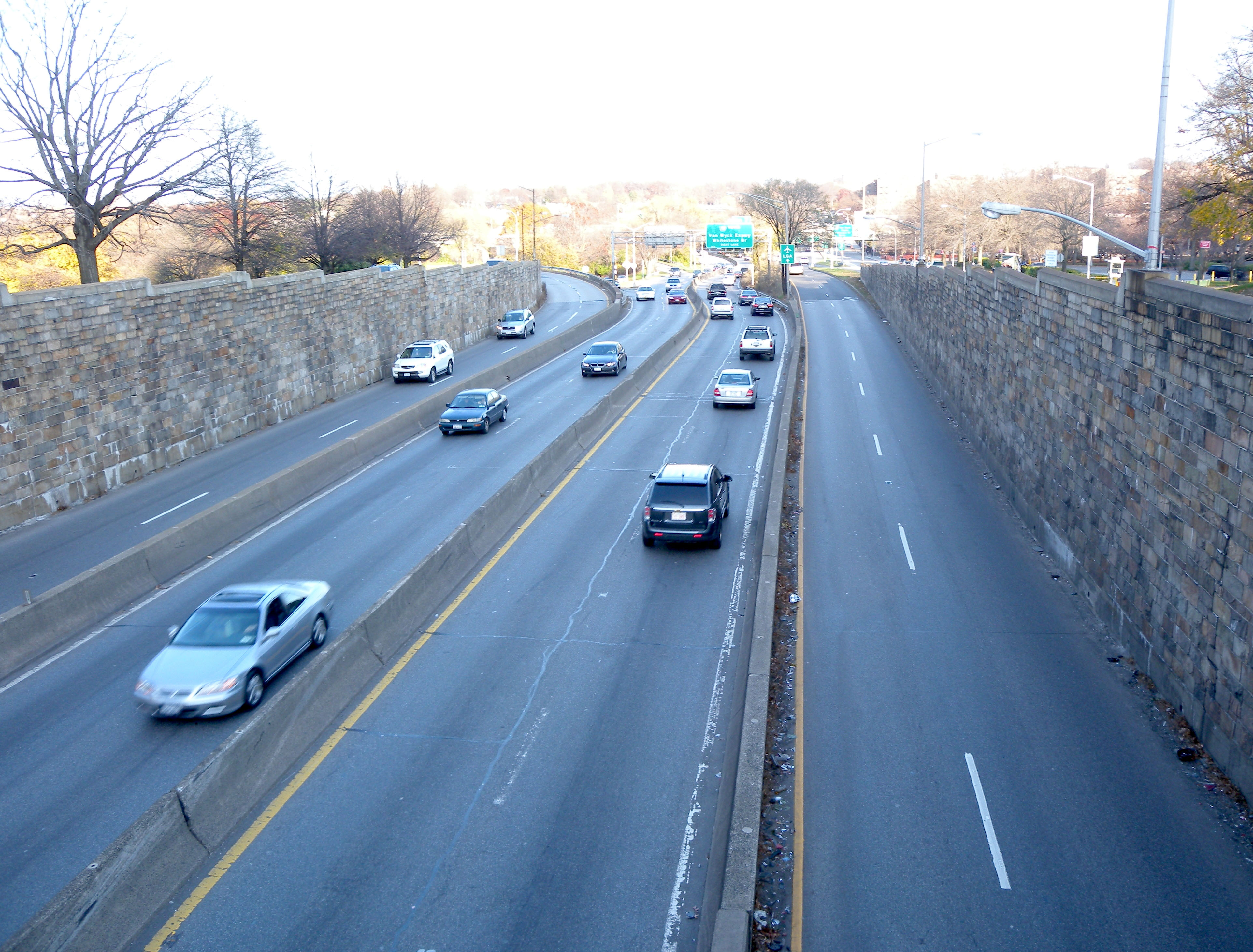
 Eastern junction
An extension to Jamaica Bay was proposed in the 1960s.
The parkway's name was changed to honor Jackie Robinson in May 1997, as part of 50th anniversary activities marking his breaking of the baseball color line.[3] At first, local residents continued to refer to the highway as the Interborough, which led to confusion, but recently the parkway's new name has begun to stick locally. Part of the original parkway contract included the construction of a pair of service stations just west of exit 6 (Metropolitan Avenue) in Forest Park. The stone-faced gas stations, which were located along the eastbound and westbound lanes of the parkway, were torn down in the late 1970s.
A juncture at the eastern end of the parkway was placed on the list of New York State's most dangerous roads in 2007, based on accident data from 2004–2006.[4]
Exit list
County Location Mile[2] Exit Destinations Notes Kings East New York 0.00 Jamaica Avenue / Pennsylvania Avenue / Bushwick Avenue At-grade intersection 1 Highland Boulevard Westbound exit and eastbound entrance Queens Highland Park 2 Cypress Avenue / Vermont Place – Highland Park 1.42 3 Cypress Hills Street No westbound entrance Glendale 4 Forest Parkway 5 Myrtle Avenue / Union Turnpike No westbound exit Kew Gardens 4.02 6 Metropolitan Avenue 4.95 7 I-678 – Whitestone BridgeEastbound exit and westbound entrance 8W-E Grand Central Parkway – RFK Bridge, Long IslandEastbound exit and westbound entrance 1.000 mi = 1.609 km; 1.000 km = 0.621 mi See also
References
- ^ Roleke, John. "Jackie Robinson Pkwy (Interboro Pkwy)". About. The New York Times Company. http://queens.about.com/cs/transportation/g/jackie_robinson.htm. Retrieved August 29, 2007.
- ^ a b "2007 Traffic Data Report for New York State" (PDF). New York State Department of Transportation. July 25, 2008. https://www.nysdot.gov/divisions/engineering/technical-services/hds-respository/NYSDOT_Traffic_Data_Report_2007.pdf. Retrieved July 17, 2009.
- ^ "New York City Department of Parks and Recreation: Jackie Robinson Parkway". http://www.nycgovparks.org/parks/Q083/. Retrieved June 4, 2009.
- ^ Montefinise, Angela (February 24, 2008). "Tragic Toll of Qns. Roadway". New York Post. http://www.nypost.com/seven/02242008/news/regionalnews/tragic_toll_of_qns__roadway_99069.htm.
External links
Parkways in New York City Manhattan The Bronx Brooklyn-Queens Belt Parkway system: Cross Island - Laurelton - Shore - Southern
Others: Grand Central - Jackie Robinson (Interborough)
Former: Gowanus - Whitestone - Long Island Motor ParkwayStaten Island Korean War Veterans (Richmond)
Former: Willowbrook - Proposed: Wolfe's PondCategories:- Parkways in New York City
- Jackie Robinson
- Transportation in Queens
- Transportation in Brooklyn

Wikimedia Foundation. 2010.