- New York State Route 41A
-
NYS Route 41A
Route information Auxiliary route of NY 41 Maintained by NYSDOT Length: 25.49 mi[2] (41.02 km) Existed: 1930[1] – present Major junctions South end:  NY 41 in Homer
North end:  US 20 in Skaneateles
Location Counties: Cortland, Cayuga, Onondaga Highway system Numbered highways in New York
Interstate • U.S. • N.Y. (former) • Reference • County← NY 41NY 42  →
→New York State Route 41A (NY 41A) is a north–south New York State Route located within Onondaga, Cayuga, and Cortland Counties in Central New York. Its northern terminus is located at a junction with U.S. Route 20 in the village of Skaneateles in Onondaga County. The southern terminus is located at a junction with NY 41 in the town of Homer, in Cortland County.
Contents
Route description
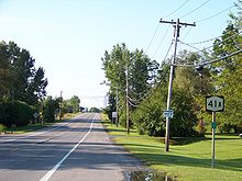 Southbound on NY 41A near its northern terminus at US 20
Cortland County
NY 41A begins at an intersection with NY 41 about two miles (3 km) north of the village of Homer in the town of the same name. It heads west to wind up a hill through a wooded area for about a mile. The route then crosses into Cayuga County.
Cayuga County
After entering Cayuga County, NY 41A runs along Lake Como and curves to the north. Through its journey through Cayuga County, NY 41A passes through the hamlets of Como, Sempronius, and New Hope (the latter within the town of Niles). Most of the routing of NY 41A through Cayuga County passes through rural farmland.
Onondaga County
NY 41A enters Onondaga County south of Skaneateles. It runs along the west shore of Skaneateles Lake. Between the county line and Skaneateles, NY 41A passes through several hamlets. In order from south to north, they are Mandana, Thornton Heights, Veggie Crossing, Thornton Grove, Winding Way, Greenfield Lane, The Lane, and Skaneateles. NY 41A finally ends at U.S. Route 20 just west of the village of Skaneateles.
History
The portion of modern NY 41A north of Mandana was originally designated as part of NY 26 in 1924.[3] NY 26 was split into several different highways as part of the 1930 renumbering of state highways in New York. The Mandana–Skaneateles portion of NY 26 became part of NY 41A, a new highway extending from Homer to Skaneateles.[1]
Major intersections
County Location Mile[2] Destinations Notes Cortland Town of Homer 0.00 NY 41Onondaga Town of Skaneateles 19.66  NY 359
Northern terminus of NY 359; hamlet of Mandana Village of Skaneateles 25.49 US 201.000 mi = 1.609 km; 1.000 km = 0.621 mi References
- ^ a b Automobile Legal Association (ALA) Automobile Green Book, 1930/31 and 1931/32 editions, (Scarborough Motor Guide Co., Boston, 1930 and 1931). The 1930/31 edition shows New York state routes prior to the 1930 renumbering
- ^ a b "2008 Traffic Volume Report for New York State" (PDF). New York State Department of Transportation. June 16, 2009. p. 110. https://www.nysdot.gov/divisions/engineering/technical-services/hds-respository/NYSDOT%20TVR%202008%20by%20Route.pdf. Retrieved January 31, 2010.
- ^ "New York's Main Highways Designated by Numbers". The New York Times: p. XX9. December 21, 1924.
External links
Categories:- State highways in New York
- Transportation in Onondaga County, New York
- Transportation in Cayuga County, New York
- Transportation in Cortland County, New York


Wikimedia Foundation. 2010.