- New York State Route 253
-
NYS Route 253

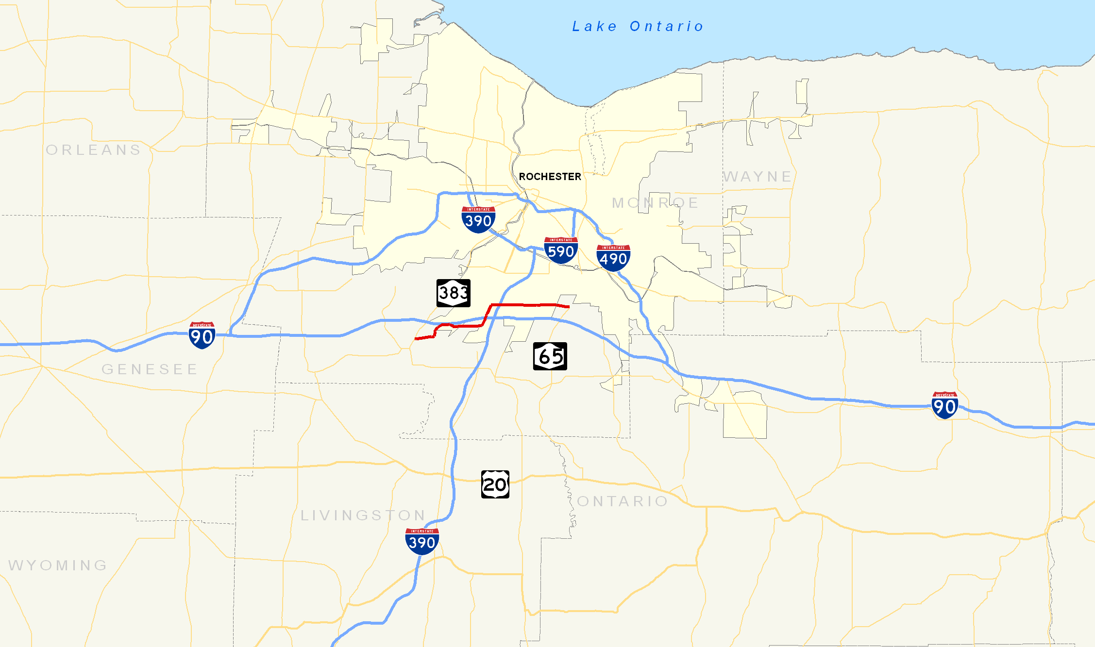
Map of the Rochester area with NY 253 highlighted in redRoute information Maintained by NYSDOT and the town of Henrietta Length: 10.83 mi[2] (17.43 km) Existed: 1930[1] – present Major junctions West end:  NY 383 in Scottsville

 I-390 to I-90 / Thruway in Henrietta
East end:  NY 65 in Pittsford
Location Counties: Monroe Highway system Numbered highways in New York
Interstate • U.S. • N.Y. (former) • Reference • County←  NY 252A
NY 254  →
→New York State Route 253 (NY 253) is a 10.83-mile (17.43 km) long east–west state highway in Monroe County, New York, United States. The western terminus of the route is at NY 383 in the village of Scottsville. Its eastern terminus is at NY 65 in the town of Pittsford. NY 253 meets Interstate 390 and connects to the New York State Thruway (Interstate 90) in the town of Henrietta. The majority of NY 253 passes through either rural or residential areas; however, the midsection of NY 253 is located in a heavily commercial portion of Henrietta.
NY 253 originally extended from NY 36 in Mumford to NY 64 south of the village of Pittsford when it was assigned as part of the 1930 renumbering of state highways in New York. By 1938, it was truncated to Scottsville on its western end but also extended northeastward to Penfield. The portion of NY 253 through East Rochester and Penfield was realigned twice in the 1960s and 1970s before the route was cut back to NY 65 in Pittsford in the 1980s. Since that time, NY 253 has also been rerouted twice in Henrietta.
Contents
Route description
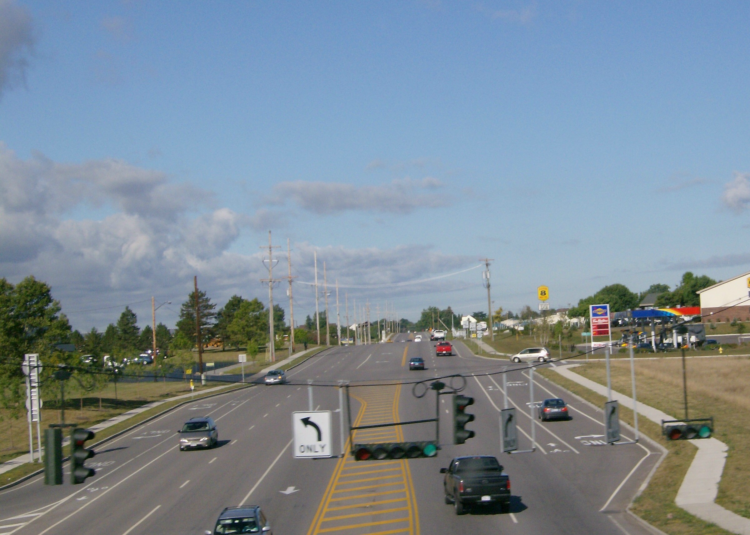
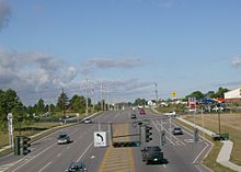 NY 253 westbound as seen from the I-390 southbound overpass in Henrietta
NY 253 begins at an intersection with NY 383 in the village Scottsville. It heads east out of the village and into the surrounding town of Wheatland as Scottsville – West Henrietta Road. Just after crossing the Genesee River into the town of Henrietta, NY 253 turns northward to briefly parallel the river. After about 0.25 miles (0.40 km), Scottsville – West Henrietta Road turns eastward; however, NY 253 continues northward onto Erie Station Road. The roadway gradually curves to the east, coming within 50 yards (46 m) of the New York State Thruway (Interstate 90) and serving the highway's Scottsville service area. NY 253 and the Thruway follow parallel routings for 0.5 miles (0.8 km) before NY 253 shifts slightly south to intersect East River Road, a highway connecting the village of Avon to the city of Rochester.[3]
East of River Road, NY 253 crosses the Livonia, Avon and Lakeville Railroad (LAL) and continues to parallel the Thruway through a lightly populated area of Henrietta toward the hamlet of West Henrietta. Instead of entering the hamlet, NY 253 leaves Erie Station Road and follows an industrial parkway named Thruway Park Drive around the northwestern edge of the community. Upon reaching the western end of Thruway Park Drive at NY 15, NY 253 turns north, joining NY 15 on West Henrietta Road and crossing over the Thruway.[3]
NY 15 and NY 253 continue northward along the heavily-developed and entirely commercial West Henrietta Road to Lehigh Station Road, where NY 253 splits from NY 15 and follows Lehigh Station Road eastward. Like West Henrietta Road before it, Lehigh Station Road is a major commercial strip, consisting of hotels, restaurants, and other establishments. This trend begins to cease as NY 253 meets Interstate 390 (and indirectly with the Thruway) at an interchange, and ceases entirely at a junction with Middle Road, a largely alternate route to I-390 between NY 251 in Rush and Calkins Road.[3]
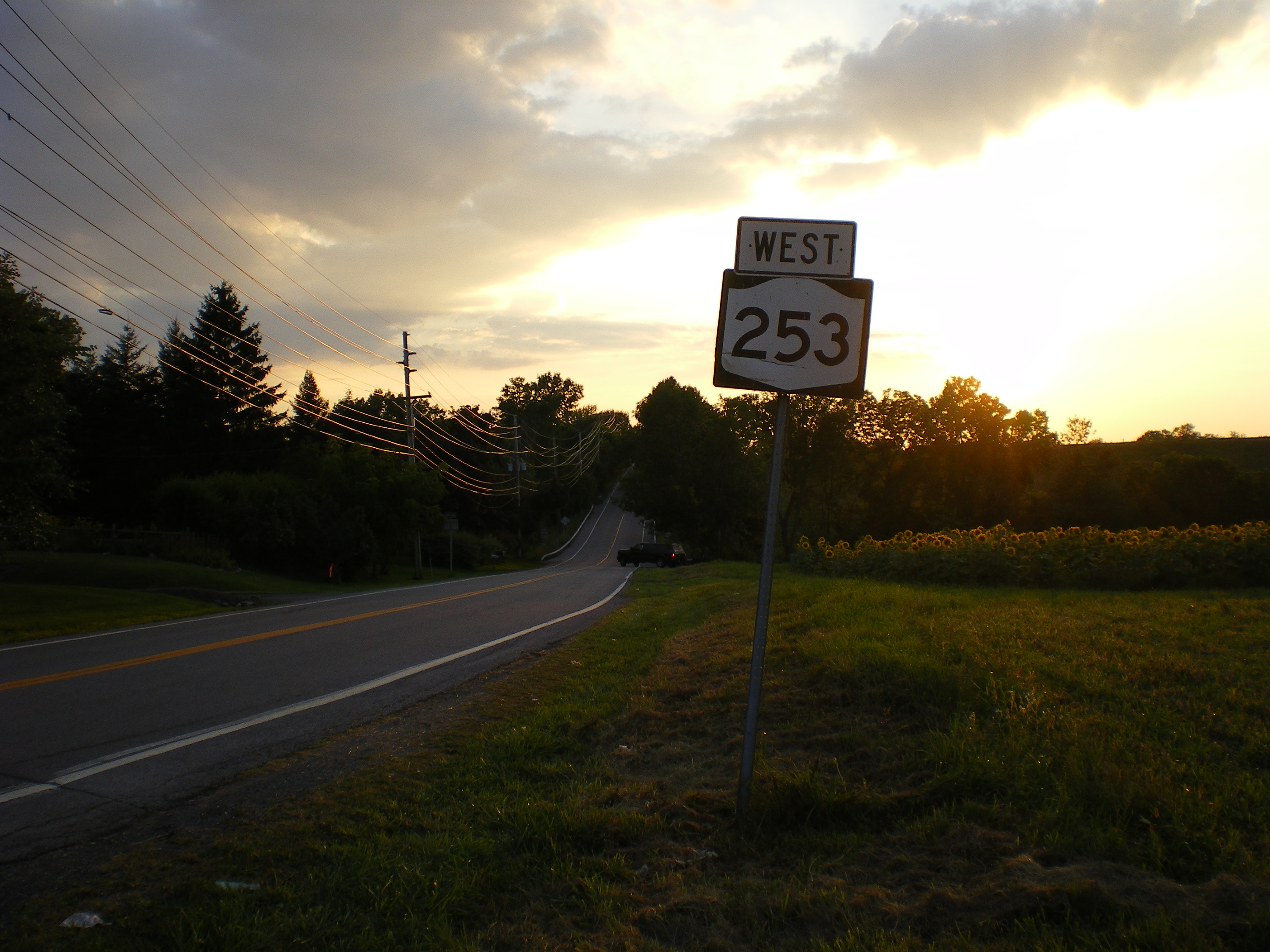
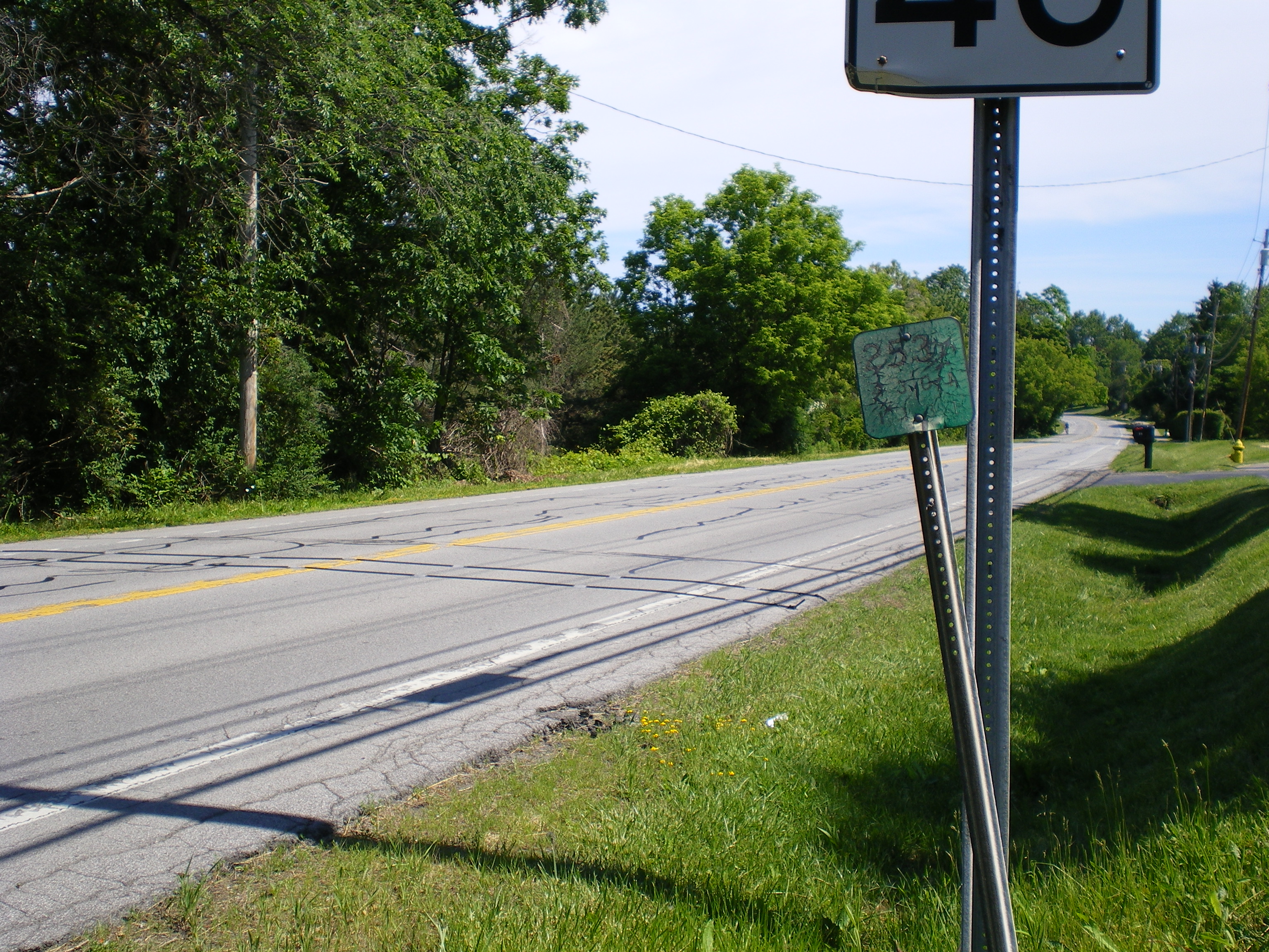
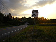 First reassurance shield on NY 253 westbound in Pittsford
Past Middle Road, NY 253 enters a predominantly residential neighborhood. It crosses a spur of the LAL that serves a pair of businesses on NY 253 and continues to the official town center of Henrietta, where it intersects NY 15A. NY 253 continues onward, meeting Pinnacle Road, a highway leading from NY 251 to NY 252, 1 mile (1.6 km) east of NY 15A. East of Pinnacle Road, the amount of development along NY 253 declines sharply, and it continues eastward through open fields to its eastern terminus at NY 65 about 1 mile (1.6 km) east of the Henrietta–Pittsford town line.[3]
History
Establishment and early routing
NY 253 was assigned as part of the 1930 renumbering of state highways in New York. It initially began at NY 36 in the hamlet of Mumford and followed Scottsville–Mumford Road to the village of Scottsville. NY 253 had overlaps with NY 251 and NY 35 through Scottsville, then continued east on Scottsville – West Henrietta, East River, and Erie Station Roads to the Henrietta hamlet of West Henrietta. Here, it turned north to follow NY 2 (now NY 15) to Lehigh Station Road, which it followed eastward to its end at NY 65 in the town of Pittsford. NY 253 continued on, however, joining NY 65 northward to Calkins Road. It then followed Calkins and Mendon Center Roads to NY 64 south of the village of Pittsford.[1][4]
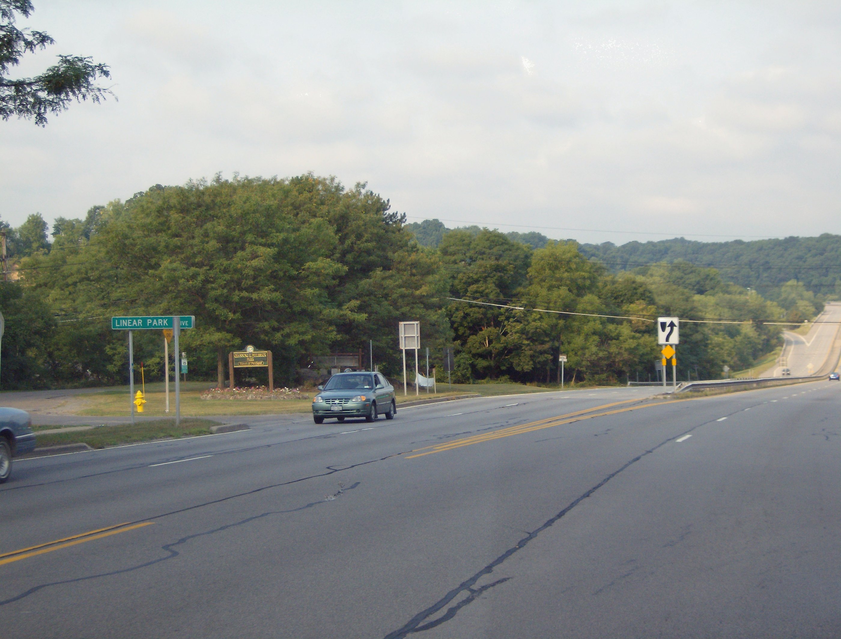
 The junction of NY 441 and Linear Park Drive was the eastern terminus of NY 253 from the late 1930s to the 1960s.
NY 253 was extended northward through Pittsford and East Rochester by 1936 along NY 64, NY 15 (now NY 96), and Washington Street to a new terminus at NY 33 (modern NY 441) in Penfield.[5] Ca. 1938, NY 35 was rerouted south of Scottsville to follow the routing of NY 253 to Mumford. As a result, NY 253 was truncated to the northern terminus of its overlap with NY 35 (modern NY 383) north of the village center.[6][7]
Penfield realignments and truncation
The bridge carrying NY 253 over Irondequoit Creek in Penfield's Linear Park was closed to vehicular traffic in the 1960s.[8] The portion of North Washington Street north of the creek, now severed from the rest of the route, was renamed Linear Park Drive.[9] NY 253, meanwhile, was rerouted north of the junction of North Washington Street and Linden Avenue to follow Linden Avenue eastward across Irondequoit Creek to Whitney Road in Perinton. It then turned north to follow Whitney and Five Mile Line Roads to the Four Corners of Penfield, where it ended at NY 441.[10]
An extension of Panorama Trail, named Panorama Trail South, was built from Panorama Creek Drive south to North Washington Street in the late 1960s and early 1970s to connect Washington to the new NY 441 limited-access highway being constructed through the towns of Brighton and Penfield. NY 253 was rerouted by 1971 to follow North Washington Street and the new highway northwest to the latter road's interchange with NY 441.[10][11]
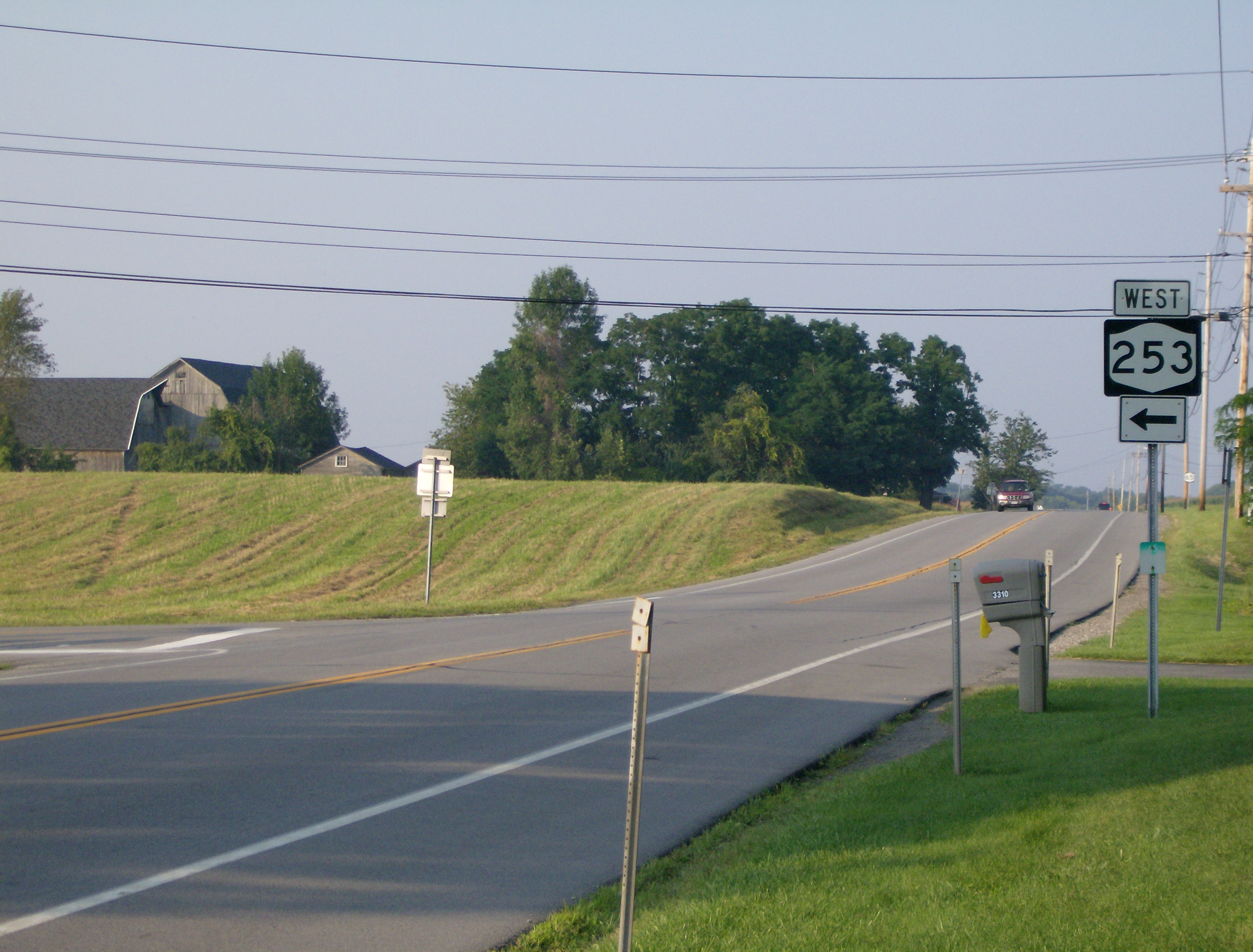
 The current eastern terminus of NY 253 at NY 65 in Pittsford. This was once the southern terminus of NY 253's overlap with NY 65.
In the latter half of the 1980s, NY 253 was truncated southward to the southern terminus of its overlap with NY 65 in Pittsford. The former routing of NY 253 north of NY 96 was redesignated as NY 153[12][13] while the segment between NY 65 and NY 64 on Calkins and Mendon Center Roads became NY 943C, an unsigned reference route 1.68 miles (2.70 km) in length.[2]

Henrietta realignments
To the southwest in Henrietta, construction began by 1978 on an extension of Erie Station Road in the vicinity of Scottsville – West Henrietta and East River Roads. The new roadway, as proposed, would begin at the junction of Erie Station and East River Roads and parallel the New York State Thruway westward toward the Genesee River, then loop back to the southeast to end at Farrell Road.[14] Ultimately, the proposed loop to Farrell Road was scrapped in favor of a more direct connection with Scottsville – West Henrietta Road. The new highway became part of a rerouted NY 253 on April 1, 1984, when it was added to the state highway system as part of a highway maintenance swap between the state of New York and Monroe County. In the swap, ownership and maintenance of the former routing of NY 253 on Scottsville – West Henrietta Road was transferred from the state to the town of Henrietta while the East River Road portion was given to Monroe County[15] and is now part of County Route 84.[16]
In the late 1990s, the amount of traffic at the intersection between NY 253 (Erie Station Road) and NY 15 (West Henrietta Road) began to increase due to the creation of the Thruway Industrial Park. Due to the presence of historical buildings at the intersection, the junction could not be widened to handle the increased traffic flow.[8] As a result, plans were developed to construct a bypass of the intersection to the northwest. On July 29, 1999, Governor George Pataki announced that the state of New York would contribute $1 million[17] (equivalent to $1.32 million in 2011)[18] toward the construction of the highway, which would be an extension of Thruway Park Drive.[17] It opened to traffic in 2000 as a realignment of NY 253.[8] The roadway was dedicated to the town of Henrietta, and although a proposal was made that would transfer maintenance of the highway to the New York State Department of Transportation,[17] it remains a town highway today.[19] The 0.96-mile (1.54 km) long former routing of NY 253 on Erie Station Road became NY 943E, an unsigned reference route.[2][20]
Major intersections
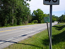 Reference marker for NY 253 on Mendon Center Road (now NY 943C) in the town of Pittsford
The entire route is in Monroe County.
Location Mile[2] Destinations Notes Scottsville 0.00 NY 383Henrietta 5.03  NY 15 south
Southern terminus of NY 15 / NY 253 overlap 5.98 NY 15 northNorthern terminus of NY 15 / NY 253 overlap 6.50 I-390 to I-90 / ThruwayExit 12 (I-390) 6.57 Middle Road (CR 88) 7.98  NY 15A
8.98 Pinnacle Road (CR 92) Town of Pittsford 10.83 NY 651.000 mi = 1.609 km; 1.000 km = 0.621 mi References
- ^ a b Dickinson, Leon A. (January 12, 1930). "New Signs for State Highways". The New York Times: p. 136.
- ^ a b c d "2008 Traffic Volume Report for New York State" (PDF). New York State Department of Transportation. June 16, 2009. pp. 198, 272. https://www.nysdot.gov/divisions/engineering/technical-services/hds-respository/NYSDOT%20TVR%202008%20by%20Route.pdf. Retrieved February 1, 2010.
- ^ a b c d Yahoo! Inc. Yahoo! Maps – overview map of NY 253 (Map). Cartography by NAVTEQ. http://maps.yahoo.com/#mvt=h&lat=43.019252&lon=-77.724669&zoom=14&q1=43.028197%2C-77.743239&q2=43.046516%2C-77.658696&q3=43.057931%2C-77.556815. Retrieved April 14, 2010.
- ^ Standard Oil Company of New York (1930). Road Map of New York (Map). Cartography by General Drafting.
- ^ Standard Oil Company (1936). New York (Map). Cartography by General Drafting.
- ^ Standard Oil Company (1937). New York (Map). Cartography by General Drafting.
- ^ Esso (1938). New York Road Map for 1938 (Map). Cartography by General Drafting.
- ^ a b c Sinsabaugh, Mark. "New York State Route 253". New York Routes. http://www.gribblenation.net/nyroutes/ind/250_259.htm#253. Retrieved May 20, 2009.
- ^ Google, Inc. Google Maps – New York State Route 253 (Map). Cartography by Google, Inc. http://maps.google.com/maps?ie=UTF8&ll=43.127353,-77.484641&spn=0.00276,0.006963&t=h&z=18. Retrieved May 20, 2009.
- ^ a b Esso (1968). New York (Map). Cartography by General Drafting (1969–70 ed.).
- ^ United States Geological Survey (1978). Webster Quadrangle – New York (Map). 1:24,000. 7.5 Minute Series (Topographic). http://www.nysgis.state.ny.us/gisdata/quads/drg24/usgspreview/index.cfm?code=o43077b4. Retrieved May 20, 2009.
- ^ Mobil (1985). Mobil Travel Map – Buffalo, Niagara Falls, Rochester (Map). Cartography by Rand McNally and Company.
- ^ DeLorme Mapping (1990). Upstate New York City Street Maps (Map). 1" = 1/2 mile. Cartography by DeLorme Mapping (1st ed.). p. 5. ISBN 0-89933-300-1.
- ^ United States Geological Survey (1978). West Henrietta Quadrangle – New York – Monroe Co. (Map). 1:24,000. 7.5 Minute Series (Topographic). http://www.nysgis.state.ny.us/gisdata/quads/drg24/usgspreview/index.cfm?code=o43077a6. Retrieved May 20, 2009.
- ^ New York State Legislature. "Highway Law, Article 12, Section 341". http://public.leginfo.state.ny.us/menugetf.cgi?COMMONQUERY=LAWS. Retrieved May 20, 2009.
- ^ New York State Department of Transportation (1997). West Henrietta Digital Raster Quadrangle (Map). 1:24,000. http://www.nysgis.state.ny.us/gisdata/quads/drg24/dotpreview/index.cfm?code=p17. Retrieved May 20, 2009.
- ^ a b c "Governor Announces $1 Million To Increase Jobs In Monroe County". Office of the Governor of New York. July 29, 1999. http://worldcat.org/arcviewer/1/AO%23/2007/01/12/0000057321/viewer/file6410.html. Retrieved May 20, 2009.
- ^ Consumer Price Index (estimate) 1800–2008. Federal Reserve Bank of Minneapolis. Retrieved December 7, 2010.
- ^ New York State Department of Transportation (March 2, 2009). "Region 4 Inventory Listing". https://www.nysdot.gov/divisions/engineering/technical-services/highway-data-services/inventory-listing. Retrieved May 20, 2009.
- ^ New York State Department of Transportation (October 2004) (PDF). Official Description of Highway Touring Routes, Scenic Byways, & Bicycle Routes in New York State. https://www.nysdot.gov/divisions/operating/oom/transportation-systems/repository/tour_route_0.pdf. Retrieved May 20, 2009.
External links
Categories:- State highways in New York
- Transportation in Monroe County, New York


Wikimedia Foundation. 2010.