- Moodna Creek
-
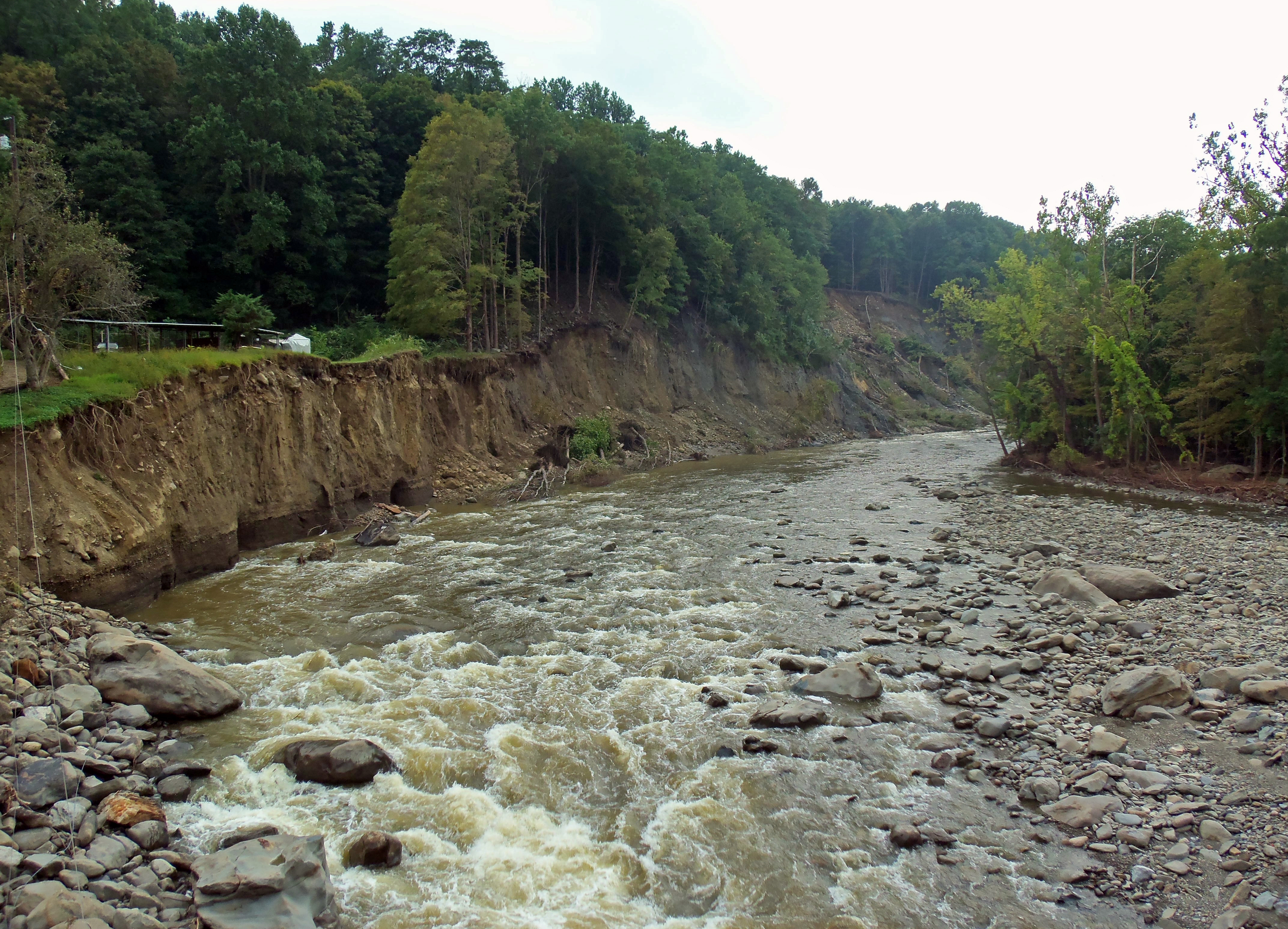
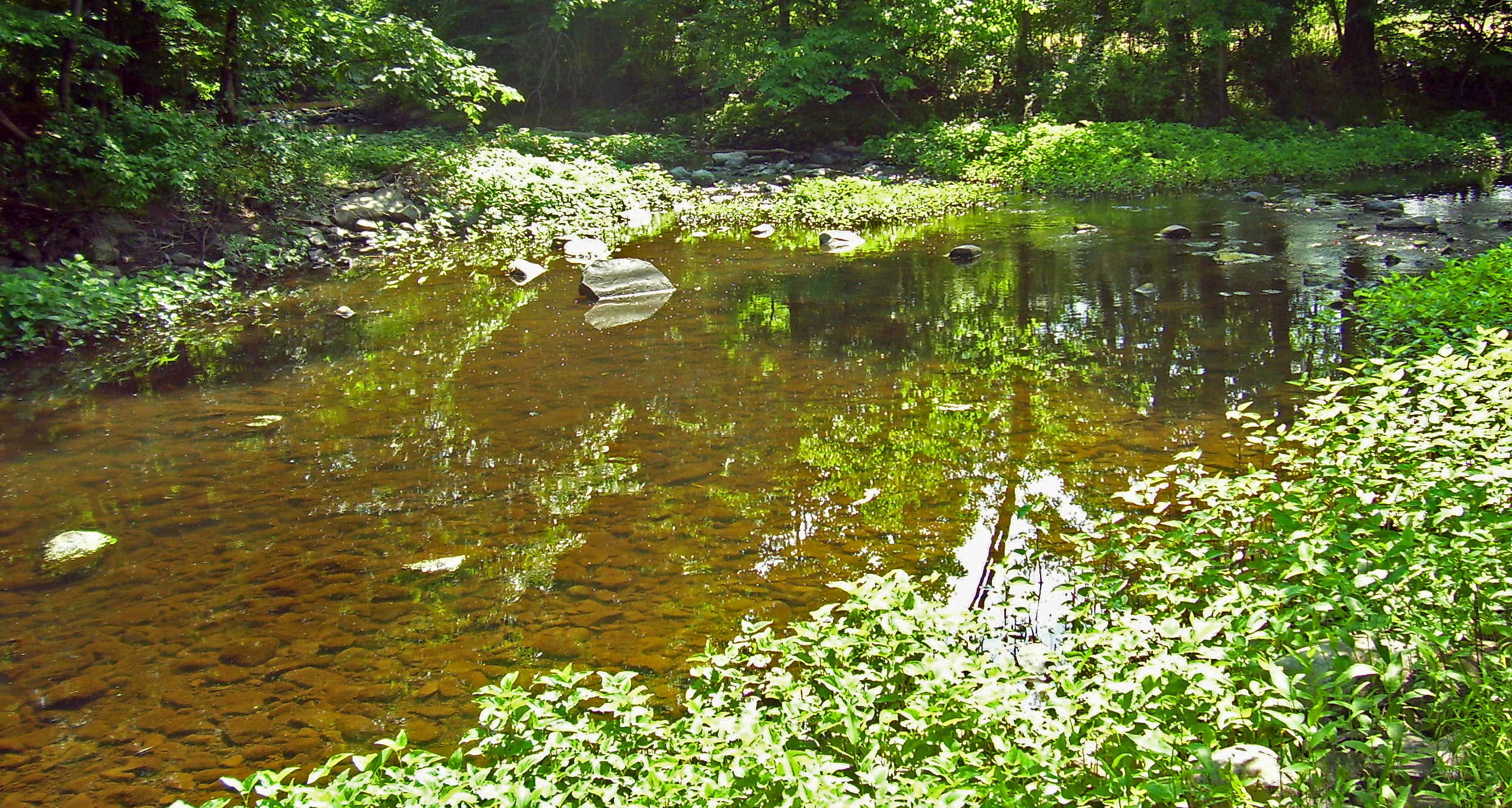
Moodna Creek River  Moodna Creek near Knox's Headquarters State Historic Site in New Windsor, showing widening of channel resulting from floods after Hurricane Irene
Country United States State New York County Orange Towns Cornwall, New Windsor, Blooming Grove Tributaries - right Woodbury Creek Villages Washingtonville Source Otter Kill - location Goshen Reservoir No. 2, Town of Goshen - elevation 460 ft (140 m) - coordinates 41°22′06″N 74°19′02″W / 41.36833°N 74.31722°W Secondary source Cromline Creek - location Tomahawk Lake, Blooming Grove - elevation 340 ft (104 m) - coordinates 41°24′57″N 74°13′07″W / 41.41583°N 74.21861°W Source confluence - location Blooming Grove - elevation 300 ft (91 m) - coordinates 41°25′51″N 74°11′41″W / 41.43083°N 74.19472°W Mouth Hudson River - location Cornwall - elevation 0 ft (0 m) - coordinates 41°27′13″N 74°01′00″W / 41.45361°N 74.0166667°W Length 15.5 mi (25 km) Basin 187.2 sq mi (485 km2) 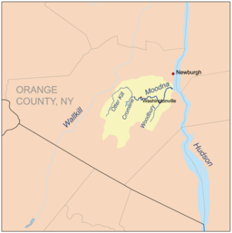 Moodna Creek and its watershed and major tributaries
Moodna Creek is a small tributary of the Hudson River that drains eastern Orange County, New York. At 15.5 miles (25 km)[1] in length from its source at the confluence of Cromline Creek and Otter Kill west of Washingtonville, it is the longest stream located entirely within the county.
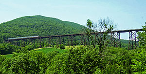
Despite its small size relative to the Hudson, it has been a major influence on the topography of eastern central Orange County. Its 187.2-square mile (485 km²) watershed,[1] including not only both its parent streams but Woodbury Creek as well, reaches as far inland as Warwick as well as 21 other area communities. Near Salisbury Mills it is crossed by the Moodna Viaduct, the longest actively-used railroad trestle east of the Mississippi.
Contents
Name
"Moodna" is a corruption of the Dutch "Moordenaars", from Murderers' Creek, its original name. Local lore has it that the name came from the massacre of the Stacys, an early family of settlers, along its banks.[2] Murderers' Creek was in common use in the mid-18th century, however by the dawn of the 20th Moodna was being used on maps although the older name persisted.[3]
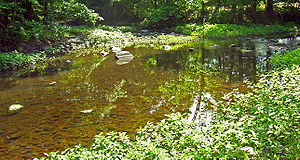 Confluence of Cromline Creek (center) and Otter Kill (right), creating Moodna Creek (left).
Course
From the confluence, just off NY 208, the Moodna flows through woods and field alongside the highway for a short distance, then veers southwestward to where it crosses NY 94. The creek and Route 94 will keep close company for several miles as it turns eastward again into Washingtonville, where it crosses under 208 just south of downtown. Past the village, Route 94 and the creek enter first the Town of Blooming Grove and then Cornwall. They run close together at first, then further apart as the Moodna valley opens up just to the north of Schunemunk Mountain. At Salisbury Mills the viaduct crosses 193 feet (59 m) overhead.
After that point, the Moodna turns southward slightly, following the curve of Schunemunk's north end under the Thruway and leaving the Route 94 corridor. It descends into the narrower valley, forming the eastern boundary of Storm King Art Center. Here the already wide creek gets even wider with the addition of Woodbury Creek just after it tumbles over a small dam. Immediately afterwards NY 32 crosses between Vails Gate and Mountainville. The wide, rocky stream curves between steep, wooded hills to enter New Windsor and cross Old Forge Hill Road just below Knox's Headquarters State Historic Site, receiving its only major northern tributary, Silver Stream, in the process. Following Old Forge Hill briefly, it passes its last road crossing at US 9W, then bends southwards back into Cornwall to empty into the Hudson amid tidal marshes. The CSX Hudson River Subdivision freight line crosses right at its mouth.
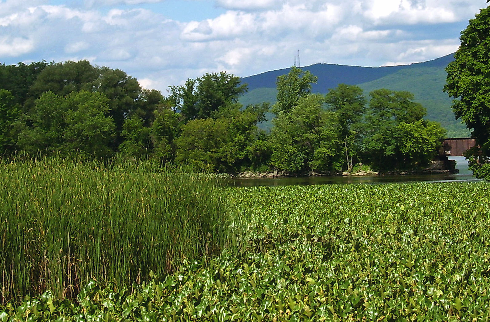
 The tidal marshes at the creek's mouth, home to some rare species and communities.
Natural history
The 75 acres (30 ha) of tidal marsh in the creek's estuary, between Route 9W and the Hudson, are home to several rare plants and natural communities. Anadromous fish species, such as striped bass, spawn there as well. This fish supply has been attractive not only to human anglers but to predatory bird species as well: bald eagles and ospreys have been seen feeding in the Moodna's marshes[4] Bald Eagles have been confirmed nesting on the Black Meadow Creek.
Two herpetofaunal species listed by the NYS Department of Environmental Conservation occur along the Moodna. One, the Northern Cricket Frog (Acris c. crepitans) occurs along the length of the Black Meadow creek, which runs from Warwick, NY into Chester, NY. The Northern Cricket Frog, NY's only endangered frog species, occurs in its most numerous population along the Black Meadow creek, in the Orange-County-owned Glenmere Lake reservoir lands.
While the water quality in that area remains generally good, there is effluent from the Town of New Windsor's sewage treatment plant. In November 2003 the Riverkeeper environmental organization sued the town over discharge into the creek leaking from two manholes into the creek. It was settled in 2005 when the town agreed to repair the manholes, remediate the area and provide public access to the water.[5]
Recreation
The six miles (10 km) between Woodbury Creek and Old Forge Hill Road in Cornwall have become a popular place for whitewater kayaking[6]. Section ratings on the International Scale of River Difficulty range from Class II to Class IV.[7] Anglers, too, have taken advantage of the stream above the salt marshes. The New York State Department of Environmental Conservation keeps Moodna Creek regularly stocked with brown and rainbow trout.[8]
History
During colonial times, and for a short time after independence, the creek formed part of the boundary between Orange and Ulster counties.[3] In 1798, however, Rockland County was created, and the line was adjusted northward, giving Orange the current towns of Newburgh, Montgomery and Crawford as compensation for the lost territory.
Heavy rains during the April 2007 Nor'easter caused the creek to flood extensively in its upper course in and around Washingtonville. Route 94 was blocked in both directions, and Route 208 from the south, leaving only northern access to the village available. Almost a hundred residents had to leave their homes for temporary shelter at a local elementary school.[9]
Tributaries
- Silver Stream
- Woodbury Creek
- Baby Brook
- Perry Creek
- Satterly Creek
- Black Meadow Creek
- Otterkill
See also
References
- ^ a b Nolan, J. Kelly; April 2004; Rapid Bioassessment of the Moodna Creek, Orange County NYPDF (2.51 MiB); Hudson Basin River Watch; retrieved June 29, 2007.
- ^ Murphy, Glenn; Town of New Windsor Online History; retrieved June 29, 2007.
- ^ a b Smith, Richard; Francis Whiting Halsey (1906). A Tour of Four Great Rivers: The Hudson, Mohawk, Susquehanna and Delaware in 1769, Being the Journal of Richard Smith, Of Burlington, New Jersey. New York, NY: Charles Scribner & Sons. pp. 7. http://books.google.com/books?id=jPTEUBg7PRgC&pg=PA7&lpg=PA7&dq=%22moodna+creek%22+murderers&source=web&ots=6aNeoTGccF&sig=snsxPwqlhducdd07dh-NRXfxR_8#PPA7,M1. Retrieved 2007-06-29..
- ^ New York State Department of State, Division of Coastal Resources; Moodna CreekPDF (194 KiB) retrieved June 30, 2007.
- ^ "Riverkeeper and New Windsor Settle Sewage Case" (in English) (Press release). Riverkeeper. March 24, 2005. http://riverkeeper.org/campaign.php/pollution/we_are_doing/1066. Retrieved 2007-06-30.
- ^ Moodna Creek, NY; Woodbury Creek to Old Forge Hill Road American Whitewater
- ^ "New York whitewater - Moodna Creek, Orange County". Riverfacts.com. http://www.riverfacts.com/rivers/12159.html. Retrieved 2007-07-03.
- ^ "Spring 2007 Trout Stocking for Orange County". New York State Department of Environmental Conservation. http://www.dec.ny.gov/outdoor/23300.html. Retrieved 2007-07-03.
- ^ Al-Rikabi, Ramsey; April 17, 2007; "Moodna Creek floods Washingtonville"; Times-Herald Record; retrieved June 30, 2007.
External links
 Media related to Moodna Creek at Wikimedia Commons
Categories:- Rivers of New York
- Tributaries of the Hudson River
- Rivers of Orange County, New York


Wikimedia Foundation. 2010.