- Blooming Grove, New York
-
Blooming Grove, New York — Town — Location within the state of New York
 Blooming Grove, New York
Coordinates: 41°26′N 74°10′W / 41.433°N 74.167°W Country United States State New York County Orange Government – Type Town Council – Town Supervisor Frank A. Fornario, Jr. (R) – Town Council Members' ListArea – Total 35.3 sq mi (91.5 km2) – Land 34.8 sq mi (90.2 km2) – Water 0.5 sq mi (1.3 km2) Elevation 374 ft (114 m) Population (2000) – Total 17,351 – Density 498.5/sq mi (192.5/km2) Time zone Eastern (EST) (UTC-5) – Summer (DST) EDT (UTC-4) ZIP code 10914 Area code(s) 845 FIPS code 36-07003 GNIS feature ID 0978739 Blooming Grove is a town in Orange County, New York, USA. The population was 17,351 at the 2000 census.
The Town of Blooming Grove is in the central part of the county, located southwest of Newburgh.
Contents
History
The Town of Blooming Grove was formed from the Town of Cornwall in 1799. In 1830, the Town of Hamptonburgh was established from part of Blooming Grove. Another part of Blooming Grove was taken to form the Town of Chester in 1845.
The Brotherhood Winery in Washingtonville is the oldest continuously operating winery in the United States, having been established in 1839.
As of July 2006, legislation has been passed in order to incorporate a southern portion of the town into a separate community known as South Blooming Grove. This legislative action has led to the creation of a new community in Orange County for the first time since the late 1970s. On July 14, 2006 the state of New York incorporated the hamlet of South Blooming Grove into a village. This hamlet is now known as the "Village of South Blooming Grove."
Geography
According to the United States Census Bureau, the town has a total area of 35.3 square miles (91 km2), of which, 34.8 square miles (90 km2) of it is land and 0.5 square miles (1.3 km2) of it (1.42%) is water.
Combined NY-17- US Route 6 pass through the south of Blooming Grove.
Demographics
As of the census[1] of 2000, there were 17,351 people, 5,836 households, and 4,575 families residing in the town. The population density was 498.5 people per square mile (192.5/km²). There were 6,559 housing units at an average density of 188.4 per square mile (72.8/km²). The racial makeup of the town was 90.24% White, 3.80% African American, 0.49% Native American, 1.41% Asian, 0.02% Pacific Islander, 2.41% from other races, and 1.63% from two or more races. Hispanic or Latino of any race were 8.97% of the population.
There were 5,836 households out of which 44.2% had children under the age of 18 living with them, 66.1% were married couples living together, 8.6% had a female householder with no husband present, and 21.6% were non-families. 18.3% of all households were made up of individuals and 6.4% had someone living alone who was 65 years of age or older. The average household size was 2.97 and the average family size was 3.41.
In the town the population was spread out with 30.1% under the age of 18, 6.5% from 18 to 24, 30.9% from 25 to 44, 24.2% from 45 to 64, and 8.3% who were 65 years of age or older. The median age was 36 years. For every 100 females there were 99.5 males. For every 100 females age 18 and over, there were 95.0 males.
The median income for a household in the town was $66,040, and the median income for a family was $74,428. Males had a median income of $51,719 versus $35,865 for females. The per capita income for the town was $25,097. About 2.0% of families and 3.9% of the population were below the poverty line, including 4.2% of those under age 18 and 7.6% of those age 65 or over.
Communities and locations within the Town of Blooming Grove
- Beaver Dam Lake – A lake partly inside the northeast corner of Blooming Grove.
- Beaverdam Lake – A hamlet that is also located in the Town of New Windsor.
- Blooming Grove – The hamlet of Blooming Grove, located on NY-94, south of Washingtonville.
- Bull Mine – A hamlet in the south part of town on NY-208.
- Craigville – A hamlet south of Blooming Grove village on NY-94.
- Mountain Lodge Park – A former summer community located on Schunemunk Mountain.
- Oxford – A hamlet in the south part of town by NY-17.
- Salisbury Mills – A hamlet by the east town line on NY-94. The hamlet is also located in the Town of Cornwall.
- Schunnemunk Mountain – The highest mountain in the county is at the east town line.
- South Blooming Grove – The Village of South Blooming Grove.
- Tomahawk Lake – A lake by the west boundary of the town.
- Washingtonville – The Village of Washingtonville is located at the junction of state highways NY-94 and NY-208.
References
- ^ "American FactFinder". United States Census Bureau. http://factfinder.census.gov. Retrieved 2008-01-31.
External links
Coordinates: 41°26′N 74°10′W / 41.433°N 74.167°W
Municipalities and communities of Orange County, New York Cities 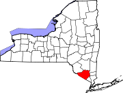
Towns Blooming Grove | Chester | Cornwall | Crawford | Deerpark | Goshen | Greenville | Hamptonburgh | Highlands | Minisink | Monroe | Montgomery | Mount Hope | New Windsor | Newburgh | Tuxedo | Wallkill | Warwick | Wawayanda | Woodbury
Villages Chester | Cornwall-on-Hudson | Florida | Goshen | Greenwood Lake | Harriman | Highland Falls | Kiryas Joel | Maybrook | Monroe | Montgomery | Otisville | South Blooming Grove | Tuxedo Park | Unionville | Walden | Warwick | Washingtonville | Woodbury
CDPs Other
hamletsAmity | Arden | Bellvale | Bullville | Circleville | Howells | Little Britain | Michigan Corners | Mountain Lodge Park | Mountainville | New Hampton | Pine Island | Ridgebury | Slate Hill | Sugar Loaf | Thompson Ridge | Westbrookville
Categories:- Towns in New York
- Populated places in Orange County, New York
- Poughkeepsie–Newburgh–Middletown metropolitan area


Wikimedia Foundation. 2010.