- Minisink, New York
-
Minisink, New York — Township — Location within the state of New York
 Minisink, New York
Coordinates: 41°20′3″N 74°32′45″W / 41.33417°N 74.54583°WCoordinates: 41°20′3″N 74°32′45″W / 41.33417°N 74.54583°W Country United States State New York County Orange Area – Total 23.2 sq mi (60.0 km2) – Land 23.1 sq mi (59.8 km2) – Water 0.1 sq mi (0.2 km2) Elevation 554 ft (169 m) Population (2000) – Total 3,585 – Density 155.2/sq mi (59.9/km2) Time zone Eastern (EST) (UTC-5) – Summer (DST) EDT (UTC-4) FIPS code 36-47713 GNIS feature ID 0979226 Minisink is a town located in southwest Orange County, New York northeast of the New Jersey border between the Town of Greenville and the Town of Warwick. The population was 3,585 at the 2000 census.
Contents
History
Historically, the name Minisink, which dates to the mid 17th century, has applied to a much larger area than the current town, running as far north as Minisink Ford, twenty miles northwest of present day Minisink, south to the Delaware Water Gap, thirty miles southwest of present day Minisink, and from the Kittatinny Ridge to the east to the Poconos to the west (See [1]). The Minisink Patent, granted in 1704, was a somewhat smaller area, but still far larger than the present town, which was given its present boundaries in 1800. Adding to the confusion is the fact that the New York - New Jersey border was previously seven or eight miles north of its present location: Minisink used to be in New Jersey.
The town was first settled around 1725 and organized as a town in 1788. Minisink lost territory to newer towns: Deer Park (1798), Wawayanda (1849), and Greenville (1853). In 1871, the community of Unionville set itself off from the town by incorporating as a village.
Geography
According to the United States Census Bureau, the town has a total area of 23.2 square miles (60 km2), of which, 23.1 square miles (60 km2) of it is land and 0.1 square miles (0.26 km2) of it (0.39%) is water.
The south town line is the border of New Jersey (Sussex County).
NY-284 is a north-south highway in Minisink.
Demographics
As of the census[1] of 2000, there were 3,585 people, 1,182 households, and 945 families residing in the town. The population density was 155.2 people per square mile (59.9/km²). There were 1,245 housing units at an average density of 53.9 per square mile (20.8/km²). The racial makeup of the town was 95.96% White, 1.42% African American, 0.03% Native American, 0.59% Asian, 0.06% Pacific Islander, 1.03% from other races, and 0.92% from two or more races. Hispanic or Latino of any race were 4.60% of the population.
There were 1,182 households out of which 44.8% had children under the age of 18 living with them, 69.3% were married couples living together, 7.6% had a female householder with no husband present, and 20.0% were non-families. 15.9% of all households were made up of individuals and 6.2% had someone living alone who was 65 years of age or older. The average household size was 3.02 and the average family size was 3.39.
In the town the population was spread out with 29.8% under the age of 18, 6.3% from 18 to 24, 31.3% from 25 to 44, 24.3% from 45 to 64, and 8.3% who were 65 years of age or older. The median age was 36 years. For every 100 females there were 97.3 males. For every 100 females age 18 and over, there were 95.2 males.
The median income for a household in the town was $55,561, and the median income for a family was $58,906. Males had a median income of $36,912 versus $28,750 for females. The per capita income for the town was $20,967. About 4.5% of families and 5.8% of the population were below the poverty line, including 6.8% of those under age 18 and 3.7% of those age 65 or over.
Education
Communities and locations in Minisink
- Johnson – A hamlet near the north town line on NY-284.
- Laurel Hill – An elevation in the eastern part of Minisink.
- Millsburg – a location near the north town line.
- Unionville – The Village of Unionville is near the New Jersey border on highway NY-284.
- Waterloo Mills – A hamlet northwest of Westtown.
- Westtown – A hamlet north of Unionville on NY-284 on County Road 1.
References
- ^ "American FactFinder". United States Census Bureau. http://factfinder.census.gov. Retrieved 2008-01-31.
External links
Municipalities and communities of Orange County, New York Cities 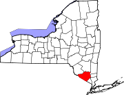
Towns Blooming Grove | Chester | Cornwall | Crawford | Deerpark | Goshen | Greenville | Hamptonburgh | Highlands | Minisink | Monroe | Montgomery | Mount Hope | New Windsor | Newburgh | Tuxedo | Wallkill | Warwick | Wawayanda | Woodbury
Villages Chester | Cornwall-on-Hudson | Florida | Goshen | Greenwood Lake | Harriman | Highland Falls | Kiryas Joel | Maybrook | Monroe | Montgomery | Otisville | South Blooming Grove | Tuxedo Park | Unionville | Walden | Warwick | Washingtonville | Woodbury
CDPs Other
hamletsAmity | Arden | Bellvale | Bullville | Circleville | Howells | Little Britain | Michigan Corners | Mountain Lodge Park | Mountainville | New Hampton | Pine Island | Ridgebury | Slate Hill | Sugar Loaf | Thompson Ridge | Westbrookville
Categories:- Towns in New York
- Populated places in Orange County, New York
- Populated places established in 1800
- Poughkeepsie–Newburgh–Middletown metropolitan area


Wikimedia Foundation. 2010.