- Maybrook, New York
-
Maybrook Village 
Country USA State New York Region Hudson Valley County Orange Towns Montgomery, Hamptonburgh Elevation 420 ft (128 m) Coordinates 41°29′21″N 74°12′48″W / 41.48917°N 74.21333°W Highest point Unnamed hill near west village line - elevation 520 ft (158 m) - coordinates 41°29′17″N 74°13′12″W / 41.48806°N 74.22°W Lowest point Swampy area in northeast corner - elevation 360 ft (110 m) - coordinates 41°29′48″N 74°12′09″W / 41.49667°N 74.2025°W Area 1.3 sq mi (3 km2) - land 1.3 sq mi (3 km2) Population 3,084 (2000) Density 2,306.3 / sq mi (890 / km2) Founded 1926 Mayor Ron Herman Timezone Eastern (EST) (UTC-5) - summer (DST) EDT (UTC-4) ZIP Code 12543 Area code 845 Exchange 427 FIPS code 36-46162 GNIS feature ID 0956701 
 Location of Maybrook within New York
Wikimedia Commons: Maybrook, New York Maybrook is a village in Orange County, New York, United States. The population was 3,084 at the 2000 census. It is part of the Poughkeepsie–Newburgh–Middletown, NY Metropolitan Statistical Area as well as the larger New York–Newark–Bridgeport, NY-NJ-CT-PA Combined Statistical Area.
It is located mostly in the Town of Montgomery, but a small portion is in the Town of Hamptonburgh. It is also defined by the 427 telephone exchange in the 845 area code and the 12543 ZIP code, as well as its own eponymous fire district.
Contents
Geography
Maybrook is located at 41°29′12″N 74°12′52″W / 41.48667°N 74.21444°W (41.486660, -74.214463)[1]. Northern Orange County
According to the United States Census Bureau, the village has a total area of 1.3 square miles (3.4 km2), all of it land. The village is centered around NY 208 which runs through it for the village's two-mile (3.2 km) length in a northeast-southwest orientation, from the small extension in the Town of Hamptonburgh to its northern boundary. By contrast, it is only a mile wide at its widest point, near its south end, and even narrower to the north.
The village is mostly flat, rising up to hills on its west side. The summit of one is its highest elevation, at 520 feet (160 m) above sea level. Maybrook's lowest point is a swampy, undeveloped area in its northeast corner, 360 feet (110 m) in elevation.
Demographics
As of the census[2] of 2000, there were 3,084 people, 1,043 households, and 780 families residing in the village. The population density was 2,306.3 people per square mile (888.6/km²). There were 1,077 housing units at an average density of 805.4 per square mile (310.3/km²). The racial makeup of the village was 82.81% White, 8.98% African American, 0.29% Native American, 1.20% Asian, 3.99% from other races, and 2.72% from two or more races. Hispanic or Latino of any race were 12.74% of the population.
There were 1,043 households out of which 46.3% had children under the age of 18 living with them, 54.3% were married couples living together, 14.7% had a female householder with no husband present, and 25.2% were non-families. 19.9% of all households were made up of individuals and 7.1% had someone living alone who was 65 years of age or older. The average household size was 2.95 and the average family size was 3.41.
In the village the population was spread out with 32.7% under the age of 18, 8.2% from 18 to 24, 32.8% from 25 to 44, 19.0% from 45 to 64, and 7.4% who were 65 years of age or older. The median age was 32 years. For every 100 females there were 95.2 males. For every 100 females age 18 and over, there were 92.7 males.
The median income for a household in the village was $52,872, and the median income for a family was $56,912. Males had a median income of $40,165 versus $30,385 for females. The per capita income for the village was $19,194. About 3.6% of families and 6.1% of the population were below the poverty line, including 6.9% of those under age 18 and 11.2% of those age 65 or over.
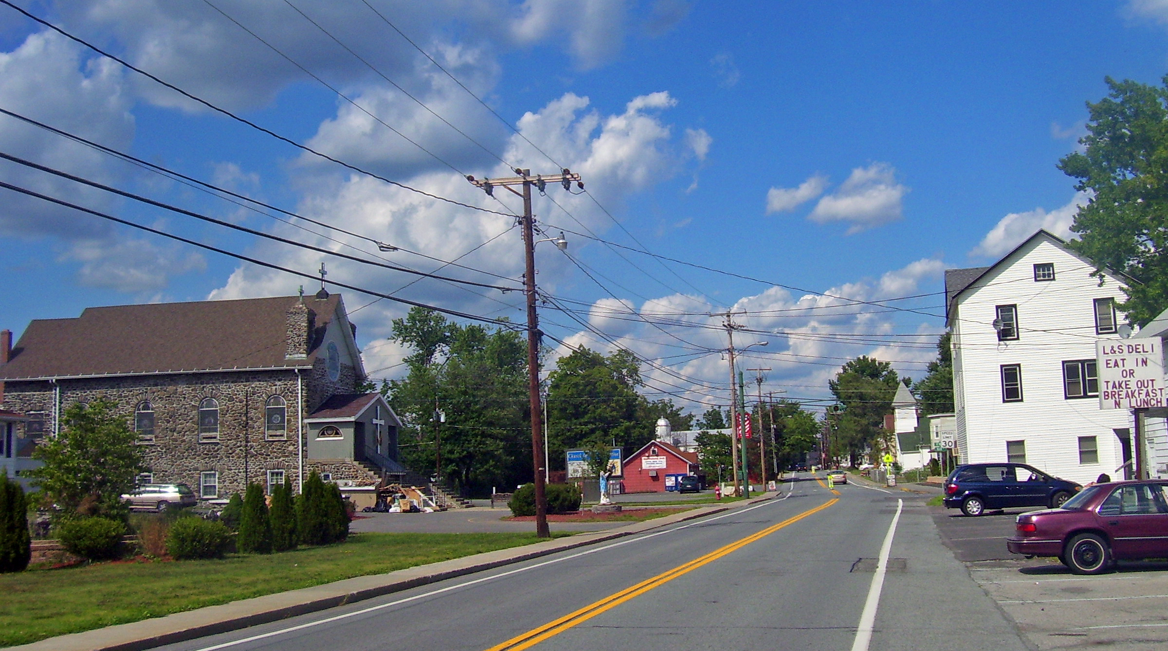
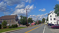 Downtown
History
The hamlet did not incorporate as a village until 1926, making it the last of the Town of Montgomery's three villages to do so.
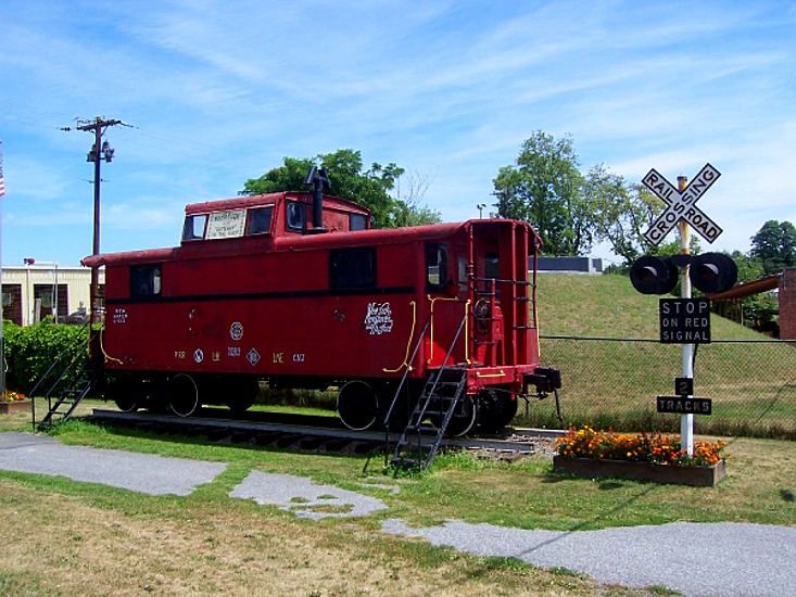
Maybrook's development as a village owes much to the railroads, and in 1910 the largest rail hub in the East was built there. It stayed open until 1974, employing 1,500 at its peak.
Today the railroads are gone but the village's proximity to Interstate 84, the New York State Thruway and Stewart International Airport ensure its continued status as a transportation and distribution center. Yellow Freight operates a center in the village and is its largest employer. For many years, Maybrook was a local destination for Pat's Pizza, Four Star Video, and Lu-Jon's Ice Cream.
Many residents in Orange County consider Maybrook to be a trap for unwary motorists in terms of the police force aggressively giving out traffic tickets. On a typical night in traffic court, the courthouse is packed with motorists who received traffic tickets of varying kinds, including driving 30 miles (48 km) an hour in a 30-mile (48 km) an hour zone, and ignoring a “No Left Turn” sign which is instructing motorists not to make a left turn on route 208 from a side street, even though motorists in that predicament have no other way to go back toward Interstate Route 84. Cases like these that involve enforcing traffic laws that are frivolous and unreasonable, can overwhelm the court clerks who must keep track of every case and its disposition. The court accepts Mastercard and Visa.
References
- ^ "US Gazetteer files: 2010, 2000, and 1990". United States Census Bureau. 2011-02-12. http://www.census.gov/geo/www/gazetteer/gazette.html. Retrieved 2011-04-23.
- ^ "American FactFinder". United States Census Bureau. http://factfinder.census.gov. Retrieved 2008-01-31.
External links
Municipalities and communities of Orange County, New York Cities 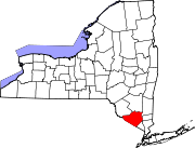
Towns Blooming Grove | Chester | Cornwall | Crawford | Deerpark | Goshen | Greenville | Hamptonburgh | Highlands | Minisink | Monroe | Montgomery | Mount Hope | New Windsor | Newburgh | Tuxedo | Wallkill | Warwick | Wawayanda | Woodbury
Villages Chester | Cornwall-on-Hudson | Florida | Goshen | Greenwood Lake | Harriman | Highland Falls | Kiryas Joel | Maybrook | Monroe | Montgomery | Otisville | South Blooming Grove | Tuxedo Park | Unionville | Walden | Warwick | Washingtonville | Woodbury
CDPs Other
hamletsAmity | Arden | Bellvale | Bullville | Circleville | Howells | Little Britain | Michigan Corners | Mountain Lodge Park | Mountainville | New Hampton | Pine Island | Ridgebury | Slate Hill | Sugar Loaf | Thompson Ridge | Westbrookville
Categories:- Villages in New York
- Populated places in Orange County, New York
- Populated places established in 1926
- Poughkeepsie–Newburgh–Middletown metropolitan area


Wikimedia Foundation. 2010.