- New York State Route 207
-
NYS Route 207 Route information Maintained by NYSDOT and the city of Newburgh Length: 19.10 mi[2] (30.74 km) Existed: 1930[1] – present Major junctions West end: 


 US 6 / NY 17 / NY 17A / NY 17M in Goshen
East end:  NY 17K in Newburgh
Location Counties: Orange Highway system Numbered highways in New York
Interstate • U.S. • N.Y. (former) • Reference • County←  NY 206
NY 208  →
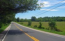
→New York State Route 207 (NY 207) is a state highway located entirely within Orange County, New York, in the United States. It serves as a connector between the village of Goshen and the city of Newburgh. It has for a long time provided the main access to Stewart International Airport. The highway follows the path of the old Goshen–Newburgh Turnpike and is a two-lane road through its entire length. It is also shared with New York State Bicycle Route 17.
Contents
Route description
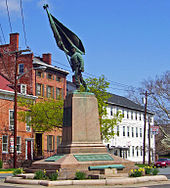
The route begins in southwest Goshen, at the intersection of the Quickway (US 6 and NY 17) and NY 17M. South of the junction NY 17A continues as Pulaski Highway toward Florida and Warwick. It enters Goshen as Greenwich Avenue, becoming Main Street at a five-way intersection at the southwest corner of the village's large triangular central green (Westbound traffic sometimes misses the Greenwich fork and continues on Main as there is no overhead sign, just one at the side of the road). The historic buildings in this area of Goshen have been federally recognized as the Church Park Historic District. At the triangle's northern end, after passing next to Orange County's original courthouse and the Orange Blossoms monument, it is joined by Park Place and passes the Harness Racing Museum & Hall of Fame on the right, then the Orange County Government Center on the left, before leaving the village.
Entering the countryside, it begins to veer more to the east. Six miles (9.6 km) later in the Town of Hamptonburgh, Route 207 goes into a short tunnel under the Metro North-Norfolk Southern tracks and then immediately bears right, more due east, where NY 416 splits off to the left, northward, toward Montgomery. It then passes through what could be called downtown Campbell Hall at a grade crossing with the former Wallkill Valley Railroad, still used today by NS as a freight spur to Walden.
Three miles further down it goes through a slightly staggered intersection with NY 208 in the hamlet of Rock Tavern between Maybrook and Washingtonville. Now known as Little Britain Road, it skirts the southern boundary of Stewart State Forest for several miles, passes Little Britain Elementary School and a new medical office park.
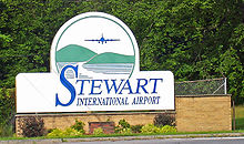
The intersection with Drury Lane, long the dividing lane between the airport proper and lands seized in the early 1970s for a massive expansion that was later canceled, has been expanded and rebuilt to support a new exit on Interstate 84. A traffic light was installed, and Drury became NY 747. A mile and half later 207 reaches an entrance to Stewart International Airport. After that, it passes under (but does not intersect with) the New York State Thruway (Interstate 87), immediately west of its junction with NY 300.
After a concurrent section of 0.2-mile (0.3 km), 207 then splits to the northeast at the Squire Patton House, now the city of Newburgh's police K-9 training facility. It runs past Lake Washington reservoir, the water supply for the city of Newburgh, into the town of Newburgh and then into the city itself and, shortly afterward, its eastern terminus at a junction with NY 17K.
History
NY 207 was assigned to its current alignment as part of the 1930 renumbering of state highways in New York.[1] When it was widened,[clarification needed] the short section concurrent with NY 300 was relocated just to the south.[citation needed] The former right of way can still be seen.[citation needed] While much of the countryside surrounding NY 207 is rural and picturesque, increasing development within the county has given it the highest growth in traffic volume of any Orange County state highway in the early 2000s, according to New York State Department of Transportation data analyzed by the Times Herald-Record.[3][4]
Major intersections
The entire route is in Orange County.
Location Mile[2] Destinations Notes Village of Goshen 0.00 


 US 6 / NY 17 / NY 17M / NY 17A
Exit 124 (NY 17); northern terminus of NY 17A Hamptonburgh 5.48  NY 416
Southern terminus of NY 416 9.11  NY 208 south
Western terminus of NY 207 / NY 208 overlap 9.24  NY 208 north
Eastern terminus of NY 207 / NY 208 overlap Town of New Windsor 13.78  NY 747
Southern terminus of NY 747; former southern terminus of CR 54 16.57  NY 300 north (Union Avenue)
Western terminus of NY 207 / NY 300 overlap; to I-87 / Thruway 16.96  NY 300 south (Union Avenue)
Eastern terminus of NY 207 / NY 300 overlap City of Newburgh 19.10  NY 17K (Broadway)
1.000 mi = 1.609 km; 1.000 km = 0.621 mi References
- ^ a b Standard Oil Company of New York (1930). Road Map of New York (Map). Cartography by General Drafting.
- ^ a b "2008 Traffic Volume Report for New York State" (PDF). New York State Department of Transportation. June 16, 2009. p. 186. https://www.nysdot.gov/divisions/engineering/technical-services/hds-respository/NYSDOT%20TVR%202008%20by%20Route.pdf. Retrieved February 1, 2010.
- ^ McKenna, Chris; Mele, Chris (February 5, 2007). "Small towns feel brunt of growth on roadways". Times Herald-Record (Middletown, Orange County, New York). http://www.recordonline.com/apps/pbcs.dll/article?AID=/20070205/NEWS/702050320. Retrieved February 12, 2007.
- ^ Also see this attached map and chart.
External links
Categories:- State highways in New York
- Transportation in Orange County, New York
Wikimedia Foundation. 2010.


