- New York State Route 787
-
NYS Route 787
Route information Maintained by NYSDOT Length: 2.56 mi[3] (4.12 km) Existed: 1980s[1][2] – present Major junctions South end: 
 I-787 / NY 7 in Colonie
North end:  NY 32 in Cohoes
Location Counties: Albany Highway system Numbered highways in New York
Interstate • U.S. • N.Y. (former) • Reference • County← I-787I-790  →
→New York State Route 787 (NY 787) is a state highway in Albany County, New York, in the United States. It is a superhighway extension of I-787, continuing northward from the underpass at exit 9 for NY 7 near Green Island to downtown Cohoes at NY 32. It is a four-lane divided highway, having only at-grade intersections, thus may loosely be considered to be an expressway. NY 787 parallel to and between NY 32 and the Hudson River.
Contents
Route description
NY 787 begins at the partial cloverleaf interchange connecting NY 7 to Interstate 787, the continuation of NY 787 south of the NY 7 arterial, near Green Island. Unlike I-787, which is a limited-access highway for its entire length, NY 787 is predominantly a divided highway as it lowers to grade level a small distance north of the I-787/NY 7 interchange. Near the Green Island-Cohoes city line, NY 787 intersects Tibbits Avenue, the first in a series of local streets connecting NY 787 to NY 32, which NY 787 parallels as it heads northward through Cohoes.
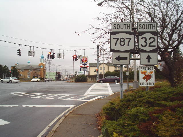
 Route 787's northern terminus as viewed from Route 32 in Cohoes
After intersections with Dyke Avenue and Bridge Avenue (the latter leading to lower Van Schaick Island) on the western bank of the Hudson River, NY 787 intersects NY 470, an east–west route linking Cohoes to northern Troy via upper Van Schaick Island. Past NY 470, NY 787 curves to the northwest and immediately intersects NY 32. Although NY 787 terminates here, New Courtland Street (later named North Mohawk Street and Cohoes Crescent Road) continues northwest from the intersection along the Mohawk River to US 9 in Colonie, just south of the hamlet of Crescent, in Saratoga County.
Along NY 787, markers continue from those of I-787, without interruption. At the beginning of NY 787, some reference markers have the letter "I" along the top (route) row. The markers continue from those of I-787 and the control segments thereof.
History
The southernmost section of NY 787 was originally built in the early 1970s as part of Interstate 787. At the time, the highway ended at a junction with Arch Street.[4][5] It was extended north to Tibbits Avenue in the early 1980s[1][6] and to NY 470 by 1990, at which time the portion of the I-787 freeway north of NY 7 was designated as NY 787.[2] The short connector between NY 470 and NY 32 was completed by the following year.[7]
Future
Though never implemented, the original plans called for Route 787 to continue across the Mohawk River through the village of Waterford in Saratoga County.[citation needed] The route was to use the bed of the Champlain Canal.[citation needed] However, the exact route and terminus is not clear.[citation needed]
Major intersections
The entire route is in Albany County.
Location Mile[3] Destinations Notes Colonie 0.00 I-787 / NY 7Interchange; northern terminus of I-787; exits 9E/9W (I-787) 0.76 To NY 32 via Tibbits AvenueCohoes 1.51 To NY 32 via Dyke Avenue2.03 To NY 32 via Bridge Avenue2.44  NY 470 (Ontario Street)
2.56 NY 32 (Saratoga Street)1.000 mi = 1.609 km; 1.000 km = 0.621 mi References
- ^ a b Rand McNally and Company (1985). New York (Map). ISBN 0-528-91040-X.
- ^ a b DeLorme Mapping (1990). Upstate New York City Street Maps (Map). 1" = 1/2 mile. Cartography by DeLorme Mapping (1st ed.). p. 39. ISBN 0-89933-300-1.
- ^ a b "2008 Traffic Volume Report for New York State" (PDF). New York State Department of Transportation. June 16, 2009. p. 244. https://www.nysdot.gov/divisions/engineering/technical-services/hds-respository/NYSDOT%20TVR%202008%20by%20Route.pdf. Retrieved February 1, 2010.
- ^ New York State Thruway Authority (1971). New York Thruway (Map). Cartography by Rand McNally and Company.
- ^ Shell Oil Company (1973). New York (Map). Cartography by H.M. Gousha Company (1973 ed.).
- ^ State of New York (1981). I Love New York Tourism Map (Map). Cartography by Rand McNally and Company.
- ^ New York State Department of Transportation (1991). Troy North Digital Raster Quadrangle (Map). 1:24,000. http://www.nysgis.state.ny.us/gisdata/quads/drg24/dotpreview/index.cfm?code=r49. Retrieved June 24, 2010.
External links
Categories:- State highways in New York
- Limited-access roads in New York
- Transportation in Albany County, New York

Wikimedia Foundation. 2010.