- Champlain Canal
-
Champlain Canal
 Tug and barge on the Champlain Canal during the 1980s
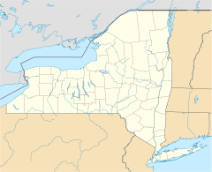

Location: Rensselaer / Saratoga / Washington counties, New York, USA; extends from Waterford through Fort Edward to Whitehall Coordinates: 43°26′31″N 73°26′48″W / 43.44194°N 73.44667°WCoordinates: 43°26′31″N 73°26′48″W / 43.44194°N 73.44667°W Built: 1823 Architect: Wright,Benjamin; Jarvis,John B. Architectural style: Transportation Canal Governing body: Local NRHP Reference#: 76001274
[1]Added to NRHP: September 01, 1976 The Champlain Canal is a 60 miles (97 km) canal that connects the south end of Lake Champlain to the Hudson River in New York. It was simultaneously constructed with the Erie Canal and is now part of the New York State Canal System and the Lakes to Locks Passage.
The canal was proposed in 1812 and construction authorized in 1817. By 1818, 12 miles (19 km) were completed and in 1819 the canal was opened from Fort Edward to Lake Champlain. The canal was officially opened on September 10, 1823.[2] It was an immediate financial success and carried substantial commercial traffic until the 1970s.
Today, the enlarged barge canal provides a convenient route from the Atlantic/Hudson River to Lake Champlain for recreational boaters. By traveling the length of Lake Champlain, boaters can access the Chambly Canal, which connects Lake Champlain to the Saint Lawrence Seaway.
-
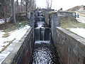
Second-generation Locks circa 1845, Glens Falls Feeder, Fort Edward, NY
References
- ^ "National Register Information System". National Register of Historic Places. National Park Service. 2009-03-13. http://nrhp.focus.nps.gov/natreg/docs/All_Data.html.
- ^ Whitford, Nobel E. (1906). "History of the Canal System of the State of New York". http://www.history.rochester.edu/canal/bib/whitford/old1906/. Retrieved 12 June 2009.
External links
- Information and Boater's Guide to the New York State Canal System
- History of the Canal System of the State of New York — Champlain Canal
- New York State Canals — Map of the Champlain Canal
- Champlain Canal Net— History and Photographs
- Historic Glens Falls Feeder Canal
Categories:- Historic districts in New York
- Canals in New York
- Canals on the National Register of Historic Places
- Buildings and structures on the National Register of Historic Places in New York
- Transportation in Albany County, New York
- Transportation in Rensselaer County, New York
- Transportation in Saratoga County, New York
- Transportation in Washington County, New York
- New York geography stubs
-


Wikimedia Foundation. 2010.