- New York State Route 324
-
"New York State Route 325" redirects here. For the former alignment of NY 325 in Tompkins County, see New York State Route 325 (1932–1933).
NYS Route 324
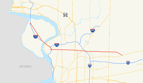
Map of the Buffalo – Niagara Falls area with NY 324 highlighted in redRoute information Maintained by NYSDOT, NYSTA, and Erie County Length: 22.51 mi[3] (36.23 km) Existed: ca. 1933[1][2] – present Major junctions West end: 

 I-190 / Thruway / NY 384 in Niagara Falls I-190 / Thruway on Grand Island
 NY 265 in Tonawanda
 I-290 in Amherst
 NY 78 in Amherst / Clarence
East end:  NY 5 in Clarence
Location Counties: Niagara, Erie Highway system Numbered highways in New York
Interstate • U.S. • N.Y. (former) • Reference • County←  NY 323
NY 326  →
→New York State Route 324 (NY 324) is an east–west state highway located in the western portion of New York in the United States. Officially, NY 324 begins at NY 384 in Niagara Falls and overlaps Interstate 190 (I-190, the Niagara Section of the New York State Thruway) south to Grand Island, where it separates from I-190 and continues southward as Grand Island Boulevard. As signed, however, NY 324 begins at the southern end of the official overlap and is contained entirely within Erie County. At the southern edge of Grand Island, NY 324 joins I-190 to cross over to the mainland, where it runs due east across three towns before reaching its eastern end at a junction with NY 5 in the town of Clarence.
NY 324 is known by two names along its routing: Grand Island Boulevard on Grand Island and Sheridan Drive in the northern suburbs of Buffalo. As the latter, the route serves as a major commercial strip for Tonawanda, Amherst, and Clarence. NY 324, assigned ca. 1933, is one of two routes to occupy part of Sheridan Drive; the other is New York State Route 325, which follows the westernmost 1.42 miles (2.29 km) of the street. NY 324 once extended northwest to downtown Niagara Falls; however, it was truncated to its current western terminus ca. 1962.
Contents
Route description
According to the New York State Department of Transportation (NYSDOT), NY 324 begins at NY 384 in eastern Niagara Falls. NY 324 heads south, overlapping with I-190 (the Niagara Section of the New York State Thruway) across the North Grand Island Bridge to Grand Island, where it leaves the expressway at exit 20.[4] However, as signed, NY 324 begins at the north end of Grand Island, where it splits off from the Interstate Highway as Grand Island Boulevard. South of exit 20, the official and signed routings are identical.[5]
Maintenance of the route is split between NYSDOT, the New York State Thruway Authority (NYSTA), and Erie County. All but the northernmost 0.02 miles (0.03 km) of the portion of the route that overlaps with I-190 is maintained by NYSTA. The two county-maintained sections extend from exit 20B to Grand Island Boulevard on Grand Island and from exit 15 to Grand Island Boulevard in Tonawanda, where NY 324 utilizes small portions of the county-owned Long Road and Kenmore Avenue, respectively. The remainder of NY 324 is maintained by NYSDOT.[6][7]
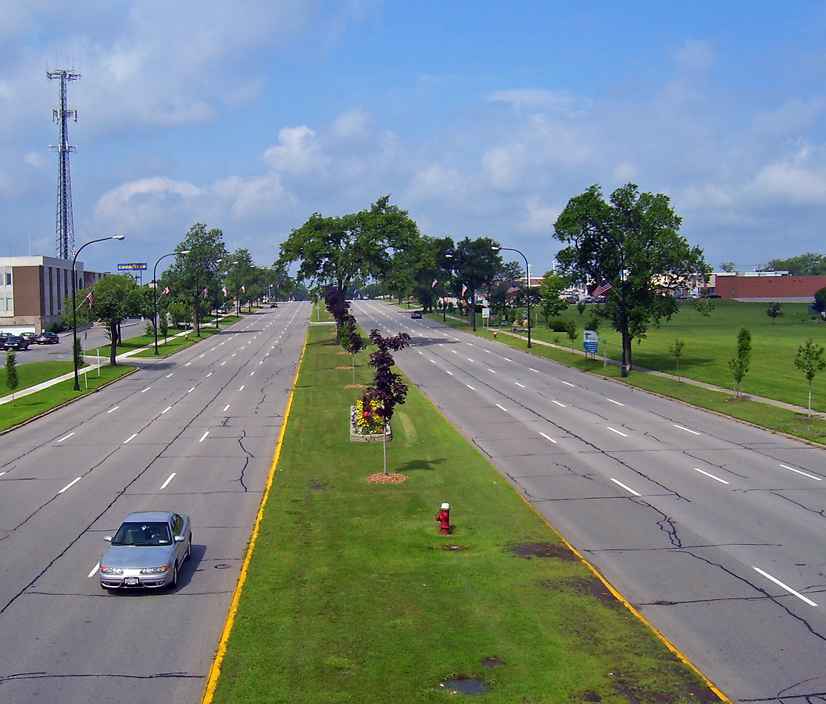
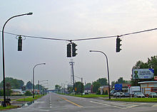 Looking down Route 325 from Route 324
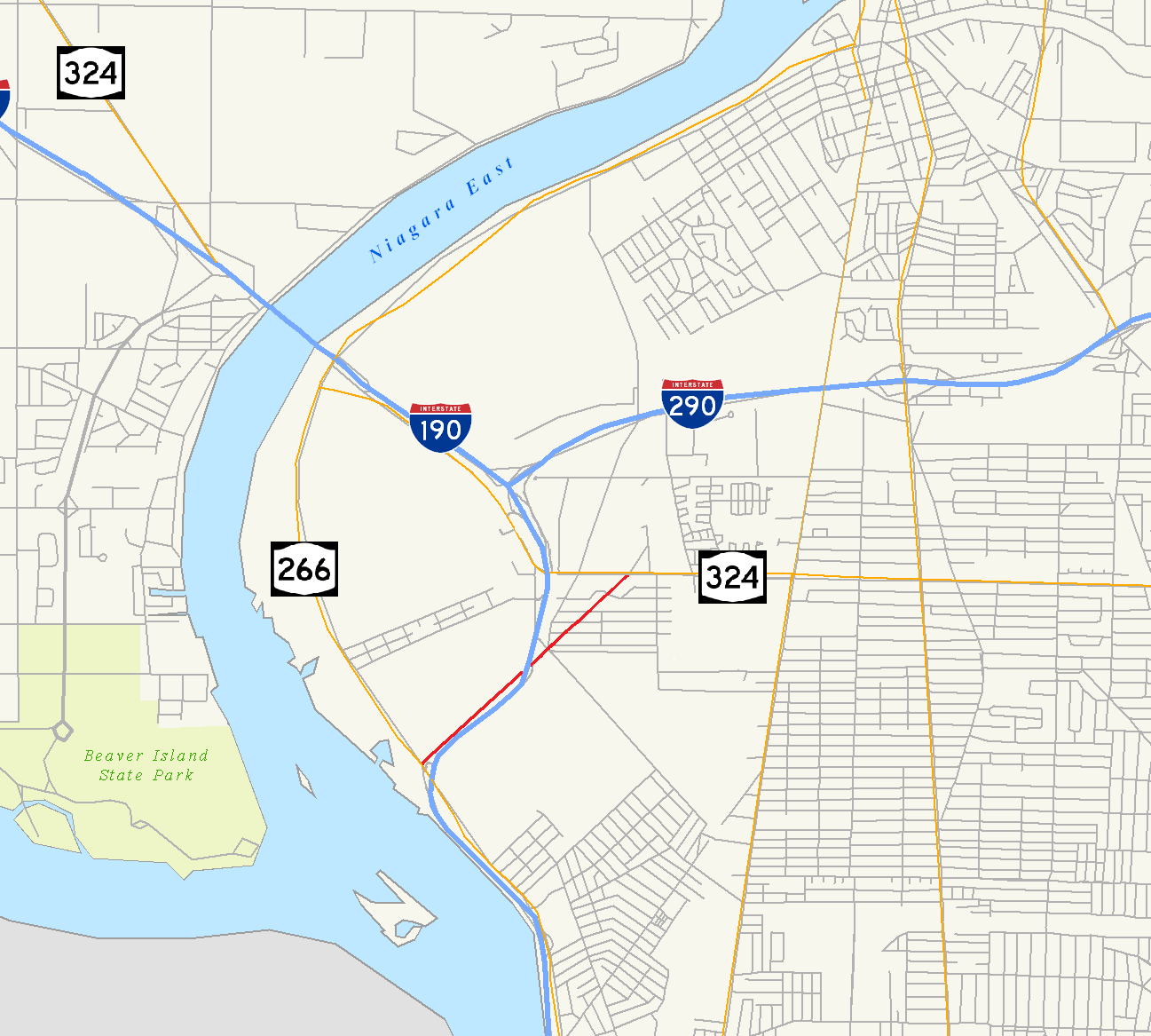
From I-190 exit 20, NY 324 runs in a more southeasterly direction, serving as the main commercial strip on Grand Island, before it overlaps I-190 in order to cross the Niagara River. It parts company with the Interstate Highway on the other side of the river at exit 15, where it turns north to parallel I-190 on Kenmore Avenue. After 250 yards (229 m), it veers east onto Tonawanda's portion of Grand Island Boulevard for 0.5 miles (0.8 km) to a junction with Sheridan Drive. The latter carries NY 325, a 1.42-mile (2.29 km) route that begins at NY 266 on the banks of the Niagara and passes through a commercial and industrial area of the town of Tonawanda. NY 324 takes on the Sheridan Drive name here and assumes a more due easterly course across northern Erie County. Though the street is signed as a state highway on both NY 324 and NY 325, most residents simply refer to this road by its local name.[3][5]
Through much of this portion, the road is divided, with a tree-lined median strip. Businesses, both local and national, line both sides of the road and traffic is heavy. It crosses some other major strips such as Niagara Falls Boulevard (U.S. Route 62 or US 62), a major contributor to traffic on Sheridan due to the proximity of the Boulevard Mall, and Millersport Highway (NY 263), which feeds the Amherst campus of the University at Buffalo.[5]
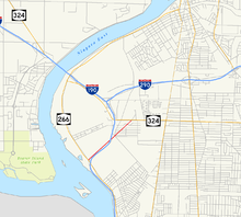 Map of NY 325's routing between NY 324 and NY 266
In Amherst it meets the Youngmann Expressway (I-290) where NY 240 (Harlem Road), reaches its northern end. Past the Youngmann development abates, green returns to the roadside and the median ends, although the road remains four-lane and high-volume. There is another pocket of development around the Wegmans supermarket north of Williamsville, which has seen some rapid growth in the last few years.[5]
NY 324 crosses its last major route, Transit Road (NY 78), on an overpass just north of the once-thriving Eastern Hills Mall, which had been the premier mall in the Buffalo area until it began losing tenants and customers to the larger Walden Galleria in Cheektowaga.[5]

Beyond Transit, the road is still four-lane but primarily residential as it enters the Town of Clarence. After Harris Hill Road, the highway bends to the southeast once again for a final mile into its eastern end at Main Street (NY 5). This last section was widened from two lanes to four in the mid-1990s, and has seen some development but still remains lightly trafficked most of the day.[5]
History
 Sheridan Drive continues west of NY 324 as NY 325.
When NY 324 was assigned ca. 1933, it began at NY 384 (River Road; now NY 266) in the town of Tonawanda and followed Sheridan Drive eastward to NY 5 in the town of Clarence.[1][2] By 1935, what is now NY 324 between Niagara Falls and Tonawanda via Grand Island was designated as NY 325.[8] NY 324 was extended northward to NY 384 in Niagara Falls ca. 1937, supplanting the entirety of NY 325. The NY 325 designation was reassigned to the short piece of Sheridan Drive not designated as NY 324.[9][10] The route was extended one final time by 1948 to follow NY 384 westward from the North Grand Island Bridge into downtown Niagara Falls.[11]
NY 324 remained unchanged until ca. 1962 when the overlap with NY 384 was removed. Although the overlap with the new I-190 on the North Grand Island Bridge was also removed from maps during the same period,[12][13] and is no longer signed, this overlap was never officially removed from either NYSDOT's description of the route[4][14] or the annual NYSDOT Traffic Data Report.[3]
Major intersections
County Location Mile[3] Destinations Notes Niagara Niagara Falls 0.00 I-190 / Thruway north / NY 384Exit 21 (I-190 / Thruway); northern terminus of I-190 / NY 324 overlap Erie Grand Island 1.57 I-190 / Thruway southExit 20B (I-190 / Thruway); southern terminus of I-190 / NY 324 overlap 6.17 I-190 / Thruway northExit 18 (I-190 / Thruway); northern terminus of I-190 / NY 324 overlap Town of Tonawanda 7.42  NY 266 (River Road)
Exit 17 (I-190 / Thruway) 8.02 I-290 (Youngmann Expressway)Exit 16 (I-190 / Thruway); western terminus of I-290 8.25 I-190 / Thruway southExit 15 (I-190 / Thruway); southern terminus of I-190 / NY 324 overlap (eastbound) 9.05 I-190 / Thruway northExit 15 (I-190 / Thruway); southern terminus of I-190 / NY 324 overlap (westbound) 9.56  NY 325 (Sheridan Drive)
Northern terminus of NY 325 9.95 NY 265 (Military Road)10.78 NY 384 (Delaware Avenue)13.11  US 62 north (Niagara Falls Boulevard)
Western terminus of US 62 / NY 324 overlap Amherst 13.56 US 62 south (Bailey Avenue)Eastern terminus of US 62 / NY 324 overlap 14.32  NY 263 (Millersport Highway)
15.09  NY 240 (Harlem Road)
Northern terminus of NY 240 15.13 I-290 (Youngmann Expressway)Exit 6 (I-290) 15.90  NY 277 (Union Road)
Northern terminus of NY 277 19.50 NY 78 (Transit Road)Clarence 22.51 NY 5 (Main Street)1.000 mi = 1.609 km; 1.000 km = 0.621 mi References
- ^ a b Texas Oil Company (1932). Texaco Road Map – New York (Map). Cartography by Rand McNally and Company.
- ^ a b Texas Oil Company (1933). Texaco Road Map – New York (Map). Cartography by Rand McNally and Company.
- ^ a b c d "2008 Traffic Data Report for New York State" (PDF). New York State Department of Transportation. June 16, 2009. pp. 293–294. https://www.nysdot.gov/divisions/engineering/technical-services/hds-respository/NYSDOT_Traffic_Data_Report_2008.pdf. Retrieved December 8, 2009.
- ^ a b New York State Department of Transportation (January 2009) (PDF). Official Description of Highway Touring Routes, Bicycling Touring Routes, Scenic Byways, & Commemorative/Memorial Designations in New York State. https://www.nysdot.gov/divisions/operating/oom/transportation-systems/repository/2009%20tour-bk.pdf. Retrieved July 16, 2009.
- ^ a b c d e f I Love New York (2007). 1977–2007 I Love New York State Map (Map). Cartography by Map Works. Buffalo inset.
- ^ "Erie County Inventory Listing" (CSV). New York State Department of Transportation. March 2, 2010. https://www.nysdot.gov/divisions/engineering/technical-services/hds-repository2/INV_2010-03-02_erie.csv. Retrieved December 16, 2010.
- ^ "Niagara County Inventory Listing" (CSV). New York State Department of Transportation. March 2, 2010. https://www.nysdot.gov/divisions/engineering/technical-services/hds-repository2/INV_2010-03-02_niagara.csv. Retrieved December 16, 2010.
- ^ Shell Oil Company (1935). Niagara Falls and Vicinity (Map). Cartography by H.M. Gousha Company. http://www.ontarioroadmaps.ca/Oil_Companies/Shell/1935/Niagara.jpg. Retrieved December 31, 2009.
- ^ Standard Oil Company (1936). New York (Map). Cartography by General Drafting.
- ^ Standard Oil Company (1937). New York (Map). Cartography by General Drafting.
- ^ United States Geological Survey (1948). Tonawanda Quadrangle – New York (southwest) (Map). 1:62,500. 15 Minute Series (Topographic). http://docs.unh.edu/NY/tonw48sw.jpg. Retrieved December 31, 2009.
- ^ Sunoco (1961). New York and Metropolitan New York (Map). Cartography by H.M. Gousha Company (1961–62 ed.).
- ^ Esso (1962). New York with Sight-Seeing Guide (Map). Cartography by General Drafting.
- ^ State of New York Department of Transportation (January 1, 1970) (PDF). Official Description of Touring Routes in New York State. http://www.greaternyroads.info/pdfs/state70.pdf. Retrieved December 31, 2009.
External links
Categories:- Transportation in Erie County, New York
- Transportation in Niagara Falls, New York
- State highways in New York


Wikimedia Foundation. 2010.