- New York State Route 277
-
NYS Route 277
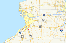
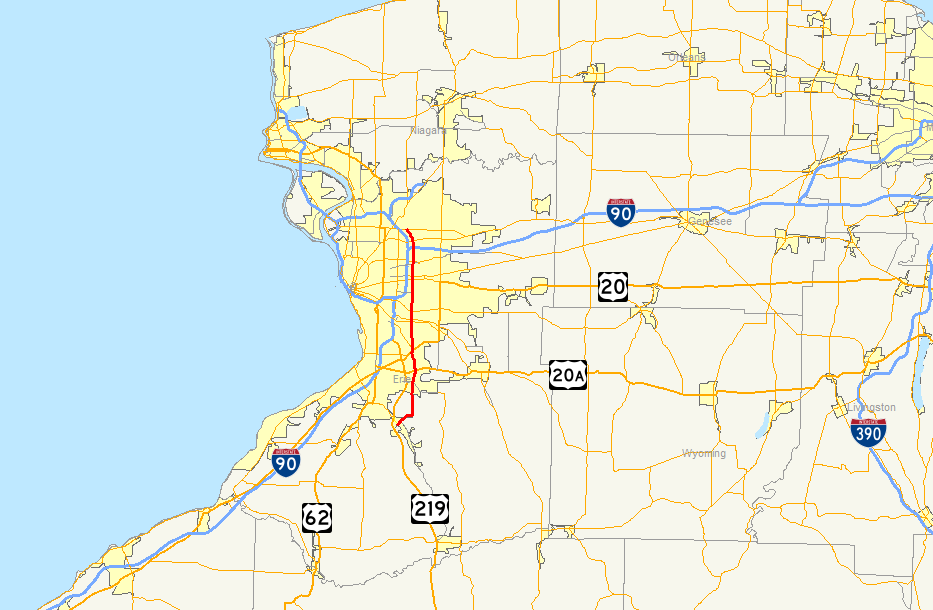
Map of western New York with NY 277 highlighted in redRoute information Maintained by NYSDOT Length: 21.40 mi[3] (34.44 km) Existed: ca. 1931[1][2] – present Major junctions South end:  NY 391 in Boston
 US 20A in Orchard Park
 US 20 in Orchard Park
 NY 400 in West Seneca
 NY 33 in Cheektowaga
North end:  NY 324 in Amherst
Location Counties: Erie Highway system Numbered highways in New York
Interstate • U.S. • N.Y. (former) • Reference • County←  NY 276
I-278  →
→←  NY 18A
NY 18D  →
→New York State Route 277 (NY 277) is a state highway in New York, USA. This highway is also called Union Road, along with other names. NY 277 is a major north–south road east of Buffalo, New York, through the middle of Erie County. The section of NY 277 north of Orchard Park used to be New York State Route 18B until the portion of NY 18 south of Niagara Falls was deleted.
Contents
Route description
NY 277 begins at an intersection with NY 391 in the community of North Boston. This intersection also serves as the southern terminus for NY 391. NY 277 continues to the northeast as Herman Hill Road and Boston Ridge Road before turning to the north at an intersection with CR 552, becoming Chestnut Ridge Road.
In the village of Orchard Park, NY 277 meets NY 240 south of the village center. The two routes form a concurrency along Buffalo Road through the village, meeting U.S. Route 20A in the middle of the village. North of the village in the town of Orchard Park, NY 240/277 meets Milestrip Road, a major east–west arterial during Buffalo Bills home games. To the north of Milestrip is U.S. Route 20, followed by the split of the concurrency just north of US 20. While NY 240 heads northwest toward downtown Buffalo, NY 277 continues due north and becomes Union Road.
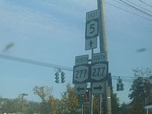 Sign assembly at the NY 277 / NY 5 intersection in Williamsville
Now in the town of West Seneca, NY 277 meets NY 16 as well as NY 400, the Aurora Expressway, which parallels NY 16 for most of its length. North of town is a junction with NY 354 in the hamlet of Gardenville, its last major intersection before entering Cheektowaga.
Near the east end of CSX's Frontier Yard in downtown Buffalo, NY 277 connects to NY 130 by way of an interchange in the neighborhood of Forks. The interchange was created out of necessity, as NY 277 has to ascend onto a bridge to traverse the CSX Buffalo Terminal Subdivision mainline, which is four tracks wide in this location. Just north of the tracks is Walden Avenue and the Walden Galleria, which is bordered on its east side by NY 277.
To the north of the mall and west of the Buffalo Niagara International Airport, NY 277 intersects both the former routing of NY 33 at Genesee Street and its current routing slightly north of Genesee on the Kensington Expressway. Northwest of the airport, NY 277 passes over the New York State Thruway (Interstate 90) near the Williamsville toll barrier.
North of the Thruway, NY 277 enters the heart of Amherst, meeting NY 5 near the western edge of the Village of Williamsville. Heading north, NY 277 becomes North Forest Road and begins to curve to the northwest, deviating from its perfect north–south alignment that it takes through most of the Buffalo suburbs. NY 277 continues on a northwest track as it comes to an end at NY 324, better known as Sheridan Drive, in Amherst.
History
In the 1930 renumbering of state highways in New York, the portion of Union Road between NY 354 in Gardenville and Genesee Street (then NY 33) in Cheektowaga was designated as part of NY 355, a route that continued north to Williamsville by way of Genesee Street and Cayuga Road. At the same time, the section of Union Road in northern Orchard Park was designated as part of NY 240.[1] NY 277, meanwhile, was assigned by the following year to the portion of its modern routing from Boston north to NY 240 south of the village of Orchard Park.[2]
Ca. 1935, the Union Road portion of NY 355 was incorporated into NY 18B, an alternate route of NY 18 that began at NY 240 in Orchard Park and followed what is now NY 277 north to Sheridan Drive (NY 324). From there, NY 18B followed NY 324 west to Bailey Avenue, where it connected to NY 18. NY 355 was truncated northward to the eastern terminus of its overlap with NY 33 as a result.[4][5] The NY 355 designation was completely removed ca. 1937.[6][7] Ca. 1962, NY 18 was truncated to Lewiston on its western end, leading to the removal of the NY 18B designation. The portion of the route's former alignment that did not overlap NY 324 became a northward extension of NY 277.[8][9]
Major intersections
The entire route is in Erie County.
Location Mile[3] Destinations Notes Boston 0.00 NY 391Hamlet of North Boston; southern terminus of NY 391 Town of Orchard Park 5.27  NY 240 south
Southern terminus of NY 240 / NY 277 overlap Village of Orchard Park 6.57 US 20ATown of Orchard Park 8.63 US 208.88 NY 240 northNorthern terminus of NY 240 / NY 277 overlap West Seneca 11.63  NY 16
NY 1611.90 NY 400Interchange 12.71  NY 354
Cheektowaga  NY 130
Interchange 16.31 Walden Avenue (NY 952Q) 17.90 NY 33Interchange Williamsville 20.03  NY 5
NY 5Amherst 21.40 NY 3241.000 mi = 1.609 km; 1.000 km = 0.621 mi References
- ^ a b Standard Oil Company of New York (1930). Road Map of New York (Map). Cartography by General Drafting.
- ^ a b Kendall Refining Company (1931). New York (Map). Cartography by H.M. Gousha Company.
- ^ a b "2008 Traffic Volume Report for New York State" (PDF). New York State Department of Transportation. June 16, 2009. pp. 203–204. https://www.nysdot.gov/divisions/engineering/technical-services/hds-respository/NYSDOT%20TVR%202008%20by%20Route.pdf. Retrieved February 1, 2010.
- ^ Texas Oil Company (1934). Road Map of New York (Map). Cartography by Rand McNally and Company.
- ^ Shell (1935). Niagara Falls and Vicinity (Map). Cartography by H.M. Gousha Company. http://www.ontarioroadmaps.ca/Oil_Companies/Shell/1935/Niagara.jpg. Retrieved December 3, 2009.
- ^ Standard Oil Company (1936). New York (Map). Cartography by General Drafting.
- ^ Standard Oil Company (1937). New York (Map). Cartography by General Drafting.
- ^ Sunoco (1961). New York and Metropolitan New York (Map). Cartography by H.M. Gousha Company (1961–62 ed.).
- ^ Esso (1962). New York with Sight-Seeing Guide (Map). Cartography by General Drafting.
External links
Categories:- State highways in New York
- Transportation in Erie County, New York


Wikimedia Foundation. 2010.