- North Boston, New York
-
North Boston, New York — CDP — Location within the state of New York
 North Boston, New York
Coordinates: 42°40′55″N 78°47′3″W / 42.68194°N 78.78417°WCoordinates: 42°40′55″N 78°47′3″W / 42.68194°N 78.78417°W Country United States State New York County Erie Area – Total 4.1 sq mi (10.6 km2) – Land 4.1 sq mi (10.6 km2) – Water 0.0 sq mi (0.0 km2) Elevation 823 ft (251 m) Population (2000) – Total 2,680 – Density 652.9/sq mi (252.1/km2) Time zone Eastern (EST) (UTC-5) – Summer (DST) EDT (UTC-4) ZIP code 14110 Area code(s) 716 FIPS code 36-51583 GNIS feature ID 0958691 North Boston is a hamlet (and census-designated place) located in the Town of Boston in Erie County, New York, United States. As of the 2000 census, this hamlet population was 2,680. It is part of the Buffalo–Niagara Falls Metropolitan Statistical Area.
North Boston is on the northern town line, located around the junction of NY Routes 277 and 391.
Geography
North Boston is located at 42°40′55″N 78°47′3″W / 42.68194°N 78.78417°W (42.681935, -78.784065)[1].
According to the United States Census Bureau, the CDP has a total area of 4.1 square miles (11 km2), all land.
Demographics
As of the census[2] of 2000, there were 2,680 people, 1,049 households, and 766 families residing in the CDP. The population density was 652.9 per square mile (252.4/km²). There were 1,080 housing units at an average density of 263.1/sq mi (101.7/km²). The racial makeup of the CDP was 99.10% White, 0.07% African American, 0.19% Native American, 0.04% Asian, 0.04% Pacific Islander, 0.26% from other races, and 0.30% from two or more races. Hispanic or Latino of any race were 0.90% of the population.
There were 1,049 households out of which 31.6% had children under the age of 18 living with them, 62.1% were married couples living together, 8.3% had a female householder with no husband present, and 26.9% were non-families. 23.0% of all households were made up of individuals and 9.4% had someone living alone who was 65 years of age or older. The average household size was 2.55 and the average family size was 3.02.
In the CDP the population was spread out with 24.0% under the age of 18, 6.3% from 18 to 24, 29.3% from 25 to 44, 26.3% from 45 to 64, and 14.1% who were 65 years of age or older. The median age was 40 years. For every 100 females there were 100.0 males. For every 100 females age 18 and over, there were 95.5 males.
The median income for a household in the CDP was $45,898, and the median income for a family was $57,266. Males had a median income of $35,833 versus $29,479 for females. The per capita income for the CDP was $22,089. About 1.0% of families and 1.8% of the population were below the poverty line, including 2.2% of those under age 18 and 4.2% of those age 65 or over.
References
- ^ "US Gazetteer files: 2010, 2000, and 1990". United States Census Bureau. 2011-02-12. http://www.census.gov/geo/www/gazetteer/gazette.html. Retrieved 2011-04-23.
- ^ "American FactFinder". United States Census Bureau. http://factfinder.census.gov. Retrieved 2008-01-31.
Municipalities and communities of Erie County, New York Cities 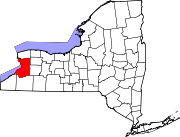
Towns Alden | Amherst | Aurora | Boston | Brant | Cheektowaga | Clarence | Colden | Collins | Concord | Eden | Elma | Evans | Grand Island | Hamburg | Holland | Lancaster | Marilla | Newstead | North Collins | Orchard Park | Sardinia | Tonawanda | Wales | West Seneca
Villages Akron | Alden | Angola | Blasdell | Depew | East Aurora | Farnham | Gowanda‡ | Hamburg | Kenmore | Lancaster | North Collins | Orchard Park | Sloan | Springville | Williamsville
CDPs Angola on the Lake | Billington Heights | Cheektowaga | Clarence Center | Eden | Elma Center | Harris Hill | Holland | Lake Erie Beach | North Boston | Tonawanda | Town Line | West Seneca
Other
hamletsAkron Junction | Alden Center | Armor | Athol Springs | Bagdad | Bellevue | Big Tree | Blakeley | Blossom | Boston | Bowmansville | Brant | Brighton | Carnegie | Chaffee | Clarksburg | Cleveland Hill | Clifton Heights | Collins Center | Concord | Creekside | Crittenden | Dellwood | Derby | Doyle | Duells Corner | Dutchtown | East Amherst | East Concord | East Eden | East Elma | East Seneca | Ebenezer | Eden Valley | Eggertsville | Ellicott | Elma | Evans Center | Ferry Village | Footes | Forks | Fowlerville | Gardenville | Getzville | Glenwood | Grandyle Village | Green Acres | Griffins Mills | Holland | Hunts Corners | Jerusalem Corners | Jewettville | Kenilworth | Lake View | Langford | Lawtons | Locksley Park | Loveland | Marilla | Marshfield | Millersport | Millgrove | Morton Corners | Mount Vernon | Murrays Corner | New Ebenezer | New Oregon | North Bailey | North Evans | Oakfield | Patchin | Peters Corners | Pine Hill | Pinehurst | Pontiac | Porterville | Protection | Sand Hill | Sandy Beach | Scranton | Sheenwater | Shirley | Snyder | South Newstead | South Wales | Spring Brook | Swifts Mills | Taylor Hollow | Town Line Station | Swormville | Walden Cliffs | Wales Hollow | Wanakah | Water Valley | Webster Corners | Wende | West Alden | West Falls | Weyer | Williston | Windom | Wolcottsburg | Woodlawn | Woodside | Wyandale | Zoar
Indian
reservationsFootnotes ‡This populated place also has portions in an adjacent county or counties
Categories:- Hamlets in New York
- Census-designated places in New York
- Buffalo – Niagara Falls metropolitan area
- Populated places in Erie County, New York


Wikimedia Foundation. 2010.