- Elma, New York
:" For other places with this name, see Elma".Geobox Settlement
name = Elma
native_name =
other_name =
other_name1 =
category = Town
image_size =
image_caption =
flag_size =
symbol =
symbol_size =
nickname =
nickname1 =
motto =
country = United States
state = New York
region_type = County
region = Erie County
district_type =
district =
area_imperial = 34.5
area_land_imperial = 34.5
area_water_imperial = 0.0
area_water_percentage = auto
area_percentage_round = 2
area_round = 1
location =
lat_d = 42
lat_m = 49
lat_s = 17
lat_NS = N
long_d = 78
long_m = 38
long_s = 13
long_EW = W
elevation_imperial = 869
elevation_round = 1
population_as_of = 2000
population = 11304
population_density_imperial = 327.7
population_density_round = 1
established_type = Incorporated
established = 1857
leader = Mike Nolan "(2007)"
leader_type = Supervisor
timezone = EST
utc_offset = -5
timezone_DST = EDT
utc_offset_DST = -4
postal_code = 14059
postal_code_type = ZIP code
area_code = 716
area_code_type =
code2_type =
code2 =
free_type = FIPS code
free = 36-24130
free1_type = GNIS feature ID
free1 = 0978937
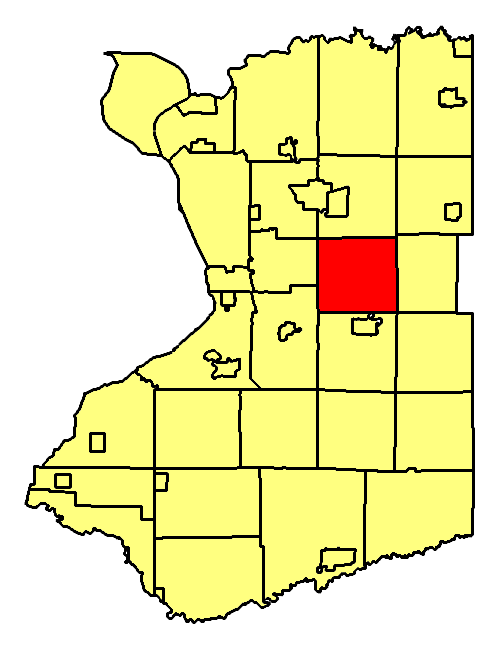
map_caption = Location of Elma in Erie County
map1 = New York Locator Map.png
map1_locator = New York
map2 = Map of USA NY.svg
map2_caption = Location of New York in the United States
website = http://www.elmanewyork.comElma is a
town in Erie County,New York ,United States . The population was 11,304 at the 2000 census. The town is named after a type of tree.The Town of Elma is located in the north-central part of the county, east of Buffalo,
New York . Because of its location, Elma likes to refer to itself as the "heart of Erie County."History
The region was first settled around 1827. The early residents included members of the Ebenezer Society.
The town was established in 1857 from parts of the Towns of Aurora and Lancaster. Elma was the last town formed in the county. When the town was formed, a resident suggested it be named after a famous large
American elm , then growing in the town.Fran Striker was killed in a car accident here on September 4,1962 while moving with his family.Geography
According to the
United States Census Bureau , the town has a total area of 34.5square mile s (89.3km² ), all of it land.The west town line is marked by
New York State Route 78 . The East Aurora Expressway (New York State Route 400 ) crosses the town.Adjacent Cities & Towns
*Town of West Seneca - west
*Town of Orchard Park - west
*Town of Aurora - south
*Village of East Aurora - south
*Town of Wales - southeast
*Town of Marilla - east
*Town of Lancaster - north
*Town of Cheektowaga - northwestMajor Highways in the Town of Elma
* (Transit Rd.), East-West highway (North-South in town) that marks the western border of towb with Orchard Park and West Seneca. (Runs concurrent with NY 78 north of Seneca Street.)
* ((Seneca St.) North-South roadway (Northwest-Southeast in town) that runs concurrent with NY 16 from West Seneca town line to Aurora town line.
* (Transit Rd., Seneca St.) North-South roadway that marks west town line with West Seneca (when also concurrent with US 20) and runs concurrent with NY 16 southeast into Town of Aurora.* (Transit Rd.) North-South roadway that forms west boundary of town with Orchard park. (Continuation of Transit after US 20 splits off to west.)
* (Clinton St.), East-West route through town from West Seneca to Marilla.
*.), North-South highway (runs generally East-West through town) from West Seneca town line at NY 16/NY 78 to Aurora town line just east of Village of Aurora.
Demographics
As of the
census GR|2 of 2000, there were 11,304 people, 4,186 households, and 3,294 families residing in the town. Thepopulation density was 327.7 people per square mile (126.5/km²). There were 4,296 housing units at an average density of 124.5/sq mi (48.1/km²). The racial makeup of the town was 99.09% White, 0.05% African American, 0.05% Native American, 0.27% Asian, 0.01% Pacific Islander, 0.07% from other races, and 0.46% from two or more races. Hispanic or Latino of any race were 0.60% of the population.There were 4,186 households out of which 32.6% had children under the age of 18 living with them, 70.0% were married couples living together, 6.0% had a female householder with no husband present, and 21.3% were non-families. 17.9% of all households were made up of individuals and 9.6% had someone living alone who was 65 years of age or older. The average household size was 2.69 and the average family size was 3.08.
In the town the population was spread out with 24.5% under the age of 18, 5.5% from 18 to 24, 26.1% from 25 to 44, 27.9% from 45 to 64, and 16.0% who were 65 years of age or older. The median age was 42 years. For every 100 females there were 97.8 males. For every 100 females age 18 and over, there were 95.4 males.
The median income for a household in the town was $56,334, and the median income for a family was $63,922. Males had a median income of $42,679 versus $28,826 for females. The
per capita income for the town was $25,960. About 2.3% of families and 3.4% of the population were below thepoverty line , including 3.4% of those under age 18 and 6.3% of those age 65 or over.Communities and locations in Elma
*Billington Heights -- A location in the south part of the town.
*Blossom -- A hamlet in the northwest corner of the town. It was the principal location of the Ebenezer Society.
*Buffalo Creek -- A stream flowing westward through the northern part of the town. The French name for this stream was "Beau Fleuve", and the name of the city of Buffalo,New York is derived from the stream. There were no Buffalo living in the area in the colonial period, although they are now raised on several farms locally. As it approaches the City of Buffalo, the creek is called Buffalo River.
*Cazenovia Creek -- A stream flowing northward through the southwest part of the town.
*Elma -- A hamlet near the northern town line on Bowen Road.
*Elma Center -- A hamlet near the town's center and south of Elma village on Bowen Road.
*East Elma -- A hamlet in the southeast corner of the town.
*Spring Brook -- A hamlet on Route 16 near the eastern town line.
*"Rusty's" -- a wooded area lining the Buffalo Creek that has recently become a favorite hang-out place for local students; It is rumored to be haunted and students swear to mysterious happenings when they camp on the groundschools
Public schools in Elma are under the jurisdiction of the [http://www.iroquoiscsd.org/iroquois/site/default.asp Iroquois School District] . Iroquois Central Schools consistently enjoys top rank as the 5th or 6th best public school in the Western New York area. Consisting of approximately 3,000 students district-wide, Iroquois divides its students in an unconventional manner, with three separate primary schools for students in kindergarten through 3rd grade, an intermediate school for students in 4th and 5th grade, a middle school for students from 6th to 8th grade, and a high school for students in 9th to 12th grade. While the primary schools are located in the respective towns indicated by their names (Elma Primary, Marilla Primary, and Wales Primary), the other three schools are located on the same expansive campus at 2111 Girdle Road in Elma. The Campus is divided such that the high school and middle school are separated by the intermediate school, acting as a buffer between the similar age groups. The three buildings are connected by walkways, but it is rare that students should need to leave the building to which their grade belongs. In accord, the primary, intermediate, middle, and high school buildings each have their own gymnasium, cafeteria, library, and administrative offices. One of the greatest assets of this school district is the expansive undeveloped areas surrounding every school, providing plenty of open space for younger students to play and older students to participate in extracurricular activities. Some of the latest additions to the school, in fact, involve the development of a large field directly across the street from the high school. In addition, the middle school library was recently remodeled, an extra wing of classrooms was added to the high school, and plans are in order for the renovation of the high school music department.
Fire Companies
The town of Elma has four volunteer fire companies: Blossom, Elma, Jamison Road, and Springbrook.
References
External links
* [http://www.elmanewyork.com Town of Elma official webpage]
* [http://history.rays-place.com/ny/elma-ny.htm Elma history]
Wikimedia Foundation. 2010.