- New York State Route 187
-
This article is about the current alignment of NY 187. For the former alignment of NY 187 in St. Lawrence and Franklin Counties, see New York State Route 187 (1930–1938).
NYS Route 187
Transit Road 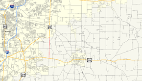
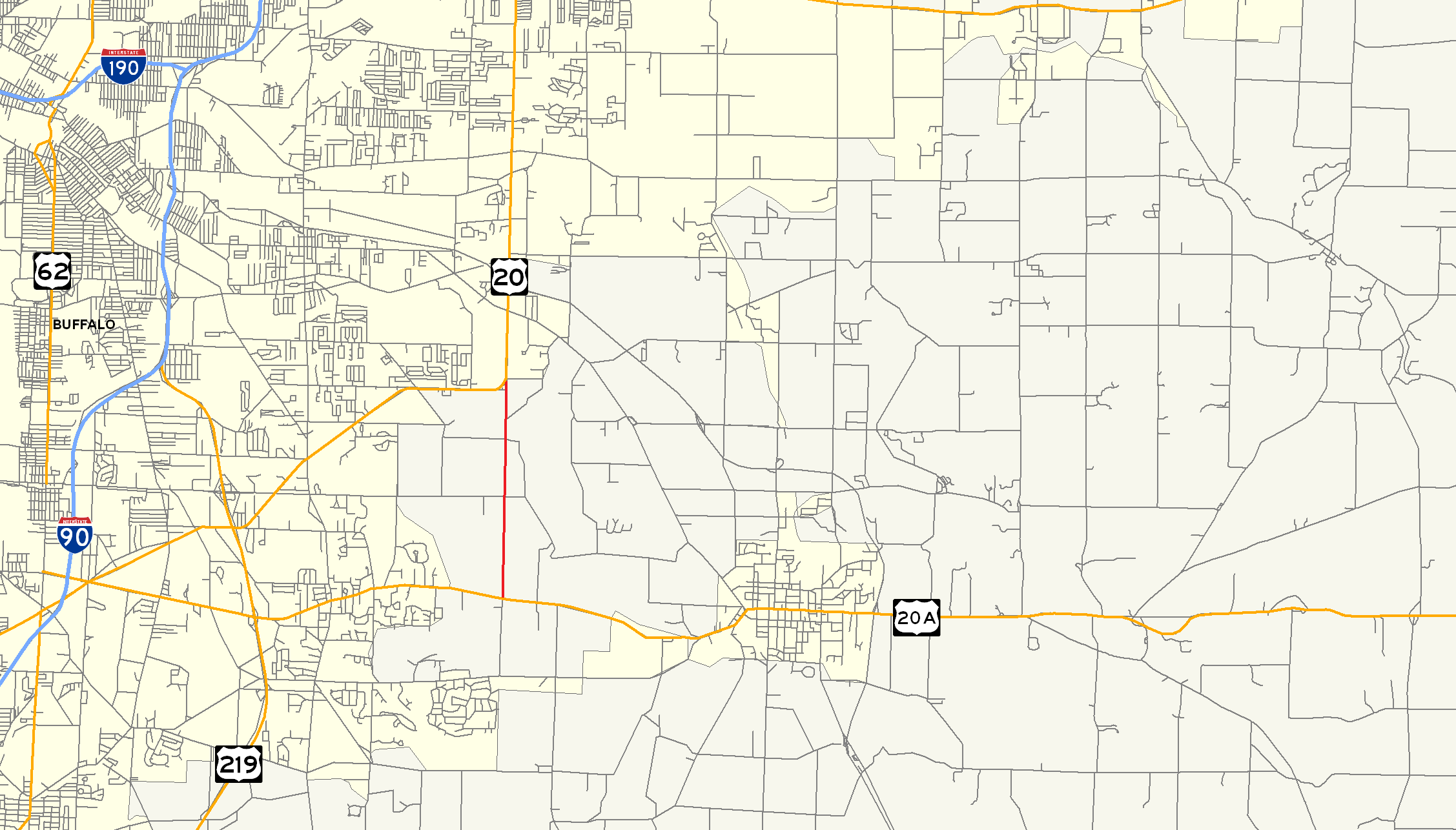
Map of the Buffalo area with NY 187 highlighted in redRoute information Maintained by NYSDOT Length: 3.09 mi[3] (4.97 km) Existed: early 1940s[1][2] – present Major junctions South end:  US 20A in Orchard Park
North end:  US 20 in Elma
Location Counties: Erie Highway system Numbered highways in New York
Interstate • U.S. • N.Y. (former) • Reference • County←  NY 186
NY 188  →
→New York State Route 187 (NY 187) is a short state highway located entirely in Erie County, New York, United States. It serves as the southern end of the busy Transit Road in the town of Elma. Its southern terminus is at Quaker Road (U.S. Route 20A or US 20A) and its northern terminus at US 20 where that highway becomes Transit Road. Unlike much of the rest of Transit, which is mostly designated as part of NY 78, the NY 187 portion is lightly trafficked, two-lane and largely undeveloped.
Contents
History
When NY 78 was assigned as part of the 1930 renumbering of state highways in New York, it initially bypassed the southeastern Buffalo suburbs on a routing that passed through the village of East Aurora, the hamlet of Elma, and the village of Lancaster.[4] It was rerouted ca. 1932 to head west from East Aurora instead by way of an overlap with US 20 (now US 20A), then head north on Transit Road to rejoin its former routing in Depew.[5][6] NY 78 was realigned again ca. 1939 to overlap NY 16 northwest from East Aurora, bypassing the southernmost portion of Transit Road.[7][8] The former routing of NY 78 between US 20A and US 20 was redesignated as NY 187 in the early 1940s.[1][2]
Major intersections
The entire route is in Erie County.
Location Mile[3] Destinations Notes Orchard Park 0.00 US 20AElma 3.09 US 201.000 mi = 1.609 km; 1.000 km = 0.621 mi References
- ^ a b Esso (1940). New York (Map). Cartography by General Drafting.
- ^ a b Esso (1942). New York with Pictorial Guide (Map). Cartography by General Drafting.
- ^ a b "2008 Traffic Volume Report for New York State" (PDF). New York State Department of Transportation. June 16, 2009. p. 181. https://www.nysdot.gov/divisions/engineering/technical-services/hds-respository/NYSDOT%20TVR%202008%20by%20Route.pdf. Retrieved February 1, 2010.
- ^ Standard Oil Company of New York (1930). Road Map of New York (Map). Cartography by General Drafting.
- ^ Kendall Refining Company (1931). New York (Map). Cartography by H.M. Gousha Company.
- ^ Texas Oil Company (1932). Texaco Road Map – New York (Map). Cartography by Rand McNally and Company.
- ^ Thibodeau, William A. (1938). The ALA Green Book (1938–39 ed.). Automobile Legal Association.
- ^ Standard Oil Company (1939). New York (Map). Cartography by General Drafting.
External links
Categories:- State highways in New York
- Transportation in Erie County, New York

Wikimedia Foundation. 2010.