- Marshfield, New York
-
Marshfield, New York is a small, unincorporated hamlet in the town of North Collins in southern Erie County, New York, USA.[1]
References
Coordinates: 42°32′34″N 78°50′30″W / 42.54278°N 78.84167°W
Municipalities and communities of Erie County, New York Cities 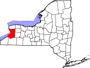
Towns Alden | Amherst | Aurora | Boston | Brant | Cheektowaga | Clarence | Colden | Collins | Concord | Eden | Elma | Evans | Grand Island | Hamburg | Holland | Lancaster | Marilla | Newstead | North Collins | Orchard Park | Sardinia | Tonawanda | Wales | West Seneca
Villages Akron | Alden | Angola | Blasdell | Depew | East Aurora | Farnham | Gowanda‡ | Hamburg | Kenmore | Lancaster | North Collins | Orchard Park | Sloan | Springville | Williamsville
CDPs Other
hamletsAkron Junction | Alden Center | Armor | Athol Springs | Bagdad | Bellevue | Big Tree | Blakeley | Blossom | Boston | Bowmansville | Brant | Brighton | Carnegie | Chaffee | Clarksburg | Cleveland Hill | Clifton Heights | Collins Center | Concord | Creekside | Crittenden | Dellwood | Derby | Doyle | Duells Corner | Dutchtown | East Amherst | East Concord | East Eden | East Elma | East Seneca | Ebenezer | Eden Valley | Eggertsville | Ellicott | Elma | Evans Center | Ferry Village | Footes | Forks | Fowlerville | Gardenville | Getzville | Glenwood | Grandyle Village | Green Acres | Griffins Mills | Holland | Hunts Corners | Jerusalem Corners | Jewettville | Kenilworth | Lake View | Langford | Lawtons | Locksley Park | Loveland | Marilla | Marshfield | Millersport | Millgrove | Morton Corners | Mount Vernon | Murrays Corner | New Ebenezer | New Oregon | North Bailey | North Evans | Oakfield | Patchin | Peters Corners | Pine Hill | Pinehurst | Pontiac | Porterville | Protection | Sand Hill | Sandy Beach | Scranton | Sheenwater | Shirley | Snyder | South Newstead | South Wales | Spring Brook | Swifts Mills | Taylor Hollow | Town Line Station | Swormville | Walden Cliffs | Wales Hollow | Wanakah | Water Valley | Webster Corners | Wende | West Alden | West Falls | Weyer | Williston | Windom | Wolcottsburg | Woodlawn | Woodside | Wyandale | Zoar
Indian
reservationsFootnotes ‡This populated place also has portions in an adjacent county or counties
Categories:- Hamlets in New York
- Populated places in Erie County, New York
- Erie County, New York geography stubs

Wikimedia Foundation. 2010.