- Nelliston, New York
-
Nelliston, New York — Village — Location within the state of New York
 Nelliston, New York
Coordinates: 42°56′1″N 74°36′49″W / 42.93361°N 74.61361°WCoordinates: 42°56′1″N 74°36′49″W / 42.93361°N 74.61361°W Country United States State New York County Montgomery Area – Total 1.2 sq mi (3.1 km2) – Land 1.1 sq mi (2.9 km2) – Water 0.1 sq mi (0.2 km2) Elevation 367 ft (112 m) Population (2000) – Total 622 – Density 565.0/sq mi (218.1/km2) Time zone Eastern (EST) (UTC-5) – Summer (DST) EDT (UTC-4) ZIP code 13410 Area code(s) 518 FIPS code 36-49748 GNIS feature ID 0958362 Nelliston is a village in Montgomery County, New York, United States. The population was 622 at the 2000 census. The name is from members of the Nellis family.
The Village of Nelliston is in the Town of Palatine and is west of Amsterdam.
The Erie Canal passes the village.
Contents
History
Andrew Nellis, founder of the Nellis family in the area, came to the Town of Palatine in 1722. Fort Fox and Fort Wagner were built at this location during the late colonial period. The village was not well-developed until the time of the American Civil War.
Geography
Nelliston is located at 42°56′1″N 74°36′49″W / 42.93361°N 74.61361°W (42.933644, -74.613531)[1].
According to the United States Census Bureau, the village has a total area of 1.2 square miles (3.1 km2), of which, 1.1 square miles (2.8 km2) of it is land and 0.1 square miles (0.26 km2) of it (7.56%) is water.
The village is on the northeast side of the Mohawk River across from the Village of Fort Plain and the New York State Thruway.
NY Route 5 (Main Street) passes through Nelliston.
Demographics
As of the census[2] of 2000, there were 622 people, 257 households, and 172 families residing in the village. The population density was 565.0 people per square mile (218.3/km²). There were 281 housing units at an average density of 255.3 per square mile (98.6/km²). The racial makeup of the village was 97.75% White, 0.96% Native American, 0.16% Asian, and 1.13% from two or more races. Hispanic or Latino of any race were 0.64% of the population.
There were 257 households out of which 26.8% had children under the age of 18 living with them, 51.4% were married couples living together, 10.9% had a female householder with no husband present, and 32.7% were non-families. 29.2% of all households were made up of individuals and 14.8% had someone living alone who was 65 years of age or older. The average household size was 2.42 and the average family size was 2.91.
In the village the population was spread out with 24.0% under the age of 18, 7.4% from 18 to 24, 27.7% from 25 to 44, 21.5% from 45 to 64, and 19.5% who were 65 years of age or older. The median age was 41 years. For every 100 females there were 93.8 males. For every 100 females age 18 and over, there were 91.5 males.
The median income for a household in the village was $31,544, and the median income for a family was $35,875. Males had a median income of $26,500 versus $20,375 for females. The per capita income for the village was $15,002. About 6.4% of families and 9.8% of the population were below the poverty line, including 8.7% of those under age 18 and 8.3% of those age 65 or over.
Notable residents
- Bill Dahlen, major league baseball player[3]
References
- ^ "US Gazetteer files: 2010, 2000, and 1990". United States Census Bureau. 2011-02-12. http://www.census.gov/geo/www/gazetteer/gazette.html. Retrieved 2011-04-23.
- ^ "American FactFinder". United States Census Bureau. http://factfinder.census.gov. Retrieved 2008-01-31.
- ^ Reichler, Joseph L., ed (1979) [1969]. The Baseball Encyclopedia (4th edition ed.). New York: Macmillan Publishing. ISBN 0-02-578970-8.
Municipalities and communities of Montgomery County, New York City 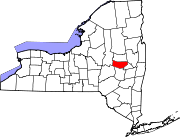
Towns Amsterdam | Canajoharie | Charleston | Florida | Glen | Minden | Mohawk | Palatine | Root | St. Johnsville
Villages Ames | Canajoharie | Fonda | Fort Johnson | Fort Plain | Fultonville | Hagaman | Nelliston | Palatine Bridge | St. Johnsville
CDP Hamlets Categories:- Villages in New York
- Populated places in Montgomery County, New York


Wikimedia Foundation. 2010.