- Michigan State Trunkline Highway System
-


Highway markers for Interstate 75, US Highway 23 and M-28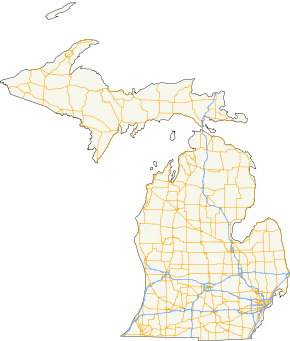
A map of highways in the state of MichiganSystem information Formed: c. July 1, 1919[1][2] Length: 9,716 mi[3][a] (15,636 km) Highway names Interstates: Interstate nn (I-nn) US Routes: US Highwayn n (US nn) State: M-nn County-Designated: A-nn through H-nn County Road: County Road nn (CR nn, Co. Rd. nn) System links Michigan State Trunkline Highway System
Interstate • US • StateThe Michigan State Trunkline Highway System is made up of all the highways designated as Interstates, U.S. Highways and State Highways in the US state of Michigan. The system is maintained by the Michigan Department of Transportation (MDOT) and comprises 9,716 miles (15,636 km) of trunklines in all 83 counties of Michigan on both the Upper and Lower peninsulas (UP, LP), linked by the Mackinac Bridge.[3][b] The system ranges in size from the unsigned Business Spur Interstate 375 (BS I-375) at 0.170 miles (0.274 km) and signed M-212 at 0.732 miles (1.178 km) to Interstate 75 (I-75) at 395.40 miles (636.33 km).[5] Some trunklines in Michigan are maintained by MDOT but bear no signage along the route to indicate this. These unsigned trunklines are mostly segments of former highway designations that have been moved or had the designations decommissioned.[6] These segments remain under state control until the appropriate city or county accepts jurisdiction of the roadway from the state.
Contents
Usage
The M in the state highway numbers is an integral part of the designation and included on the reassurance marker shields posted along the side of the highway. Michigan highways are properly referred to using the M and never as "Route 28" or "Highway 28", but as M-28. Michigan is one of only two states that does this, the other one being Kansas.[7] This usage dates from c. 1918–19, when Michigan's state trunklines were first signed along the roadways. The state highway route marker is a diamond with a block letter "M" at the top.[1][2]
Although "M-nn" outside of Michigan could refer to other state, provincial, local, or national highways, local usage in those areas does not mimic the Michigan usage in most cases. In the United Kingdom, "M" refers to motorways, analogous to freeways in the United States,[8] whereas "M-nn" designations in Michigan simply signify state trunklines in general and may exist on any type of highway. "M-nn" trunklines are designated along eight-lane freeways in urban areas, four-lane rural freeways and expressways, principal arterial highways, two-lane highways in far-flung rural areas, and even M-185, a non-motorized road restricted to bicycles, horse-drawn carriages and pedestrians on Mackinac Island.[9]
The highest numbers used for highway designations include M-553 in the UP and I-696 running along the northern Detroit suburbs.[9] The lowest numbers in use are M-1 along Woodward Avenue in Detroit and US 2 across the UP.[9] Most M-numbered trunkline designations are lower than the low 200s, but some have been designated in the low 300s. MDOT has not assigned a designation outside the Interstate System in the 400s at this time. No discernible pattern is to be inferred in Michigan's numbering system, although most of the M-numbered routes lower than 15 tend to be located in or close to the major cities of Detroit and Grand Rapids.[9]
Numerical duplication
Unlike some other states, there are no formal rules prohibiting the usage of the same route number under different systems. Motorists driving Michigan's highways can encounter both I-75 and M-75 as well as both US 8 and M-8.[9] Many of the state's U.S. Highways were assigned numbers duplicating those of state routes when the U.S. Highway system was created in 1926.[10][11] The coming of the Interstate Highway System in the late 1950s further complicated the situation: each mainline Interstate designation has a similar but unrelated "M-nn" numbered state trunkline counterpart elsewhere in the state.[12]
Many U.S. Highways in Michigan have left an M-numbered highway with the same number as a relic of their existence. As an example, M-27 runs along a portion of former US 27.[9][12] In addition, two occurrences of an original "M-numbered" state route which became U.S. Highways with the same route designation existed: all of M-16 became US 16 and most of M-10 from Detroit to Saginaw was assumed into the route of US 10 in 1926. In fact each iteration of M-10 has existed along a former or future alignment of US 10, at least in part.[2][11]
There were also some examples of "M-numbered" state highways which once existed as extensions of US Highways. M-25 was originally an extension of US 25 before the latter was decommissioned in Michigan. M-24 was once an extension of US 24 before routing changes separated those two highways.[12] M-131 was an extension of US 131 until US 131 was routed onto the former M-131.[13][14] There was also once an M-112 that served as an alternate routing for US 112 (both have since been changed, to I-94 and US 12 respectively).[9][15]
Highway systems
There are four systems of highways maintained by MDOT as part of the overall state trunkline system. In addition there are systems of roads maintained by the federal government and counties. There is considerable overlap as designations from different systems share the same stretch of pavement in concurrencies. The freeway between Flint and Standish carries both the I-75 and US 23 designations for around 75 miles (121 km) as just one example of the phenomenon.[9]
State Trunkline Highways

 Markers for BL I-196 (left), and BUS M-60 (right)
The State Trunkline Highway System comprises four types of highways: Michigan's portions of the Interstate Highway System and United States Numbered Highway System (U.S. Highways), and the regular state trunklines.[16] In addition, special routes, which are variations of the other three types of highway, are distinguished by special plates placed above the route marker. The plates indicate the routes as business or connector routes. Business loops and spurs of the Interstate Highway System use a special green version of the standard Interstate marker which places the word "Business" at the top where "Interstate" appears normally. These business loops and spurs connect downtown districts to the main highways after realignments and bypasses have routed the main highway out of the downtown area.[17] Other highways are the connector routes which as the name suggests, connect two highways together. Most of these connectors are unsigned.[18] The highways names for special routes are formed by prefacing the parent highway with the type of special route. The full names are commonly abbreviated like other highways: Business Loop Interstate 196 (BL I-196), Business M-60 (BUS M-60) or Connector M-44 (CONN M-44).
County roads

 Markers of C-66 (left), and CR 492 (right)
There exists a parallel system of county-designated highways in Michigan with numbers assigned in a grid system by MDOT. These highways, while signed from connecting trunklines and shown on the official MDOT map, are maintained by the various counties. They were started in 1970 as a supplement to the main trunkline system. They carry a letter-number combination and use the national standard pentagon-shaped marker in blue and yellow.[19] Other county systems are designated and maintained in each of the 83 counties and practices vary between using the pentagon marker to older square markers in black and white.
Other systems
 Federal Forest Highway 16
The U.S. Forest Service maintains Federal Forest Highways providing access to the National Forests in the state, a handful of which exist in the state. In addition to these, Michigan participates in the Great Lakes Circle Tour program, signing tours along the state-maintained highway closest to Michigan's Great Lakes shorelines.[20] There is also the Michigan Heritage Route system created in 1993 to highlight trunklines with Historic, Recreational or Scenic qualities.[21]
History
Nineteenth century
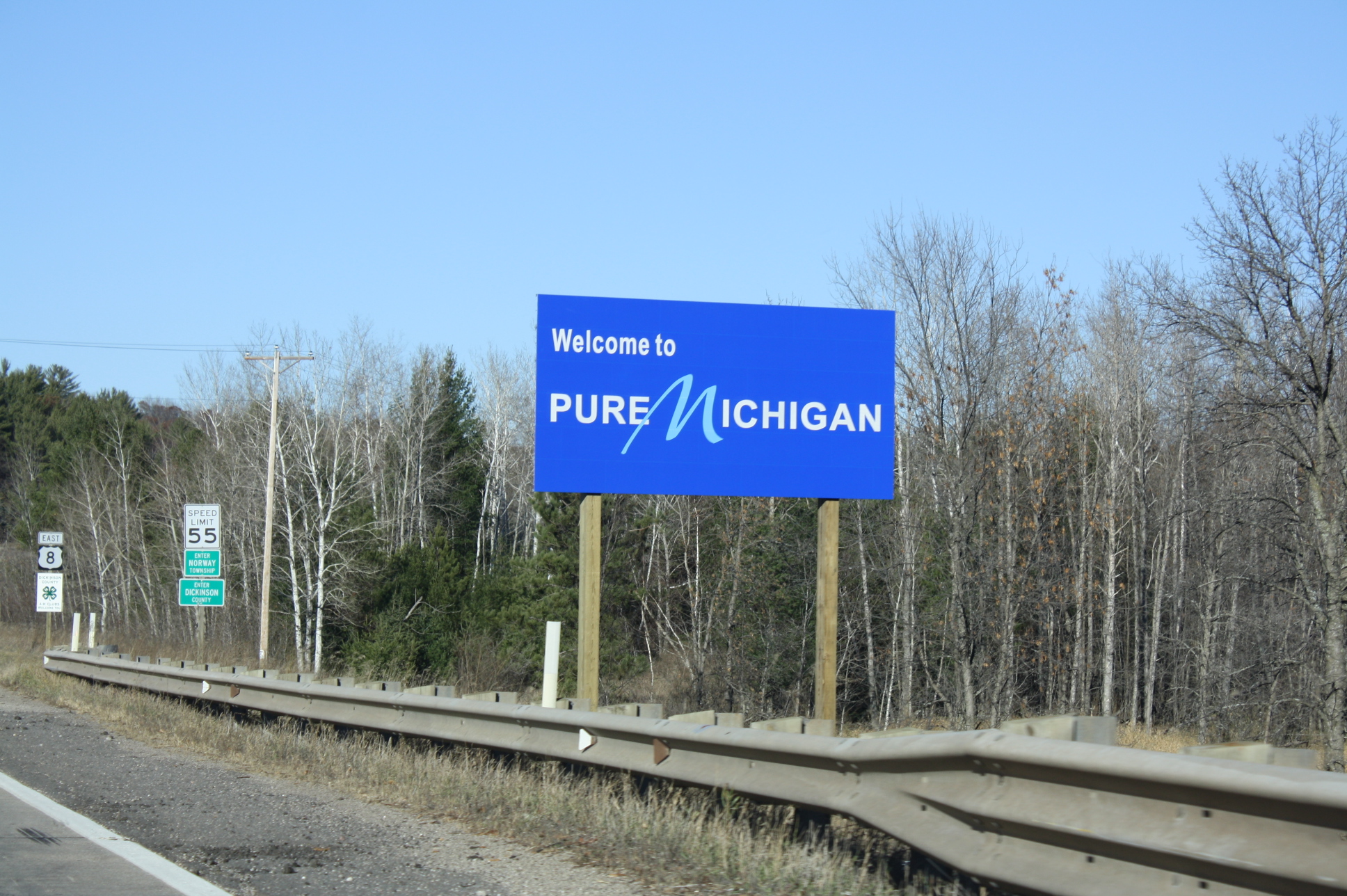
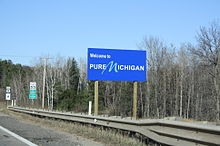 Welcome sign along US 8
The history of the highway system in Michigan dates back to the old Native-American trails that criss-crossed the state. These trails were pathways no wider than approximately 12–18 inches (30–46 cm) permitting single-file traffic. Many of the modern highways in the state follow the path of these old trails, including the Great Trail from Fort Pitt to Fort Detroit which is now US 24 from Detroit to Toledo, Ohio. This trail connected with Braddock's Road which lead to the Atlantic Coast.[22]
The Michigan Territory was established in 1805, and the first roads districts were established by the territorial governor.[22] Detroit created 120-foot (37 m) rights-of-way for the five Great Avenues in the city following a fire in the city.[23] These roads were primarily built to serve the agricultural needs of the farming population of the area at the time.[22]
Outside of Detroit, the situation was quite different. Maps of the territory where printed with the words "interminable swamp" across the interior until 1839.[24] Reports of the first explorers and government surveyors crossing the future state only seemed to confirm the assessment that Michigan land was unsuitable for agriculture or other productive activities. The few roads in the area were impassable for half of the year. The poor quality of the early roads meant that most transportation in the state was by way of the lakes and rivers at first. Commerce was limited to trade to and from Canada. Before the War of 1812, a barrel of flour cost $50 (equivalent to $645 in 2011[25]).[24]
These roads proved inadequate to the needs of the military during the War of 1812. Territorial Governor Lewis Cass lobbied the federal government for road construction funding to bolster defensive needs as well as aid in settlement of the territory. Military roads debuted in 1816 with the construction of the Detroit–Fort Meigs Road to Toledo as a response to transportation needs. More roads were built with Congressional appropriations in the 1820s and 1830s connecting Detroit to Port Huron, Saginaw, Grand Rapids and Chicago.[22]
Townships were given authority to construct roads under the supervision of county commissioners in 1817. This supervision was difficult since in one case, one county covered all of the Upper Peninsula and several of today's counties in the Lower Peninsula. Direct supervision over construction was granted to the townships in 1827, and federal involvement in road building ended with the 1837 granting of statehood. Private construction companies built roads starting in 1844 to fill the void in long-distance road construction left by the departure of the federal government.[22] The first roads were corduroy roads. To build these, logs of all sizes were placed across the road. The gaps between the logs were filled in with smaller logs or earth. In swampy or marshy areas, brush was laid down first for drainage. In time, the logs would rot, leaving large gaps to the roadway that would catch wagon wheels or draft animal feet. Later, roads were built with oak planks. The plank road companies had to be chartered by the state after passage of legislation in 1848. According the plank road law, these companies had to build their roads to a set of minimum specifications. These specifications included 2–4 rods (33–66 ft; 10–20 m) in total width, a road surface 16 feet (4.9 m) wide with at least 8 feet (2.4 m) made of 3-inch (8 cm) planks.[26] Later amendments to the law allowed the companies to substitute gravel for the planks.[27]
The early plank roads were funded by tolls. These fares were collected at turnstiles every few miles along the roads, at rates of $0.02/mile for wagons pulled by two animals (equivalent to $0.53 in 2011[25])[28] As time passed, the planks would warp and rot. The tolls were insufficient to fund the maintenance necessary to keep the roads in good repair.[28] Even Mark Twain remarked, "The road could not have been bad if some unconscionable scoundrel had not now and then dropped a plank across it," after a trip to Grand Rapids.[27] The planks were removed over time and replaced with gravel roads.[28] The longest chartered road was a distance of 220 miles (350 km) from Zilwaukee to Mackinaw City by way of Traverse City; the shortest was a mile (1.6 km) near Sault Ste. Marie.[29]
Townships continued to maintain and build local roads using the "statute labor system". Able-bodied men residing in a local road district were expected to pay his road taxes by performing 30 days of labor on the roads in his district. If he was unable to work off the tax, a rate of $0.625/day was assessed (equivalent to $16.45 in 2011[25]).[30] This road was performed under the guidance of the township road overseer, a separate elected township official, according to the wishes of his constituents, often without any county-level planning or coordination. Often the "improved roads" were in worse condition than unimproved roads due to the amateur nature of the maintenance.[30]
An early form of federal aid contributed to the road network in the state starting in 1850s. Congress granted certain forest and swamp lands to the state in 1850.[31] A stipulation on the grant stated that the proceeds from the lands would be used to reclaim them for use. The Michigan Legislature established several roads to be built by contractors, paid with the proceeds from the sale of the land adjoining the roads, or with land itself.[30] Only 1,179 miles (1,897 km) of the 5,082 miles (8,179 km) of plank roads authorized by the state were ever built by 89 of the 202 chartered plank road companies.[32]
The tax system was partially reformed in 1881, allowing for direct payment of road taxes instead of relying totally on the statute-labor system. The first road district larger than the township level was created in Bay County in 1883 under Public Act 278. This roads district encompassed eight townships and provided for better coordination and planning of road construction. Other county systems were created in 1893 with passage of legislation which allowed other counties to follow the lead of Bay County.[30] By 1900, the plank roads were generally abandoned. While a few were still in good repair, most consisted of rotting logs with intermittent patches of gravel. Toll houses were empty shacks, and the ditches were clogged with duck ponds.[27] Only 23 of the original 202 plank roads chartered by the state were still in operation.[32]
Twentieth century and later
See also: Michigan Department of Transportation
 Previous marker designs originally in use for US 31 and M-35 in 1926
The first state road agency, the Michigan State Highway Department was created on July 1, 1905. At first the department administered rewards to the counties and townships for building roads to state minimum specifications. In 1905, there were 68,000 miles (110,000 km) of roads in Michigan. Of these roads, only 7,700 miles (12,000 km) were improved with gravel and 245 miles (394 km) were macadam. The state's statute labor system was abolished in 1907. Instead a property tax system was instituted with the funding only for permanent improvements, not maintenance.[33] The nation's first mile of concrete roadway was laid along Woodward Avenue between Six Mile and Seven Mile roads in Detroit. This section of street was 17 feet 8 inches (5.38 m) wide.[34]
 Dead Man's Curve along the Marquette–Negaunee Road shown in 1917 with its hand-painted centerline, the first in the nation
Passage of the "State Trunkline Act" in 1913 provided for 3,000 miles (4,828 km) of roadways in a state-financed system.[35] Further legislation at the time allowed for special assessment taxing districts for road improvements, taxation of automobiles based on weight and horsepower and tree-planting along highway roadsides.[36] The first centerline was painted on a state highway in 1917 along the Marquette-Negaunee Road which was designated Trunkline 15, now Marquette County Road 492 (The first centerline was invented in 1911 in Wayne County by Edward N. Hines.) Winter maintenance started during World War I to keep 590 miles (950 km) of strategic highways clear.[37] In 1919, Michigan first signed the trunklines, becoming the second state after Wisconsin to do so.[38] Alan Williams, Ionia County engineer, helped to design the diamond marker used to sign the highways; he is also known for placing a picnic table alongside US 16 (Grand River Avenue) in 1929 south of Saranac, considered the first in the country.[39]
While Michigan was the second jurisdiction to post route designations along its state trunkline highway system in 1919,[38] Michigan actually began assigning internal trunkline route designations for internal inventory purposes as early as 1913.[36] From 1918 to 1926, only the "M-numbered" route designations existed on state highways throughout Michigan, while the coming of the U.S. Highway System in 1926 caused several existing designations to be either reassigned or retired altogether.[10]
The 1932 McNitt act consolidated all of the township-controlled roads into 83 county road commissions.[40] During World War II, the Willow Run Expressway, the Detroit Industrial Expressway and the Davison Freeway were built, ushering in the beginnings of the state's freeway system.[41][42]
Act 51 of 1951 amended and clarified the current system of jurisdiction over roads in the state. The existing tri-level system was maintained, splitting road jurisdiction between the state, counties and cities, as well as subdivided each level into several classifications. Further legislation redefined the exact distribution, but Act 51 set up a system to distribute road funding from gas taxes from a single funding source, currently the Michigan Transportation Fund.[43] Michigan was the first state to complete a border-to-border Interstate Highway in 1960 with the completion of Interstate 94 in Michigan.[44] The 1,241-mile (1,997 km) Interstate Highway network in Michigan was completed in 1992 with the last 4 miles (6 km) of Interstate 69 in Michigan.[44]
See also
Notes
- ^ Measurement as of June 18, 2010[update].
- ^ The Mackinac Bridge Authority (MBA) is an independent state agency responsible for the Mackinac Bridge and thus maintains that section of the overall highway system. The MBA works with MDOT but does not report to it. The executive secretary of the MBA is appointed by MDOT with MBA approval.[4]
References
- ^ a b Michigan State Highway Department (July 1, 1919). State of Michigan: Upper Peninsula (Map). Cartography by MSHD.
- ^ a b c Michigan State Highway Department (July 1, 1919). State of Michigan: Lower Peninsula (Map). Cartography by MSHD.
- ^ a b Staff (June 18, 2010). "Road & Highway Facts". Michigan Department of Transportation. http://www.michigan.gov/mdot/0,1607,7-151-9620_11154-129683--,00.html. Retrieved September 27, 2010.
- ^ "Bridge Legislation Signed". The Grand Rapids Press. Associated Press: p. B3. December 29, 2005.
- ^ Michigan Department of Transportation (2009). MDOT Physical Reference Finder Application (Map). Cartography by Michigan Center for Geographic Information. http://www.mcgi.state.mi.us/prfinder/. Retrieved September 24, 2010.
- ^ Michigan Department of Transportation (2008). Truck Operator's Map (Map). 1 in:15 mi/1 cm:9 km, .
- ^ Schirmer, p.
- ^ Driving Standards Agency, pp. 85+.
- ^ a b c d e f g h Michigan Department of Transportation (2010). Official Department of Transportation Map (Map). 1 in:15 mi/1 cm:9 km, .
- ^ a b Bureau of Public Roads (November 11, 1926) (PDF). United States System of Highways (Map). http://www.okladot.state.ok.us/hqdiv/p-r-div/maps/misc-maps/1926us.pdf. Retrieved May 10, 2008.
- ^ a b Michigan State Highway Department (December 1, 1926). Official Highway Service Map (Map). Cartography by MSHD.
- ^ a b c Michigan State Highway Department (1958). Official Highway Map (Map). (Includes all changes through July 1, 1958)
- ^ Michigan State Highway Department (December 1, 1937). 1937/8 Official Michigan Highway Map (Map). Cartography by Rand McNally (Winter ed.).
- ^ Michigan State Highway Department (December 1, 1938). 1938 Official Michigan Highway Map (Map). Cartography by Rand McNally (Winter ed.).
- ^ Michigan State Highway Department (June 1, 1943). 1942 Official Michigan Highway Map (Map). Cartography by Rand McNally (Summer ed.). Section M13.
- ^ Hamilton, William E. (February 2007). "Act 51 Primer: A Guide to 1951 Public Act 51 and Michigan Transportation Funding" (PDF). Michigan House Fiscal Agency. p. 8. http://house.michigan.gov/hfa/PDFs/act51.pdf. Retrieved September 27, 2010.
- ^ Staff (December 2009). "Chapter 2D: Guide Signs – Conventional Roads" (PDF). Manual on Uniform Traffic Control Devices (2009 ed.). Federal Highway Administration. pp. 143–146. ISBN 978-1598045352. http://mutcd.fhwa.dot.gov/pdfs/2009/part2d.pdf.
- ^ Staff (May 1, 2008). "Appendix C: State Trunkline Connector Routes" (PDF). Michigan Geographic Framework. Michigan Department of Information Technology. http://www.michigan.gov/documents/Appendix_C_Connector_19295_7.pdf. Retrieved October 15, 2008.
- ^ "County Primary Road Marking System Okayed". Holland Evening Sentinel: p. 6. October 5, 1970.
- ^ Davis, R. Matt (May 1, 1986). "Signs To Mark Lake Circle Tour". The Daily Mining Gazette. Capital News Service (Houghton, MI).
- ^ Staff (February 5, 2010). "Drive Home Our Heritage". Heritage Routes. Michigan Department of Transportation. http://www.michigan.gov/mdot/0,1607,7-151-9621_11041_11209-217276--,00.html. Retrieved May 7, 2011.
- ^ a b c d e Pohl, p.1
- ^ Lingeman, p. 1.
- ^ a b Forster, p. 5.
- ^ a b c Consumer Price Index (estimate) 1800–2008. Federal Reserve Bank of Minneapolis. Retrieved December 7, 2010.
- ^ Morrison, pp. 65–6.
- ^ a b c Morrison, p. 66.
- ^ a b c Forster, pp. 11–2.
- ^ Mason (1980), p. 3.
- ^ a b c d Pohl, p.2
- ^ Mason (1959), p.7.
- ^ a b Mason (1980), p. 4
- ^ Kulsea, p.3
- ^ Kulsea, p.5
- ^ Kulsea, p.7
- ^ a b Kulsea, p.9
- ^ Kulsea, p.10
- ^ a b "Michigan May Do Well Following Wisconsin's Road Marking System". The Grand Rapids Press: p. 10. September 20, 1919.
- ^ Ellison, Garret (July 4, 2011). "Ionia County Boasts First Roadside Picnic Table, One of West Michigan's Hidden Gems". The Grand Rapids Press. http://www.mlive.com/news/grand-rapids/index.ssf/2011/07/ionia_county_boasts_first_road.html. Retrieved July 6, 2011.
- ^ Pohl, p.4
- ^ Kulsea, p.18
- ^ Mieczko, Louis (May 17, 1986). "State, County Haggle Over Davison Repairs". Detroit News.
- ^ Pohl, p.5
- ^ a b "A Brief History of Paving". TheGrand Rapids Press: p. A8. March 1, 2010.
Works cited
- Driving Standards Agency (2007). "Motorways". The Official Highway Code. Department for Transport. ISBN 978 011 552814 9.
- Forster, Edith C. (1951). Norris, Joe L. ed. Yesterday's Highways: Traveling Around Early Detroit. Detroit: Wayne University Press. OCLC 3324319.
- Kulsea, Bill; Shawver, Tom; Kach, Carol (1980). Making Michigan Move: A History of Michigan Highways and the Michigan Department of Transportation. Lansing, MI: Michigan Department of Transportation. OCLC 8169232.
- Lingeman, Stanley D. (April 6, 2001). Michigan Highway History Timeline 1701–2001: 300 Years of Progress. Lansing, MI: Library of Michigan. OCLC 435640179.
- Mason, Philip P. (1959). Michigan Highways From Indian Trails to Expressways. Ann Arbor, MI: Braun-Brumfield. OCLC 23314983.
- —— (1980). Howard, Saralee R.; Walters, Timothy N. eds. "The Plank Road Craze: A Chapter in the History of Michigan's Highways". Great Lakes Informant (Lansing, MI: Michigan Department of State) 2 (1): 1–4. OCLC 17646708.
- Morrison, Roger L. (Autumn 1937). "The History and Development of Michigan Highways". Michigan Alumnus Quarterly Review (Ann Arbor, MI: University of Michigan Bureau of Alumni Relations) 39 (54): 59–73. OCLC 698029175.
- Pohl, Dorothy G.; Brown, Norman E. (December 2, 1997). "The History of Roads in Michigan". Association of Southern Michigan Road Commissions. http://www.michiganhighways.org/history.html. Retrieved September 11, 2008.
- Schirmer, Sherry Lamb; Wilson, Dr. Theodore A. (December 1986). Milestones: A History of the Kansas Highway Commission and the Department of Transportation. Kansas Department of Transportation. OCLC 19126368.
External links
Numbered highways in the United States National systems State highways Alabama · Alaska · Arizona · Arkansas · California · Colorado · Connecticut · Delaware · Florida · Georgia · Hawaii · Idaho · Illinois · Indiana · Iowa · Kansas · Kentucky · Louisiana · Maine · Maryland · Massachusetts · Michigan · Minnesota · Mississippi · Missouri · Montana · Nebraska · Nevada · New Hampshire · New Jersey · New Mexico · New York · North Carolina · North Dakota · Ohio · Oklahoma · Oregon · Pennsylvania · Rhode Island · South Carolina · South Dakota · Tennessee · Texas · Utah · Vermont · Virginia · Washington · West Virginia · Wisconsin · Wyoming
Other areas Categories:- Transportation in Michigan
- State highways in Michigan


Wikimedia Foundation. 2010.