- M-553 (Michigan highway)
-
M-553
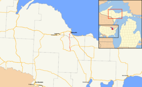
M-553 highlighted in redRoute information Maintained by MDOT Length: 19.618 mi[2] (31.572 km) Existed: October 1, 1998[1] – present Major junctions South end:  M-35 near Gwinn
 M-94 near K.I. Sawyer
 Sawyer International Airport
 CR 480 in Sands Township
North end: 
 US 41 / M-28 in Marquette
Location Counties: Marquette Highway system Michigan State Trunkline Highway System
Interstate • US • State←  I-496
I-496M-554  →
→M-553 is a north–south state trunkline highway in the Upper Peninsula of the US state of Michigan. The trunkline was originally Marquette County Road 553. It is the main highway connection between the US 41/M-28 corridor and both the Sawyer International Airport and Gwinn.
M-553 was given its number based on the county road it replaced. It was designated in 1998 and extended through the City of Marquette in 2005. The highway is related to M-554 which was decommissioned and turned over to the city in the state route swap that extended M-553.
Contents
Route description
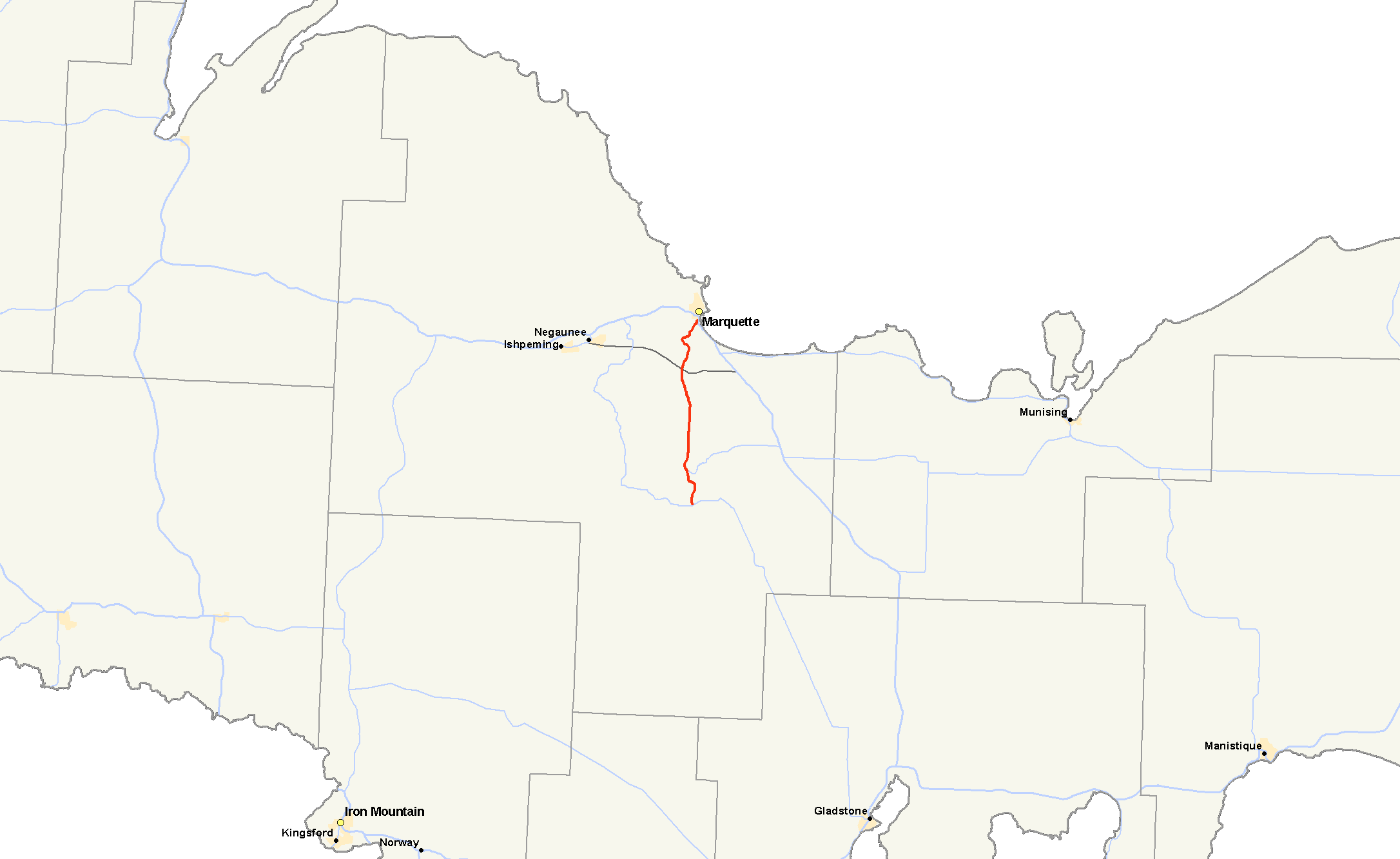
M-553 begins as a two-lane rural highway east of Gwinn in the New Swanzy neighborhood. From there it runs north through the Sands Plains, past M-94 and the west gate of the former K. I. Sawyer Air Force Base. M-553 reaches CR 480 at the "Crossroads" area of Marquette County just north of the Sands Plains. There it passes into hilly, wooded terrain. It descends a steep curve alongside the Marquette Mountain Ski Area before crossing the Carp River.[3]
 Guide sign directing M-553 traffic through a Michigan Left.
On the south side of the City of Marquette, M-553 takes McClellan Ave, a four-lane boulevard divided by a center turn lane. The northern terminus of M-553 is a signalized intersection along the Marquette Bypass portion of US 41/M-28, a four-lane divided expressway that bypasses downtown Marquette. The intersection is designed as a "Michigan Left". Traffic wishing to make a left turn at the intersection must instead use a median cross-over lane to complete the turn.[3]
History
As part of Governor Engler's Rationalization plan, County Road 553 was transferred to state jurisdiction on October 1, 1998.[1][4] The Michigan Department of Transportation designated the highway M-553 based on the former county designation. A portion of CR 553 was numbered M-554 but not signed. The highway designation stopped at the intersection with M-554 and McClellan Ave in the City of Marquette until 2005.[5]
In 2005, the City of Marquette agreed to a "route swap" with MDOT. This swap placed former BUS US 41 and M-554 under city jurisdiction in exchange for the extension of M-553 to its current northern terminus at the Marquette Bypass. M-553 was extended northward along McClellan Ave.[6] MDOT has initiated a speed study to determine what speed limits should apply on the extension. The McClellan Ave portion of M-553 was placed under a temporary traffic control order leaving the 35 mph (56 km/h) limit in place. A school zone may be placed near the Superior HIlls Elementary school.[7] MDOT has started construction of a new 20-space commuter parking lot at the southern terminus of M-553 at M-35 on August 11, 2008 with an expected completion date of August 30, 2008. This is part of an effort to offer expanded ride-sharing opportunities in Marquette County.[8]
Major intersections
 Guide sign outside of Sawyer International Airport directing to M-553
The entire highway is in Marquette County.
Location Mile[2][9] Destinations Notes Forsyth Township 0.000 M-35 – Palmer, Gladstone2.843 M-94 east – SkandiaSands Township 7.023 Kelly Johnson Memorial DriveAccess to Sawyer International Airport 13.256 CR 480Marquette 19.618  US 41 / M-28 / LSCT – Escanaba, Munising, Baraga
Northern terminus of M-553; roadway continues north as McClellan Avenue 1.000 mi = 1.609 km; 1.000 km = 0.621 mi References
- ^ a b "MDOT Accepts Responsibility for 120 Miles of Local Roads" (Press release). Michigan Department of Transportation. September 24, 1998. http://www.michigan.gov/mdot/0,1607,7-151-9620_11057-94859--,00.html. Retrieved August 26, 2008.
- ^ a b Michigan Department of Transportation (2009). Control Section/Physical Reference Atlas (Map). http://mdotwas1.mdot.state.mi.us/public/maps/pr/. Retrieved July 26, 2009.
- ^ a b Google, Inc. Google Maps – M-553 (Michigan highway) (Map). Cartography by Google, Inc. http://maps.google.com/maps?f=d&saddr=County+Road+553+%26+M-35,+Gwinn,+Marquette,+Michigan+49841,+United+States&daddr=CR-553%2FM-335+%4046.316330,+-87.417500+to:CR-553+%26+Johnson+Drive,+Gwinn,+Michigan+to:CR-553+%26+CR-480,+Sands,+Michigan+to:US-41+%26+McClellan+Ave,+Marquette,+MI+49855&hl=en&geocode=%3B2461088769564456457,46.316330,-87.417500%3B%3B%3B&mra=ls&sll=46.37005,-87.416225&sspn=0.301326,0.458679&ie=UTF8&ll=46.409931,-87.41684&spn=0.301107,0.458679&z=11. Retrieved August 26, 2008.
- ^ Michigan Department of Transportation (1999). Official 1999 Department of Transportation Map (Map). Cartography by MDOT. Section C6.
- ^ Michigan Department of Transportation (2006). Official 2006 Department of Transportation Map (Map). Cartography by MDOT. Section C6.
- ^ "MDOT and city of Marquette complete jurisdictional transfer" (Press release). Michigan Department of Transportation. November 9, 2005. http://www.michigan.gov/mdot/0,1607,7-151-9620_11057-129975--,00.html. Retrieved July 31, 2008.
- ^ Moeller, Miriam (November 9, 2007). "McClellan Ave. speed could go up or down". The Mining Journal. Marquette, MI. http://www.miningjournal.net/page/content.detail/id/501377.html. Retrieved January 20, 2008.
- ^ "MDOT building new lot for Marquette County commuters" (Press release). Michigan Department of Transportation. August 19, 2008. http://www.michigan.gov/mdot/0,1607,7-151-9620_11057-198497--,00.html. Retrieved August 26, 2008.
- ^ "MDOT Physical Reference Finder Application". Michigan Department of Transportation. 2009. http://www.mcgi.state.mi.us/prfinder/. Retrieved April 9, 2010.
External links
Categories:- State highways in Michigan
- Transportation in Marquette County, Michigan


Wikimedia Foundation. 2010.