- Sawyer International Airport
-
Sawyer International Airport 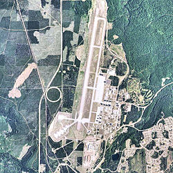
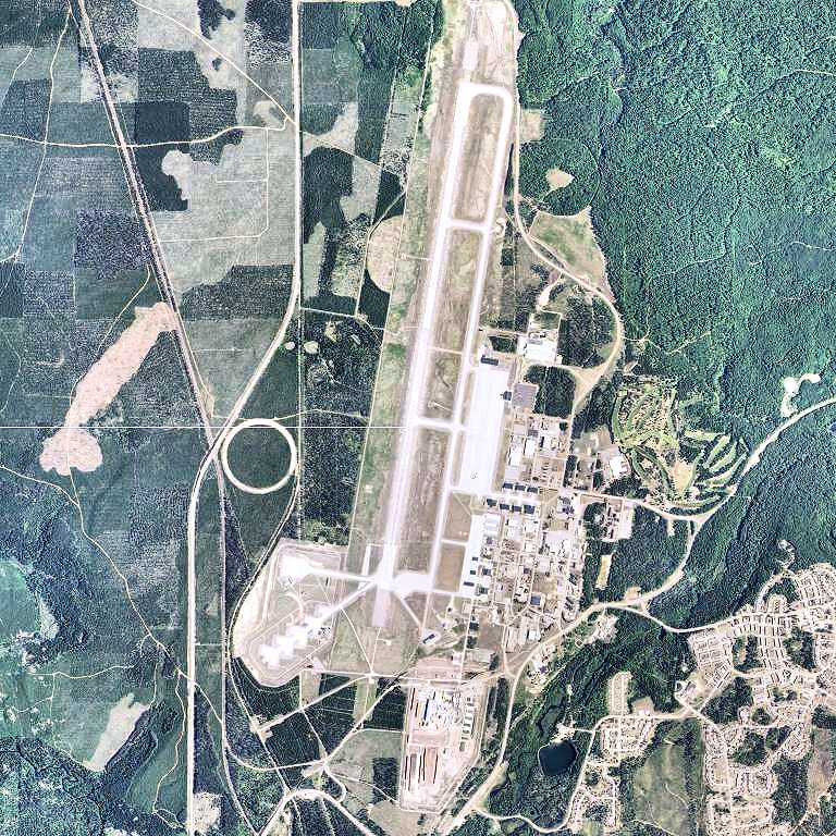
2006 USGS photo IATA: MQT – ICAO: KSAW – FAA LID: SAW Summary Airport type Public Owner Marquette County Serves Marquette, Michigan Location Gwinn, Michigan Elevation AMSL 1,221 ft / 372 m Coordinates 46°21′13″N 87°23′43″W / 46.35361°N 87.39528°WCoordinates: 46°21′13″N 87°23′43″W / 46.35361°N 87.39528°W Website Map Location of airport in Michigan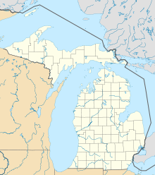
 MQT
MQTRunways Direction Length Surface ft m 1/19 12,370 3,770 Asphalt/Concrete Statistics (2010) Total Passengers 114,295  6%
6%Total Enplanements 57,595 7%Aircraft operations (2008) 22,515 Based aircraft (2008) 44 Source: FAA[1], Michigan DOT[2] Sawyer International Airport (IATA: MQT, ICAO: KSAW, FAA LID: SAW) is a public airport located 17 miles (27 km) south of the central business district of Marquette, a city in Marquette County, Michigan, United States. The airport is publicly owned by Marquette County.[1]
This commercial and general aviation airport is located near Gwinn, Michigan on a portion of the former K. I. Sawyer Air Force Base, which closed in September 1995. The airport opened for passenger service in September 1999, serving Marquette and the surrounding area. It replaced the former Marquette County Airport (IATA: MQT, ICAO: KMQT, FAA LID: MQT) which closed the same year.
Although most U.S. airports use the same three-letter location identifier for the FAA and IATA, Sawyer International is assigned SAW by the FAA and MQT by the IATA (which had previously assigned SAW to Sabiha Gökçen International Airport in Istanbul, Turkey). The airport's ICAO identifier is KSAW. [3] [4]
Contents
Facilities and aircraft
Sawyer International Airport covers an area of 2,100 acres (850 ha). It has a single asphalt/concrete runway, 12,370 x 150 ft (3,770 x 46 m),[1] originally re-designed in 1959 to accommodate B-52 bombers and KC-135 tankers.
For 12-month period ending December 31, 2008, the airport had 22,515 aircraft operations, an average of 62 per day: 49% general aviation (10,940), 47% air taxi (10,536), <1% scheduled commercial (8), and 5% military (1,031)[citation needed]. There are 44 aircraft based at this airport: 91% single engine (40) and 9% multi engine (4).[1]
There is an industrial park, the Telkite Technology Park[5], adjacent to the airport, with 1,000 acres (4.0 km2) of land and 1,500,000 square feet (140,000 m2) of space in a Michigan Renaissance Zone, which exempts the tenant or owner from the majority of state and local taxes.
The airport is home to the Marquette County Aviation Wall of Honor which features many influential pilots and engineers.[6]
Airlines and destinations
Airlines Destinations American Eagle Chicago-O'Hare Delta Connection operated by Pinnacle Airlines Detroit References
- ^ a b c d FAA Airport Master Record for SAW (Form 5010 PDF), faa.gov, retrieved 2010-Sep-14
- ^ Michigan Department of Transportation. Measures of Michigan Air Carrier Demand, Michigan.gov, retrieved 2011-Jan-13
- ^ Great Circle Mapper: MQT / KSAW - Marquette, Michigan (Sawyer International Airport)
- ^ Great Circle Mapper: SAW / LTFJ - Istanbul, Turkey (Sabiha Gökçen International Airport)
- ^ Telkite Technology Park
- ^ Airmen added to Wall of Honor
External links
- Official website
- Michigan Airport Directory: Sawyer International AirportPDF (48.3 KiB)
- Photos of the closed Marquette County Airport
- Resources for this airport:
- AirNav airport information for KSAW
- ASN accident history for MQT
- FlightAware airport information and live flight tracker
- NOAA/NWS latest weather observations
- SkyVector aeronautical chart, Terminal Procedures for KSAW
Categories:- Airports in Michigan
- Buildings and structures in Marquette County, Michigan
- Transportation in Marquette County, Michigan

Wikimedia Foundation. 2010.