- Marquette County, Michigan
-
Marquette County, Michigan 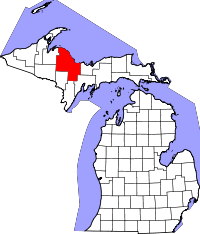
Location in the state of Michigan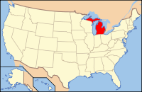
Michigan's location in the U.S.Founded March 9, 1843 [1] Seat Marquette Area
- Total
- Land
- Water
3,425.17 sq mi (8,871 km²)
1,821.05 sq mi (4,716 km²)
1,604.12 sq mi (4,155 km²), 57.56%Population
- (2000)
- Density
64,634
44/sq mi (17/km²)Website www.co.marquette.mi.us Marquette County is a county in the U.S. state of Michigan. As of the 2010 census, the population was 67,077.[1] The county seat is Marquette[2]. Marquette County is the largest county in land area in Michigan, and the most populous county in the Upper Peninsula of Michigan.
Contents
Geography
The Huron Mountains are located in the county. According to the 2000 census, the county has a total area of 3,425.17 square miles (8,871.1 km2), of which 1,821.05 square miles (4,716.5 km2) (or 53.17%) is land and 1,604.12 square miles (4,154.7 km2) (or 46.83%) is water.[3]
Adjacent counties
- Alger County (east)
- Delta County (southeast)
- Menominee County (south)
- Dickinson County (south)
- Iron County (southwest)
- Baraga County (west)
- Houghton County (northwest, water boundary only, in Lake Superior)
- Keweenaw County (north, water boundary only, in Lake Superior)

Houghton County Lake Superior; Keweenaw County Baraga County 
Alger County  Marquette County, Michigan

Iron County Menominee County and Dickinson County Delta County See also: List of counties bordering eight countiesNational protected areas
- Hiawatha National Forest (part)
- Huron National Wildlife Refuge
- Ottawa National Forest (part)
University
Northern Michigan University is a four-year university, established in 1899, located in Marquette, Michigan, on Michigan's Upper Peninsula. The school is home to over 9,000 students and offers over 100 academic programs leading to degrees at the levels of bachelor, associate, certificate, as well as several graduate programs. Their Teaching, Learning and Communication (TLC) program, which is the largest of its kind in the country, gives every student an IBM ThinkPad or Apple MacBook. NMU has the world's largest wooden dome, the Superior Dome. It is also home to the United States Olympic Education Center, or USOEC, one of only four US Olympic training centers and the only one affiliated with a university. Athletes receive scholarships and utilize the school's facilities training in several sports: Men's and Women's Weightlifting; Boxing; Men's and Women's Speedskating; Greco-Roman Wrestling; and Women's Freestyle Wrestling.
State trunkline highways
 Map of the county's highways
Demographics
As of the census[4] of 2000, there were 64,634 people, 25,767 households, and 16,490 families residing in the county. The population density was 36 people per square mile (14/km²). There were 32,877 housing units at an average density of 18 per square mile (7/km²). The racial makeup of the county was 95.12% White, 1.32% Black or African American, 1.49% Native American, 0.49% Asian, 0.02% Pacific Islander, 0.25% from other races, and 1.31% from two or more races. 0.69% of the population were Hispanic or Latino of any race. 21.2% were of Finnish, 12.0% German, 10.6% English, 9.0% French, 8.1% Italian, 6.6% Irish and 6.0% Swedish ancestry according to Census 2000. 96.0% spoke English, 1.5% Finnish and 1.0% Spanish as their first language.
There were 25,767 households out of which 28.60% had children under the age of 18 living with them, 51.30% were married couples living together, 8.90% had a female householder with no husband present, and 36.00% were non-families. 28.90% of all households were made up of individuals and 10.50% had someone living alone who was 65 years of age or older. The average household size was 2.35 and the average family size was 2.90.
In the county the population was spread out with 21.40% under the age of 18, 13.60% from 18 to 24, 26.90% from 25 to 44, 24.60% from 45 to 64, and 13.50% who were 65 years of age or older. The median age was 38 years. For every 100 females there were 100.90 males. For every 100 females age 18 and over, there were 100.10 males.
The median income for a household in the county was $35,548, and the median income for a family was $46,281. Males had a median income of $36,431 versus $23,609 for females. The per capita income for the county was $18,070. About 6.00% of families and 10.90% of the population were below the poverty line, including 11.20% of those under age 18 and 6.40% of those age 65 or over.
Government
The county government operates the jail, KI Sawyer International Airport, maintains rural roads, operates the major local courts, keeps files of deeds and mortgages, maintains vital records, administers public health regulations, and participates with the state in the provision of welfare and other social services. The county board of commissioners controls the budget but has only limited authority to make laws or ordinances. In Michigan, most local government functions — police and fire, building and zoning, tax assessment, street maintenance, etc. — are the responsibility of individual cities and townships.
Marquette County elected officials
- Prosecuting Attorney: Gary L. Walker
- Sheriff: Michael H. Lovelace
- County Clerk: Connie M. Branam
- County Treasurer: Anne Giroux
- Register of Deeds: Patricia A. Manley
- Drain Commissioner: P. Michael Farrell
- Mine Inspector: John Carlson
(information as of July 24, 2009)
Historical markers
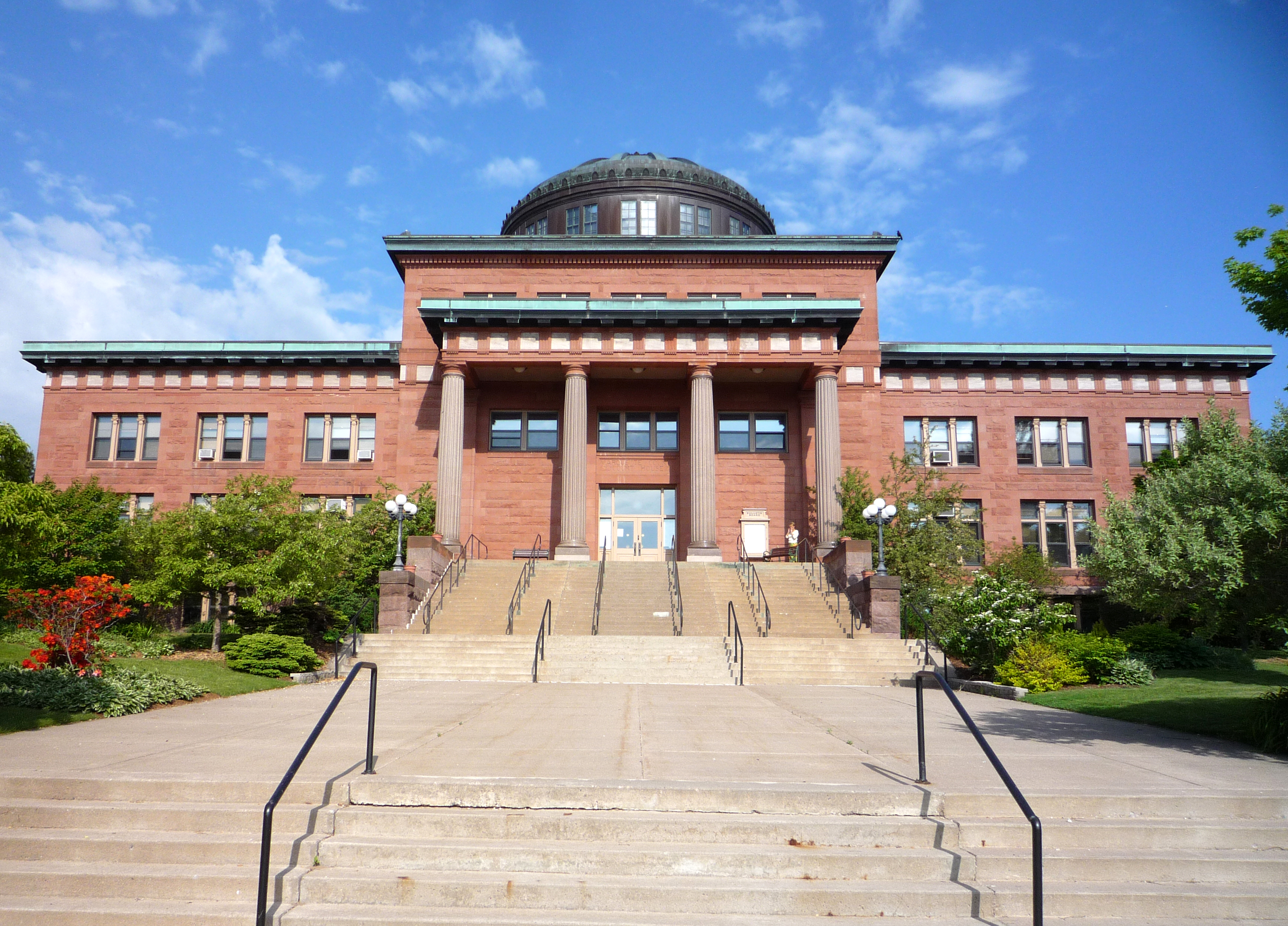
 Marquette County Courthouse was used in the film version of Anatomy of a Murder, which was set in the area.
There are ten historical markers in the County,[5] namely:
- Cliffs Shaft Mine
- Dandelion Cottage
- Father Marquette Park
- First Steam Railroad in Upper Peninsula
- Ishpeming: Historic Ski Center
- Jackson Mine
- Marquette County Courthouse
- Marquette Iron Range
- Northern Michigan University
- Sam Cohodas Lodge / Sam Cohodas
Cities, villages, and townships
Cities
Villages
None
Unincorporated communities
- Harvey
- K. I. Sawyer AFB
- Michigamme
- Palmer
Townships
See also
References
- ^ "2010 US census",
- ^ "Find a County". National Association of Counties. http://www.naco.org/Counties/Pages/FindACounty.aspx. Retrieved 2011-06-07.
- ^ "Census 2000 U.S. Gazetteer Files: Counties". United States Census. http://www.census.gov/tiger/tms/gazetteer/county2k.txt. Retrieved 2011-02-13.
- ^ "American FactFinder". United States Census Bureau. http://factfinder.census.gov. Retrieved 2008-01-31.
- ^ Michigan Historical markers.
Further reading
External links
Municipalities and communities of Marquette County, Michigan Cities 
Charter
townshipsGeneral law
townshipsUnincorporated
communitiesArnold | Austin | Big Bay | Gwinn | Harvey | K. I. Sawyer AFB | Little Lake | Michigamme | National Mine | New Swanzy | Palmer | Republic | Trowbridge Park | West Ishpeming
Indian reservation Categories:- Michigan counties
- Marquette County, Michigan
- 1843 establishments in the United States
- Populated places established in 1843


Wikimedia Foundation. 2010.