- Charlevoix County, Michigan
-
Charlevoix County, Michigan 
Logo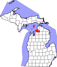
Location in the state of Michigan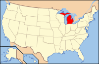
Michigan's location in the U.S.Founded 1869 Seat Charlevoix Largest city Boyne City Area
- Total
- Land
- Water
1,390.76 sq mi (3,602 km²)
416.84 sq mi (1,080 km²)
973.92 sq mi (2,522 km²), 70.03%Population
- (2000)
- Density
26,090
62/sq mi (24/km²)Website www.charlevoixcounty.org Charlevoix County is a county in the U.S. state of Michigan. As of the 2000 census, the population was 26,090. The county seat is Charlevoix.[1]
Contents
Geography
- Lake Charlevoix, with 17,200 acres (7,000 ha) surface area and 56 miles (90 km) of shoreline, is a very prominent feature of the county. According to the 2000 census, the county has a total area of 1,390.76 square miles (3,602.1 km2), of which 416.84 square miles (1,079.6 km2) (or 29.97%) is land and 973.92 square miles (2,522.4 km2) (or 70.03%) is water.[2]
- The county is considered to be part of Northern Michigan.
- Gull, Hat, Pismire, and Shoe Islands, which are part of the Beaver Island archipelago, form the Lake Michigan division of the Michigan Islands National Wildlife Refuge, and two of them are part of the Michigan Islands Wilderness Area.
Adjacent counties
- Mackinac County (north)
- Cheboygan County & Emmet County (northeast)
- Otsego County (southeast)
- Antrim County (south)
- Leelanau County (southwest)
- Schoolcraft County (northwest)

Schoolcraft County Mackinac County Cheboygan County & Emmet County 
 Charlevoix County, Michigan

Leelanau County Antrim County Otsego County National protected area
Transportation
State highways
County-designated highways
 C-48
C-48 C-56
C-56 C-65
C-65 C-71
C-71 C-73
C-73 C-81
C-81
Airports
Ferry service
- Beaver Island Boat Company maintains a regular auto ferry from Charlevoix:[5]
- The Ironton Ferry at Ironton, Michigan crosses the south arm of Lake Charlevoix. It is a designated Michigan Historical Site in operation since 1876.
Demographics
As of the census[6] of 2000, there were 26,090 people, 10,400 households, and 7,311 families residing in the county. The population density was 63 people per square mile (24/km²). There were 15,370 housing units at an average density of 37 per square mile (14/km²). The racial makeup of the county was 96.31% White, 0.17% Black or African American, 1.54% Native American, 0.23% Asian, 0.09% Pacific Islander, 0.41% from other races, and 1.25% from two or more races. 1.04% of the population were Hispanic or Latino of any race. 21.8% were of German, 12.0% English, 11.0% American, 10.6% Irish and 8.4% Polish ancestry according to Census 2000. 97.3% spoke English and 1.1% Spanish as their first language.
There were 10,400 households out of which 31.80% had children under the age of 18 living with them, 58.40% were married couples living together, 8.10% had a female householder with no husband present, and 29.80% were non-families. 25.20% of all households were made up of individuals and 10.50% had someone living alone who was 65 years of age or older. The average household size was 2.48 and the average family size was 2.96.
In the county the population was spread out with 25.90% under the age of 18, 6.50% from 18 to 24, 27.40% from 25 to 44, 25.20% from 45 to 64, and 14.90% who were 65 years of age or older. The median age was 39 years. For every 100 females there were 97.90 males. For every 100 females age 18 and over, there were 94.80 males.
The median income for a household in the county was $39,788, and the median income for a family was $46,260. Males had a median income of $32,457 versus $22,447 for females. The per capita income for the county was $20,130. About 5.40% of families and 8.00% of the population were below the poverty line, including 10.00% of those under age 18 and 5.90% of those age 65 or over.
Government
The county government operates the jail, maintains rural roads, operates the major local courts, keeps files of deeds and mortgages, maintains vital records, administers public health regulations, and participates with the state in the provision of welfare and other social services. The county board of commissioners controls the budget but has only limited authority to make laws or ordinances. In Michigan, most local government functions — police and fire, building and zoning, tax assessment, street maintenance, etc. — are the responsibility of individual cities and townships.
Cities, villages, and townships
Cities
Villages
- Boyne Falls, village
Unincorporated communities
- Bay Shore
- Norwood
Townships
History and historical markers
- Beaver Island has a unique history, particularly because of the temporary influence of James J. Strang, who founded the Church of Jesus Christ of Latter Day Saints (Strangite). Strang moved his followers to Beaver Island in 1848, and they are known as Strangites.
- There are ten recognized Michigan historical markers in the county:[7]
- Big Rock Point Nuclear Power Plant
- Boyne City United Methodist Church
- Charlevoix Depot
- Greensky Hill Mission
- Horace S. Harsha House
- Horton Bay
- John Porter and Eva Porter Estate
- Mormon Kingdom
- Mormon Print Shop
- Norwood Township Hall
See also
Notes
- ^ "Find a County". National Association of Counties. http://www.naco.org/Counties/Pages/FindACounty.aspx. Retrieved 2011-06-07.
- ^ "Census 2000 U.S. Gazetteer Files: Counties". United States Census. http://www.census.gov/tiger/tms/gazetteer/county2k.txt. Retrieved 2011-02-13.
- ^ Fresh Air Aviation
- ^ Island Airways
- ^ Beaver Island Auto ferry
- ^ "American FactFinder". United States Census Bureau. http://factfinder.census.gov. Retrieved 2008-01-31.
- ^ Michigan Historical Markers
External links
- Charlevoix County web site
- Charlevoix Area Chamber of commerce, with links, calendar of events
- Clarke Historical Library, Central Michigan University, Bibliography on Charlevoix County
Municipalities and communities of Charlevoix County, Michigan Cities 
Village Townships Bay | Boyne Valley | Chandler | Charlevoix | Evangeline | Eveline | Hayes | Hudson | Marion | Melrose | Norwood | Peaine | South Arm | St. James | Wilson
Unincorporated
communityNorthern Michigan Topics Major Highways Central cities Satellite cities Region Outlying regions Counties See also: MichiganCategories:
- Michigan counties
- Charlevoix County, Michigan
- Populated places established in 1869


Wikimedia Foundation. 2010.