- Midland County, Michigan
-
Midland County, Michigan 
Seal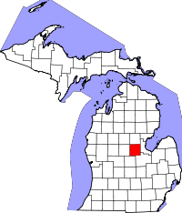
Location in the state of Michigan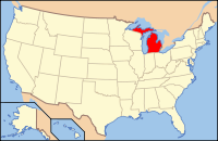
Michigan's location in the U.S.Founded 1831 Seat Midland Area
- Total
- Land
- Water
527.89 sq mi (1,367 km²)
521.19 sq mi (1,350 km²)
6.70 sq mi (17 km²), 1.27%Population
- (2000)
- Density
83,629
160/sq mi (61.9/km²)Website www.co.midland.mi.us Midland County is a county in the U.S. state of Michigan. As of the 2010 census, the population was 83,629. The county seat is Midland[1].
Contents
Geography
- According to the 2000 census, the county has a total area of 527.89 square miles (1,367.2 km2), of which 521.19 square miles (1,349.9 km2) (or 98.73%) is land and 6.70 square miles (17.4 km2) (or 1.27%) is water.[2]
- The Roman Catholic Diocese of Saginaw is the controlling regional body for the Catholic Church.[3]
- Midland County is part of the Flint/Tri-Cities.
See also: List of Midland parksTransportation
US Highways
 US 10
US 10
BUS US 10 a business loop serving the city of Midland.
Michigan State Highways
Airports
Scheduled airline service is available from MBS International Airport[4] near Freeland, Michigan and Bishop International Airport in Flint, Michigan.[5] Midland also has a general aviation airport, Jack Barstow Municipal Airport.[6]
Public Transportation
There is no regularly scheduled public transportation (bus service). Residents can call in advance to schedule pickup for transport within the county by two government sponsored agencies ("Dial-A-Ride" within the city of Midland and "County Connection" for those outside the city of Midland but still within Midland County) for a nominal fee.[7]
Adjacent counties
- Gladwin County - north
- Bay County - east
- Saginaw County - southeast
- Gratiot County - south
- Isabella County - west
- Clare County - northwest

Clare County Gladwin County Isabella County 
Bay County  Midland County, Michigan

Gratiot County Saginaw County Demographics
As of the census[8] of 2000, there were 82,874 people, 31,769 households, and 22,683 families residing in the county. The population density was 159 people per square mile (61/km²). There were 33,796 housing units at an average density of 65 per square mile (25/km²). The racial makeup of the county was 95.50% White, 1.05% Black or African American, 0.40% Native American, 1.49% Asian, 0.03% Pacific Islander, 0.44% from other races, and 1.09% from two or more races. 1.55% of the population were Hispanic or Latino of any race. 28.6% were of German, 11.5% English, 10.2% United States or American, 8.9% Irish and 6.1% Polish ancestry according to Census 2000. 96.7% spoke English and 1.6% Spanish as their first language.
There were 31,769 households out of which 34.90% had children under the age of 18 living with them, 60.10% were married couples living together, 8.10% had a female householder with no husband present, and 28.60% were non-families. 23.50% of all households were made up of individuals and 9.00% had someone living alone who was 65 years of age or older. The average household size was 2.56 and the average family size was 3.04.
In the county the population was spread out with 26.90% under the age of 18, 8.70% from 18 to 24, 29.20% from 25 to 44, 23.20% from 45 to 64, and 12.00% who were 65 years of age or older. The median age was 36 years. For every 100 females there were 96.30 males. For every 100 females age 18 and over, there were 93.30 males.
The median income for a household in the county was $45,674, and the median income for a family was $55,483. Males had a median income of $45,656 versus $27,470 for females. The per capita income for the county was $23,383. About 5.70% of families and 8.40% of the population were below the poverty line, including 9.50% of those under age 18 and 7.50% of those age 65 or over.
Politics
Midland County predominantly supports the Republican Party, in contrast to the neighboring counties of Saginaw and Bay, who mainly support the Democratic Party.
In the 2008 presidential election, Republican candidate John McCain received 22,263 votes (50.83% of the county's share) to Democrat Barack Obama's 20,701 (47.26%), even as Obama carried the state by a double-digit margin.[9]
In 2004, Republican president George W. Bush received 24,369 (56.31%) votes to Democrat John Kerry's 18,355 (42.41%).[10]
In 2000, Bush received 21,887 votes (56.28%) to Democrat Al Gore's 15,959 (41.04%).[11]
Government
The county government operates the jail, maintains rural roads, operates the major local courts, keeps files of deeds and mortgages, maintains vital records, administers public health regulations, and participates with the state in the provision of welfare and other social services. The county board of commissioners controls the budget but has only limited authority to make laws or ordinances. In Michigan, most local government functions — police and fire, building and zoning, tax assessment, street maintenance, etc. — are the responsibility of individual cities and townships.
Midland County elected officials
- Prosecuting Attorney: Michael D. Carpenter
- Sheriff: Jerry A. Nielsen
- County Clerk: Ann Manary
- County Treasurer: Richard A. Enszer
- Register of Deeds: Julie Atkinson
- Drain Commissioner: Douglas D. Enos
(information as of October 2010)
County Board of Commissioners
7 members, elected from districts (2 Democrats, 5 Republican)
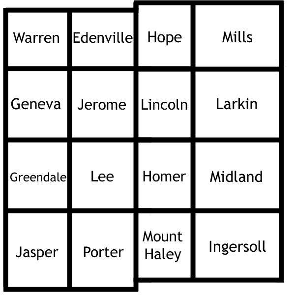
District Commissioner Party Positions 1 Howard Schoenherr Democrat Chair of Administrations & Operations Committee 2 Mark Bone Republican Chair of Executive Committee 3 James Leigeb Republican Chair of Law Enforcement and Judiciary Committee 4 Richard Keenan Republican 5 Otis Wilson Republican Chair of Finance Committee 6 James Bradley Republican Chairman of the Board 7 Rose Marie McQuaid Democrat Chair of Human Services Committee Cities, villages, and townships
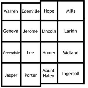 Midland County, MI Township boundary map
See also
Notes
- ^ "Find a County". National Association of Counties. http://www.naco.org/Counties/Pages/FindACounty.aspx. Retrieved 2011-06-07.
- ^ "Census 2000 U.S. Gazetteer Files: Counties". United States Census. http://www.census.gov/tiger/tms/gazetteer/county2k.txt. Retrieved 2011-02-13.
- ^ Saginaw County Diocese home page
- ^ MBS International Airport
- ^ Flint Bishop International Airport
- ^ Jack Barstow Municipal Airport
- ^ Dial-A-Ride homepage
- ^ "American FactFinder". United States Census Bureau. http://factfinder.census.gov. Retrieved 2008-01-31.
- ^ http://www.uselectionatlas.org/RESULTS/statesub.php?year=2008&fips=26111&off=0&elect=0&f=0
- ^ http://www.uselectionatlas.org/RESULTS/statesub.php?year=2004&fips=26111&off=0&elect=0&f=0
- ^ http://www.uselectionatlas.org/RESULTS/statesub.php?year=2000&off=0&elect=0&fips=26111&f=0
External links
- Midland County web site
- Midland County Historical Society
- Midland County's Historic Bridges
- MidlandOnline
- Clarke Historical Library, Central Michigan University, Bibliography on Midland County
Municipalities and communities of Midland County, Michigan Cities 
Village Charter
townshipsGeneral law
townshipsFootnotes ‡This populated place also has portions in an adjacent county or counties
Categories:- Michigan counties
- Midland County, Michigan


Wikimedia Foundation. 2010.