- Clare County, Michigan
-
Clare County, Michigan 
Seal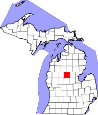
Location in the state of Michigan
Michigan's location in the U.S.Founded 1840 Seat Harrison Area
- Total
- Land
- Water
575.22 sq mi (1,490 km²)
566.80 sq mi (1,468 km²)
8.42 sq mi (22 km²), 1.46%Population
- (2000)
- Density
31,252
54/sq mi (21/km²)Website www.clareco.net Clare County is a county in the U.S. state of Michigan. As of the 2010 census, the population was 31,252. The county seat is Harrison.[1] Farwell was the first county seat; in 1877 the county seat was moved to Harrison.
Contents
History
The county was set off in 1840 as Kaykekee County from Mackinac County. It was renamed Clare in 1843 after County Clare in Ireland. It was officially organized in 1871.[2][3]
Geography
- According to the 2000 census, the county has a total area of 575.22 square miles (1,489.8 km2), of which 566.80 square miles (1,468.0 km2) (or 98.54%) is land and 8.42 square miles (21.8 km2) (or 1.46%) is water.[4]
- The Roman Catholic Diocese of Saginaw is the controlling regional body for the Catholic Church.[5]
- It is considered to be part of Northern Michigan.
Geographic features
- Au Sable State Forest
- Gladwin FMU (Arenac, Bay, Clare, Gladwin, southern Iosco, Isabella, and Midland counties).
Highways


is a loop route through downtown Clare.
is another loop route through downtown Clare.
is a loop route through downtown Harrison.


Adjacent counties
- Roscommon County (northeast)
- Gladwin County (east)
- Isabella County (south)
- Osceola County (west)
- Missaukee County (northwest)

Missaukee County Roscommon County Osceola County 
Gladwin County  Clare County, Michigan

Isabella County Demographics
As of the census[6] of 2000, there were 31,252 people, 12,686 households, and 8,753 families residing in the county. The population density was 55 people per square mile (21/km²). There were 22,229 housing units at an average density of 39 per square mile (15/km²). The racial makeup of the county was 97.36% White, 0.33% Black or African American, 0.72% Native American, 0.26% Asian, 0.01% Pacific Islander, 0.30% from other races, and 1.03% from two or more races. 1.09% of the population were Hispanic or Latino of any race. 24.7% were of German, 13.9% American, 13.3% English, 9.9% Irish, 5.5% Polish and 5.3% French ancestry according to Census 2000. 96.8% spoke English, 1.1% German and 1.0% Spanish as their first language.
There were 12,686 households out of which 27.90% had children under the age of 18 living with them, 55.30% were married couples living together, 9.40% had a female householder with no husband present, and 31.00% were non-families. 26.20% of all households were made up of individuals and 11.70% had someone living alone who was 65 years of age or older. The average household size was 2.42 and the average family size was 2.89.
In the county the population was spread out with 24.40% under the age of 18, 7.10% from 18 to 24, 24.90% from 25 to 44, 26.40% from 45 to 64, and 17.30% who were 65 years of age or older. The median age was 40 years. For every 100 females there were 97.20 males. For every 100 females age 18 and over, there were 95.60 males.
The median income for a household in the county was $28,845, and the median income for a family was $33,934. Males had a median income of $30,032 versus $20,733 for females. The per capita income for the county was $15,922. About 12.10% of families and 16.00% of the population were below the poverty line, including 21.40% of those under age 18 and 10.70% of those age 65 or over.
Government
The county government operates the jail, maintains rural roads, operates the major local courts, keeps files of deeds and mortgages, maintains vital records, administers public health regulations, and participates with the state in the provision of welfare and other social services. The county board of commissioners controls the budget but has only limited authority to make laws or ordinances. In Michigan, most local government functions — police and fire, building and zoning, tax assessment, street maintenance, etc. — are the responsibility of individual cities and townships.
Clare County elected officials
- Prosecuting Attorney: Michelle Ambrozaitis
- Sheriff: John Wilson
- County Clerk/Register of Deeds: Pamela Mayfield
- County Treasurer: Jenny Beemer-Fritzinger
- Drain Commissioner: Carl Parks
- County Surveyor: Paul A. Lapham
- Road Commissioners: Donald Armentrout; Richard Haynak; Tim Haskin
Local attractions and activities
It is in the middle of large state forests. Wildlife are nearby, including bear, deer, eagles, Kirtland's Warblers, and turkeys. Local attractions and activities include:
- Birding
- Boating
- Fishing.
- Hiking
- Hunting
- Kirtland'a Warbler Habitat and Festival[7]
- Michigan Shore-to-Shore Trail passes through the area. It runs from Empire to Oscoda, but also to points north and south. It is a 500-mile interconnected system of trails.[8]
- Nordic skiing
- ORV and groomed snowmobile trails.
- Paddling (canoe and kayak)
(information as of September 2005)
Cities, villages, and townships
Cities
- Clare, partially
- Harrison
Villages
Townships
See also
References
- ^ "Find a County". National Association of Counties. http://www.naco.org/Counties/Pages/FindACounty.aspx. Retrieved 2011-06-07.
- ^ Michigan History, Arts and Libraries on sources of County names.
- ^ Clarke Historical Library, Central Michigan University, Bibliography on Clare County.
- ^ "Census 2000 U.S. Gazetteer Files: Counties". United States Census. http://www.census.gov/tiger/tms/gazetteer/county2k.txt. Retrieved 2011-02-13.
- ^ Saginaw County Diocese home page
- ^ "American FactFinder". United States Census Bureau. http://factfinder.census.gov. Retrieved 2008-01-31.
- ^ Kirtland Warbler link/festival
- ^ Michigan Shore to Shore Riding and Hiking Trail.
External links
Official Visitor Information Site
News from Clare County
Municipalities and communities of Clare County, Michigan County seat: Harrison Cities 
Village Townships Unincorporated
communitiesColonville | Lake | Lake George | Leota | Temple
Footnotes ‡This populated place also has portions in an adjacent county or counties
Northern Michigan Topics Major Highways Central cities Satellite cities Region Outlying regions Counties See also:  MichiganCategories:
- Michigan counties
- Clare County, Michigan


Wikimedia Foundation. 2010.