- Oakland County, Michigan
-
Oakland County, Michigan 
Seal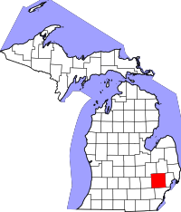
Location in the state of Michigan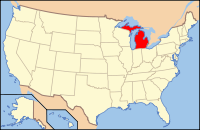
Michigan's location in the U.S.Founded January 12, 1819[1] Seat Pontiac Area
- Total
- Land
- Water
908.00 sq mi (2,352 km²)
872.51 sq mi (2,260 km²)
35.49 sq mi (92 km²), 3.91%Population
- (2010)
- Density
1,202,362
1,391/sq mi (537/km²)Website www.OakGov.Com Oakland County is a county in the U.S. state of Michigan. The 2010 Census recorded a population of 1,202,362. The county seat is Pontiac.[2] Oakland County is part of the Detroit metropolitan area, though the actual city of Detroit is located in neighboring Wayne County, south of Eight Mile Road. Oakland County is home to 62 cities, villages and townships. These communities range from blue-collar, inner-ring suburbs like Ferndale and Hazel Park, to wealthy cities such as Birmingham, Bloomfield Hills, West Bloomfield Township, and Franklin. The white-collar cities of Troy, Southfield, Farmington Hills, and Auburn Hills host a diverse mix of Fortune 500 companies. The cities of Royal Oak, home of the Detroit Zoological Park, and Ferndale attract many young people to their mature, bohemian downtowns, which have many restaurants, shops and night clubs. Oakland County is also home to Oakland University, a large public institution that straddles the Auburn Hills and Rochester border.
The county's knowledge-based economic initiative, coined "Automation Alley", is one of the largest employment centers for engineering and related occupations in the United States. Oakland County has shared in the recent economic hardships brought on by troubles at General Motors, Ford, and Chrysler, although it has fared better than Detroit and Flint, as its economy is more diverse and less reliant on manufacturing jobs. All three automotive companies are major employers within southeast Michigan and have a significant presence within Oakland County.
Contents
Geography
According to the 2000 census, the county has a total area of 908.00 square miles (2,351.7 km2), of which 872.51 square miles (2,259.8 km2) (or 96.09%) is land and 35.49 square miles (91.9 km2) (or 3.91%) is water.[3]
Oakland County was originally divided into 25 separate townships, which are listed below. Each township is roughly equal in size at six miles (10 km) by six miles, for a total township area of 36 square miles (93 km2). The roots of this design were born out of the Land Ordinance of 1785 and the subsequent Northwest Ordinance of 1787. Oakland County itself is a prime example of the land policy that was established, as all townships are equal in size (save for slight variations due to waterways). Section 16 in each township was reserved for financing and maintaining public education, and even today many schools in Oakland County townships are located within that section.
Wayne County, where the city of Detroit is located, borders Oakland County to the south. The southern boundary is 8 Mile Road, also known as "Baseline Road" in some areas. The baseline was used during the original surveying for Michigan, and it serves as the northern/southern boundaries for counties from Lake St. Clair all the way to Lake Michigan. This divide (8 Mile Road) has been widely known as an unofficial racial dividing line between the largely black city and almost exclusively white suburbs. Some exceptions to this pattern of de facto segregation have developed in recent years, as middle-class African-Americans depart the city for inner-ring suburbs, notably Southfield, west of Woodward Avenue, but to the east the line has endured.
Adjacent counties
- Lapeer County (northeast)
- Genesee County (northwest)
- Macomb County (east)
- Wayne County (southeast)
- Washtenaw County (southwest)
- Livingston County (west)

Genesee County Genesee County
Lapeer CountyLapeer County Livingston County 
Macomb County  Oakland County, Michigan

Washtenaw County Wayne County (Detroit) Demographics
Historical populations Census Pop. %± 1900 44,792 — 1910 49,576 10.7% 1920 90,050 81.6% 1930 211,251 134.6% 1940 254,068 20.3% 1950 396,001 55.9% 1960 690,259 74.3% 1970 907,871 31.5% 1980 1,011,793 11.4% 1990 1,083,592 7.1% 2000 1,194,156 10.2% 2010 1,202,362 0.7% As of the 2010 Census, there were 1,202,362 people, 471,115 households, and 315,175 families residing in the county. The population density as of the 2000 census was 1,369 people per square mile (528/km²). There were 492,006 housing units at an average density of 564 per square mile (218/km²). In 2000, the racial makeup of the county was 82.75% White, 10.11% Black or African American, 0.27% Native American, 4.14% Asian American, 0.02% Pacific Islander, 0.84% from other races, and 1.86% from two or more races. 2.43% of the population were Hispanic or Latino of any race. Regarding ancestry, 14.4% were German, 9.0% Irish, 8.5% English, 8.5% Polish, 5.7% Italian and 5.5% American, according to Census 2000. 87.4% spoke only English at home; 2.0% spoke Spanish, 1.3% Syriac (Neo Aramaic) and 1.0% Arabic.
The 2000 census showed two Native American tribes with more than 1,000 members in Oakland County. There were 2,095 Cherokee and 1,458 Chippewa.[4]
The Jewish community of metropolitan Detroit, with a population of 72,000, is the 21st largest Jewish community in the nation. This community is concentrated in Oakland County, especially in West Bloomfield, Bloomfield Hills, Farmington Hills, Troy and Huntington Woods.[5]
There were 471,115 households, of which 32.40% had children under the age of 18 living with them. 54.20% were married couples living together, 9.50% had a female householder with no husband present, and 33.10% were non-families. 27.30% of all households were made up of individuals and 8.50% had someone living alone who was 65 years of age or older. The average household size was 2.51 and the average family size was 3.09.
Among Asian Americans, eight ethnic groups had more than 1,000 members in the county. The most numerous were those of Asian Indian descent, with 20,705. Next were those of Chinese heritage, numbering 10,018. Next were those of Japanese (5,589), Filipino (5,450) Korean (5,351), Vietnamese (1,687), Pakistani (1,458) and Hmong (1,210) ancestry.[4]
The county's population was spread out in terms of age, with 25.20% of people under the age of 18, 7.20% from 18 to 24, 32.40% from 25 to 44, 23.90% from 45 to 64, and 11.30% who were 65 years of age or older. The median age was 37 years. For every 100 females there were 95.90 males. For every 100 females age 18 and over, there were 92.70 males.
The median income for a household in the county was $61,907, and the median income for a family was $75,540 (these figures had risen to $62,308 and $79,589 respectively as of a 2009 estimate[6]). Males had a median income of $55,833 versus $35,890 for females. The per capita income for the county was $32,534. About 3.80% of families and 5.50% of the population were below the poverty line, including 6.50% of those under age 18 and 6.50% of those age 65 or over.
In 2009, the U.S. Census Bureau estimated that non-Hispanic whites (including Arabs and Chaldeans) formed 76.8% of the population; African-Americans, 12.5%; Asian-Americans, 5.7%; and Hispanic or Latino people (of any race), 3.2%.
History
Created by territorial Gov. Lewis Cass in 1819, sparsely settled Oakland was twice its current size at first, but shrank as Michigan's population grew and new counties were established. Woodward Avenue and the Detroit and Pontiac Railroad helped draw settlers in the 1840s. By 1840, Oakland had more than fifty mills. Pontiac, located on the Clinton River, was Oakland's first town and became the county seat. After the Civil War, Oakland was mainly an agricultural county with numerous isolated villages. By the end of the 19th century, three rail lines served Pontiac and the city attracted carriage and wagon factories. Streetcars began moving people in the late 1890s.
Developers turned southern Oakland County into a suburb of Detroit in the 1890s, when a Cincinnati firm platted a section of Royal Oak called "Urbanrest." Migration worked both ways. Several thousand people moved from Oakland County farms to Detroit as the city attracted factories. By 1910, a number of rich Detroiters had summer homes and some year-round residences in what became Bloomfield Hills. The auto age enveloped Pontiac in the early 1900s. The Oakland Motor Car Co. was founded in 1907 and became a part of General Motors Corp., which was soon Pontiac's dominant firm.
In the 1950s, jobs and people began leaving Detroit. Northland Center opened in 1954. Oakland County passed Wayne County in effective buying power by 1961, when it ranked 28th in the nation in household income. It ranked second-highest nationally in per capita income for counties of more than a million people, behind New York County (Manhattan). The median price of a home in Oakland County skyrocketed to $164,697, more than $30,000 above the national median.
Government
The county government operates the jail, operates the major local courts, keeps files of deeds and mortgages, maintains vital records, administers public health regulations, and participates with the state in the provision of welfare and other social services. The county board of commissioners controls the budget but has limited authority to make laws or ordinances. In Michigan, most local government functions — police and fire, building and zoning, tax assessment, street maintenance, etc. — are the responsibility of individual cities and townships. Oakland County has an elected sheriff, and his or her law-enforcement services are used throughout the county. Fourteen cities/townships do not have personalized police forces, but rather contract with the sheriff for police services specific to the municipalities. For instance, the city of Rochester Hills does not have a "Rochester Hills Police Department," but instead has an established sheriff substation in the city with deputies who are dedicated to that city only. That branch operates as the Oakland County Sheriff's Department, Rochester Hills substation. The sheriff operates in the same manner with other municipalities who opt not to have their own police agencies. This typically is a cost-effective way for municipalities to provide police services to its citizens. The county sheriff also maintains a civil division, marine division, alcohol and traffic enforcement units, and an aviation division.
Roads that are not maintained by a local community (city/village) are maintained by the Road Commission for Oakland County, which is governed by three board members appointed by the Oakland County Board of Commissioners.
Oakland County elected officials
- County Executive: L. Brooks Patterson (Republican)
- Prosecuting Attorney: Jessica R. Cooper (Democrat)[7]
- Sheriff: Mike Bouchard (Republican)
- County Clerk/Register of Deeds: Bill Bullard, Jr. (Republican)
- County Treasurer: Andy Meisner (Democrat)
- Water Resources Commissioner: John P. McCulloch (Republican)
- Board of Commissioners: 25 members, elected from districts (15 Republicans, 10 Democrats)
Oakland County Commissioners District 01: Beth Nuccio, District 02: Robert Hoffman, District 03: Michael J. Gingell (Chairman of the Board of Commissioners), District 04: Thomas Middleton, District 05: John A. Scott, District 06: Jim Runestad, District 07: Christine Long, District 08: Philip J. Weipert, District 09: Kathy Crawford, District 10: Mattie M. Hatchett, District 11: Tim Greimel, District 12: Jeff Matis, District 13: Robert Gosselin, District 14: William Dwyer, District 15: Jim Nash, District 16: Shelley G. Taub, District 17: Marcia Gershenson, District 18: Dave Woodward, District 19: Mike Bosnic, District 20: David W. Potts, District 21: Janet Jackson, District 22: Helaine Zack, District 23: Nancy L. Quarles, District 24: Gary R. McGillivray, District 25: Craig Covey
(information as of January 2011)
Politics
Presidential Election Results 1960-2008 Year Democrat Republican 2008 56.42% 373,270 41.94% 277,480 2004 49.75% 319,387 49.32% 316,633 2000 49.31% 281,201 48.10% 274,319 1996 47.84% 241,884 43.48% 219,855 1992 38.64% 214,733 43.57% 242,160 1988 37.78% 174,745 61.27% 283,359 1984 32.76% 150,286 66.71% 306,050 1980 35.58% 164,869 54.65% 253,211 1976 39.47% 164,266 58.69% 244,271 1972 34.16% 129,400 63.78% 241,613 1968 44.76% 154,630 45.31% 156,538 1964 61.44% 182,797 38.33% 114,025 1960 45.39% 135,531 54.27% 162,026 Oakland County historically has been a stronghold of the Republican Party. However, the county contains a sizable number of unaffiliated voters, many of whom have recently favored the Democratic Party. In the 1990s, Oakland County moved toward the Democratic Party at the national level. Political analyst Michael Barone, among others, has theorized that this occurred when cultural issues such as abortion rights and gun control became more salient than economic concerns for more voters, especially affluent suburban women. Democratic presidential candidates won a plurality of the county's vote in 1996, 2000 and 2004, and a majority in 2008 (See chart at right).
In the 111th Congress, Oakland County is represented by two Democrats, Gary Peters and Sander Levin, and two Republicans, Thaddeus McCotter and Mike Rogers. Peters was elected for the first time 2008, a victory that was seen as a particular coup for the Democrats as his seat, the 9th, had been held by Republicans for over twenty years.
Cities, villages, and townships
 The white areas represent unincorporated charter and civil townships. The gray areas represent incorporated cities and villages.
Cities
1In the 2000 Census, Farmington Hills was the most populous city in the county. As of the 2005 Census estimates, Troy is now the most populous city.
2As of 2004, Hazel Park was the second most densely populated city in the state, succeeding Royal Oak Charter Township after a portion of the township was annexed into Oak Park.
Villages
- Beverly Hills
- Bingham Farms
- Franklin
- Holly
- Lake Orion
- Leonard
- Milford
- Ortonville
- Oxford
- Wolverine Lake
Townships
- Addison Township
- Avon Township* (now Rochester Hills)
- Bloomfield Charter Township
- Brandon Township
- Commerce Charter Township
- Farmington Township*
- Groveland Township
- Highland Charter Township
- Holly Township
- Independence Charter Township
- Lyon Charter Township
- Milford Charter Township
- Novi Township
* Township has been incorporated into a city: Avon to the City of Rochester Hills; Farmington to the City of Farmington Hills; Pontiac to the City of Pontiac, City of Lake Angelus and City of Auburn Hills; and Troy to the City of Troy. For survey purposes, these areas are still referred to by the assigned township name.
Transportation
Air
- Detroit Metropolitan Wayne County Airport (DTW) (Romulus) - Major commercial airport, hub for Delta Air Lines and Spirit Airlines; located in Wayne County.
- Flint-Bishop International Airport(FNT) (Flint) - Commercial airport, which is located in neighboring Genesee County.
- Coleman A. Young International Airport (DET) (Detroit) - General aviation only. This airport is in neighboring Wayne County in the city of Detroit.
- Oakland County International Airport (PTK) Waterford Township) - Charter passenger facility.
Major highways

(Walter P. Chrysler Freeway) is the main north-south route in the region, serving Flint, Pontiac, Troy, and Detroit, before continuing south (as the Fisher and Detoit-Toledo Freeways) to serve many of the communities along the shore of Lake Erie. 
runs northwest-southeast through Oakland County and (as the Jeffries Freeway) has its eastern terminus in downtown Detroit. 
runs north-south from I-75 in the south to the junction of I-96 and I-696 in the north, providing a bypass through the western suburbs of Detroit. 
(Walter P. Reuther Freeway) runs east-west from the junction of I-96 and I-275, providing a route through the northern suburbs of Detroit. Taken together, I-275 and I-696 form a semicircle around Detroit. 
US-24 ends north of Pontiac at I-75. To the south, US 24 serves suburban Detroit and Monroe before entering Ohio. Much of US 24 in Oakland County is named Telegraph Road (US 24), and it is a major north-south road extending from Toledo, Ohio through Monroe, Wayne, and Oakland Counties to Pontiac. It gained notoriety in a song (Telegraph Road) by the group Dire Straits. 
M-1 (Woodward Avenue) has a northern terminus in Pontiac. The route continues southerly from Oakland County into the City of Detroit, ending downtown. The Detroit Zoo is located along M-1 in Oakland County. M-1 is also home to the Woodward Dream Cruise, a classic-car cruise from Pontiac to Ferndale that is held in August. It is the largest single-day classic-car cruise in America. 
M-5 
M-10: The John C. Lodge Freeway runs largely parallel to I-75 from Southfield to downtown Detroit. 
M-15 (Ortonville Road, Main St. in Clarkston) 
M-24 (Lapeer Road) has a southern terminus at I-75 north of Pontiac. To the north, the route continues to Lapeer and beyond. Note: M-24 and US 24 do not intersect at present, although this was the case until the 1950s. 
M-39: The Southfield Freeway runs north-south from Southfield to Allen Park from I-94. North of 10 Mile Road, the freeway ends and continues as Southfield Road into Birmingham. 
M-59 (Highland Road [from Pontiac westerly], Huron Street [within Pontiac] and Veterans Memorial Freeway [Pontiac to Utica]), continues east in Macomb County as Hall Road to Clinton Township and west to I-96 near Howell 
M-102 Perhaps better known as 8 Mile Road, M-102 follows the Oakland/Wayne County boundary line for most of its length. 8 Mile Road, known by many due to the film 8 Mile, forms the dividing line between Detroit on the south and the suburbs of Macomb and Oakland counties on the north. It is also known as Baseline Road outside of Detroit, because it coincides with the baseline used in surveying Michigan; that baseline is also the boundary for a number of Michigan counties, as well as the boundary for Illinois and Wisconsin. It is designated as M-102 for much of its length in Wayne County. 
M-150 (Rochester Road) serves as a spur highway from M-59 into the city of Rochester. Other major roads
- Grand River Avenue connects the suburbs of Brighton, Novi, and Farmington to downtown Detroit. The avenue follows the route of old U.S. Route 16, before I-96 replaced it in 1962. It is one of the five roads planned by Judge August Woodward to radiate out from Detroit and connect the city to other parts of the state.
Mile roads
- Surface-street navigation in metro Detroit is commonly anchored by "mile roads," major east-west surface streets that are spaced at one-mile (1.6 km) intervals and increment as one travels north and away from the city center. Mile roads sometimes have two names, the numeric name (e.g., 15 Mile Road), used in Macomb County, and a local name (e.g., Maple Road), used in Oakland County (for the most part).
Main article: Mile Road System (Detroit)
Bicycling
The conditions on most non-residential roads in Oakland County are not favorable to bicycling. Exceptions to this are primarily in the inner-ring suburbs within the southeast corner of the county. This is due to their street grid.
A primary reason for these unfavorable cycling conditions is the Road Commission for Oakland County has a policy of not accommodating bicycles on the road. As a result, some communities have designated sidepaths (locally called "safety paths") as bike routes which do not meet the American Association of State Highway and Transportation Officials (AASHTO) guidelines for bicycling facilities and have been found to be less safe than on-road bike facilities.[8]
As a result, there are no designated Bicycle Friendly Communities within Oakland County.
Novi, Berkley, Clawson, and Ferndale have passed Complete Streets resolutions or ordinances. Only the city of Ferndale has a comprehensive bicycle network. The city of Troy has developed the first non-motorized plan within the county but it has not been adopted by their city council (as of October 2010.) Royal Oak and Novi are currently developing non-motorized plans.
Programs
Oakland County Community and Home Improvement Division
Funded through The Department of Housing and Urban Development (HUD) primarily in the form of Community Development Block Grants (CDBG), this program benefits low to moderate income residents of the 50 communities in Oakland County's program. CDBG funds are used to keep residential neighborhoods sound, attractive, and economically viable.
One facet of the program involves distributing low-interest, deferred-payment loans to homeowners in participating communities to update their residences. Oakland County technicians inspect approved homes and write up work specifications, which are then bid out to approximately six contractors. After bidding, homeowners may either approve the lowest bidder or pay the difference between the lowest bidder and the contractor of their choice.
Oakland County Homebuyer Program For Vacant Foreclosed PropertiesOakland County's Homebuyer Program for vacant foreclosed properties is part of the Neighborhood Stabilization Program (NSP) created by the U.S. Congress in 2008 for redeveloping and occupying abandoned and foreclosed homes. NSP is funded through The Department of Housing and Urban Development (HUD), Office of Community Planning and Development under the Community Development Block Grant (CDBG) Program and locally administered by the staff at the Oakland County Community & Home Improvement Division.
Oakland County's Homebuyer Program provides homebuyers loans for down payment assistance, closing costs, home improvements for eligible vacant foreclosed single family homes located within participating Oakland County communities.
Oakland County Main Street ProgramOakland County established the first county-level Main Street program in the U.S. in February 2000.
Main Street Oakland County (MSOC) is housed within the Planning Group of the Planning & Economic Development Services Division of Oakland County's Department of Community & Economic Development. Oakland County is now a partner with the National Trust's Main Street Center and contracts with them for services to the county and local communities.
MSOC ...
- empowers Oakland County's traditional downtowns to establish and/or maintain successful, comprehensive, ongoing revitalization programs;
- builds a greater awareness of the economic and quality of life importance of revitalizing and maintaining the county's historic commercial districts;
- provides the stakeholders of Oakland County's traditional downtowns with technical assistance and training resources;
- provides information about downtown revitalization to the county's communities, business organizations, and residents;
- assists communities in implementing the "Main Street Four Point Approach" to downtown management in each of the county's traditional downtowns and corridors;
- facilitates networking and communication between communities about downtown revitalization;
- provides information about county business finance programs and other economic development resources to existing downtown businesses and to those considering downtown locations;
- monitors and measures progress and success in local downtown revitalization efforts; and
- assists each of the county's 30 traditional downtowns and town centers to help them realize their full economic development potential while preserving their sense of place.
MSOC is currently working with 12 downtowns in Oakland County. These communities were selected after a detailed application process in which they demonstrated their readiness and commitment to participating in the National Trust Main Street program.
Oakland County's Main Street Communities
Farmington Keego Harbor Pontiac Ferndale Lake Orion Rochester Highland Ortonville Royal Oak Holly Oxford Walled Lake Education
Higher education
Oakland County is home to several institutions of higher education.
Baker College of Auburn Hills, located in Auburn Hills, Michigan, has a current enrollment of approximately 5,000 students. Baker College of Auburn Hills is part of the nine campus Baker College System.
Oakland University, located in Rochester, is a research university with more than 18,000 students. Rated as one of the country's 82 Doctoral/Research universities by the Carnegie Foundation for the Advancement of Teaching, OU announced plans in the spring of 2007 to establish a medical school on its campus in collaboration with William Beaumont Hospital. The medical school, which will be the fourth in the state of Michigan to offer the M.D. degree, is slated to open in the fall of 2011 or winter of 2012. OU has also partnered with The Thomas M. Cooley Law School which operates one of its campuses near OU, to provide a legal curriculum.
Lawrence Technological University, located in Southfield, has a current enrollment of approximately 4,000 students. Lawrence Tech, which was originally founded in 1932 as Lawrence Institute of Technology, is consistently ranked in the top tier of Midwestern Master's Universities in the annual U.S. News & World Report rankings.
Rochester College, located in Rochester, has a current enrollment of approximately 1,000 students. Affiliated with the Churches of Christ, Rochester College offers a variety of academic programs in the liberal arts and sciences, business, and education.
South University has a new campus in Novi on Twelve Mile Road just east of Twelve Oaks Mall.
Walsh College, officially Walsh College of Accountancy and Business, has campuses in Troy, Novi, and in Macomb County.
Oakland Community College, which is one of Michigan's largest community colleges, operates five campuses throughout Oakland County: Orchard Ridge, Auburn Hills, Southfield, Highland Lakes, and Royal Oak.
Primary and secondary education
Many of the public school districts in Oakland County have multiple "National Exemplary" Schools. The International Academy (IA), which is part of the Bloomfield Hills School District, has been ranked by Newsweek as one of the top 10 public high schools in the nation every year since 2003, when IA was ranked the top public high school in the United States.
Oakland County also is home to a number of well-known private schools,[citation needed] including the Detroit Country Day School, Detroit Catholic Central High School, Brother Rice High School, the Cranbrook Schools, Notre Dame Preparatory, Everest Academy, Eagle Creek Academy, and the Roeper School.
Sports
Club League Venue Established Championships Detroit Pistons National Basketball Association The Palace of Auburn Hills 1958 (moved to the Palace in 1988) 3 Detroit Shock Womens National Basketball Association Moved to Oklahoma, October 2009 1998 3 Oakland County Cruisers FL, Baseball Diamond at the Summit 2009 0 See also
- National Register of Historic Places listings in Oakland County, Michigan
- Oakland County Child Killer
- Saginaw Trail
References
- ^ "History of Oakland County," OaklandWeb.com. Retrieved 2007-07-02.
- ^ "Find a County". National Association of Counties. http://www.naco.org/Counties/Pages/FindACounty.aspx. Retrieved 2011-06-07.
- ^ "Census 2000 U.S. Gazetteer Files: Counties". United States Census. http://www.census.gov/tiger/tms/gazetteer/county2k.txt. Retrieved 2011-02-13.
- ^ a b See search results from U.S. Census Bureau. Retrieved 2007-07-02.
- ^ http://detroitjcrc.org/community_relations/detroit.php?page=10080
- ^ http://factfinder.census.gov/servlet/ADPTable?_bm=y&-qr_name=ACS_2009_1YR_G00_DP3&-geo_id=05000US26125&-context=adp&-ds_name=&-tree_id=309&-_lang=en&-redoLog=false&-format=
- ^ Martindale, Mike (January 15, 2009). "New Oakland prosecutor 'going pretty hard'". The Detroit News. http://www.detnews.com/apps/pbcs.dll/article?AID=/20090115/METRO/901150398. Retrieved 2009-03-01.
- ^ "Risk of Sidewalk and Wrong-way Riding". Bicyclist Injuries: Learning from the Statistics. Archived from the original on 2007-05-20. http://web.archive.org/web/20070520071232/http://www.massbike.org/resources/stats.htm#sidewalk. Retrieved 2007-03-17.
External links
- Oakland County
- Map of Oakland County
- An Account of Oakland County edited by Lillian Drake Avery. Dayton, Ohio: National Historical Association, Inc., [1925?]
- Clarke Historical Library, Central Michigan University, Bibliography on Oakland County
- Automation Alley
- Main Street Oakland County
- Oakland County Home Improvement Division
Metro Detroit Topics Architecture · Culture · Detroit River · Economy · Freeways · History · Historic places · International Riverfront · Lake St. Clair · Media · Music · Parks and beaches · People · Skyscrapers · Sports · Theatre · Tourism · Transportation
Major city Municipalities
over 80,000Canton Township · Clinton Township · Dearborn · Livonia · Sterling Heights · Troy · Warren · WestlandMunicipalities
45,000 to 80,000Dearborn Heights · Farmington Hills · Grosse Pointe · Macomb Township · Novi · Pontiac · Redford Township · Rochester Hills · Royal Oak · St. Clair Shores · Shelby Township · Southfield · Taylor · Waterford Township · West Bloomfield TownshipSatellite cities Counties in MSA Counties in CSA Regions Outlying regions  Michigan ·
  United States
 State of Michigan
Lansing (capital) Topics Index · Congressional delegation · Geography · Governors · History · Islands · Legislature · Lieutenant Governors · Lighthouses · Museums · National Historic Landmarks · National Register of Historic Places listings · People · State Historic Sites · State parks · Supreme Court · Tallest buildings · Timeline · Topics · Visitor attractions
Regions Largest
MunicipalitiesAlpena · Ann Arbor · Battle Creek · Bay City · Bloomfield Township · Canton Township · Chesterfield Township · Clinton Township · Commerce Township · Dearborn · Dearborn Heights · Detroit · East Lansing · Eastpointe · Farmington Hills · Flint · Flint Township · Georgetown Township · Grand Rapids · Holland · Jackson · Kalamazoo · Kentwood · Lansing · Lincoln Park · Livonia · Macomb Township · Meridian Township · Midland · Muskegon · Novi · Pontiac · Portage · Redford · Rochester Hills · Roseville · Royal Oak · Saginaw · Saginaw Township · St. Clair Shores · Shelby Township · Southfield · Sterling Heights · Taylor · Troy · Warren · Waterford Township · West Bloomfield · Westland · Wyoming · Ypsilanti Township
Counties Alcona · Alger · Allegan · Alpena · Antrim · Arenac · Baraga · Barry · Bay · Benzie · Berrien · Branch · Calhoun · Cass · Charlevoix · Cheboygan · Chippewa · Clare · Clinton · Crawford · Delta · Dickinson · Eaton · Emmet · Genesee · Gladwin · Gogebic · Grand Traverse · Gratiot · Hillsdale · Houghton · Huron · Ingham · Ionia · Iosco · Iron · Isabella · Jackson · Kalamazoo · Kalkaska · Kent · Keweenaw · Lake · Lapeer · Leelanau · Lenawee · Livingston · Luce · Mackinac · Macomb · Manistee · Marquette · Mason · Mecosta · Menominee · Midland · Missaukee · Monroe · Montcalm · Montmorency · Muskegon · Newaygo · Oakland · Oceana · Ogemaw · Ontonagon · Osceola · Oscoda · Otsego · Ottawa · Presque Isle · Roscommon · Saginaw · Sanilac · Schoolcraft · Shiawassee · St. Clair · St. Joseph · Tuscola · Van Buren · Washtenaw · Wayne · Wexford
Categories:- Michigan counties
- Oakland County, Michigan
- Metro Detroit


Wikimedia Foundation. 2010.