- Independence Township, Michigan
-
Independence Charter Township, Michigan — Charter township — Location within Oakland County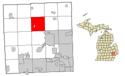 Location within the state of Michigan
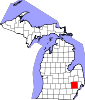
 Independence Charter Township, Michigan
Coordinates: 42°44′24″N 83°22′59″W / 42.74°N 83.38306°WCoordinates: 42°44′24″N 83°22′59″W / 42.74°N 83.38306°W Country United States State Michigan County Oakland Area – Total 36.3 sq mi (94.0 km2) – Land 35.2 sq mi (91.2 km2) – Water 1.1 sq mi (2.8 km2) Elevation 1,112 ft (339 m) Population (2010) – Total 34,681 – Density 955.6/sq mi (368.9/km2) Time zone Eastern (EST) (UTC-5) – Summer (DST) EDT (UTC-4) ZIP codes 48346, 48348 Area code(s) 248 FIPS code 26-40400[1] GNIS feature ID 1626511[2] Independence Charter Township is a charter township of Oakland County in the U.S. state of Michigan. The population was 34,681 at the 2010 census.[3] The township was named by one of its earliest settlers, Joseph Van Sycle, who came to the area in 1834 from Independence, New Jersey.[4]
Contents
History
John W. Beardslee, a Sussex County, New Jersey native, was the first person to settle Independence Township in 1826. Subsequently, settlers from New Jersey and New York began to settle the township until by 1834 all sections of land in the southern half of the township was settled. (The northern half was largely unsettled.) The southern half of the township was marked by flat plains that made it suitable for farming, most notably the Sashabaw Plains in the southeast corner of the township. The rest of the township comprised flat plains, rolling hills and lakes, connected by branches of the Clinton River. By 1840 Independence Township's population was 830, but a decade later new construction had boosted the township's population to 1,200. By 1877 Independence Township's swampland was converted to agricultural use. In the late 1800s, E.V. Bailey, a prominent resident, donated to Clarkston a section of land at what is now Whipple Lake Road and Pine Knob Road. Clarkston, which is located in the heart of Independence Township, used the land to erect the area's first schoolhouse.
While the 19th century saw a primarily agricultural economy, the 20th century saw the completion of a railroad depot and the arrival of the automobile, as a number of visitors from Detroit began to visit the township. Independence Township continued to grow at the same time as cottages were built, farms were subdivided and new houses built, all the way up to the 1930s when the Great Depression temporarily ended future land developments. After World War II, the township's population not only rebounded, it has boomed as new shopping centers, new subdivisions, new schools, new churches, several parks and the DTE Energy Music Theatre have been built over the years, helped by access via I-75, M-15 and US-23. Independence Township's economy is today service-based.
The DTE Energy Music Theatre shares a complex with Pine Knob Golf and Ski Courses. The township is also home to various parks, the largest of which is Independence Oaks County Park.
Geography
According to the United States Census Bureau, the township has a total area of 36.3 square miles (94 km2), of which 35.2 square miles (91 km2) is land and 1.1 square miles (2.8 km2), or 3.03%, is water.
Schools
The primary school district in the township is Clarkston Community Schools, which has eleven school buildings. Students attend their local elementary school from kindergarten up until fifth grade. They then attend Sashabaw Middle School for grades six and seven, followed by eighth and ninth grade at Clarkston Junior High School. Their final three years are usually completed at Clarkston High School. Alternatively, students may attend Renaissance High School instead, which is intended for students requiring different needs to graduate.
Within Clarkston High School is Clarkston's Science, Math, and Technology Academy, or CSMTech Academy. CSMTech is open to students grades nine through twelve free of charge. Students focus on the areas on mathematics, sciences, and technology beyond average requirements.
Demographics
As of the census[1] of 2000, there were 32,581 people, 11,765 households, and 9,094 families residing in the township. The population density was 925.6 per square mile (357.4/km²). There were 12,375 housing units at an average density of 351.6 per square mile (135.7/km²). The racial makeup of the township was 95.84% White, 0.84% African American, 0.24% Native American, 1.22% Asian, 0.01% Pacific Islander, 0.61% from other races, and 1.24% from two or more races. Hispanic or Latino of any race were 2.51% of the population.
There were 11,765 households out of which 39.1% had children under the age of 18 living with them, 66.5% were married couples living together, 7.9% had a female householder with no husband present, and 22.7% were non-families. 17.9% of all households were made up of individuals and 4.7% had someone living alone who was 65 years of age or older. The average household size was 2.75 and the average family size was 3.14.
In the township the population was spread out with 27.7% under the age of 18, 6.9% from 18 to 24, 31.7% from 25 to 44, 25.7% from 45 to 64, and 8.1% who were 65 years of age or older. The median age was 36 years. For every 100 females there were 99.1 males. For every 100 females age 18 and over, there were 96.9 males.
The median income for a household in the township was $74,993, and the median income for a family was $84,227. Males had a median income of $62,620 versus $36,520 for females. The per capita income for the township was $33,067. About 1.6% of families and 2.5% of the population were below the poverty line, including 2.4% of those under age 18 and 4.4% of those age 65 or over.
References
- ^ a b "American FactFinder". United States Census Bureau. http://factfinder.census.gov. Retrieved 2008-01-31.
- ^ U.S. Geological Survey Geographic Names Information System: Independence Township, Michigan
- ^ "Race, Hispanic or Latino, Age, and Housing Occupancy: 2010 Census Redistricting Data (Public Law 94-171) Summary File (QT-PL), Independence charter township, Oakland County, Michigan". U.S. Census Bureau, American FactFinder 2. http://factfinder2.census.gov. Retrieved August 22, 2011.
- ^ "Official Township Website". http://www.twp.independence.mi.us/. Retrieved 28 September 2010.
External links
Municipalities and communities of Oakland County, Michigan Cities Auburn Hills | Berkley | Birmingham | Bloomfield Hills | Clarkston | Clawson | Farmington | Farmington Hills | Fenton‡ | Ferndale | Hazel Park | Huntington Woods | Keego Harbor | Lake Angelus | Lathrup Village | Madison Heights | Northville‡ | Novi | Oak Park | Orchard Lake Village | Pleasant Ridge | Pontiac | Rochester | Rochester Hills | Royal Oak | South Lyon | Southfield | Sylvan Lake | Troy | Walled Lake | Wixom
Villages Beverly Hills | Bingham Farms | Franklin | Holly | Lake Orion | Leonard | Milford | Ortonville | Oxford | Wolverine Lake
Charter
townshipsBloomfield | Brandon | Commerce | Highland | Independence | Lyon | Milford | Oakland | Orion | Oxford | Royal Oak | Springfield | Waterford | West Bloomfield | White Lake
General law
townshipsUnincorporated
communitiesDrayton Plains | Goodison | Lakeville | Union Lake
Footnotes ‡This populated place also has portions in an adjacent county or counties
Metro Detroit Topics Architecture · Culture · Detroit River · Economy · Freeways · History · Historic places · International Riverfront · Lake St. Clair · Media · Music · Parks and beaches · People · Skyscrapers · Sports · Theatre · Tourism · Transportation
Major city Municipalities
over 80,000Canton Township · Clinton Township · Dearborn · Livonia · Sterling Heights · Troy · Warren · WestlandMunicipalities
45,000 to 80,000Dearborn Heights · Farmington Hills · Grosse Pointe · Macomb Township · Novi · Pontiac · Redford Township · Rochester Hills · Royal Oak · St. Clair Shores · Shelby Township · Southfield · Taylor · Waterford Township · West Bloomfield TownshipSatellite cities Counties in MSA Counties in CSA Regions Outlying regions Categories:- Townships in Oakland County, Michigan
- Charter townships in Michigan
- Populated places established in 1826


Wikimedia Foundation. 2010.