- Howell, Michigan
Infobox Settlement
official_name = Howell, Michigan
settlement_type =City
nickname =
motto =
imagesize =
image_caption =
image_
imagesize =
image_caption =
image_
mapsize = 250px
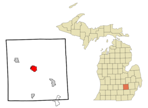
map_caption = Location of Howell, Michigan
mapsize1 =
map_caption1 =subdivision_type = Country
subdivision_name =United States
subdivision_type1 = State
subdivision_name1 =Michigan
subdivision_type2 = County
subdivision_name2 = Livingstongovernment_footnotes =
government_type =
leader_title =
leader_name =
leader_title1 =
leader_name1 =
established_title =
established_date =unit_pref = Imperial
area_footnotes =area_magnitude =
area_total_km2 = 11.2
area_land_km2 = 10.6
area_water_km2 = 0.5
area_total_sq_mi = 4.3
area_land_sq_mi = 4.1
area_water_sq_mi = 0.2population_as_of = 2000
population_footnotes =
population_total = 9232
population_density_km2 = 867.1
population_density_sq_mi = 2245.8timezone = Eastern (EST)
utc_offset = -5
timezone_DST = EDT
utc_offset_DST = -4
elevation_footnotes =
elevation_m = 285
elevation_ft = 935
latd = 42 |latm = 36 |lats = 35 |latNS = N
longd = 83 |longm = 55 |longs = 58 |longEW = Wpostal_code_type =
ZIP code s
postal_code = 48800-48899
area_code = 517
blank_name = FIPS code
blank_info = 26-39540GR|2
blank1_name = GNIS feature ID
blank1_info = 0628717GR|3
website =
footnotes =Howell is a city in the
U.S. state ofMichigan . As of the 2000 census, the city had a total population of 9,232 while the 2006 estimate placed the city's population at 9,854. It is thecounty seat of Livingston CountyGR|6 and is located mostly within Howell Township, but is politically independent. The city is part of the South Lyon-Howell-Brighton Urban Area.Howell is known for the Michigan Balloonfest Challenge, an annual hot air balloon festival that is usually held the third weekend of June that the city hosts.
The city is also the site of the
Howell Melon Festival , an annual celebration of the Howell melon, a juicy hybridcantaloupe known to grow only in the surrounding area. The three day festival, held in mid-August, draws approximately 50,000 visitors each year.Demographics
As of the
census GR|2 of 2000, there were 9,232 people, 3,857 households, and 2,248 families residing in the city. Thepopulation density is 2,245.8 per square mile (867.3/km²). There are 4,088 housing units at an average density of 994.5/sq mi (384.0/km²). The racial makeup of the city is 95.97% White, 0.31% African American, 0.61% Native American, 1.23% Asian, 0.18% Pacific Islander, 0.73% from other races, and 0.96% from two or more races. 2.16% of the population are Hispanic or Latino of any race.There are 3,857 households out of which 30.4% have children under the age of 18 living with them, 41.8% are married couples living together, 12.6% have a female householder with no husband present, and 41.7% are non-families. 33.6% of all households are made up of individuals and 10.9% have someone living alone who is 65 years of age or older. The average household size is 2.29 and the average family size is 2.96.
In the city the population is spread out with 24.1% under the age of 18, 10.9% from 18 to 24, 33.6% from 25 to 44, 18.9% from 45 to 64, and 12.5% who are 65 years of age or older. The median age is 33 years. For every 100 females there are 96.0 males. For every 100 females age 18 and over, there are 90.2 males.
The median income for a household in the city is $43,958, and the median income for a family is $57,149. Males have a median income of $44,980 versus $27,956 for females. The
per capita income for the city is $22,254. 6.6% of the population and 4.6% of families are below thepoverty line . Out of the total population, 7.2% of those under the age of 18 and 7.9% of those 65 and older are living below the poverty line.Education
Elementary Schools
*Northwest Elementary School (Eagles)
*Southwest Elementary School (Coyotes)
*Southeast Elementary School (Super Stars)
*Challenger Elementary School (Space Pups)
*Voyager Elementary School
*Latson Road Elementary School (Dragons)
*Hutchings Elementary School (Hurricanes)Middle Schools
*Three Fires Middle School (Timberwolves)
*Highlander Way Middle School (Hawks)
*McPherson Middle School (Tigers) was converted to the Howell High School Freshman Campus after Three Fires Middle School opened in the 2002-2003 school year.High Schools
*Howell High School (grades 10-12) (Highlanders)
*Howell High School Freshman Campus (grade 9) (Highlanders)
*Renaissance Alternative School
*William Parker High School (Patriots)Geography
According to the
United States Census Bureau , the city has a total area of 4.3square mile s (11.2km² ), of which, 4.1 square miles (10.6 km²) of it is land and 0.2 square miles (0.5 km²) of it is water. The total area is 4.64% water.Major highways
References
External links
* [http://www.cityofhowell.org City of Howell Website]
* [http://www.downtownhowell.org Downtown Howell Website]
* [http://www.livingstondaily.com Livingston County Daily Press & Argus, local newspaper Web site]
* [http://www.howellschools.com/C5/Wellness Howell Public Schools Wellness Web Page]
* [http://www.howellareafd.org Howell Area Fire Department]
* [http://www.howelllibrary.org Howell Carnegie District Library] [http://www.theconnectionyouthservices.org The Connection Youth Services]
* [http://topics.nytimes.com/top/reference/timestopics/organizations/k/ku_klux_klan/index.html?query=HOWELL%20(MICH)&field=geo&match=exact NY Times Article on Howell Klan Connection]
Wikimedia Foundation. 2010.


