- Dearborn Heights, Michigan
-
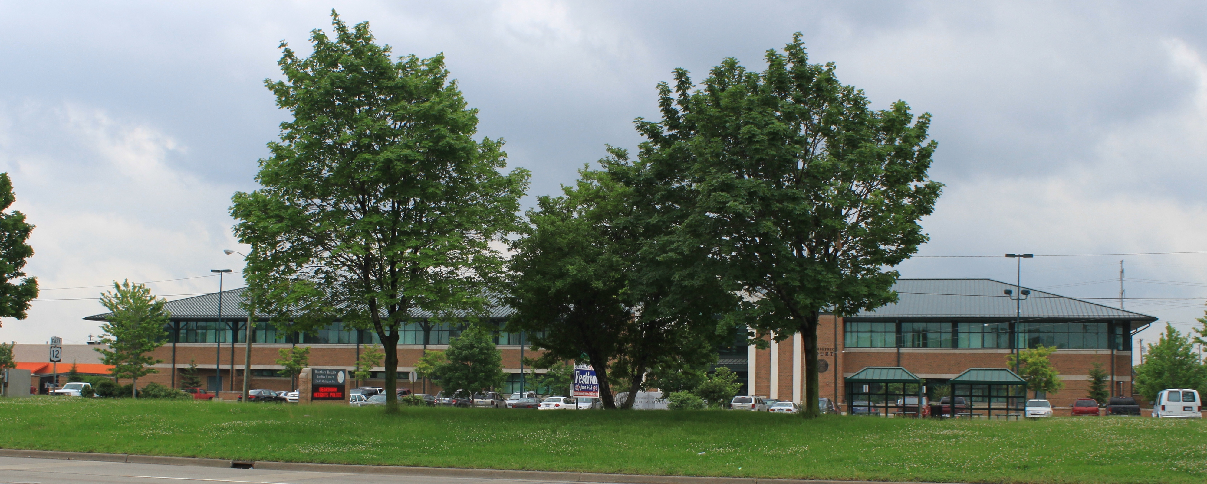
Dearborn Heights, Michigan — City — Dearborn Heights Justice Center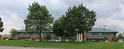

SealMotto: Dei Gratia (By the grace of God) Location of Dearborn Heights within Michigan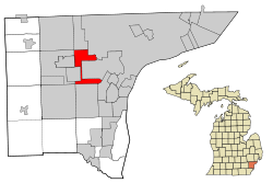
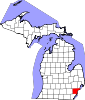
Coordinates: 42°19′47″N 83°16′48″W / 42.32972°N 83.28°WCoordinates: 42°19′47″N 83°16′48″W / 42.32972°N 83.28°W Country United States State Michigan County Wayne Government - Type Mayor-Council - Mayor Daniel S. Paletko Area - City 11.7 sq mi (30.4 km2) - Land 11.7 sq mi (30.4 km2) - Water 0.0 sq mi (0.0 km2) Elevation 620 ft (185 m) Population (2010) - City 57,774 - Density 4,922.2/sq mi (1,900.5/km2) - Metro 4,296,250 (Metro Detroit) Time zone EST (UTC-5) - Summer (DST) EDT (UTC-4) ZIP codes 48125, 48127 Area code(s) 313 FIPS code 26-21020[1] GNIS feature ID 0624433[2] Website www.ci.dearborn-heights.mi.us Dearborn Heights is a city in Wayne County, in the Detroit metropolitan area, in the U.S. state of Michigan. The population was 57,774 at the 2010 census.[3]
Contents
History
Dearborn Heights was incorporated from the two discontinuous sections of Dearborn Township and a quarter-mile connecting strip of land from the village of Inkster. Incorporation petitions were filed on Friday, March 4, 1960, while Inkster officials delivered their petitions for incorporation on Monday, March 7, 1960. The residents approved Dearborn Heights incorporation on an election held June 20, 1960, which is the official date of incorporation. Inkster filed a lawsuit that was not finally resolved until the Michigan Supreme Court handed down a decision favorable to Dearborn Heights on April 8, 1963.[4][5]
Dearborn Heights is considered a bedroom community.[5]
Geography
According to the United States Census Bureau, the city has a total area of 11.7 square miles (30 km2), all land. The southern portion of the city is in the watershed of the north branch of the Ecorse Creek (also known as Ecorse River).[6] The area surrounding the Ecorse is subject to flooding.[7] The northern portion of the city is in the Rouge River watershed.[8]
Demographics
Historical populations Census Pop. %± 1930 1,345 — 1940 8,052 498.7% 1950 20,235 151.3% 1960 61,118 202.0% 1970 80,069 31.0% 1980 67,706 −15.4% 1990 60,838 −10.1% 2000 58,264 −4.2% 2010 57,774 −0.8% As of the census[1] of 2000, there were 58,264 people, 23,276 households, and 15,781 families residing in the city. The population density was 4,973.1 per square mile (1,919.4/km²). There were 23,913 housing units at an average density of 2,041.1 per square mile (787.8/km²). The racial makeup of the city was 91.64% White, 2.12% African American, 0.37% Native American, 2.24% Asian, 0.01% Pacific Islander, 0.81% from other races, and 2.81% from two or more races. Hispanic or Latino of any race were 3.39% of the population. 19.8% were of Polish, 12.3% German, 8.8% Arab, 8.3% Italian, 8.0% Irish and 5.3% English ancestry according to Census 2000. 82.1% spoke English, 6.6% Arabic, 2.3% Polish, 2.1% Spanish, 1.5% Italian and 1.0% Macedonian as their first language. Dearborn Heights, including neighboring Dearborn, has one of the largest Maltese-American populations due to availibility of jobs during automobile boom.
There were 23,276 households out of which 27.5% had children under the age of 18 living with them, 52.7% were married couples living together, 10.8% had a female householder with no husband present, and 32.2% were non-families. 28.0% of all households were made up of individuals and 13.0% had someone living alone who was 65 years of age or older. The average household size was 2.47 and the average family size was 3.04.
In the city the population was spread out with 22.5% under the age of 18, 7.5% from 18 to 24, 29.5% from 25 to 44, 21.7% from 45 to 64, and 18.7% who were 65 years of age or older. The median age was 39 years. For every 100 females there were 93.2 males. For every 100 females age 18 and over, there were 90.4 males.
The median income for a household in the city was $48,222, and the median income for a family was $54,392. Males had a median income of $45,226 versus $29,234 for females. The per capita income for the city was $22,829. About 4.4% of families and 6.1% of the population were below the poverty line, including 8.5% of those under age 18 and 4.7% of those age 65 or over.
As of 2010 the population of Dearborn Heights was 57,774. The racial and ethnic makeup of the population was 83.0% Non-Hispanic white, 7.9% black or African American, 0.4% Native American, 1.7% Asian, 0.1% non-Hispanics of some other race, 2.8% reporting more than one race and 4.7% Hispanic or Latino.[9]
Dearborn Heights Tax Increment Finance Authority (TIFA)
Since TIFA's establishment in 1986, many projects have been completed, including the new Justice Center and JFK Library. The Dearborn Heights Tax Increment Finance Authority is a community service office branched out of the State of Michigan and the City of Dearborn Heights. The goal is to encourage economic revitalization and historic preservation. TIFA remains established to continue efforts in elevating the standard of living for all residents of the district.
Property availability list
A property availability list (PAL) is regularly updated on the TIFA website. It is a comprehensive list of all commercial and industrial parcels for sale in the district, which provides the browser with property specifications and contact information for the appropriate real estate agent. The goal of the PAL is not to promote or advocate businesses, but rather to avoid vacancies and assist in the occupancy of commercial buildings in the district, in turn stimulating the local economy.Recent programs
The Business Improvement Program was launched in June 2008. It is a grant program designed to assist business owners in the TIFA district who wish to repair structural or exterior deterioration of their buildings.Education
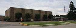 Robichaud High School
Dearborn Heights is divided into three school districts. Most north end residents are in the Crestwood School District, while south end residents fall into the Westwood Community School District or the Dearborn Heights No. 7 School District. There are three High Schools in Dearborn Heights: Crestwood High School on Beech Daly Road (Crestwood School District), Robichaud High School on Janet Street (Westwood Community Schools), and Annapolis High School on Clippert Street (Dearborn Heights District No. 7).
The Roman Catholic Archdiocese of Detroit operated St. Mel Elementary School in Dearborn Heights. It closed in 2005.[10]
References
- ^ a b "American FactFinder". United States Census Bureau. http://factfinder.census.gov. Retrieved 2008-01-31.
- ^ U.S. Geological Survey Geographic Names Information System: Dearborn Heights, Michigan
- ^ "Race, Hispanic or Latino, Age, and Housing Occupancy: 2010 Census Redistricting Data (Public Law 94-171) Summary File (QT-PL), Dearborn Heights city, Michigan". U.S. Census Bureau, American FactFinder 2. http://factfinder2.census.gov. Retrieved September 6, 2011.
- ^ "Dearborn Area Living". http://www.dearbornarealiving.com/history.shtml. Retrieved 2007-07-20.
- ^ a b "American Local History Network". USGenNet. Debbie Axtman and Linda Ball. 2000. Archived from the original on 2005-08-02. http://web.archive.org/web/20050802090607/http://www.geocities.com/michhist/dbnhts.html. Retrieved 2007-02-09.
- ^ "Ecorse Creek Watershed Management Plan". Ecorse Creek Watershed Inter-Municipality Committee (ECIC). http://www.ecorsecreek.com/wtr.htm. Retrieved 2007-07-22.
- ^ "$2 million to help reduce Ecorse Creek flood threat". Press & Guide, A Heritage Newspaper. http://www.pressandguide.com/stories/091306/loc_20060913003.shtml. Retrieved 2007-07-22.[dead link]
- ^ "Rouge River Facts". Friends of the Rouge (FOTR). Archived from the original on 2007-08-13. http://web.archive.org/web/20070813221130/http://www.therouge.org/Rouge+Info/rouge_river+info.htm. Retrieved 2007-07-22.
- ^ census report for 2010 pop. of Dearborn Heights
- ^ "15 Catholic Schools To Close In Metro Detroit." Click on Detroit. March 17, 2005. Retrieved on October 7, 2011.
External links
- City of Dearborn Heights official website
- Dearborn Heights Tax Increment Finance Authority (TIFA)
- Focus Dearborn Heights
Municipalities and communities of Wayne County, Michigan County seat: Detroit Cities Allen Park | Belleville | Dearborn | Dearborn Heights | Detroit | Ecorse | Flat Rock‡ | Garden City | Gibraltar | Grosse Pointe | Grosse Pointe Farms | Grosse Pointe Park | Grosse Pointe Shores‡ | Grosse Pointe Woods | Hamtramck | Harper Woods | Highland Park | Inkster | Lincoln Park | Livonia | Melvindale | Northville‡ | Plymouth | River Rouge | Riverview | Rockwood | Romulus | Southgate | Taylor | Trenton | Wayne | Westland | Woodhaven | Wyandotte
Charter
townshipsBrownstown | Canton | Huron | Northville | Plymouth | Redford | Van Buren
General law
townshipsUnincorporated
communityCherry Hill | Martinsville | New Boston | West Sumpter
Footnotes ‡This populated place also has portions in an adjacent county or counties
Metro Detroit Topics Architecture · Culture · Detroit River · Economy · Freeways · History · Historic places · International Riverfront · Lake St. Clair · Media · Music · Parks and beaches · People · Skyscrapers · Sports · Theatre · Tourism · Transportation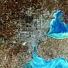
Major city Municipalities
over 80,000Canton Township · Clinton Township · Dearborn · Livonia · Sterling Heights · Troy · Warren · WestlandMunicipalities
45,000 to 80,000Dearborn Heights · Farmington Hills · Grosse Pointe · Macomb Township · Novi · Pontiac · Redford Township · Rochester Hills · Royal Oak · St. Clair Shores · Shelby Township · Southfield · Taylor · Waterford Township · West Bloomfield TownshipSatellite cities Counties in MSA Counties in CSA Regions Outlying regions  Michigan ·
  United StatesCategories:
- Populated places in Wayne County, Michigan
- Cities in Michigan
- Metro Detroit
- 1960 establishments


Wikimedia Foundation. 2010.