- Monroe, Michigan
-
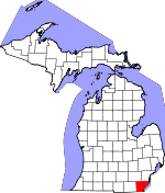
Monroe, Michigan — City — Monroe’s historic downtown on South Monroe Street Location in Monroe County and the state of Michigan
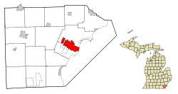
Coordinates: 41°54′59″N 83°23′52″W / 41.91639°N 83.39778°W Country United States State Michigan County Monroe Platted 1817 Incorporated 1837 Government – Mayor Robert Clark Area – City 10.1 sq mi (26.1 km2) – Land 9 sq mi (23.4 km2) – Water 1 sq mi (2.7 km2) Elevation 594 ft (182 m) Population (2010) – City 20,733 – Density 2,303.7/sq mi (886.0/km2) – Urban 53,153 – Metro 152,021 Time zone Eastern (EST) (UTC-5) – Summer (DST) EDT (UTC-4) ZIP codes 48161, 48162 Area code(s) 734 FIPS code 26-55020[1] GNIS feature ID 0632572[2] Website http://www.ci.monroe.mi.us/ Monroe is a city in the U.S. state of Michigan. The population was 20,733 at the 2010 census. It is the largest city and county seat of Monroe County.[3] The city is bordered on the south by Monroe Charter Township, but both are politically independent. The city is located approximately 14 miles (23 km) north of Toledo, Ohio and 25 miles (40 km) south of Detroit. The United States Census Bureau lists Monroe as the core city in the Monroe Metropolitan Area, which had a population of 152,021 in 2010.[4] Monroe itself is officially part of the Detroit-Ann Arbor-Flint CSA, and Monroe is also sometimes unofficially included as a northerly extension of the Toledo Metropolitan Area.
Settled as early as 1784, Monroe was platted in 1817[5] and was named after then-President James Monroe. Today, the city has a strong sense of historic preservationism and is remembered for the Battle of Frenchtown during the War of 1812, as well as being the childhood residence of George Armstrong Custer and other members of his family, including his wife Elizabeth Bacon and brother Boston Custer. The city has numerous historic museums and landmarks. Monroe is also recognized as the home of the La-Z-Boy world headquarters.
Contents
History
The area was settled by Indian tribes (specifically the Potawatomi) hundreds of years before the French reached the area for the first time in the late seventeenth-century. Robert de LaSalle claimed the area for New France after his 1679 exhibition on the Griffon. In 1784, Francis Navarre was given a portion of land south of the River Raisin by the Potawatomi. Frenchtown was settled shortly thereafter as the third European settlement in the state. Around the same time, the Sandy Creek Settlement was established just north of Frenchtown by Joseph Porlier Benec.[6]
The area, because of its close location to Detroit, was of strategic importance during the War of 1812, especially after Detroit fell to the enemy British during the Siege of Detroit in August 1812. The area of Frenchtown served as a stepping stone for the American forces to retake Detroit, and this led to the devastating Battle of Frenchtown in January 1813. The American forces camped in the area in an attempt to move to retake Detroit when they met British and Indian opposition near the shores of the River Raisin on January 18. Initially, the Americans, under the command of James Winchester, fought off the British and Indians in what was later dubbed the First Battle of the River Raisin. However, four days later, the Americans were counterattacked in the same location. Many of the Americans were injured from the previous battle, and their escape routes were cut off. The British, under Henry Proctor, and their Indian allies slaughtered almost 400 American soldiers in what would later be known as the Battle of Frenchtown (or the Second Battle of the River Raisin). The surviving Americans who were unable to retreat became prisoners of war, but some were later slaughtered by Indian forces in an incident dubbed the River Raisin massacre.[7] Today, the site of the battle houses a small visitor center[8] and the recently authorized River Raisin National Battlefield Park.[9]

The area of Frenchtown was renamed and incorporated as the village of Monroe in honor of President James Monroe, who visited the Michigan Territory in 1817. In the same year, the city of Monroe was named the county seat of the newly-created Monroe County. Monroe re-incorporated as a city in 1837.[5] Monroe is known for the residency of United States Major General George Armstrong Custer (1839–1876) during his childhood. While he was not born in Monroe, Custer spent much of his boyhood living in Monroe, where he later met and married Elizabeth Bacon (1842–1933) during the Civil War in 1864. In 1910, President William Howard Taft and the widowed Elizabeth Bacon unveiled an equestrian statue of Custer (George Armstrong Custer Equestrian Monument) that now rests at the corner of Elm Street and Monroe Street.[10][11] Custer’s namesake is honored as street names, various historic markers, buildings, schools, and the Custer Airport.[12] City limit signs for Monroe also mention the city as "the home of General Custer." The city is also known as the home of La-Z-Boy, which was founded in Monroe in 1927.[13] Their world headquarters are located in Monroe on Telegraph Road. In 1974, the Monroe Power Plant, currently the fourth largest coal firing plant in North America, opened. At 805 feet (245 m) tall, the dual smokestacks are the visible from over 25 miles (40 km) away and are among the tallest structures in the state.
Demographics
In the census[1] of 2000, there were 22,076 people, 8,594 households, and 5,586 families in the city. The population density was 2,440.9 per square mile (942.9/km²). There were 9,107 housing units at an average density of 1,007.0 per square mile (389.0/km²). The racial makeup was 90.87% White, 5.07% African American, 0.24% Native American, 0.84% Asian, 0.02% Pacific Islander, 0.90% from other races, and 2.06% from two or more races. Hispanic or Latino of any race were 2.76% of the population.
There were 8,594 households of which 33.6% had children under 18 living with them, 46.6% were married couples living together, 14.3% had a female householder with no husband present, and 35.0% were non-families. 30.7% of all households were up of individuals and 12.7% had someone living alone 65 years or older. The average household size was 2.47 and the average family size 3.10.
In the city the population was 26.9% under 18, 8.7% from 18 to 24, 29.3% from 25 to 44, 20.1% from 45 to 64, and 15.0% who 65 or older. The median age was 35 years. For every 100 females there were 90.2 males. For every 100 females age 18 and over, there were 85.2 males.
The median income for a household in the city was $41,810, and the median income for a family $51,442. Males had a median income of $42,881 versus $25,816 for females. The per capita income for the city was $19,948. 9.0% of families and 12.6% of the population were below the poverty line, including 15.0% of those under 18 and 16.1% of those 65 or over.
Geography
According to the United States Census Bureau, the city has a total area of 10.1 square miles (26 km2), of which 9.0 square miles (23 km2) of it is land and 1.0 square mile (2.6 km2) of it (10.14%) is water. Monroe sits at the lowest elevation in state of Michigan, which is the shores of Lake Erie at 571 feet (174 meters).[14] The average elevation of the city of Monroe is 594 feet (182 meters).[15] The Port of Monroe is the only Michigan port on Lake Erie,[16] and Sterling State Park is the only of Michigan's 98 state parks located on or near Lake Erie.[17] The River Raisin and Sandy Creek travel through Monroe, although these waterways are unnavigable.
Climate
Monroe lies in the humid continental climate zone. Monroe only receives an average of 28.5 inches (72.4 cm) of snow a year — the lowest average snowfall for any large city in the state. July is the warmest month with an average high temperature of 84 °F (29 °C), and January is the coldest month with an average low temperature of 16 °F (-9 °C). Monroe does not normally have extremely hot or cold temperatures. On average, the temperature only drops below 0 °F (-18 °C) a couple of times during a winter season, and it is even rarer for the temperature to rise above 100 °F (38 °C) during the summer. The coldest recorded temperature was -21 °F (-29 °C) on February 5, 1918. The highest recorded temperature was 106 °F (41 °C) on July 24, 1934, with another equal temperature recorded on one occasion many years earlier.[18]
Climate data for Monroe, Michigan Month Jan Feb Mar Apr May Jun Jul Aug Sep Oct Nov Dec Year Record high °F (°C) 70
(21)70
(21)83
(28)90
(32)95
(35)106
(41)106
(41)103
(39)103
(39)92
(33)81
(27)68
(20)106
(41)Average high °F (°C) 31
(−1)33
(1)43
(6)57
(14)69
(21)80
(27)84
(29)82
(28)75
(24)62
(17)48
(9)36
(2)58 Average low °F (°C) 16
(−9)18
(−8)27
(−3)38
(3)49
(9)59
(15)64
(18)62
(17)55
(13)43
(6)33
(1)22
(−6)40 Record low °F (°C) −18
(−28)−21
(−29)−2
(−19)11
(−12)26
(−3)35
(2)35
(2)38
(3)27
(−3)21
(−6)1
(−17)−12
(−24)−21
(−29)Precipitation inches (mm) 1.6
(41)1.7
(43)2.6
(66)3.0
(76)3.1
(79)3.5
(89)3.1
(79)3.2
(81)3.0
(76)2.3
(58)2.8
(71)2.8
(71)32.7
(831)Snowfall inches (cm) 7.4
(18.8)6.2
(15.7)5.3
(13.5)0.9
(2.3)0
(0)0
(0)0
(0)0
(0)0
(0)0
(0)2.2
(5.6)6.0
(15.2)28
(71)Source: [19] Education
 The Hall of the Divine Child, now the Norman Towers senior citizens residence, was a boarding school in Monroe from 1918–1980.
The city of Monroe is served by only one large public school district, Monroe Public Schools (MPS), which enrolls approximately 6,700 students.[20] MPS operates nine elementary schools, one middle school, one high school, one alternative high school, and two specialized education centers.[21] At around 2,100 students, Monroe High School is one of the largest high schools in the state. Monroe is also served by the Monroe County Intermediate School District, which provides services to other schools in the form of special education services, support staff, substitute teachers, and educational technology (such as computers and distance learning). Students in Monroe may also attend one of two public charter schools, and there are also over a dozen various parochial schools in and around Monroe. The largest of these schools is St. Mary Catholic Central High School, which enrolls over 400 students a year and has a full sports program that competes against the other public school districts. Students may also be homeschooled.
Marygrove College, sponsored by the local Sisters, Servants of the Immaculate Heart of Mary (IHM), was founded in Monroe in 1905 as a Catholic, liberal arts college. The college then moved to its current location in Detroit in 1927. The IHM also operated a boarding school, the Hall of the Divine Child, in Monroe from 1918–1980. Monroe County Community College was founded in 1964 just west of Monroe. It is the only higher education school in Monroe County.[22]
Economy
Top employers
According to the City's 2010 Comprehensive Annual Financial Report,[23] the top employers in the city are:
# Employer # of Employees 1 Mercy Memorial Hospital 1,600 2 County of Monroe 1,062 3 DTE Energy 530 4 La-Z-Boy 522 5 Macsteel 450 6 Monroe Bank & Trust 401 7 Sisters, Servants of the Immaculate Heart of Mary 265 8 City of Monroe 205 9 Monroe Publishing Company 200 10 SYGMA Network 162 Transportation

The city of Monroe is served by the Lake Erie Transit public transportation bus system. Established in 1975, Lake Erie Transit currently has a fleet of 31 buses and serves approximately 400,000 riders every year. In 2008, the system logged 764,000 miles.[24] The system operates buses on eight fixed routes in and around the city of Monroe. It also serves several neighboring townships outside of its normal routes should a passenger call ahead for a ride. From Bedford Township, its provides transportation to and from two shopping malls in Toledo, Ohio.

I-75 Interstate 75 travels through Monroe and provides access to Toledo and Detroit. There are five interchanges in and near Monroe: LaPlaisance Road (exit 11), Elm Street (exit 13), Front Street (exit 14), North Dixie Highway (exit 15), and Nadeau Road (exit 18). 
I-275 I-275 has its southern terminus just north of Monroe. Splitting off from I-75, I-275 is a western bypass around Detroit but does not actually merge back with I-75. Aside from I-75, the highway can be accessed near Monroe by US-24 (Telegraph Road) via exit 2. 
M-50 The recently truncated eastern terminus of M-50 is in Monroe at US-24 and provides a direct route to Dundee, Jackson, and further. In Monroe, M-50 is known locally as South Custer Road. Its former terminus used to be I-75 at exit 15.[25] 
US-24 US-24 travels through Monroe and provides access to Toledo and western portions of Detroit. The road is known locally as North Telegraph and South Telegraph — divided at the River Raisin. US-24 also connects to I-275 just north of Monroe. 
M-125 M-125 travels directly through the downtown area before merging into US-24 north of Monroe. South of downtown after Jones Avenue, it is called South Dixie Highway. In the downtown area, it is South Monroe Street. North of the River Raisin, it is North Monroe Street. 
M-130 M-130 was a state highway existing from 1930–1955 and ran along the northern banks of the River Raisin. M-130 had its eastern terminus at US-24 and ran for just over nine miles (14 km). In 1955, control of the highway was transferred back to the county. Today, it is called North Custer Road. 
Dixie Highway The old Dixie Highway ran through Monroe in as early as 1915. It was originally one of the few ways to reach places like Florida, but the highway was largely replaced by I-75 beginning in the 1960s. Today, the namesake of the highway is used for two non-connecting highways (one being M-125), although the same route and remnants of the original highway are long gone. 
US-25 U.S. Route 25 was the designated name for the portion of Dixie Highway north of Cincinnati, including the portion running through Monroe. Like Dixie Highway, US-25 was largely replaced, and the existing highway was truncated at Cincinnati. 
Custer Airport Built in 1946, Custer Airport is located on the former M-130. It is a very small and seldom used airport. There are no commercial or passenger flights departing from or arriving at Custer Airport. There is one paved runway used by small personal airplanes. There is also a small aviation school on the site. All air services in the area are primarily through the Metro Airport in Wayne County.[12] Notable natives and residents
- Frankie Biggz (b. Francisco Andres Lucio, 1973), record producer, singer-songwriter, musician and DJ.
- Vic Braden (b. 1929), former tennis champion and coach.
- Christie Brinkley (b. 1954), model, born in Monroe.
- Robert K. Brown (b. 1932), combat correspondent, investigative journalist, and founder/editor/publisher of Soldier of Fortune magazine.
- Horace Thompson Carpenter (1857–1947), artist and art critic/historian.
- Isaac P. Christiancy (1812–1890), former Chief Justice of the Michigan Supreme Court.
- Ken W. Clawson (1936–1999), Deputy Director of Communications for President Richard Nixon during Watergate scandal.
- Oliver H. P. Cowdery (1806–1850), important figure in founding of the Mormon church, lived in Monroe.
- Boston Custer (1848–1876), younger brother of George Custer, lived in Monroe, killed at Battle of Little Big Horn.
- Elizabeth Bacon Custer (1842–1933), wife of General Custer, born in Monroe.
- George Armstrong Custer (1839–1876), world-famous warrior, lived much of his early life in Monroe, killed also at Little Big Horn.
- Robert S. Duncanson (1821–1872), first professional African-American artist.
- Elisha Peyre Ferry (1825–1895), first Governor of the U.S. State of Washington.
- Carl Ford (b. 1980), American football player.
- Louis Florent Gillet (1813–1892) and Teresa Maxis (1810–1892), co-founders of the order of Sisters, Servants of the Immaculate Heart of Mary (IHM).
- Don Gonyea (b. 1956), White House correspondent for National Public Radio.
- George F. Heath, founder of the American Numismatic Association.
- Ernest Ingersoll (1852–1946), environmentalist and naturalist.
- Mary Harris "Mother" Jones (1837–1930), union organizer, lived in Monroe.
- John E. Joseph (b. 1956), author and professor at University of Edinburgh.
- Edward M. Knabusch and Edwin J. Shoemaker, inventors of La-Z-Boy chair.
- Karen Koch (b. 1951), world's first professional female ice hockey player.
- Stephen H. Langdon (1876–1937), Assyriologist and professor at Oxford University.
- Charles Lanman (1819–1895), author, artist and US government official.
- Frances Mallon, Nun in the convent of the Immaculate Heart of Mary under the name of Sister Catherine Frances.whose metastatic mammary adenocarcinoma was adapted as the MCF-7 cell line, greatly aiding breast cancer research. Her name is unknown to the vast majority of cancer researchers, died in 1970. Her cells were the source of much of current knowledge about breast cancer.[26][27].
- Robert McClelland (1807–1880), prominent Michigan politician.
- Charles S. McIntyre and August F. Meyer, founders of Monroe Auto Equipment.
- Bronco McKart (b. 1971), former World Boxing Organization champion.
- Elizabeth McWebb (1904–2004), author of the Little Brown Bear book series.
- J. Sterling Morton (1832–1902), prominent conservationist, lived in Monroe from 1834–1854.
- Fannie Ellsworth Stone Newberry (1848–1942), author, best known for stories for girls, especially The Wrestler of Philippi (1896).
- Roy Parmelee (1907–1981), professional baseball player, pitcher in the Major Leagues from 1929–1939.
- Hermann Pinkus, (1905–1985), world renowned dermatologist (as was his father, Felix Pinkus (1868–1947), who died in Monroe).
- Kaye Lani Rae Rafko (b. 1963), Miss America 1988.
- Henry Armstrong Reed (1858–1876), nephew of George Custer, lived in Monroe, killed at Little Big Horn.
- Paul W. Smith, WJR morning host.
- Vern Sneider (1916–1981), novelist most famous for Teahouse of the August Moon.
- Ryan Sontag (b. 1985), current pitcher for the Boise Hawks minor league baseball team.
- Lt Col Matt Urban (1919–1995), most decorated combat soldier of WWII.
Sister cities
Monroe, Michigan has only one official sister city:
References
- ^ a b "American FactFinder". United States Census Bureau. http://factfinder.census.gov. Retrieved 2008-01-31.
- ^ "US Board on Geographic Names". United States Geological Survey. 2007-10-25. http://geonames.usgs.gov. Retrieved 2008-01-31.
- ^ "Find a County". National Association of Counties. http://www.naco.org/Counties/Pages/FindACounty.aspx. Retrieved 2011-06-07.
- ^ Population of Michigan Regions and Statistical Areas, 2000 and 2010, at www.michigan.gov
- ^ a b Romig, Walter (1986) [1973]. Michigan Place Names. Detroit, Michigan: Wayne State University Press. ISBN 0-8143-1838-X.
- ^ http://www.monroeinfo.com/set1_source.html Monroe, Michigan historical markers
- ^ http://www.riverraisinbattlefield.org/the_battles.htm River Raisin Battlefield
- ^ http://www.riverraisinbattlefield.org/visitorscenter.htm Battlefield Visitor Center
- ^ Monroe Evening News staff (31 March 2009). "Battlefield bill signing celebrated". Monroe Evening News (Monroe, Michigan). http://www.monroenews.com/article/20090331/NEWS01/703319972/-1/NEWS. Retrieved 3 April 2009.
- ^ http://query.nytimes.com/mem/archive-free/pdf?_r=1&res=9D0DE7DA1530E233A25756C1A9639C946196D6CF History of the Custer statue
- ^ http://monroe.lib.mi.us/books_movies_music/special_collections/custer_statue_moved.htm Custer statue moved
- ^ a b http://mich.gov/documents/Ttf_19117_7.pdf Custer Airport details
- ^ http://www.la-z-boy.com/about/our_history.aspx La-Z-Boy history
- ^ http://egsc.usgs.gov/isb/pubs/booklets/elvadist/elvadist.html#Highest USGS Elevations and Distances in the United States
- ^ http://michigan.hometownlocator.com/mi/monroe/monroe.cfm Elevation of Monroe, MI
- ^ http://www.portofmonroe.com/ Port of Monroe
- ^ http://www.michigandnr.com/ParksandTrails/Details.aspx?id=497&type=SPRK Sterling State Park
- ^ http://climate.geo.msu.edu/Stations/5558/NARRAT.txt Climate of Monroe
- ^ "Average Weather for Monroe, MI - Temperature and Precipitation". Weatherbase. http://www.weatherbase.com/weather/weather.php3?s=855502&refer=. Retrieved May 28, 2009.
- ^ http://www.greatschools.net/michigan/monroe/Monroe-Public-Schools/ Great Schools profile of Monroe Public Schools
- ^ http://www.monroe.k12.mi.us/ Monroe Public Schools homepage
- ^ http://www.monroeccc.edu/ MCCC homepage
- ^ City of Monroe CAFR
- ^ Michigan DOT: Lake Erie Transit http://www.michigan.gov/mdot/0,1607,7-151-9625_21607-164483--,00.html
- ^ http://www.michiganhighways.org/listings/MichHwys50-59.html Michigan Highways 50 through 59
- ^ Soule, HD; Vazquez J, Long A, Albert S, Brennan M. (1973). "A human cell line from a pleural effusion derived from a breast carcinoma". Journal of the National Cancer Institute 51 (5): 1409–1416. PMID 4357757.
- ^ Levenson, AS; Jordan VC. (1997). "MCF-7: the first hormone-responsive breast cancer cell line". Cancer Research 57 (15): 3071–3078. PMID 9242427.
- ^ http://www.ci.monroe.mi.us/Hofu_Mayor_Visit.cfm Twin towning with Hofu, Japan
External links
- City's official website
- Monroe County Tourism Bureau
- History of Monroe
- Monroe Evening News
 "Monroe, Mich.". Encyclopedia Americana. 1920.
- "Monroe, a city and county-seat of Monroe co., Mich.". Collier's New Encyclopedia. 1921.
Municipalities and communities of Monroe County, Michigan County seat: MonroeCities Flat Rock‡ | Luna Pier | Milan‡ | Monroe | Petersburg
Villages Carleton | Dundee | Estral Beach | Maybee | South Rockwood
Charter
townshipsBerlin | Frenchtown | Monroe
General law
townshipsUnincorporated
communitiesAzalia | Detroit Beach | Diann | Erie | Ida | Lambertville | La Salle | Newport | Ottawa Lake | Samaria | Scofield | South Monroe | Stony Point | Temperance | West Monroe | Whiteford Center | Woodland Beach
Footnotes ‡This populated place also has portions in an adjacent county or counties
Metro Detroit Topics Architecture · Culture · Detroit River · Economy · Freeways · History · Historic places · International Riverfront · Lake St. Clair · Media · Music · Parks and beaches · People · Skyscrapers · Sports · Theatre · Tourism · Transportation
Major city Municipalities
over 80,000Canton Township · Clinton Township · Dearborn · Livonia · Sterling Heights · Troy · Warren · WestlandMunicipalities
45,000 to 80,000Dearborn Heights · Farmington Hills · Grosse Pointe · Macomb Township · Novi · Pontiac · Redford Township · Rochester Hills · Royal Oak · St. Clair Shores · Shelby Township · Southfield · Taylor · Waterford Township · West Bloomfield TownshipSatellite cities Counties in MSA Counties in CSA Regions Outlying regions Coordinates: 41°54′59″N 83°23′52″W / 41.91639°N 83.39778°W

Ann Arbor
Milan
MaybeeBelleville
Romulus
CarletonDetroit
Downriver
South RockwoodAdrian / Petersburg / Dundee 
Lake Erie  Monroe

Temperance
LambertvilleLuna Pier
Toledo, OhioLake Erie Categories:- Monroe, Michigan
- Cities in Michigan
- Populated places in Monroe County, Michigan
- County seats in Michigan
- Populated places on the Great Lakes
- Metro Detroit
- Michigan in the War of 1812
- Populated places established in 1817


Wikimedia Foundation. 2010.