- M-125 (Michigan highway)
-
M-125
South Dixie Highway/Monroe Street 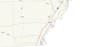
Route information Maintained by MDOT Length: 19.38 mi[1] (31.19 km) Existed: 1974 – present Major junctions South end: Michigan/Ohio state line near Toledo, Ohio 
 CONN M-125 near Erie
North end:  US 24 near Monroe
Location Counties: Monroe Highway system Michigan State Trunkline Highway System
Interstate • US • State←  M-124
M-124M-126  →
→M-125 is a 19.38-mile (31.19 km) long state trunkline highway in the US state of Michigan. The route is entirely within Monroe County with the southern terminus on the Ohio state border at Toledo and a northern terminus at US Highway 24 (US 24) in Frenchtown Charter Township, 5 miles (8.0 km) north of Monroe.
Contents
Route description
In Ohio, the road continues as Detroit Avenue, which merges with US 24 two miles (3 km) further south. M-125 runs roughly parallel with and between both US 24 and I-75 its entire length, separated from US 24 by less than a mile most of the way.
From the Ohio state line to Jones Street in downtown Monroe, M-125 is also known as South Dixie Highway. North of that point, M-125 is named Monroe Street (South Monroe Street south of the River Raisin and then North Monroe Street after the river).
There is a 2.9-mile (4.7 km) connector route CONN M-125, also named "Summit Street", running from the first northbound exit off I-75 in Michigan and merging with M-125 just north of Erie.
History
Previous designations
From 1931 to 1937, M-125 was designated on a road in the Upper Peninsula from US 2 to north of Thompson. Later, from 1938 to 1957, the M-125 designation was used on Parish Road in Bay County for 3 miles (4.8 km), and it junctioned with US 23 (now M-13) between Kawkawlin and Linwood and ran westward to 7 Mile Road.
Current designation
The present route of M-125 is a relic of the old U.S. Route 25 in Michigan. This highway is not a spur of M-25 and there is not any near connection between the termini of M-25 or M-125. Both M-125 and M-25 have segments that were formerly designated as U.S. Route 25, and is why both these highways exist without any other apparent connection, though state highway numbering in Michigan has no directional, geographical reference like US and Interstate highways do.
Major intersections
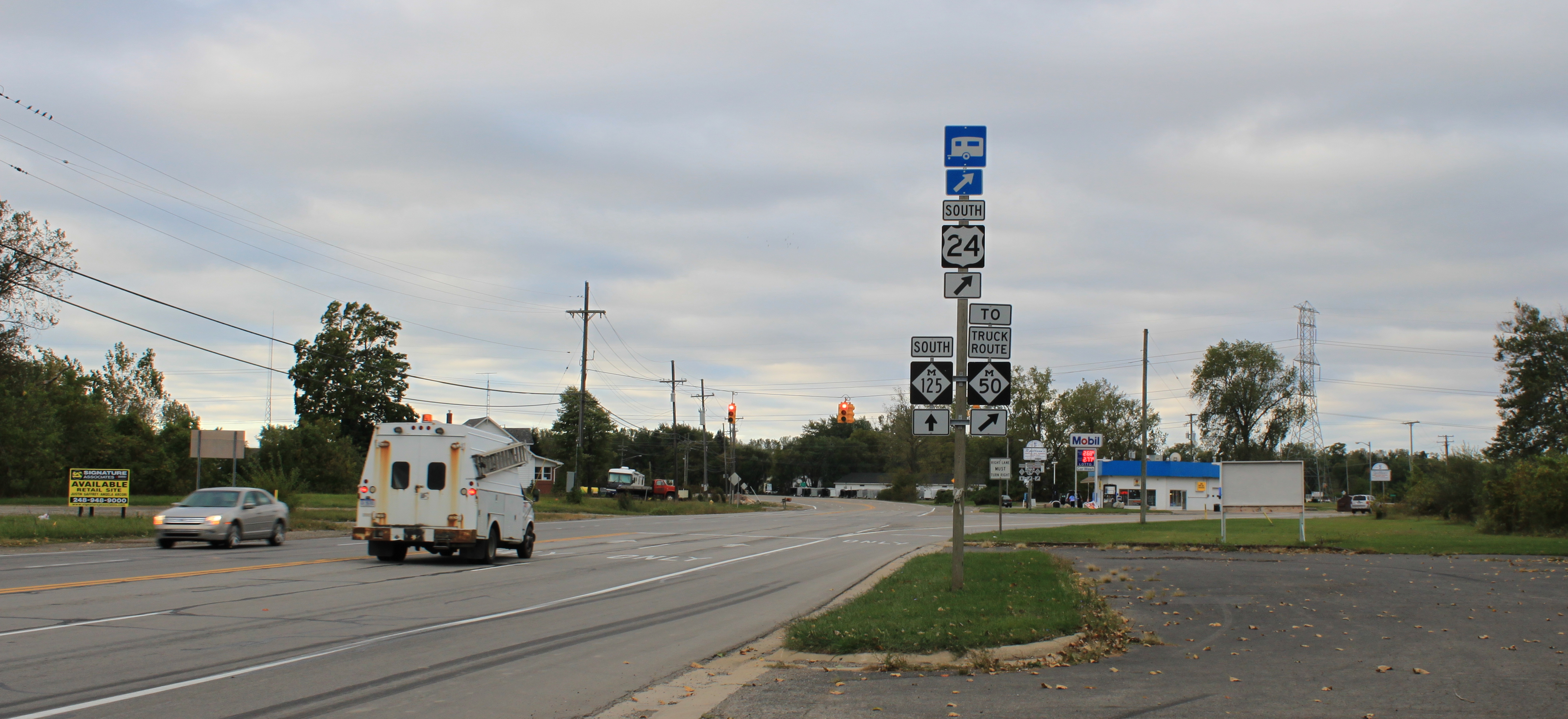
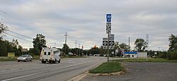 Intersection of M-125 & US 24, facing south
The entire highway is in Monroe County.
Location Mile Destinations Notes Erie Township 0.00 Detroit Avenue Ohio state line
CONN M-125 (Summit Street)Frenchtown Charter Township 19.38 US 241.000 mi = 1.609 km; 1.000 km = 0.621 mi Connector route

CONN M-125
Location: Erie Length: 2.9 mi[2] (4.7 km) Existed: October 5, 1960[3]–present M-125 Connector is a connector route running through Erie. It connects I-75 with M-125. It is a four lane divided highway for its entire length, named "Summit Street" in Erie. It is known internally to the Michigan Department of Transportation as "Connector 2". It rarely carries signage showing its given name, usually only TO I-75 or TO M-125 depending on the direction traveled and location.
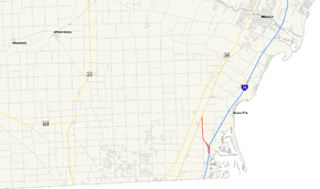 Map of CONN M-125
References
- ^ Bessert, Christopher J. (October 22, 2006). "Michigan Highways: Highways 120 through 139". Michigan Highways. http://www.michiganhighways.org/listings/MichHwys120-139.html#M-125. Retrieved September 11, 2006.
- ^ Garnell, Dan (December 14, 2004). "Connector M-125 @ Michigan Ends". Michigan Ends. http://www.state-ends.com/michigan/conn125/. Retrieved November 13, 2006.
- ^ Bessert, Christopher J. (October 22, 2006). "Michigan Highways: Business Connections 2 through 31". Michigan Highways. http://www.michiganhighways.org/listings/MichHwysBus2-31.html#US-24CONN-E. Retrieved September 4, 2006.
External links
Categories:- State highways in Michigan
- Transportation in Monroe County, Michigan
- U.S. Route 25
- Dixie Highway


Wikimedia Foundation. 2010.