- Temperance, Michigan
Infobox Settlement
official_name = Temperance, Michigan
settlement_type = CDP
imagesize =
image_caption =
image_
imagesize =
image_caption =
image_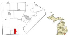
mapsize = 250x200px
map_caption = Location in Bedford Township, Monroe County and the state ofMichigan
mapsize1 =
map_caption1 =
subdivision_type = Country
subdivision_type1 = State
subdivision_type2 = County
subdivision_name =United States
subdivision_name1 =Michigan
subdivision_name2 = Monroe
government_type =
leader_title =
leader_name =
established_date =
area_magnitude =
area_total_km2 = 12
area_total_sq_mi = 4.7
area_land_km2 = 11.9
area_land_sq_mi = 4.6
area_water_km2 = 0.1
area_water_sq_mi = 0.1
elevation_ft = 623
elevation_m = 190
population_as_of = 2000
population_footnotes =
population_total = 7757
population_metro =
population_density_km2 = 646.4
population_density_sq_mi = 1650.4
timezone = Eastern (EST)
utc_offset = -5
latd = 41 |latm = 46 |lats = 45 |latNS = N
longd = 83 |longm = 34 |longs = 08 |longEW = W
timezone_DST = EDT
utc_offset_DST = -4
postal_code_type =ZIP code
postal_code = 48182
area_code = 734
blank_name = FIPS code
blank_info = 26-79240GR|2
blank1_name = GNIS feature ID
blank1_info = 1614669 [gnis|1614669]
footnotes =
website =Temperance is an
unincorporated community in Bedford Township, Monroe County in theU.S. state ofMichigan . It is aCensus-designated place (CDP) used for statistical purposes. The population was 7,757 at the 2000 census. The TemperanceZIP code , 48182, serves most of Bedford Township outside of the Lambertville area, as well as portions of western Erie Township, southern Ida Township, and northeast Whiteford Township. [ [http://factfinder.census.gov/servlet/MapItDrawServlet?geo_id=86000US48182&_bucket_id=50&tree_id=420&context=AdvSearch&_lang=en 48182 5-Digit ZCTA, 481 3-Digit ZCTA - Reference Map - American FactFinder] , U.S. Census Bureau, 2000 census]Geography
According to the
United States Census Bureau , the community has a total area of 4.7square mile s (12.0km² ), of which, 4.6 square miles (11.9 km²) of it is land and 0.1 square miles (0.1 km²) of it (1.08%) is water.Demographics
As of the
census GR|2 of 2000, there were 7,757 people, 2,857 households, and 2,177 families residing in the community. Thepopulation density was 1,688.0 per square mile (651.1/km²). There were 2,953 housing units at an average density of 642.6/sq mi (247.9/km²). The racial makeup of the community was 98.10% White, 0.19% African American, 0.14% Native American, 0.53% Asian, 0.01% Pacific Islander, 0.40% from other races, and 0.62% from two or more races. Hispanic or Latino of any race were 1.93% of the population.There were 2,857 households out of which 37.0% had children under the age of 18 living with them, 65.3% were married couples living together, 8.3% had a female householder with no husband present, and 23.8% were non-families. 20.2% of all households were made up of individuals and 8.9% had someone living alone who was 65 years of age or older. The average household size was 2.68 and the average family size was 3.11.
In the community the population was spread out with 27.3% under the age of 18, 6.1% from 18 to 24, 29.2% from 25 to 44, 25.3% from 45 to 64, and 12.0% who were 65 years of age or older. The median age was 38 years. For every 100 females there were 96.7 males. For every 100 females age 18 and over, there were 91.3 males.
The median income for a household in the community was $61,090, and the median income for a family was $70,230. Males had a median income of $51,182 versus $30,233 for females. The
per capita income for the community was $24,237. About 2.3% of families and 3.6% of the population were below thepoverty line , including 3.7% of those under age 18 and 2.9% of those age 65 or over.References
Wikimedia Foundation. 2010.