- Sterling Heights, Michigan
Infobox Settlement
official_name = City of Sterling Heights
other_name =
native_name =
nickname =
settlement_type =City
motto = To Strive on Behalf of All.
imagesize =
image_caption =
flag_size =
image_
seal_size =
image_shield =
shield_size =
image_blank_emblem =
blank_emblem_size =
imagesize =
image_caption =
flag_size =
image_
seal_size =
image_shield =
shield_size =
image_blank_emblem =
blank_emblem_size =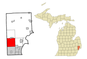
mapsize = 250x200px
map_caption = Location of Sterling Heights, Michigan
mapsize1 =
map_caption1 =
image_dot_
dot_mapsize =
dot_map_caption =
dot_x =
dot_y =
pushpin_
pushpin_label_position =
pushpin_map_caption =
pushpin_mapsize =
subdivision_type = Country
subdivision_type1 = State
subdivision_type2 = County
subdivision_name =United States
subdivision_name1 =Michigan
subdivision_name2 = Macomb
subdivision_type3 =
subdivision_name3 =
subdivision_type4 =
subdivision_name4 =
government_footnotes =
government_type =Council-Manager
leader_title =Mayor
leader_name = Richard J. Notte
leader_title1 =City Manager
leader_name1 = Mark D. Vanderpool
leader_title2 =
leader_name2 =
leader_title3 =
leader_name3 =
leader_title4 =
leader_name4 =
established_title =
established_date =
established_title2 =
established_date2 =
established_title3 = Incorporated
established_date3 = 1968
area_magnitude =
unit_pref = Imperial
area_footnotes =
area_total_km2 = 95.0
area_land_km2 = 94.9
area_water_km2 = 0.1
area_total_sq_mi = 36.7
area_land_sq_mi = 36.6
area_water_sq_mi = 0.1
area_water_percent =
area_urban_km2 =
area_urban_sq_mi =
area_metro_km2 =
area_metro_sq_mi =
population_as_of = 2000
population_footnotes =
population_note =
population_total = 124471
population_density_km2 = 1311.6
population_density_sq_mi = 3397.0
population_metro =
population_density_metro_km2 =
population_density_metro_sq_mi =
population_urban =
population_density_urban_km2 =
population_density_urban_sq_mi =
population_blank1_title =
population_blank1 =
population_density_blank1_km2 =
population_density_blank1_sq_mi =
timezone = Eastern (EST)
utc_offset = -5
timezone_DST = EDT
utc_offset_DST = -4
latd = 42 |latm = 34 |lats = 47 |latNS = N
longd = 83 |longm = 1 |longs = 41 |longEW = W
elevation_footnotes =
elevation_m = 187
elevation_ft = 614
postal_code_type =ZIP code s
postal_code = 48310-48314
area_code = 586
blank_name = FIPS code
blank_info = 26-76460GR|2
blank1_name = GNIS feature ID
blank1_info = 0638798 [gnis|0638798]
website = http://www.sterling-heights.net/
footnotes = Sterling Heights (sometimes referred to as The Heights) is a city in Macomb County of theU.S. state ofMichigan . As of the 2000 census, the city had a total population of 124,471. In the 2006 census estimate, the population was 127,991 making it the fourth largest in Michigan.Geography
*According to the
United States Census Bureau , the city has a total area of 36.7square mile s (95.1km² ), of which, 36.6 square miles (94.9 km²) of it is land and 0.1 square miles (0.1 km²) of it (0.14%) is water.
*Sterling Heights is part of theClinton River watershed, and branches of it flow through it.Main highways
Sterling Heights sits on two main thoroughfares:
tate highways
* and
*).Unnumbered roads
*
Mound Road is an important north-south artery in the city.
*East-west travel is mainly on the mile roads, that is 14 Mile Road on the south (Warren) border through 20 Mile Road (M-59) on the north border. SeeMile Road System (Detroit) .
*16 Mile Road (known as Metropolitan Parkway to the east, andBig Beaver Road to the west) is a main thoroughfare.
*Utica Road is an important diagonal connector that criss-crosses the city from southeast to northwest, going at the intersection ofDodge Park Road (across from the Sterling Heights city hall, and across the road from Dodge Park) through the firstroundabout in Macomb County.Adjacent cities
*Troy west
*Warren south
*Utica north
*Shelby Township north
*Clinton Township eastDemographics
As of the
census GR|2 of 2000, there were 124,471 people, 46,319 households, and 33,395 families residing in the city. Thepopulation density was 3,397.0 per square mile (1,311.6/km²). There were 47,547 housing units at an average density of 1,297.6/sq mi (501.0/km²). The racial makeup of the city was 90.70% White, 1.30% African American, 0.21% Native American, 4.92% Asian, 0.04% Pacific Islander, 0.34% from other races, and 2.50% from two or more races. 1.34% of the population wereHispanic orLatino of any race.Ancestries: Polish (19.0%), German (14.4%), Italian (12.5%), Irish (5.7%), English (5.3), Albanian (5.4%), Assyrian/Chaldean (4.8%) and American/US (4.0%).
In 2000 there were more people in Sterling Heights born in Iraq than any other foreign country. In that year there were 5,059 people in Steling Heights born in Iraq. The next three largest nations of foreign birth were India at 1,723, Italy at 1,442 and Poland at 1,427. [http://factfinder.census.gov/servlet/DTTable?_bm=y&-context=dt&-reg=DEC_2000_SF2_U_PCT007:001|004|014|063|064|066|068|229|235|405|406|413|423|424|453;&-ds_name=DEC_2000_SF3_U&-CONTEXT=dt&-mt_name=DEC_2000_SF3_U_PCT019&-mt_name=DEC_2000_SF3_U_PCT018&-tree_id=403&-redoLog=true&-all_geo_types=N&-_caller=geoselect&-geo_id=05000US06037&-geo_id=05000US36027&-geo_id=05000US36079&-geo_id=06000US2609976460&-geo_id=06000US2609984000&-search_results=01000US&-format=&-_lang=en PCT18. ANCESTRY (TOTAL CATEGORIES TALLIED) FOR PEOPLE WITH ONE OR MORE ANCESTRY CATEGORIES REPORTED [109] - Universe: Total ancestry categories tallied for people with one or more ancestry categories reported] , U.S. Census Bureau, 2000 census]
There were 46,319 households out of which 32.9% had children under the age of 18 living with them, 60.4% were married couples living together, 8.5% had a female householder with no husband present, and 27.9% were non-families. 24.1% of all households were made up of individuals and 8.5% had someone living alone who was 65 years of age or older. The average household size was 2.66 and the average family size was 3.21.
In the city the population was spread out with 24.1% under the age of 18, 8.5% from 18 to 24, 30.4% from 25 to 44, 25.2% from 45 to 64, and 11.8% who were 65 years of age or older. The median age was 37 years. For every 100 females there were 96.0 males. For every 100 females age 18 and over, there were 92.6 males.
The median income for a household in the city was $60,494, and the median income for a family was $70,140. Males had a median income of $51,207 versus $31,489 for females. The
per capita income for the city was $24,958. About 4.0% of families and 5.2% of the population were below thepoverty line , including 6.6% of those under age 18 and 7.5% of those age 65 or over.History
Sterling Heights was incorporated as a city in 1968. It was until the 1950s an agricultural area largely devoted to growing rhubarb and other crops sold in Detroit. ["Seven Miles From Home"] Prior to 1968 Sterling Heights was known as Sterling Township. It had from 1836 until 1838 been known as Jefferson Township.
Anthony Dobry was the last township supervisor, and then he served on the first city council. Dobry on northern city limits is named for him. Gerald Donovan became the first mayor of the city. There was already a small village named Sterling in Arenac County, so the word "Heights" was added to the township name to satisfy a state law that prevents incorporated municipalities from having the same name. "Sterling Oaks" was another name under consideration for the new city. [ [https://www.sterling-heights.net/bins/site/templates/default.asp?area_2=pages/comm/history/pre-cityhistory/pre-cityhistory_506.dat&area_1=pages/nav/comm/history/history.dat&area_3=0.dat&area_0=0.dat&area_8=0.dat&objectid=BEB01220&ml_index=2&NC=758X Pre-City History] , The Official Site of the City of Sterling Heights]
The city is home to the Freedom Hill county park, [ [http://www.freedomhillcountypark.com/ Freedom Hill County Park.] ] located on Metropolitan Parkway (16 Mile Road) east of Schoenherr Road. Freedom Hill began hosting concerts in 1999 in its 7,000-seat, outdoor theater. Several residents near the park began complaining about the loud music coming from the amphitheater. [ [http://www.tickco.com/venue_schedules/freedom_hill_amphitheater.htm Freedom Hill Amphitheater.] ] The complaints led to a long legal battle between Sterling Heights and Hillside Productions, which runs the theater, over the theater's impact on the neighborhood.
In 2001, Hillside Productions filed suit in state and federal courts, accusing city officials of conspiring to interfere in its operations. In March 2004, the city settled out of court, agreeing to pay Hillside $31 million. As part of the settlement, Hillside built a convert|14|ft|m|0|sing=on-high sound wall and a huge roof to cover the pavilion seating area. It remains only partially enclosed. Concerts resumed, as did the complaints of neighbors. Sterling Heights then sued three of its insurance carriers who refused to compensate the city for its $31 million payment. In 2006, the city settled with two of the three insurers.
In the summer of 2006, it became publicly known that the city was considering amending its
fire code to include a requirement that all businesses post a premises identification sign in English, in order to facilitate the ability offirst responders to locate an emergency call. On July 13, 2006, the city received a letter from theAmerican Civil Liberties Union of Michigan (ACLU) expressing its viewpoint that the English-language requirement for business signs was discriminatory.The August 2006 issue of "Money" magazine listed Sterling Heights as No. 19 on its list of the 90 "Best Small Cities" to live in.
Sterling Heights was ranked the sixth safest city in the U.S. with a population between 100,000—499,999, according to
Morgan Quitno 's 2006 analysis of crime rates.Notable residents past and present
*Rapper
Eminem briefly lived in the city in 2000.
* 14 timeAmerican Motorcyclist Association (AMA) Amateur Sidecar National Champion Keith Root lives in Sterling Heights.Local events
The community has recurring events. They include:
*"Ice carving festival" in February; [ [http://www.suscc.com/community_events.php Community events calendar, Chamber of Commerce] ]
*"Sterlingfest" in August.Additionally, there are singular community events, and a calendar is available. [http://www.suscc.com/event_links.php Chamber of Commerce Calendar of current events.]Notes
External links
* [http://www.ci.sterling-heights.mi.us City's Website]
* [http://www.suscc.com/ Chamber of Commerce]
* [http://www.freedomhillcountypark.com/ Freedom Hill County Park]
* [http://www.shpl.net/ Sterling Heights Public Library]
Wikimedia Foundation. 2010.