- Waterville, Ohio
Infobox Settlement
official_name = Waterville, Ohio
settlement_type = Village
nickname =
motto =
imagesize =
image_caption =
image_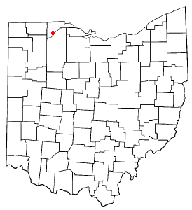
mapsize = 250x200px
map_caption = Location of Waterville, Ohio
mapsize1 =
map_caption1 =subdivision_type = Country
subdivision_name =United States
subdivision_type1 = State
subdivision_name1 =Ohio
subdivision_type2 = County
subdivision_name2 = Lucasgovernment_footnotes =
government_type =
leader_title =Mayor
leader_name = Derek Merrin
leader_title1 =
leader_name1 =
established_title =
established_date =unit_pref = Imperial
area_footnotes =area_magnitude =
area_total_km2 = 9.4
area_land_km2 = 9.1
area_water_km2 = 0.3
area_total_sq_mi = 3.6
area_land_sq_mi = 3.5
area_water_sq_mi = 0.1population_as_of = 2000
population_footnotes =
population_total = 4828
population_density_km2 = 532.6
population_density_sq_mi = 1378.7timezone = Eastern (EST)
utc_offset = -5
timezone_DST = EDT
utc_offset_DST = -4
elevation_footnotes =
elevation_m =
elevation_ft =
latd = 41 |latm = 30 |lats = 5 |latNS = N
longd = 83 |longm = 43 |longs = 38 |longEW = Wpostal_code_type =
ZIP code
postal_code = 43566
area_code = 419
blank_name =
blank_info =
blank1_name =
blank1_info =
website = http://www.waterville.org/
footnotes =Waterville is a village in Lucas County,
Ohio ,United States , along theMaumee River . The population was 4,828 at the 2000 census.Geography
Waterville is located at coor dms|41|30|5|N|83|43|38|W|city (41.501252, -83.727200)GR|1.
According to the
United States Census Bureau , the village has a total area of 3.6square mile s (9.4km² ), of which, 3.5 square miles (9.1 km²) of it is land and 0.1 square miles (0.3 km²) of it (3.04%) is water.The community is located on the
Maumee River and was formerly on theMiami and Erie Canal route.Demographics
As of the
census GR|2 of 2000, there were 4,828 people, 1,726 households, and 1,322 families residing in the village. Thepopulation density was 1,378.7 people per square mile (532.6/km²). There were 1,809 housing units at an average density of 516.6/sq mi (199.6/km²). The racial makeup of the village was 97.91% White, 0.14% African American, 0.14% Native American, 0.35% Asian, 0.56% from other races, and 0.89% from two or more races. Hispanic or Latino of any race were 1.35% of the population.There were 1,726 households out of which 39.0% had children under the age of 18 living with them, 66.6% were married couples living together, 6.9% had a female householder with no husband present, and 23.4% were non-families. 19.8% of all households were made up of individuals and 8.2% had someone living alone who was 65 years of age or older. The average household size was 2.70 and the average family size was 3.15.
In the village the population was spread out with 28.1% under the age of 18, 5.8% from 18 to 24, 27.5% from 25 to 44, 25.3% from 45 to 64, and 13.3% who were 65 years of age or older. The median age was 39 years. For every 100 females there were 92.7 males. For every 100 females age 18 and over, there were 89.3 males.
The median income for a household in the village was $60,000, and the median income for a family was $71,027. Males had a median income of $49,489 versus $31,638 for females. The
per capita income for the village was $23,679. About 1.9% of families and 1.8% of the population were below thepoverty line , including 1.4% of those under age 18 and 5.5% of those age 65 or over.Government
In 2007, 21 year-old Derek Merrin, a sitting Waterville Councilman, beat long-time incumbent Chuck Peyton to become mayor of Waterville. Merrin is believed to be the youngest elected mayor in Ohio. [http://toledoblade.com/apps/pbcs.dll/article?AID=/20071107/NEWS09/711070455 Merrin Elected]
References
External links
* [http://www.derekmerrin.com Waterville Mayor-elect Derek Merrin's Official Website]
* [http://www.toledo.com/waterville/index.php more Waterville, Ohio info from Toledo.com]
* [http://www.maumeevalleyheritagecorridor.org/ Maumee Valley Heritage Corridor] , history of Waterville
Wikimedia Foundation. 2010.