- Riverview, Michigan
Infobox Settlement
official_name = Riverview, Michigan
settlement_type =City
imagesize =
image_caption =
image_
imagesize =
image_caption =
image_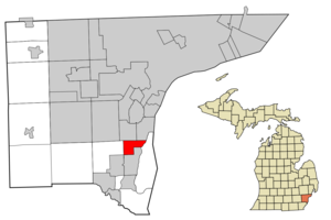
mapsize = 250x200px
map_caption = Location in Wayne County and the state ofMichigan
mapsize1 =
map_caption1 =
subdivision_type = Country
subdivision_type1 = State
subdivision_type2 = County
subdivision_name =United States
subdivision_name1 =Michigan
subdivision_name2 = Wayne
government_type =
leader_title = Mayor
leader_name = Tim Durand
established_date =
area_magnitude =
area_total_km2 = 11.7
area_total_sq_mi = 4.5
area_land_km2 = 11.4
area_land_sq_mi = 4.4
area_water_km2 = 0.3
area_water_sq_mi = 0.1
elevation_ft = 600
elevation_m = 183
population_as_of = 2000
population_footnotes =
population_total = 13272
population_metro =
population_density_km2 = 1163.2
population_density_sq_mi = 3012.6
timezone = EST
utc_offset = -5
latd = 42 |latm = 10 |lats = 30 |latNS = N
longd = 83 |longm = 11 |longs = 18 |longEW = W
timezone_DST = EDT
utc_offset_DST = -4
postal_code_type =ZIP code
postal_code = 48193
area_code = 734
blank_name = FIPS code
blank_info = 26-68880GR|2
blank1_name = GNIS feature ID
blank1_info = 0636018GR|3
footnotes =
website =Riverview is a city in Wayne County in the
U.S. state ofMichigan . The population was 13,272 at the 2000 census.The city is a
suburb in theMetro Detroit area, located along the shore of theDetroit River . It measures 11.4 km² (4.4 square miles) in area. Riverview incorporated as avillage in 1922 and as a city in 1959. Northfolk Southern and Canadian National railroads provide rail service to the City. There are 6 schools located in Riverview: 5 public schools and 1 private school. The public schools areRiverview Community High School , Seitz Middle School, Forest Elementary School, Huntington Elementary School and Memorial Elementary School. The private school is Gabriel Richard High School.Geography
According to the
United States Census Bureau , the city has a total area of 4.5square mile s (11.7km² ), of which, 4.4 square miles (11.4 km²) of it is land and 0.1 square miles (0.3 km²) of it (2.65%) is water. The main road is Fort Street (M-85).History
In 1950 Riverview only stretched as far west as the west end of the northern of Trenton's two northern boundaries. The rest of what is today Riverview was still part of unincorporated Monguagon Township at that point. [1950 Census. Population Vol. 1. p. 22-32] During the Cold War, the Department of Defense operated a missile base on the site of what is now a soccer field. [ [http://nikehercules.tripod.com/d-54.html D-54 - Riverview/Wyandotte | The Nike Detroit - Cleveland Defense Area Website ] ]
Demographics
As of the
census GR|2 of 2000, there were 13,272 people, 5,352 households, and 3,569 families residing in the city. Thepopulation density was 3,012.6 per square mile (1,162.0/km²). There were 5,532 housing units at an average density of 1,255.7/sq mi (484.3/km²). The racial makeup of the city was 94.16% White, 2.08% African American, 0.43% Native American, 1.88% Asian, 0.02% Pacific Islander, 0.32% from other races, and 1.12% from two or more races. Hispanic or Latino of any race were 2.46% of the population.There were 5,352 households out of which 27.9% had children under the age of 18 living with them, 53.1% were married couples living together, 10.8% had a female householder with no husband present, and 33.3% were non-families. 29.1% of all households were made up of individuals and 15.0% had someone living alone who was 65 years of age or older. The average household size was 2.38 and the average family size was 2.95.
In the city the population was spread out with 21.3% under the age of 18, 8.2% from 18 to 24, 25.7% from 25 to 44, 25.0% from 45 to 64, and 19.7% who were 65 years of age or older. The median age was 42 years. For every 100 females there were 87.3 males. For every 100 females age 18 and over, there were 82.5 males.
The median income for a household in the city was $47,623, and the median income for a family was $61,007. Males had a median income of $51,944 versus $31,295 for females. The
per capita income for the city was $25,460. About 3.0% of families and 4.7% of the population were below thepoverty line , including 3.4% of those under age 18 and 5.2% of those age 65 or over.References
External links
* [http://www.cityofriverview.com/ Official website]
Wikimedia Foundation. 2010.