- Crawford County, Michigan
-
Crawford County, Michigan 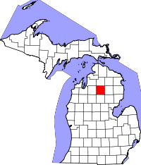
Location in the state of Michigan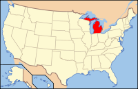
Michigan's location in the U.S.Founded 1826 Seat Grayling Area
- Total
- Land
- Water
563.37 sq mi (1,459 km²)
558.12 sq mi (1,446 km²)
5.25 sq mi (14 km²), 0.93%Population
- (2010)
- Density
14,074
114/sq mi (44/km²)Website www.crawfordco.org Crawford County is a county in the U.S. state of Michigan. As of the 2010 census, the population was 14,074.[1] The county seat is Grayling.[2]
The County is named for Col. William Crawford, a Revolutionary War soldier killed in 1782 while fighting Native Americans in Ohio. It was set off in 1840 as Shawono County, but renamed Crawford in 1843. The county was organized in 1879.[3] See List of Michigan county name etymologies
Contents
Geography
- According to the 2000 census, the county has a total area of 563.37 square miles (1,459.1 km2), of which 558.12 square miles (1,445.5 km2) (or 99.07%) is land and 5.25 square miles (13.6 km2) (or 0.93%) is water.[4]
- The County is part of the Au Sable State Forest, specifically the
- Grayling FMU (Alcona, Crawford, Oscoda, and northern Iosco counties).
- The county is part of Northern Michigan.
Glaciers shaped the area, creating a unique regional ecosystem. A large portion of the area is the so-called Grayling outwash plain, which consists of broad outwash plain including sandy ice-disintegration ridges; jack pine barrens, some white pine-red pine forest, and northern hardwood forest. Large lakes were created by glacial action.[5]
Highways
Interstates
 I-75
I-75 I-75 Business Loop is a loop route traveling through downtown Grayling.
- I-75 Business Loop is a loop route traveling through downtown Roscommon.
US Highways
Michigan State Trunklines
Crawford County Intercounty Highways
 F-32
F-32 F-97
F-97
Adjacent counties
- Otsego County - north
- Montmorency County - northeast
- Oscoda County - east
- Ogemaw County - southeast
- Roscommon County - south
- Missaukee County - southwest
- Kalkaska County - west
- Antrim County - northwest

Antrim County Otsego County Montmorency County Kalkaska County 
Oscoda County  Crawford County, Michigan

Missaukee County Roscommon County Ogemaw County
See also: List of counties bordering eight countiesNational protected area
- Huron National Forest (part)
Demographics
As of the census[6] of 2000, there were 14,273 people, 5,625 households, and 4,038 families residing in the county. The population density was 26 people per square mile (10/km²). There were 10,042 housing units at an average density of 18 per square mile (7/km²). The racial makeup of the county was 96.38% White, 1.50% Black or African American, 0.60% Native American, 0.25% Asian, 0.02% Pacific Islander, 0.20% from other races, and 1.05% from two or more races. 0.99% of the population were Hispanic or Latino of any race. 24.8% were of German, 12.5% English, 10.1% American, 8.9% Irish, 7.4% Polish and 5.9% French ancestry according to Census 2000. 97.7% spoke English and 1.5% Spanish as their first language.
There were 5,625 households out of which 30.00% had children under the age of 18 living with them, 57.60% were married couples living together, 9.70% had a female householder with no husband present, and 28.20% were non-families. 24.00% of all households were made up of individuals and 10.50% had someone living alone who was 65 years of age or older. The average household size was 2.45 and the average family size was 2.87.
In the county the population was spread out with 24.50% under the age of 18, 6.30% from 18 to 24, 26.60% from 25 to 44, 26.00% from 45 to 64, and 16.60% who were 65 years of age or older. The median age was 41 years. For every 100 females there were 104.00 males. For every 100 females age 18 and over, there were 100.40 males.
The median income for a household in the county was $33,364, and the median income for a family was $37,056. Males had a median income of $31,504 versus $21,250 for females. The per capita income for the county was $16,903. About 10.00% of families and 12.70% of the population were below the poverty line, including 17.60% of those under age 18 and 7.60% of those age 65 or over.
Government
The county government operates the jail, maintains rural roads, operates the major local courts, keeps files of deeds and mortgages, maintains vital records, administers public health regulations, and participates with the state in the provision of welfare and other social services. The county board of commissioners controls the budget but has only limited authority to make laws or ordinances. In Michigan, most local government functions — police and fire, building and zoning, tax assessment, street maintenance, etc. — are the responsibility of individual cities and townships.
Crawford County elected officials
- Prosecuting Attorney: Everette E. Ayers
- Sheriff: Kirk A. Wakefield
- County Clerk/Register of Deeds: Sandra M. Moore
- County Treasurer: Joseph V. Wakeley
(information as of September 2005)
Cities, villages, and townships
- Grayling, City
- Grayling Township
Historical markers
There are six recognized Michigan historical markers in the county:[7]
- Beginning of State Reforestation
- Chief Shoppenagon / Shoppenagon's Homesite
- The Douglas House / Thomas E. Douglas
- Michigan Grayling
- Officer's Club
- 32nd Red Arrow Division
See also
Notes
- ^ "American FactFinder". United States Census Bureau. http://factfinder2.census.gov/main.html. Retrieved 3 May 2011.
- ^ "Find a County". National Association of Counties. http://www.naco.org/Counties/Pages/FindACounty.aspx. Retrieved 2011-06-07.
- ^ Clarke Historical Collection, Bibliography on Crawford County.
- ^ "Census 2000 U.S. Gazetteer Files: Counties". United States Census. http://www.census.gov/tiger/tms/gazetteer/county2k.txt. Retrieved 2011-02-13.
- ^ Michigan regional geology.
- ^ "American FactFinder". United States Census Bureau. http://factfinder.census.gov. Retrieved 2008-01-31.
- ^ Michigan Historical Markers
External links
- Clarke Historical Collection, Bibliography on Crawford County.
- Crawford County government
- Enchanted forest, Northern Michigan source for information, calendars, etc.
Municipalities and communities of Crawford County, Michigan City 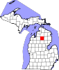
Townships Beaver Creek | Frederic | Grayling | Lovells | Maple Forest | South Branch
Northern Michigan Topics Major Highways Central cities Satellite cities Region Outlying regions Counties Categories:- Michigan counties
- Crawford County, Michigan


Wikimedia Foundation. 2010.