- Shiawassee County, Michigan
-
Shiawassee County, Michigan 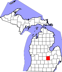
Location in the state of Michigan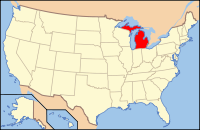
Michigan's location in the U.S.Founded 1822 Seat Corunna Area
- Total
- Land
- Water
540.73 sq mi (1,400 km²)
538.73 sq mi (1,395 km²)
2.00 sq mi (5 km²), 0.37%Population
- (2010)
- Density
70,648
132/sq mi (51/km²)Website www.shiawassee.net Shiawassee (
 /ˌʃaɪ.əˈwɒsiː/) is a county in the U.S. state of Michigan, the sole county of the Owosso Micropolitan Statistical Area, and part of the greater Lansing Combined Statistical Area. As of the 2010 census, the population was 70,648. The county seat is Corunna[1]. The center of population of Michigan is located in Shiawassee County, in the village of Morrice [2] Shiawassee County is named for the Shiawassee River, and means 'river that twists about'.[3] The Shiawassee County Courthouse was built by Claire Allen, a prominent southern Michigan architect.
Contents
Geography
According to the 2000 census, the county has a total area of 540.73 square miles (1,400.5 km2), of which 538.73 square miles (1,395.3 km2) (or 99.63%) is land and 2.00 square miles (5.2 km2) (or 0.37%) is water.[4] The Shiawassee River enters it from Genesee County in the southeast and flows through Corunna and Owosso in the center of the county, exiting to Saginaw County in the north.
Adjacent counties
- Saginaw County (north)
- Genesee County (east)
- Clinton County (west)
- Livingston County (southeast)
- Ingham County (southwest)
- Gratiot County (northwest)

Gratiot County Saginaw County Clinton County 
Genesee County  Shiawassee County, Michigan

Ingham County Livingston County Transportation

I-69 
M-13 
M-21 
M-52 
M-71 Demographics
Historical populations Census Pop. %± 1900 33,866 — 1910 33,246 −1.8% 1920 35,924 8.1% 1930 39,517 10.0% 1940 41,207 4.3% 1950 45,967 11.6% 1960 53,446 16.3% 1970 63,075 18.0% 1980 71,140 12.8% 1990 69,770 −1.9% 2000 71,687 2.7% Est. 2010 70,648 −1.4% As of the census[5] of 2000, there were 71,687 people, 26,896 households, and 19,849 families residing in the county. The population density was 133 people per square mile (51/km²). There were 29,087 housing units at an average density of 54 per square mile (21/km²). The racial makeup of the county was 97.39% White, 0.19% Black or African American, 0.47% Native American, 0.28% Asian, 0.01% Pacific Islander, 0.49% from other races, and 1.17% from two or more races. 1.81% of the population were Hispanic or Latino of any race. 25.3% were of German, 14.2% English, 13.9% American and 9.9% Irish ancestry according to Census 2000. 97.4% spoke English and 1.1% Spanish as their first language.
There were 26,896 households out of which 35.30% had children under the age of 18 living with them, 59.10% were married couples living together, 10.30% had a female householder with no husband present, and 26.20% were non-families. 21.70% of all households were made up of individuals and 9.10% had someone living alone who was 65 years of age or older. The average household size was 2.64 and the average family size was 3.06.
In the county the population was spread out with 26.80% under the age of 18, 8.30% from 18 to 24, 29.20% from 25 to 44, 23.60% from 45 to 64, and 12.00% who were 65 years of age or older. The median age was 36 years. For every 100 females there were 96.50 males. For every 100 females age 18 and over, there were 93.50 males.
The median income for a household in the county was $42,553, and the median income for a family was $49,329. Males had a median income of $39,190 versus $25,063 for females. The per capita income for the county was $19,229. About 5.70% of families and 7.80% of the population were below the poverty line, including 9.30% of those under age 18 and 7.70% of those age 65 or over.
Government
The county government operates the jail, maintains rural roads, operates the major local courts, keeps files of deeds and mortgages, maintains vital records, administers public health regulations, and participates with the state in the provision of welfare and other social services. The county board of commissioners controls the budget but has only limited authority to make laws or ordinances. In Michigan, most local government functions — police and fire, building and zoning, tax assessment, street maintenance, etc. — are the responsibility of individual cities and townships.
Shiawassee County elected officials
Governor:Rick Snyder (R) LT. Governor: Brian Calley (R) Attorney General: Bill Schuette (R) Secretary of State: Ruth Johnson (R) State Senator 22nd District: Joe Hune (R) State Rep. 85th District: Ben Glardon (R) U.S.Rep 4th District: Dave Camp (R) U.S. Rep 8th District: Mike Rogers (R) Prosecutor: Randy Colbry (R) Sheriff: George Braidwood (D) County Clerk: Lauri Braid (R) County Treasurer: Thomas W. Dwyer (R) Register of Deeds: Lori Kimble (R) Drain Commissioner: Tony Newman(D) County Surveyor: Norman Caldwell (R) Road Commissioners: Mike Constine; Stephen A. Zemcik; John Michalec County Commissioners District 1: Dan Stewart (R) District 2: Ron Elder (R) District 3: Gary Holhausen (R) District 4: Jon Michael Fuja (R) District 5: Gerald Cole (R) District 6: Dale Roszman (R) District 7: John Plowman (R) (information as of November 2010)
Cities, villages, and townships
Cities
Unincorporated
- Antrim Center
- Bennington
- Burton
- Carland
- Easton
- Five Points
- Five Points North
- Forest Green Estates
- Henderson
- Hoovers Corners
- Juddville
- Kerby
- Middletown
- Newburg
- New Haven
- Nicholson‡
- Olney Corners‡
- Pittsburg
- Shaftsburg
- Shiawasseetown
- Smith Crossing
- Union Plains
- Wolf Crossing
Townships
- Owosso Charter Township
- Perry Township
- Rush Township
- Sciota Township
See also
- National Register of Historic Places listings in Shiawassee County, Michigan
- McArthur Mining Company – Michigan's first coal mine.
Notes
- ^ "Find a County". National Association of Counties. http://www.naco.org/Counties/Pages/FindACounty.aspx. Retrieved 2011-06-07.
- ^ Population and Population Centers by State: 2000 U.S. Census Bureau
- ^ Clarke Historical Library, Central Michigan University, Bibliography on Shiawassee County.
- ^ "Census 2000 U.S. Gazetteer Files: Counties". United States Census. http://www.census.gov/tiger/tms/gazetteer/county2k.txt. Retrieved 2011-02-13.
- ^ "American FactFinder". United States Census Bureau. http://factfinder.census.gov. Retrieved 2008-01-31.
External links
- Shiawassee County History
- Shiawassee County
- City of Corunna, Michigan U.S.
- Shiawassee County Democratic Party
- Clarke Historical Library, Central Michigan University, Bibliography on Shiawassee County.
- Owosso Independent
Municipalities and communities of Shiawassee County, Michigan Cities Corunna | Durand | Laingsburg | Owosso | Perry

Villages Charter
townshipsGeneral law
townshipsAntrim | Bennington | Burns | Fairfield | Hazelton | Middlebury | New Haven | Perry | Rush | Sciota | Shiawassee | Venice | Vernon | Woodhull
Unincorporated
communitiesAntrim Center | Bennington | Burton | Carland | Easton | Five Points | Five Points North | Forest Green Estates | Henderson | Hoovers Corners | Juddville | Kerby | Middletown | Newburg | New Haven | Nicholson‡ | Olney Corners‡ | Pittsburg | Shaftsburg | Shiawasseetown | Smith Crossing | Union Plains | Wolf Crossing
Footnotes ‡This populated place also has portions in an adjacent county
Categories:- Michigan counties
- Shiawassee County, Michigan


Wikimedia Foundation. 2010.