- Roseville, Michigan
Infobox Settlement
official_name = Roseville
other_name =
native_name =
nickname =
settlement_type =City
motto =
mapsize = 250px
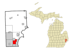
map_caption = Location of Roseville, Michigan
mapsize1 =
map_caption1 =
image_dot_
dot_mapsize =
dot_map_caption =
dot_x =
dot_y =
pushpin_
pushpin_label_position =
pushpin_map_caption =
pushpin_mapsize =
subdivision_type = Country
subdivision_name =United States
subdivision_type1 = State
subdivision_name1 =Michigan
subdivision_type2 = County
subdivision_name2 = Macomb
subdivision_type3 =
subdivision_name3 =
subdivision_type4 =
subdivision_name4 =
government_footnotes =
government_type =
leader_title =
leader_name =
leader_title1 =
leader_name1 =
leader_title2 =
leader_name2 =
leader_title3 =
leader_name3 =
leader_title4 =
leader_name4 =
established_title =
established_date =
established_title2 =
established_date2 =
established_title3 =
established_date3 =
area_magnitude =
unit_pref = Imperial
area_footnotes =
area_total_km2 = 25.5
area_land_km2 = 25.4
area_water_km2 = 0.0
area_total_dunam =
area_total_sq_mi = 9.8
area_land_sq_mi = 9.8
area_water_sq_mi = 0.0
area_water_percent =
area_urban_km2 =
area_urban_sq_mi =
area_metro_km2 =
area_metro_sq_mi =
area_blank1_title =
area_blank1_km2 =
area_blank1_sq_mi =
population_as_of = 2000
population_footnotes =
population_note =
population_total = 48129
population_density_km2 = 1894.1
population_density_sq_mi = 4905.6
population_metro =
population_density_metro_km2 =
population_density_metro_sq_mi =
population_urban =
population_density_urban_km2 =
population_density_urban_sq_mi =
population_blank1_title =
population_blank1 =
population_density_blank1_km2 =
population_density_blank1_sq_mi =
timezone = Eastern (EST)
utc_offset = -5
timezone_DST = EDT
utc_offset_DST = -4
latd = 42 |latm = 30 |lats = 12 |latNS = N
longd = 82 |longm = 56 |longs = 19 |longEW = W
elevation_footnotes =
elevation_m = 187
elevation_ft = 614
postal_code_type =ZIP code
postal_code = 48066
area_code = 586
twin1 =
twin1_country =
twin2 =
twin2_country =
twin3 =
twin3_country =
twin4 =
twin4_country =
twin5 =
twin5_country =
twin6 =
twin6_country =
twin7 =
twin7_country =
blank_name = FIPS code
blank_info = 26-69800GR|2
blank1_name = GNIS feature ID
blank1_info = 0636239GR|3
blank2_name =
blank2_info =
blank3_name =
blank3_info =
blank4_name =
blank4_info =
blank5_name =
blank5_info =
blank6_name =
blank6_info =
website = [http://www.roseville-mi.gov City of Roseville Official website]
footnotes =Roseville is a city in Macomb County in the
U.S. state ofMichigan , and is a part of theMetro Detroit area. As of the 2000 census, the city population was 48,129. Until 1958, Roseville was a part of Erin Township.Geography
According to the
United States Census Bureau , the city has a total area of 9.8square mile s (25.5km² ), of which, 9.8 square miles (25.4 km²) of it is land and 0.04 square miles (0.1 km²) of it (0.20%) is water.Main highways
Interstate highways
* runs north and south through the city.
* travels east and west through the middle of Roseville.Michigan State Trunklines
* and points north.
*.Unnumbered roads
*East-west travel is mainly on the mile roads, that is 10 Mile Road] on the south (East Pointe) border through 14 Mile Road on the north border. See
Mile Road System (Detroit) .
*Utica Road is an important diagonal connector that criss-crosses the city from southeast to northwest, starting at Gratiot Avenue (near Martin Road -- a/k/a 11 1/2 Mile Road) and heading toward Sterling Heights and Utica.Demographics
As of the
census GR|2 of 2000, there were 48,129 people, 19,976 households, and 12,724 families residing in the city. Thepopulation density was 4,905.6 per square mile (1,894.3/km²). There were 20,519 housing units at an average density of 2,091.4/sq mi (807.6/km²). The racial makeup of the city was 93.43% White, 2.60% African American, 0.42% Native American, 1.63% Asian, 0.03% Pacific Islander, 0.32% from other races, and 1.57% from two or more races. Hispanic or Latino of any race were 1.50% of the population.There were 19,976 households out of which 28.6% had children under the age of 18 living with them, 46.4% were married couples living together, 12.7% had a female householder with no husband present, and 36.3% were non-families. 30.8% of all households were made up of individuals and 12.6% had someone living alone who was 65 years of age or older. The average household size was 2.40 and the average family size was 3.02.
In the city the population was spread out with 23.1% under the age of 18, 8.2% from 18 to 24, 33.0% from 25 to 44, 20.2% from 45 to 64, and 15.4% who were 65 years of age or older. The median age was 36 years. For every 100 females there were 93.8 males. For every 100 females age 18 and over, there were 90.1 males.
The median income for a household in the city was $41,220, and the median income for a family was $49,244. Males had a median income of $40,113 versus $26,281 for females. The
per capita income for the city was $19,823. About 6.1% of families and 7.9% of the population were below thepoverty line , including 9.9% of those under age 18 and 5.8% of those age 65 or over.References
External links
* [http://www.roseville-mi.gov City of Roseville Official website]
* [http://www.rosevillelibrary.org Roseville Public Library]

Wikimedia Foundation. 2010.