- U.S. Route 31 in Michigan
Infobox road
state=MI
type=US
route=31
highway_name=U.S. Highway 31
maint=MDOT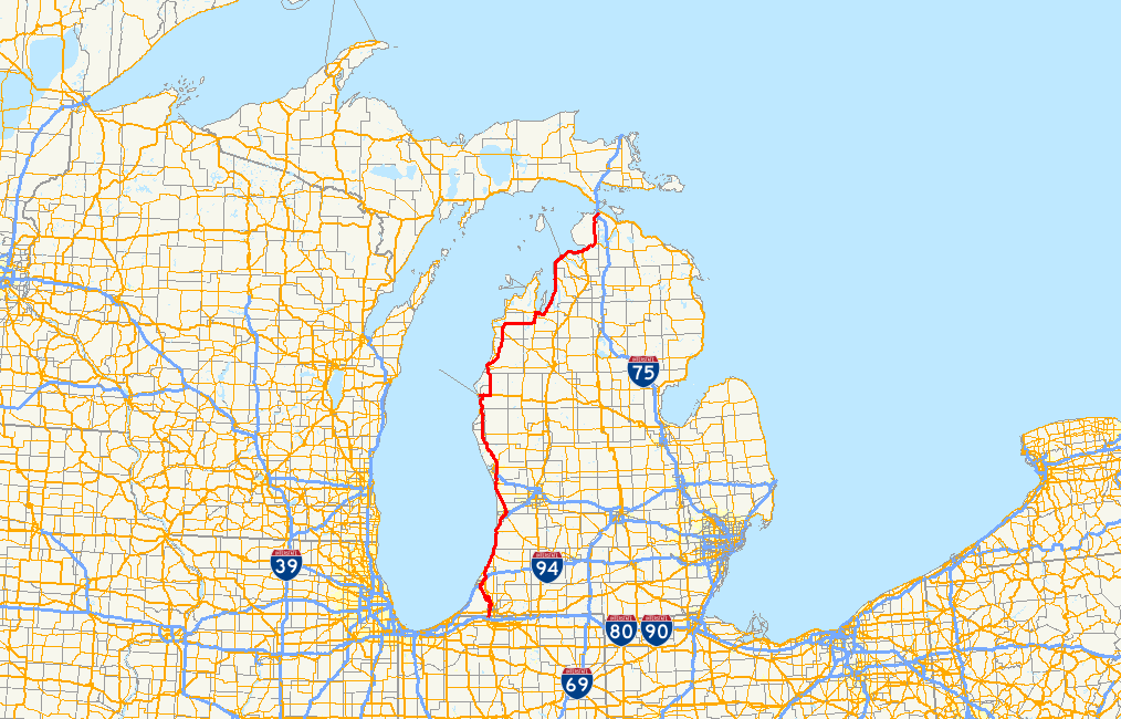
map_notes=US 31 highlighted in red
length_mi=356.04
length_round=2
length_ref=cite web | author= Bessert, Christopher J. | title= Michigan Highways: Highways 30 through 39 | date=2006-03-02 | work=Michigan Highways | url= http://www.michiganhighways.org/listings/MichHwys30-39.html#US-31 | accessdate=2006-03-02 ]
established=1926
direction_a=South
terminus_a=jct|state=IN|US|31 at theIndiana -Michigan border
junction=jct|state=MI|I|94 at Benton Harbor
jct|state=MI|I|96 at Muskegon
Jct|state=MI|US|10 in Ludington
jct|state=MI|US|131 at Petoskey
direction_b=North
terminus_b=jct|state=MI|I|75 near Mackinaw City
previous_type=MI
previous_route=30
next_type=MI
next_route=31
U.S. Highway 31 (US 31) is a state trunkline highway that is a part of the US Highway System in theU.S. state ofMichigan . It runs from theIndiana –Michigan state line south of Niles Charter Township to its terminus at Interstate 75 (I-75) south of Mackinaw City. The highway runs for convert|356.04|mi|km|2 in the state. At the introduction of the US Highway System in the 1920s the route of US 31 largely replaced the existing M-58 and M-11 route designations. It also crossed theStraits of Mackinac for a time before theMackinac Bridge was built.Route description
The northern terminus of US 31 is at I-75 south of Mackinaw City. In the 1920s and 30s, US 31 crossed the Straits of Mackinac via auto ferry and terminated at US 2 in Rogers Park north of St. Ignace. The former US 31/33, now M-51 South, enters the state of Michigan from Indiana in Niles Charter Township.
Lane configurations
The first part of the former US 31/33 is a four-lane freeway into the City of Niles where a marker is placed on the corner of Bertrand Road and what is now South 11th Street (aka M-51) in Niles Charter Township. The portion of US 31 concurrent with I-94 near Benton Harbor travels along a six-lane freeway, while the next 47 miles (44 of which are concurrent with I-196) from north of Benton Harbor to Holland a four-lane freeway. The 24 miles from Holland to Grand Haven runs along a mixture of four-lane divided highway and four-lane divided expressway. At Grand Haven, US 31 crosses the Grand River via a six-lane bascule bridge. The next 67 miles from Ferrysburg to Ludington travels along a four-lane freeway. From Ludington to its northern terminus south of Mackinaw City, US 31 consists largely of two-lane rural highway and four- to five-lane urban street segments. Two segments, however, have been constructed to two-lane limited-access standards: from Elk Rapids northerly and from Carp Lake to I-75.
History
Much of US-31 from the Indiana-Michigan state line and Ludington is built to freeway standards. Two notable exceptions are a short segment between Napier Ave and I-94 near Benton Harbor and between Holland and Ferrysburg. The portion of I-75 north of US 31's northern terminus toward the
Mackinac Bridge was designated US 31 prior to the 1990s and was US 31's most northern portion to be built to freeway status. Since its truncation at the I-75 junction, however, the most northern segment of US 31 freeway ends near Ludington.The Michigan Memorial Highway Act (Act 142 of 2001) designates all of US 31 from the Indiana border to the
Straits of Mackinac as the Blue Star Memorial Highway. [ [http://legislature.mi.gov/doc.aspx?mcl-250-1011 Section 250.1011] , Act 142 of 2001, Michigan Compiled Laws] [ [http://mdotwas1.mdot.state.mi.us/public/oga/listall.cfm All Memorial Highways] , Michigan Department of Transportation] "Act 71 of 1952" had previously designated all of US 31 in the Lower Peninsula and the portion of US 2 from St. Ignace to Sault Ste. Marie, although this was not included in the Act of 2001. Various portions of former routings of US 31 throughout southwest and west Michigan are still called "Blue Star Highway".Future
According to the recently passed Federal Transportation Bill an earmark was provided to begin planning and right of way purchases for a new route of the highway along the 120th ave corridor in Ottawa County, between Holland and Nunica. Due to tight transportation budgets at the state level, the Michigan Department of Transportation will begin construction on this project using a staged approach. The first phase in Ottawa County, designated Future M-231, will consist of a two-lane highway constructed on four-lane right-of-way for future conversion to freeway standards from M-45 (Lake Michigan Dr) to I-96 at Nunica. This segment will include a new crossing over the Grand River. MDOT is currently working on environmental clearances for this project with right-of-way acquisition to begin thereafter. Any work on the proposed US 31 freeway corridor south of M-45 (Lake Michigan Dr) has not yet been scheduled.
Major intersections
MIexit
county=Berrien
cspan=15
location=Niles Charter Township
lspan=4
mile=0.000
road=jct|state=IN|US|31
notes=Southern entry into Michigan from IndianaMIexit
mile=
exit=3
road=jct|state=MI|US|12|city1=Niles|city2=Sturgis|city3=New Buffalo
notes=MIexit
mile=
exit=5
road=Niles–Buchanan Road — Buchanan
notes=MIexit
mile=
exit=7
road=Walton Road — Buchanan
notes=Former BUS US 31MIexit
location=Oronoko Charter Township
lspan=2
mile=
exit=13
road=Snow Road — Berrien Springs
notes=MIexit
mile=
exit=15
road=jct|state=MI|M|139|road=Old 31|city1=Benton Harbor|city2=St. Joseph|city3=Berrien Springs
notes=Signed as exits 15A (Old 31) and 15B (M-139) northboundMIexit
location=Berrien Township
mile=
exit=18
road=Tabor Road — Eau Claire
notes=MIexit
location=Sodus Township
mile=
exit=22
road=Pipestone Road — Eau Claire
notes=MIexit
location=Royalton Township
mile=
exit=24
road=Napier Avenue
notes=Temporary north end of freewayMIexit
location=Benton Harbor
lspan=3
mile=
type=concur
exit=30
road=jct|state=MI|I|94|dir1=North|city1=Kalamazoo
notes=South end of I-94 concurrencyMIexit
mile=
exit=33
road=jct|state=MI|BL|94|dab1=Benton Harbor-St. Joseph|city1=St. Joseph
notes=MIexit
mile=
exit=34
type=concur
road=jct|state=MI|I|94|dir1=East|city1=Kalamazoo
jct|state=MI|I|196|dir1=North|city1=Grand Rapids
notes=North end of I-94 concurrency; South end of I-196 concurrencyMIexit
location=x
lspan=3
mile=
exit=1
road= Red Arrow Highway
notes=MIexit
mile=
exit=4
road=Coloma Road — Coloma
notes=MIexit
mile=
exit=7
road=jct|state=MI|M|63|dir1=South
notes=Northern terminus of M-63MIexit
county=Van Buren
cspan=4
location=Covert Township
mile=
exit=13
road=jct|state=MI|CR|A-2|county1=Van Buren|name1=Blue Star Highway|road=32nd Avenue
notes=MIexit
location=South Haven Charter Township
mile=
exit=18
road=jct|state=MI|BL|196|M|140|dab1=South Haven|city1=South Haven|city2=Watervliet
notes=Signed as M-140 only southboundMIexit
location=South Haven
lspan=3
mile=
exit=
type=noaccess
road=jct|state=MI|M|43
notes=Access from M-140MIexit
mile=
exit=20
road=jct|state=MI|BL|196|dab1=South Haven|city1=South Haven|road=Phoenix Street— South Haven
notes=Signed as Phoenix Street northboundMIexit
county=Allegan
cspan=10
mile=
exit=22
road=North Shore Drive — South Haven
notes=MIexit
location=a
lspan=8
mile=
exit=26
road=109th Avenue
notes=MIexit
mile=
exit=30
road=jct|state=MI|CR|A-2|county1=Allegan|name1=Blue Star Highway
notes=MIexit
mile=
exit=34
road=jct|state=MI|M|89|dir1=East|city1=Allegan
notes=MIexit
mile=
exit=36
road=jct|state=MI|CR|A-2|county1=Allegan|name1=Blue Star Highway
notes=MIexit
mile=
exit=41
road=jct|state=MI|CR|A-2|county1=Allegan|name1=Blue Star Highway
notes=MIexit
mile=
exit=44
type=concur
road=jct|state=MI|I|196|BL|196|dir1=North|name1=Ford Freeway|city1=Grand Rapids|dab2=Holland|city2=Holland
notes=North end of I-196 concurrency; south end of BL I-196 concurrency; northbound exit and southbound entranceMIexit
mile=
exit=47A
road=jct|state=MI|CR|A-2|dir1=South|county1=Allegan|name1=Blue Star Highway
notes=MIexit
exit=47B
road=Washington Avenue — Holland
notes=Former BUS US 31MIexit
location=Holland
mile=
road=jct|state=MI|M|40|dir1=South|city1=Allegan
notes=MIexit
county=Ottawa
cspan=5
location=Zeeland
mile=
type=concur
road=jct|state=MI|BL|196|dab1=Holland|name1=Chicago Drive
notes=MIexit
location=Agnew
mile=
road=jct|state=MI|M|45|dir1=East|name=Lake Michigan Drive
notes=
-
colspan="5" |
Freeway Begins
-MIexit
location=Ferrysburg
lspan=2
mile=
exit=
road=jct|state=MI|M|104|dir1=East|city1=Spring Lake
notes=MIexit
mile=
exit=
road= Van Wagoner Street — Ferrysburg
notes=MIexit
county=Muskegon
cspan=12
location=Fruitport
lspan=2
mile=
exit=
road=Pontaluna Road — Fruitport
notes=MIexit
mile=
exit=
road=Sternberg Road — Fruitport
notes=MIexit
location=Norton Shores
lspan=2
mile=
exit=
road=
jct|state=MI|I|96|US-Bus|31|dab2=Muskegon|city1=Grand Rapids|city2=Muskegon|dir1=East|dir2=North
notes=Western terminus of I-96; Southern terminus of BUS US 31MIexit
mile=
exit=
road=Sherman Boulevard — Muskegon
notes=MIexit
location=Muskegon Charter Township
mile=
exit=
road=Laketon Avenue — Muskegon
notes=MIexit
location=Muskegon
mile=
exit=
road=jct|state=MI|M|46|city1=Muskegon|city2=Cedar Springs
notes=MIexit
location=Muskegon Township
mile=
exit=
road=
jct|state=MI|US-Bus|31|dab1=Muskegon|city1=Muskegon
notes=MIexit
location=North Muskegon
mile=
exit=
road=jct|state=MI|M|120|city1=Muskegon|city2=Twin Lake
notes=MIexit
location=Dalton Township
lspan=2
mile=
exit=
road=jct|state=MI|CR|B-23|county1=Muskegon|dir1=North|city1=Lakewood Club
notes=MIexit
location=
mile=
exit=
road=White Lake Drive — Lakewood Club
notes=MIexit
location=Whitehall
mile=
exit=
road=
jct|state=MI|US-Bus|31|dab1=Whitehall|dir1=North|city1=Whitehall
notes=Southern terminus of BUS US 31MIexit
location=Montague
mile=
exit=
road=
jct|state=MI|US-Bus|31|dab1=Whitehall|dir1=South|city1=Montague
notes=Northern terminus of BUS US 31MIexit
county=Oceana
cspan=6
location=Rothbury
mile=
exit=
road=Winston Road — Rothbury
notes=MIexit
location=New Era
mile=
exit=
road=jct|state=MI|M|20|dir1=East|city1=White Cloud
notes=Western terminus of M-20MIexit
location=Shelby Township
mile=
exit=
road=Shelby Road — Shelby
notes=MIexit
location=Hart
mile=
exit=
road=
jct|state=MI|US-Bus|31|dab1=Hart|city1=Hart
notes=Southern terminus of BUS US 31MIexit
location=Pentwater
lspan=2
mile=
exit=
road=
jct|state=MI|US-Bus|31|dab1=Pentwater|city1=Pentwater|dir1=North
notes=Southern terminus of BUS US 31; Signed as Monroe Road southboundMIexit
mile=
exit=
road=
jct|state=MI|US-Bus|31|dab1=Pentwater|city1=Pentwater|dir1=South
notes=Northern terminus of BUS US 31; Signed as Oceana Drive northboundMIexit
county=Mason
cspan=4
location=Ludington
lspan=3
mile=
exit=
road=
jct|state=MI|US-Bus|31|dab1=Ludington|dir1=North|city1=Ludington
notes=MIexit
mile=
exit=
type=concur
road=jct|state=MI|US|10|dab2=Ludington|city2=Ludington|dir1=West|dir2=South
notes=North end of freeway; West end of US 10 concurrency
-
colspan=4 |
Freeway ends
-MIexit
location=Scottville
mile=
type=concur
road=jct|state=MI|US|10|city1=Reed City|dir1=East
notes=East end of US 10 concurrencyMIexit
county=Manistee
cspan=2
location=Manistee
mile=
road=jct|state=MI|M|55|dir1=East|city1=Cadillac
notes=MIexit
location=Manistee Township
road=jct|state=MI|M|22|dir1=North|city1=Frankfort
notes=MIexit
county=Benzie
cspan=2
location=Benzonia Township
mile=
type=concur
road=jct|state=MI|M|115|dir1=East|city1=Cadillac
notes=South end of M-115 concurrencyMIexit
location=Benzonia
mile=
type=concur
road=jct|state=MI|M|115|dir1=West|city1=Frankfort
notes=North end of M-115 concurrencyMIexit
county=Grand Traverse
cspan=5
location=Interlochen
mile=
road=jct|state=MI|M|137|dir1=South
notes=MIexit
location=Chums Corners
mile=
type=concur
road=jct|state=MI|M|37|dir1=South
notes=South end of M-37 concurrencyMIexit
location=Traverse City
lspan=2
mile=
type=concur
road=jct|state=MI|M|22|M|72|dir1=North|dir2=West
street=Grandview Parkway
notes=West end of M-72 concurrencyMIexit
mile=
type=concur
road=jct|state=MI|M|37|dir1=North
street=Garfield Avenue
notes=North end of M-37 concurrencyMIexit
location=Acme
mile=
type=concur
road=jct|state=MI|M|72|dir1=East
notes=East end of M-72 concurrencyMIexit
county=Antrim
cspan=2
location_special=Torch Lake Township
mile=
road=jct|state=MI|M|88|dir1=East
notes=Western terminus of M-88MIexit
location=Banks Township
mile=
road=jct|state=MI|CR|C-48|county1=Antrim|dir1=East
notes=MIexit
county=Charlevoix
cspan=2
location=Charlevoix
mile=
road=jct|state=MI|M|66|dir1=South
notes=Northern terminus of M-66MIexit
location=Hayes Township
mile=
road=jct|state=MI|CR|C-56|county1=Charlevoix|dir1=East
notes=MIexit
county=Emmet
cspan=8
location=Petoskey
lspan=3
mile=
road=jct|state=MI|US|131|dir1=South
notes=Northern terminus of US 131MIexit
mile=
road=jct|state=MI|CR|C-71|county1=Emmet|dir1=South
notes=MIexit
mile=
road=jct|state=MI|CR|C-58|county1=Emmet|dir1=East
notes=MIexit
location=Bay View
mile=
road=jct|state=MI|M|119|dir1=North
notes=MIexit
location=Alanson
mile=
road=jct|state=MI|M|68|dir1=East
notes=MIexit
location=Pellston
mile=
road=jct|state=MI|CR|C-64|county1=Emmet|dir1=East
notes=MIexit
location_special=McKinley Township
mile=
road=jct|state=MI|CR|C-66|county1=Emmet
notes=MIexit
location=Wawatam Township
mile=
road=jct|state=MI|I|75
notes=Northern terminus of US 31; Access to northbound I-75 only from northbound US 31; Access to southbound US 31 only from southbound I-75Bannered routes
* "
Bannered routes of U.S. Route 31 "References
External links
* [http://www.michiganhighways.org/listings/MichHwys30-39.html#US-031 US 31 Route Listing] at Michigan Highways
* [http://www.state-ends.com/michigan/us31/ Michigan US 31 endpoints]
* [http://www.state-ends.com/michigan/m/m-51.htm former US 31 southern Michigan terminus (now M-51)]
* [http://www.geocities.com/usend3039/End031/end031.htm US 31 endpoint photos]
* [http://www.mdot.state.mi.us/oga/listall.cfm MDOT list of Memorial Highways in Michigan]
* [http://www.taxpayer.net/road2ruin/roads/us31michigan.htm U.S. Route 31: One of the Most Wasteful Road Projects in America]
* [http://www.bluestarhighway.com Destinations along Blue Star Highway in Michigan]
Wikimedia Foundation. 2010.