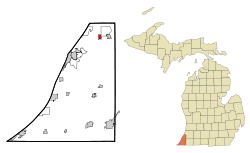
- Coloma, Michigan
-
Coloma, Michigan — City — Location of Coloma, Michigan Coordinates: 42°11′12″N 86°18′28″W / 42.18667°N 86.30778°W Country United States State Michigan County Berrien Area – Total 0.9 sq mi (2.3 km2) – Land 0.9 sq mi (2.3 km2) – Water 0.0 sq mi (0.0 km2) Elevation 669 ft (204 m) Population (2000) – Total 1,595 – Density 1,766.9/sq mi (682.2/km2) Time zone Eastern (EST) (UTC-5) – Summer (DST) EDT (UTC-4) ZIP codes 49038-49039 Area code(s) 269 FIPS code 26-17320[1] GNIS feature ID 0623623[2] Website www.cityofcoloma.org Coloma is a city in Berrien County in the U.S. state of Michigan. The population was 1,595 at the 2000 census.
Contents
Geography
According to the United States Census Bureau, the city has a total area of 0.9 square miles (2.3 km2), all land.
Rich farmland in the area made temperate by Lake Michigan is called the Fruit Belt, and Coloma is located in the Lake Michigan Shore American Viticultural Area.
Coloma is near the former resort area of Paw Paw Lake.
Demographics
As of the census[1] of 2000, there were 1,595 people, 626 households, and 446 families residing in the city. The population density was 1,766.9 per square mile (684.3/km²). There were 675 housing units at an average density of 747.7 per square mile (289.6/km²). The racial makeup of the city was 96.61% White, 1.13% African American, 0.38% Native American, 0.31% Asian, 0.25% from other races, and 1.32% from two or more races. Hispanic or Latino of any race were 1.32% of the population.
There were 626 households out of which 35.3% had children under the age of 18 living with them, 54.2% were married couples living together, 13.7% had a female householder with no husband present, and 28.6% were non-families. 24.8% of all households were made up of individuals and 12.9% had someone living alone who was 65 years of age or older. The average household size was 2.55 and the average family size was 3.03.
In the city the population was spread out with 28.2% under the age of 18, 6.0% from 18 to 24, 29.0% from 25 to 44, 22.7% from 45 to 64, and 14.1% who were 65 years of age or older. The median age was 37 years. For every 100 females there were 89.2 males. For every 100 females age 18 and over, there were 83.2 males.
The median income for a household in the city was $38,882, and the median income for a family was $46,042. Males had a median income of $36,681 versus $21,397 for females. The per capita income for the city was $17,714. About 5.9% of families and 8.9% of the population were below the poverty line, including 7.2% of those under age 18 and 8.6% of those age 65 or over.
Major highways
Coordinates: 42°11′10″N 86°18′30″W / 42.18611°N 86.30833°W
Local events
The Glad-Peach Festival is held here each August.
References
- ^ a b "American FactFinder". United States Census Bureau. http://factfinder.census.gov. Retrieved 2008-01-31.
- ^ "US Board on Geographic Names". United States Geological Survey. 2007-10-25. http://geonames.usgs.gov. Retrieved 2008-01-31.
External links
Municipalities and communities of Berrien County, Michigan Cities Benton Harbor | Bridgman | Buchanan | Coloma | New Buffalo | Niles‡ | St. Joseph | Watervliet
Villages Baroda | Berrien Springs | Eau Claire | Galien | Grand Beach | Michiana | Shoreham | Stevensville | Three Oaks
Charter
townshipsBenton | Coloma | Lake | Lincoln | Niles | Oronoko | St. Joseph | Watervliet
General law
townshipsBainbridge | Baroda | Berrien | Bertrand | Buchanan | Chikaming | Galien | Hagar | New Buffalo | Pipestone | Royalton | Sodus | Three Oaks | Weesaw
Unincorporated
communitiesBenton Heights | Berrien Center | Dayton | Fair Plain | Glendora | Harbert | Lake Michigan Beach | Lakeside | Millburg | New Troy | Paw Paw Lake | Riverside | Sawyer | Scottdale | Shorewood Hills | Union Pier
Footnotes ‡This populated place also has portions in an adjacent county or counties
Categories:- Populated places in Berrien County, Michigan
- Cities in Michigan
Wikimedia Foundation. 2010.


