- M-10 (Michigan highway)
-
This article describes a Michigan state trunkline highway numbered M-10. For the U.S. Highway, see U.S. Route 10 in Michigan; for other uses, see M10 (disambiguation)
M-10
John C. Lodge Freeway, Northwestern Highway 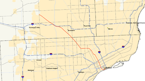
Route information Maintained by MDOT Length: 22.881 mi[1] (36.823 km) Existed: 1986 – present Major junctions South end: 
 M-3 / BS I-375 in Downtown Detroit
 I-75 in Downtown Detroit
 I-94 in Detroit
 M-8 near Highland Park
 M-39 in Southfield
 I-696 in Southfield
North end: Orchard Lake Road in West Bloomfield Location Counties: Wayne & Oakland Highway system Michigan State Trunkline Highway System
Interstate • US • State←  US 10
US 10M-11  →
→← M-3
M-5  →
→M-10, (also The Lodge, John C. Lodge Freeway, and Northwestern Highway) is a state trunkline route in the US state of Michigan. The southernmost portion follows Jefferson Avenue in downtown Detroit, and the southern terminus is at the intersection of Jefferson and Randolph Street leading to the entrance to the Detroit–Windsor Tunnel. The northern terminus is in West Bloomfield at the intersection with Orchard Lake Road. M-10 was built in segments throughout much of the 1950s and 1960s. It carried several different names before the entire route was finally officially named The John C. Lodge Freeway in 1987.[2] M-10 was named after John C. Lodge, an influential Detroiter and mayor of Detroit from 1927-1928.
Contents
Route description

This freeway, almost always referred to as "the Lodge" rather than by route number or full name runs northwesterly from downtown Detroit to the Oakland County suburbs. The freeway portion of M-10 ends at "The Mixing Bowl", the local name for the sprawling interchange of I-696, US 24/Telegraph Road, the Lodge, Northwestern Highway, Lahser Road and Franklin Road in Southfield. Beyond this interchange, M-10 continues for several miles as a four to six-lane divided highway.
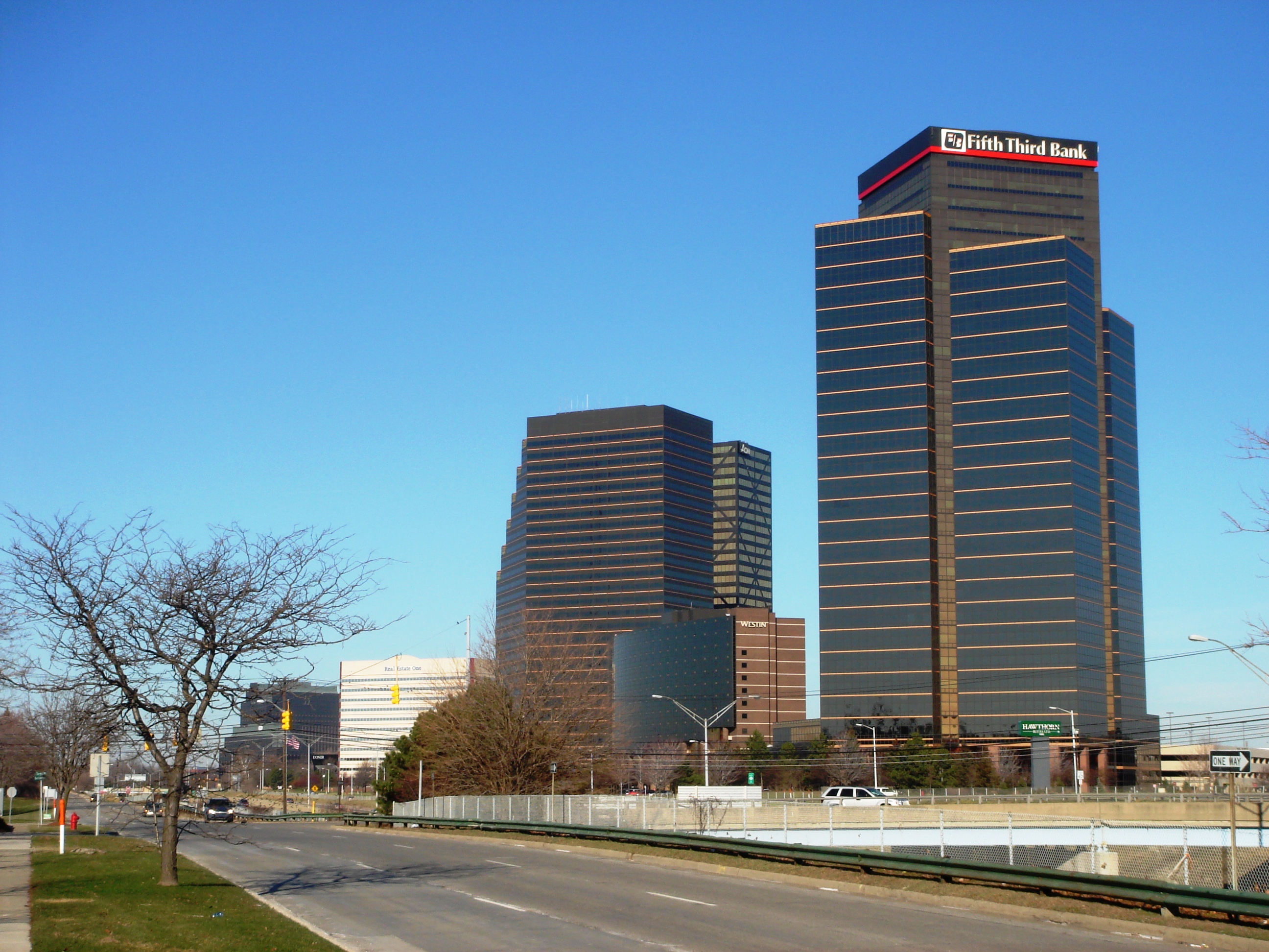
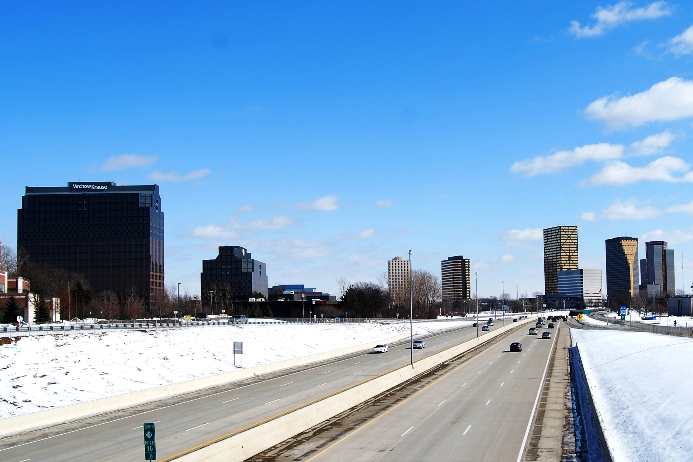
The portion of M-10 from "The Mixing Bowl" until its terminus with Orchard Lake Rd and Fourteen Mile Rd is known as Northwestern Highway. It was designed as a scenic divided four to six-lane sloping highway with a wide tree lined center median. Travelling Southbound down the hills gives a scenic view of distant downtown Detroit contrasted with the surrounding woodland area. Unfortunately, the build up of office and medical buildings on Northwestern has lessened the experience over the years.
History
Previous incarnations of M-10
Prior to its use as a designation for 'The Lodge Freeway' the M-10 designation was used twice before since Michigan first posted its highway designations in 1918. All incarnations of M-10 also had parts designated as US 10 at one time.
The first iteration of M-10 utilized the present-day segments of these following highways; US 24, M-13, US 23 and M-33 (former alignment of US 23). It also coincided with the Dixie Highway (east branch) and the Theodore Roosevelt International Highway for much of its length.
The second iteration of M-10 was, technically, the much-reduced remnant of the original, first iteration of the route in the Flint area, serving as a business connection for the city as the through route, US 10, bypassed it on the east. It was later re-designated as BUS US 10, then as BUS M-54 in the 1960s before being turned back to local control in the 1980s.
Planning
During the 1950s, this highway was proposed to be extended as far as the Fenton-Clio Expressway (US 23) at Fenton,[3] but was cancelled when I-75 was, instead, routed between Detroit and Flint via Pontiac.
Construction
The Lodge was originally made up of three legs with unique names: the 'John C. Lodge' ran from Jefferson Avenue in downtown Detroit to Wyoming Avenue; the 'James Couzens' ran from Wyoming to M-102/8 Mile Road; and the portion north of 8 Mile was named 'Northwestern Highway'. Since then the freeway itself has become known as 'The Lodge' along its complete length and only the service drives running alongside the freeway have retained their original names.[citation needed]
The intersection with the Edsel Ford Freeway, next to Wayne State University was built in 1953 and was the first full freeway-to-freeway interchange built in the United States.[4] Originally constructed and opened without any state trunkline route designation until it was assigned as a part of US 12 in the 1950s.
The section from the Edsel Ford Freeway (now I-94) into downtown Detroit was designated as US12. Then it was assigned as Business Spur I-696 in 1961 or 1962 immediately before the completion of the first phase of I-696 in 1964.[5] It was signed as a business spur of I-696 as a way to circumvent the elements it had that rendered it substandard to the Interstate Highway System. Soon after, though, the Lodge became part of US 10 when that route was removed from Woodward Avenue.
An extension to the Northwestern Highway was again proposed in the late 1960s to connect with the proposed I-275 extension. The I-275 project was then cancelled in the late-1970s and the Northwestern extension was ostensibly cancelled as well, although a dispute between the Road Commission for Oakland County and the Michigan Department of Transportation lasted through the 1990s. Due to the continuing development of the land along the proposed right-of-way (including a strip mall right at the current terminus of M-10), the Northwestern extension is unlikely to ever be built as planned.
US 10 was truncated at Bay City in 1986, and the Lodge was redesignated as M-10. The non-freeway Northwestern Highway, until then designated M-4, was also renumbered as M-10 shortly after in 1987. The southernmost portion of the Lodge Freeway was also redesignated as a portion of BS I-375 on paper from I-75 south. When the US 10 shields were removed, they were universally replaced with M-10 shields instead of BS I-375 shields.[6]
With the Michigan Department of Transportation's deemphasization of proper names historically used by Metro Detroiters for the area's Interstates, the Lodge is now one of only three in the Detroit area universally referred to by name rather than route number — the others being the Davison Freeway (M-8) and the Southfield Freeway (M-39).[citation needed]
Recent developments
From 2006 to 2007, the Lodge underwent major reconstruction to ease traffic congestion in the metro area temporarily closing down much of the freeway.[7] The $133-million project (equivalent to $141 million today[8]) included concrete pavement reconstruction and rehabilitation, new barrier walls, repairs or replacements to 50 bridges, upgrades to 22 ramps, utility upgrades, and replacement of freeway signs between Lahser Road in Southfield and Jefferson Avenue in Detroit.[9]
Previous designations along M-10
M-4 was the original designation of M-10/Northwestern Highway from I-696/US 24 to the northern terminus. M-4 was known as Northwestern Highway — back when M-10 was known as US 10 (Lodge Freeway), M-4 extended northwest past where US 10 and US 24 (Telegraph Road) intersected. When US 10 was changed to M-10, the M-4 section became part of M-10.
The Lodge was signed as Business Spur I-696 in 1961 or 1962 immediately before the completion of the first phase of I-696 in 1964.[5] It was signed as a business spur of I-696 as a way to circumvent the elements it had that rendered it substandard to the Interstate Highway System.
Exit list
County Location Mile[1] Exit Destinations Notes Wayne Detroit 0.000 M-3 north (Randolph Street)
BS I-375 northJefferson Avenue continues east as BS I-375; Detroit-Windsor Tunnel 0.590 1A Jefferson Avenue – Joe Louis Arena Joe Louis Parking Center & Riverfront Apartments; freeway begins 0.722 1B Larned Street – Cobo Center Left exit; southbound exit only 1.131 1C Howard Street – Cobo Roof Southbound exit and northbound entrance 1.533 2B Bagley Avenue Left exit; southbound exit only 1.775 2A I-75 (Fisher Freeway) – Flint, ToledoExit 49 on I-75 2.052 2C Grand River Avenue Southbound exit and northbound entrance 2.919 3 Forest Avenue, Warren Avenue 3.127 4 I-94 (Ford Freeway) – Port Huron, ChicagoSigned as exits 4A (east) and 4B (west); left exit southbound (4A); left exit northbound (4B) 3.737 4C Milwaukee Avenue, West Grand Boulevard 4.332 5A Pallister Avenue Southbound exit and northbound entrance 4.751 5B Clairmount Avenue Northbound exit and southbound entrance 5.391 5C Hamilton Avenue, Chicago Boulevard 5.652 6A Webb Avenue Northbound exit and northbound, southbound entrances 6.051 6B Elmhurst Avenue Southbound exit only 6.194 7A Glendale Avenue Northbound exit and southbound entrance Highland Park 6.406–
6.7777 M-8 (Davison Freeway, Davison Avenue)Signed as exits 7B (east) and 7C (west) northbound and 7B (east) southbound Detroit 7.453 8 Linwood Avenue 8.107 9 Livernois Avenue 9.146 10 Wyoming Avenue 9.868 11 Meyers Road, McNichols Road Northbound exit and southbound entrance 11.337 12 7 Mile Road Wayne–Oakland Detroit–Southfield 12.872 13  M-102 (8 Mile Road) / Greenfield Avenue
8 Mile Road is the county line Oakland Southfield 13.817 14 9 Mile Road – Northland Center No southbound entrance; signed as exits 14A and 14B 14.310 14C M-39 south (Southfield Freeway)
Southfield Road (north)Exit 15 on M-39; signed as Southfield Road northbound only 15.629 15 Evergreen Road, 10 Mile Road 16.787 16 Lahser Road 17.538 17 I-696 east (Reuther Freeway) – Port HuronExit 10 on I-696; left exit; southbound exit only 18.194 18  US 24 (Telegraph Road) – Dearborn, Pontiac
Signed as exits 18A (north) and 18B (south); M-10 is located in the median of I-696 18.562 18C I-696 west (Reuther Freeway) – LansingExit 8 on I-696; left exit; northbound exit only; freeway ends West Bloomfield Township 22.881 Orchard Lake Road 1.000 mi = 1.609 km; 1.000 km = 0.621 mi
Concurrency terminus • Closed/Former • Incomplete access • UnopenedReferences
- ^ a b "MDOT Physical Reference Finder Application". Michigan Department of Transportation. 2009. http://www.mcgi.state.mi.us/prfinder/. Retrieved March 23, 2010.
- ^ Baulch, Bridget. "History of the Lodge Freeway". The Detroit News (The Detroit News). http://www.detnews.com/apps/pbcs.dll/article?AID=/20070127/METRO05/701270389. Retrieved January 27, 2007.
- ^ Greenwood, Tom (January 28, 1999). "M-5 'Haggerty Connector' work to be done by 2001". Detroit News.
- ^ "Final List of Nationally and Exceptionally Significant Features of the Federal Interstate Highway System". Federal Highway Administration. November 1, 2006. http://www.environment.fhwa.dot.gov/histpres/highways_list.asp. Retrieved February 27, 2007.
- ^ a b Bessert, Christopher J. (January 2, 2007). "Michigan Highways: Master List 1918-Present". Michigan Highways. http://www.michiganhighways.org/master_list.html#routes230-696. Retrieved April 3, 2007.
- ^ Bessert, Christopher J. (October 22, 2006). "Michigan Highways: Business Connections 96 through 496". Michigan Highways. http://www.michiganhighways.org/listings/MichHwysBus96-496.html#I-375BS. Retrieved March 29, 2007.
- ^ "Dodge the Lodge II". Michigan Department of Transportation. January 23, 2007. Archived from the original on March 12, 2007. http://web.archive.org/web/20070312025350/http://www.michigan.gov/mdot/0,1607,7-151-9621_11008_44528---,00.html. Retrieved March 21, 2007.
- ^ Consumer Price Index (estimate) 1800–2008. Federal Reserve Bank of Minneapolis. Retrieved December 7, 2010.
- ^ "Massive Lodge Project Proceeds". Associated Construction Publications. June 17, 2007. http://www.acppubs.com/article/CA6451824.html.
External links
- M-10 at Michigan Highways
- M-10 at Michigan Highway Ends
- M-10 Photo Tour at GribbleNation.net
- Road Commission of Oakland County
Freeways in metropolitan Detroit  Categories:
- State highways in Michigan
- Freeways and expressways in Michigan
- U.S. Route 10


Wikimedia Foundation. 2010.