- M-39 (Michigan highway)
-
This article is about the state highway in Michigan; for other uses, see M39 (disambiguation)
M-39
Southfield Road, Southfield Freeway 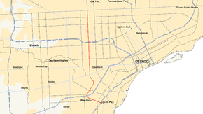
Route information Maintained by MDOT Length: 16.72 mi[1] (26.91 km) Existed: 1959 – present Major junctions South end: Lafayette Boulevard in Lincoln Park  I-75 in Lincoln Park
 I-94 in Allen Park
 US 12 in Dearborn
 I-96 in Detroit
 M-102 on the Detroit–Southfield border
North end:  M-10 in Southfield
Location Counties: Wayne, Oakland Highway system Michigan State Trunkline Highway System
Interstate • US • State←  M-38
M-38M-40  →
→M-39 is a state highway in the US state of Michigan that runs from Lincoln Park to Southfield. The southern terminus of M-39 is at the corner of Southfield Road and Lafayette Boulevard in Lincoln Park, one block southeast of the junction of I-75 (Fisher Freeway) and two blocks northwest of M-85 (Fort Street). The northern terminus is at M-10 (Lodge Freeway) in Southfield.
Contents
Route description
M-39 begins at Lafayette Boulevard a block east of its junction with I-75 in Lincoln Park. From there the road is divided highway as it passes under I-75 and continues to the northwest. In Allen Park the road turns to the northeast and beyond the junction with I-94 turns into a limited-access freeway and winds its way through Dearborn. Near Greenfield Village the road curves to the northwest around the Ford Proving Grounds before turning to the north, a direction it will maintain until the end of its run.
After the proving grounds, M-39 has a cloverleaf interchange with US 12 just to the southeast of the Fairlane Town Center, quickly after another interchange with M-153, also known as Ford Road. From there the road continues through the densely populated areas of Detroit. During this time, the road usually has a service drive where the entrances and exits are located. The road continues traveling to the north where it has a stack interchange with I-96 (Jeffries Freeway) and then another interchange with M-5 (Grand River Ave.). The road then enters the Southfield area where it has an interchange with M-102 (8 Mile Road) and then terminates at an interchange with M-10 (John C. Lodge Freeway).
History
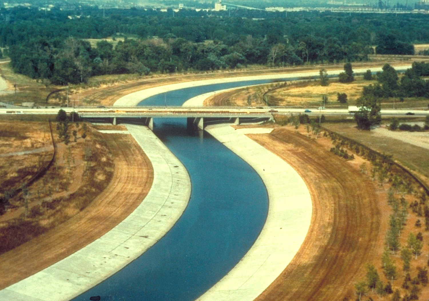
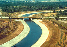 M-39 bridge over the River Rouge in Dearborn
Previously assigned to Schaefer Highway from the intersection of Dix Highway (former US 25) in Melvindale to the intersection of Grand River Avenue (former US 16) in Detroit, M-39 was reassigned to Southfield Road, connecting Fort Street with Northwestern Highway in 1959.
In the 1960s, the length of Southfield Road from I-94 to Northwestern was rebuilt as the Southfield Freeway, with the service drive retaining the Southfield Road name. The southern portion of M-39 was improved as Southfield Highway. From 1966 to 1969, while I-75 (Chrysler and Fisher Freeways) was still being constructed through Detroit, M-39 also bore a "TO I-75" designation from its junction with I-75 in Lincoln Park to M-102/8 Mile Road.
In the 1990s, the M-39 designation was truncated slightly, as Lincoln Park officials sought to make modifications along Southfield Highway that were not up to MDOT's standards. As a result, M-39 no longer officially connects to M-85. Southfield Road continues southeasterly, ending at West Jefferson Avenue along the Detroit River.
Beyond M-39's northern terminus, just north of 9 Mile Road in Southfield, Southfield Road continues northward as a local road, intersecting with I-696 (at 11 Mile Road) and ending at Maple (15 Mile) Road in Birmingham.
The freeway portion is virtually always referred to by locals as the Southfield Freeway, or "the Southfield", rather than by route number. Since 2000, the freeway has undergone a complete overhaul, easing traffic congestion in the metropolitan area.[1]
In 2011, the stretch of M-39 between the Grand River Ave/5 Mile exit north to the interchange with M-10 was closed for resurfacing and bridge replacement. MDOT re-opened this stretch in October 2011.[2][3]
Exit list
County Location Mile Exit Destinations Notes Wayne Lincoln Park 0.000 I-75 – Detroit, ToledoSouthern terminus at exit 41 on I-75 Allen Park 1 I-94 / Van Born Road – Detroit, ChicagoFreeway begins at exit 204 on I-94 Dearborn 3 Outer Drive, Van Born Road 4 Oakwood Boulevard – Melvindale, The Henry Ford 5 Rotunda Drive 6 US 12 (Michigan Avenue)Access to U of M-Dearborn, Henry Ford CC,
and Fairlane Town Center7  M-153 (Ford Road) – Garden City
Access to Fairlane Town Center Detroit 8 Warren Avenue – Downtown Dearborn Heights 9 Joy Road – Livonia 10 Plymouth Road, Schoolcraft Avenue Signed as exit 11B southbound 11 I-96 – Lansing, Downtown DetroitSigned as exit 11A southbound 12  M-5 (Grand River Avenue) / Fenkell Avenue
13 6 Mile Road – Livonia 14 7 Mile Road – Livonia Wayne–Oakland Detroit–Southfield 15 M-102 (8 Mile Road)8 Mile Road is the county line Oakland Southfield  M-10 (Lodge Freeway) to I-696 west – Lansing
Signed as exit 16 southbound; exit 14 on M-10 1.000 mi = 1.609 km; 1.000 km = 0.621 mi References
- ^ a b Bessert, Christopher J. "Michigan Highways: Highways 30 through 39." Michigan Highways. 23 Apr 2006. 25 Jul 2006 [1].
- ^ http://www.michigan.gov/mdot/0,1607,7-151-9621_11008_57471---,00.html
- ^ http://www.michigan.gov/mdot/0,1607,7-151-9621_11008_57471-255834--,00.html
External links
Freeways in metropolitan Detroit  Categories:
- Freeways and expressways in Michigan
- State highways in Michigan


Wikimedia Foundation. 2010.