- M-38 (Michigan highway)
-
This article is about the state highway in Michigan; for other uses, see M38 (disambiguation)
M-38
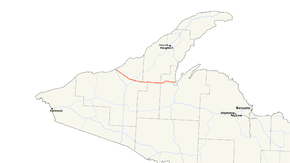
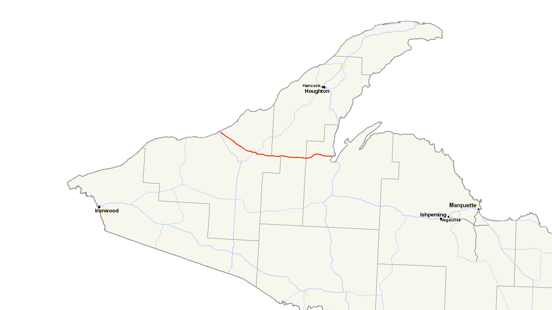
M-38 highlighted in redRoute information Maintained by MDOT Length: 42.225 mi[3] (67.95 km) Existed: 1968[1][2] – present Tourist
routes:Lake Superior Circle Tour Major junctions West end: 
 US 45 / M-64 in Ontonagon
 M-26 in Greenland
East end:  US 41 in Baraga
Location Counties: Ontonagon, Houghton, Baraga Highway system Michigan State Trunkline Highway System
Interstate • US • State←  M-37
M-37M-39  →
→M-38 is an east–west state trunkline highway in the Upper Peninsula (UP) of the U.S. state of Michigan. Its west end starts in Ontonagon and runs east to Baraga, some 42.225 miles (67.955 km) apart. The highway crosses streams and rivers in forest lands and provides access to a casino. The east end is located by the Keweenaw Bay of Lake Superior in the Keweenaw Bay Indian Community.
There have been two highways in the state to carry the designation. The first was located in the southeastern Lower Peninsula. The current version of M-38 was created from a section of M-35 in the 1960s. This section was orphaned from the rest of M-35 when the highway was cancelled through the Huron Mountains.
Contents
Route description
M-38 begins at a four-way intersection in Ontonagon. US Highway 45 (US 45) runs north–south through this intersection while M-64 runs west and M-38 runs east on Steel Street. This intersection is both the eastern terminus of M-64 and the western terminus of M-38. From here, M-38 forms a segment of the Lake Superior Circle Tour along Ontonagon–Greenland Road to a junction with M-26 near Greenland. The roadway runs through forest land and crosses several small streams while traveling southeasterly. Outside of Greenland, M-38 curves to the north around town after intersecting Plank Road. On the east side of town, M-26 and M-38 meet and join in a concurrency after Ontonagon–Greenland Road meets Plank Road a second time. The two highways run together for just over a mile to the unincorporated community of Lake Mine. There, M-38 turns south through the community while M-26 turns off to the northeast.[4]
The highway crosses a set of railroad tracks before turning east. At Post Office Road, M-38 meets a road named Old M-35 Road, a vestige of a highway straightening project during the time the highway was M-35. M-38 crosses the West Branch of the Firesteel River in hilly terrain through this area.[5] The highway continues east and provides access to the Courtney Lake National Forest Campground west of the Houghton County line. East of Federal Forest Highway 16 (FFH-16) near Nisula, M-38 crosses the West Branch of the Otter River. It is along this section of roadway in Houghton County that the lowest annual average daily traffic (AADT) counts were measured by the Michigan Department of Transportation (MDOT) in 2007. An average of 680 vehicles traveled on the roadway, according to MDOT surveys.[6] Of those vehicles, only 40 trucks on average were included in the traffic counts.[7] East of Nisula, the roadway runs parallel to Mill Creek. Mill Creek flows into the West Branch of the Sturgeon River near the Baraga County line.[4]
 Eastern terminus
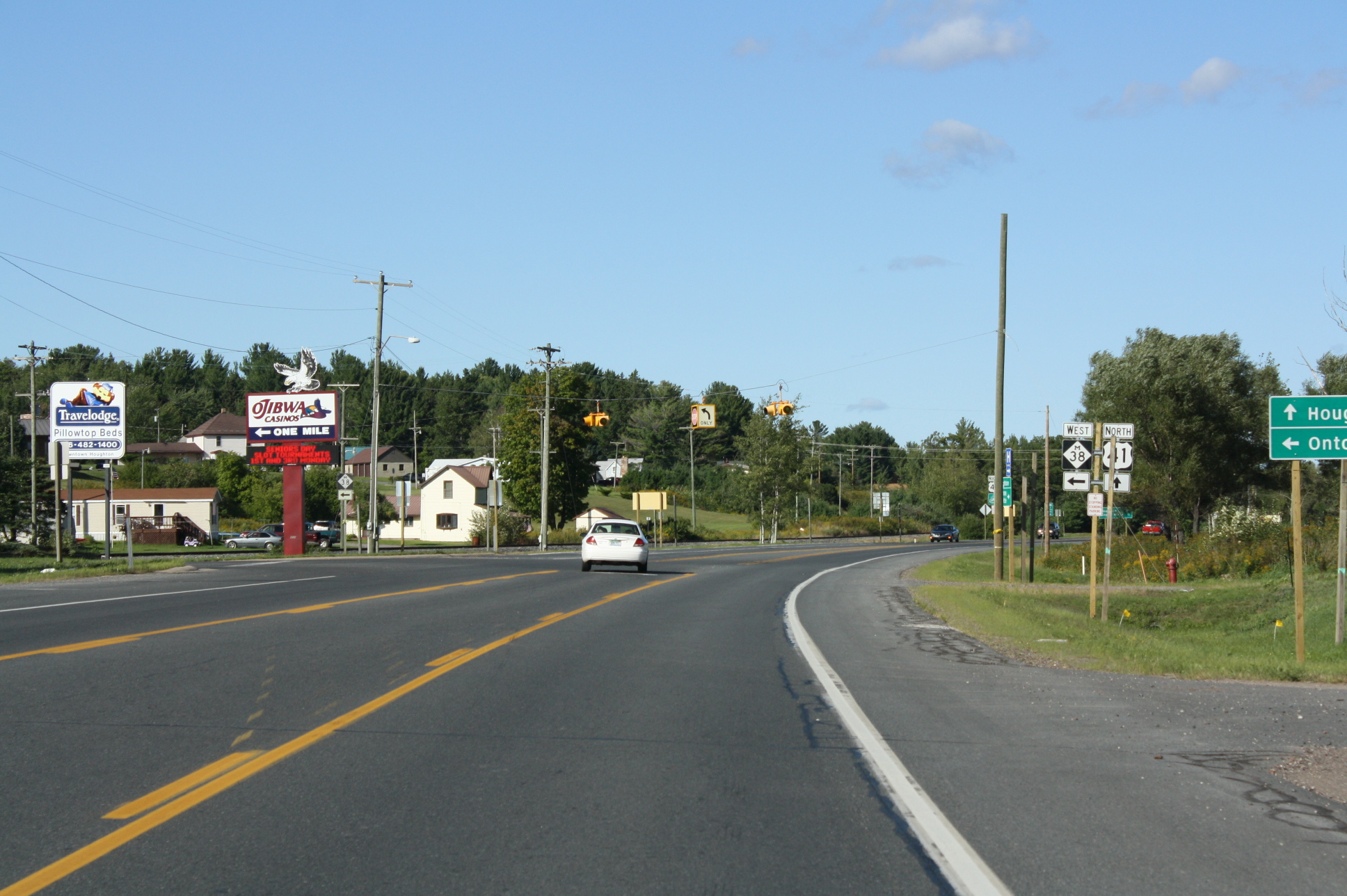
East of the county line is the crossing over the Sturgeon River south of Pelkie, home of the Baraga County Fairgrounds.[4][8] The trunkline crosses more hilly terrain while veering to the northeast. Continuing to the east, M-38 had its highest traffic usage in 2007. The AADT for the Baraga County segment of the highway was measured at 3,000 vehicles a day.[6] The roadway continues east through Baraga County and runs downhill approaching Baraga and the Keweenaw Bay Indian Community, home of the first Native American casino in the United States.[9] After passing through downtown Baraga on Michigan Avenue, M-38 ends at an intersection with US 41; on the western shore of Keweenaw Bay.[4]
History
Previous designation
The first version of M-38 was designated in 1919 in the Lower Peninsula. It was located on Junction Road from M-10 (later US 10/US 23) southeast of Bridgeport to Frankenmuth, and then ran east to M-19 in the Peck area in 1919.[10] The highway was transferred to county jurisdiction in late 1961 when the I-75/US 10/US 23 freeway was completed in the area.[11][12]
Current designation
In 1968, the Michigan Department of Transportation redesignated the western section of M-35 as M-38.[1][2] M-35 was originally planned to start in Menominee and run north to Big Bay, turn west through the Huron Mountains in northern Marquette County and run west from Baraga to Ontonagon.[10] The Huron Mountains portion of M-35 was never built due to opposition from Henry Ford and the Huron Mountain Club. This left M-35 discontinuous.[13] It was later routed along US 41 from Negaunee to Baraga, connecting the two sections until the western section was given the M-38 designation.[1][14]
The original routing of M-38 in the Upper Peninsula ran from M-26 at Greenland to Baraga.[2] US 45 was rerouted in 1971 along M-26 from Rockland to Greenland and Ontonagon–Greenland Road between those two towns. M-26 was shortened to end at the new US 45 in Greenland.[15] This change to US 45 was reversed in 1973. M-26 was reextended to Rockland, and M-38 was extended along M-26 to Ontonagon–Greenland Road to meet US 45 in Ontonagon.[16]
On October 11, 2006, the western terminus of M-38 was relocated about .25 miles (0.40 km) south to end at a junction with US 45 and the newly realigned M-64.[17]
Major intersections
County Location Mile[3] Destinations Notes Ontonagon Ontonagon 0.000 US 45 – Watersmeet
 M-64 south / LSCT west – Silver City
West end of LSCT concurrency Greenland 13.305 M-26 west – RocklandWestern end of M-26 concurrency 14.438 M-26 east / LSCT east – HoughtonEastern end of M-26 and LSCT concurrencies Houghton Laird Township 21.611  FFH 16
Marked as H-16 on MDOT maps Baraga Baraga 42.225 US 41 / LSCT – Houghton, Marquette1.000 mi = 1.609 km; 1.000 km = 0.621 mi
Concurrency terminus • Closed/Former • Incomplete access • UnopenedReferences
- ^ a b c Michigan Department of State Highways (1968). Official Highway Map (Map). Section B3.
- ^ a b c Michigan Department of State Highways (1969). Official Highway Map (Map). 1 in.:14.5 mi.. Cartography by H.M. Gousha. Section B3.
- ^ a b "MDOT Physical Reference Finder Application". Michigan Department of Transportation. 2009. http://www.mcgi.state.mi.us/prfinder/. Retrieved April 10, 2010.
- ^ a b c d Google, Inc. Google Maps – US-45 & M-38, Ontonagon, MI 49953 to US-41 & M-38, Baraga, MI 49908 (Map). Cartography by Google, Inc. http://maps.google.com/maps?saddr=US-45+%26+M-38,+Ontonagon,+MI+49953&geocode=&dirflg=&daddr=US-41+%26+M-38,+Baraga,+MI&f=d&sll=46.866772,-89.313784&sspn=0.00933,0.014505&ie=UTF8&z=10. Retrieved October 8, 2008.
- ^ Google, Inc. Google Maps – Old M-35 Road (Map). Cartography by Google, Inc. http://maps.google.com/maps?saddr=US-45+%26+M-38,+Ontonagon,+MI+49953&geocode=&dirflg=&daddr=US-41+%26+M-38,+Baraga,+MI&f=d&sll=46.866772,-89.313784&sspn=0.00933,0.014505&ie=UTF8&ll=46.771879,-89.013505&spn=0.018694,0.029011&t=p&z=15. Retrieved October 8, 2008.
- ^ a b Michigan Department of Transportation (2007) (PDF). Statewide AADT Map (Map). http://www.michigan.gov/documents/adtfront_20092_7.pdf. Retrieved October 7, 2008.
- ^ Michigan Department of Transportation (2007) (PDF). Commercial Statewide AADT Map (Map). http://www.michigan.gov/documents/cadtfront_19920_7.pdf. Retrieved October 7, 2008.
- ^ "Michigan 2008 State and County Fairs List" (PDF). Michigan Department of Agriculture. 2008. http://www.michigan.gov/documents/mda/fairschedule_228608_7.pdf. Retrieved October 8, 2008.
- ^ Winchell, Dick G.; Lounsbury, John F. and Sommers, Lawrence M. (Winter 1997). "Indian Gaming in the U.S.: Distribution, Significance and Trends.". Focus 44.
- ^ a b Michigan State Highway Department (1919). State of Michigan: Lower Peninsula (Map). Cartography by MSHD. http://maps.lib.msu.edu/miroadmaps/1919-lp.htm. Retrieved March 2, 2008.
- ^ Michigan State Highway Department (1961). Official Highway Map (Map). Section J12–J14. (Includes all changes through July 1, 1961)
- ^ Michigan State Highway Department (1962). Official Highway Map (Map). Section J12–J14.
- ^ Michigan State Highway Department (May 1, 1938). 1938 Official Michigan Highway Map (Map). Cartography by Rand McNally (Spring ed.). Section B3.
- ^ Michigan State Highway Department (April 15, 1953). 1953 Official Highway Map (Map). Section B3.
- ^ Michigan Department of State Highways (1970). Official Highway Map (Map). 1 in.:14.5 mi.. Section B3.
- ^ Michigan Department of State Highways (1971). Official Highway Map (Map). 1 in.:14.5 mi.. Section B3.
- ^ "New Ontonagon River Bridge to open Oct. 11" (Press release). Michigan Department of Transportation. October 10, 2006. http://www.michigan.gov/mdot/0,1607,7-151-9620_11057-153223--,00.html. Retrieved October 8, 2008.
External links
Categories:- State highways in Michigan
- Lake Superior Circle Tour
- Ontonagon County, Michigan
- Transportation in Houghton County, Michigan
- Transportation in Baraga County, Michigan

Wikimedia Foundation. 2010.