- M-85 (Michigan highway)
-
M-85 Fort Street 
Route information Maintained by MDOT Length: 22.15 mi[1] (35.65 km) Existed: 1956 – present Tourist
routes:Lake Erie Circle Tour Major junctions South end:  I-75 Exit 28 near Flat Rock and Gibraltar
 I-75 Exit 43 in Detroit
North end: Griswold Street in Detroit Location Counties: Wayne Highway system Michigan State Trunkline Highway System
Interstate • US • State←  M-84
M-84M-86  →
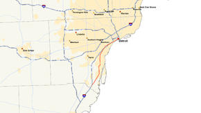
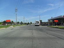
→M-85, also known as Fort Street or Fort Road for its entire length, is a state highway route in the U.S. state of Michigan.
In Detroit proper, M-85 consists of West Fort street (from Woodward Avenue downtown to the River Rouge) and South Fort street (from the River Rouge southward). The distinction is not trivial, since the address numbers on West Fort that start from Woodward, and proceed beyond 10000, are reset to zero when crossing the Rouge River onto South Fort.
M-85 was designated to service Downriver communities southwest of Detroit bordering the Detroit River as the Detroit-Toledo Expressway (originally ALT U.S. 24, later I-75) was being completed further inland. Its southern terminus is with I-75 at the south end of Woodhaven, and its northern terminus is at Griswold Street in downtown Detroit.
From its southern terminus at I-75 Exit 28 to I-75 Exit 43 in southwest Detroit, M-85 is part of the Lake Erie Circle Tour.
Contents
Route description
M-85 serves the communities of Detroit, Lincoln Park, Wyandotte, Southgate, Riverview, Trenton, Gibraltar and Brownstown
M-85's northern terminus is at the corner of Fort St & Griswold St, one block west of Woodward Avenue in Downtown Detroit. The southern terminus is at I-75 near Flat Rock and Gibraltar.
History
In the 1920s, M-85 ran from M-14 (now M-66) in Stanton to M-66 (now M-91) just south of Langston.
M-85 was extended beyond its previous terminus at I-75/Schaefer Road to replace M-3's designation along Fort Street from Clark Street to Griswold, when a number of jurisdiction changes relating to the Campus Martius Park development resulted in downtown portions of M-3 being shifted to local control in 2001. Portions of Fort Street that had not been part of the trunkline system since U.S. 25 was removed from Michigan were added to M-85.
Major intersections
The entire highway is in Wayne County.
Location Mile Destinations Notes Woodhaven 0.00 
 I-75 / LECT – Detroit, Toledo
Exit 28 on I-75; southern end of LECT concurrency Detroit 
 I-75 / LECT
Exit 43 on I-75; northern end of LECT concurrency 22.15 Griswold Street 1.000 mi = 1.609 km; 1.000 km = 0.621 mi
Concurrency terminus • Closed/Former • Incomplete access • UnopenedReferences
External links
Categories:- State highways in Michigan
- Lake Erie Circle Tour
Wikimedia Foundation. 2010.


