- M-84 (Michigan highway)
-
M-84

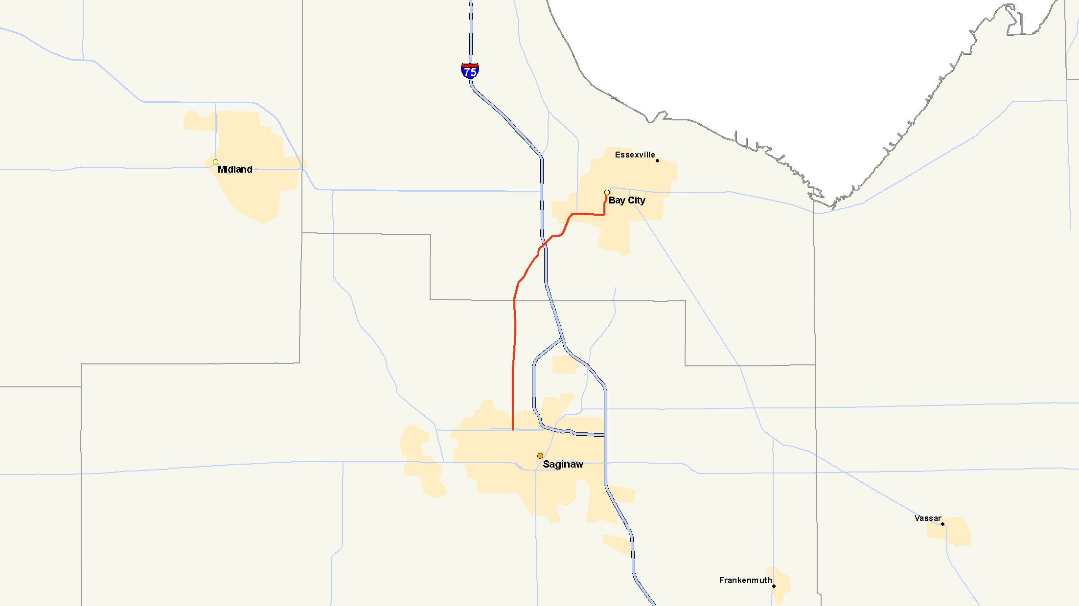
M-84 highlighted in redRoute information Maintained by MDOT Length: 13.76 mi[1] (22.14 km) Existed: 1960 – present Major junctions South end:  M-58 at Saginaw
 I-75 / US 23 near Bay City
North end:  M-25 at Bay City
Highway system Michigan State Trunkline Highway System
Interstate • US • State←  M-83
M-83M-85  →
→M-84 is a state trunkline highway in the Lower Peninsula of the US state of Michigan. It was originally part of M-47 until that road was relocated onto what was formerly US 10 from Saginaw Township to east of Midland. It serves as a connector between Saginaw and Bay City, although there is now an expressway link between the two cities via I-75.
Contents
Route description
M-84 begins at M-58 on the west side of Saginaw, and heads straight north. At this point, it is 5 lanes, with 2 lanes in each direction and a center lane for left turns only. The speed limit is 40 MPH in this area. It serves as a major artery in Saginaw Township, passing the Fashion Square Mall and several other shopping centers and major retail stores. The main entrance to Saginaw Valley State University is located on M-84 just south of the Bay County line. At the Bay County line it turns into West Side Saginaw Road, and the speed limit becomes 55 MPH. It crosses over I-75 at exit 160, proceeds through several curves into Bay City, and co-incides with M-13 in Bay City from Euclid to Broadway. The speed limit is 30 MPH from Euclid to its terminus. It crosses the Saginaw River over the Lafayette Street Bridge (sometimes called the 23rd Street Bridge), turns north at Garfield Street, flows into Washington Avenue, and ends in downtown Bay City at the intersection with M-25 near the Veterans Memorial Bridge.
History
The first M-84 in Michigan was in the Upper Peninsula from 1921 to 1926. The highway ran from Garnet to McLeods Corner, southeast of Newberry, following the current Borgstrom Road and Luce County Road 393. The highway was replaced by an extension of M-48 in 1926. The M-84 designation was reused for a section of the former M-31 in The Thumb. It ran from M-81 near Reese running through Fairgrove and Akron to M-29 at Unionville. This iteration was replaced by M-83 in 1930.[1]
The I-75/US 10/US 23 freeway was completed between Saginaw and Bay City in 1960. M-47 was relocated to the former US 10 between Saginaw and Midland, and M-84 was redesignated along the former US 23 between M-81 at Saginaw and the freeway in Bay City. A new BL I-75 was created at the same time along the former M-47 in Bay City. This business loop would be split in 1971 resulting in a new business spur. M-84 was extended over the southern section between M-25 and I-75/US 10/US 23. A reconstruction project in 2004–05 resulted in the roadway being widened to four lanes between Pierce Road in Kochville Township of Saginaw County and Delta road in Frankenlust Township in Bay County. The 2009 reconstruction resulted in new bridges over I-75 and widening of the road from Delta Road to Two-mile Road. Additional construction scheduled for 2011 will result in the widening of the road from Two-Mile to Euclid. A small section of old roadway serving as a connector road is retained as an unsigned trunkline as OLD M-84 when a curve was rebuilt along West Side Saginaw Road between Kloha and Amelith roads.[1]
Major intersections
County Location Mile Destinations Notes Saginaw Saginaw 0.000 M-58Bay Bay City I-75 / US 23Exit 160 on I-75/US 23  M-13
M-13Co-incides with M-13 from Euclid to Broadway in Bay City 
 BS I-75 west / M-25 / LHCT (McKinley Street, 7th Street)
1.000 mi = 1.609 km; 1.000 km = 0.621 mi References
- ^ a b c Bessert, Christopher J.. "Michigan Highways: Highways 80 through 89". MIchigan HIghways. http://www.michiganhighways.org/listings/MichHwys80-89.html#M-084. Retrieved 10 28, 2006.
External links
Categories:- State highways in Michigan
- Bay City, Michigan
- Transportation in Bay County, Michigan

Wikimedia Foundation. 2010.